
Fraochaidh from Ballachuilish
Route: Fraochaidh, from Ballachulish
Corbetts: Fraochaidh
Date walked: 29/09/2019
Time taken: 8.5 hours
Distance: 22km
Ascent: 805m
Fraochaidh from Ballachulish
This is a walk I’d looked forward to. A long up and down ridge into an accessible yet remote top with views of familiar hills from a different perspective. In an evolving ‘low degree of certainty’ weekend weather forecast, I had made the call to set aside Sunday for this long day trip and was a little concerned that the blue skies arrived in Glasgow on the Saturday ahead of prediction. Nevertheless. Sunday saw us head off from the visitor centre carpark in Ballachulish, not in blue skies, but on a clear, dry morning. Despite a bit of mist shrouding some of the tops, it was poised to be a good day.
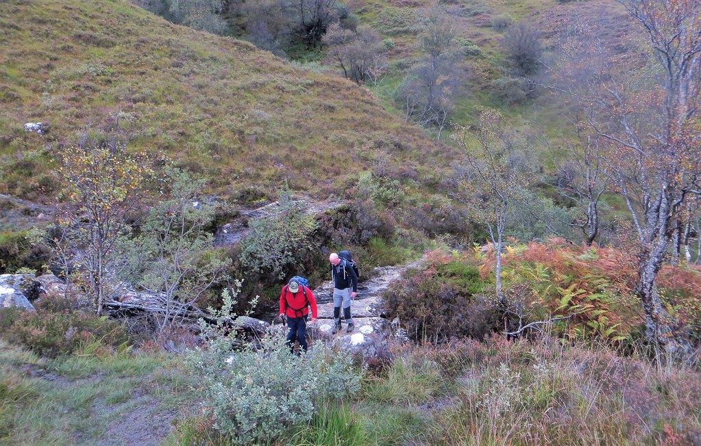
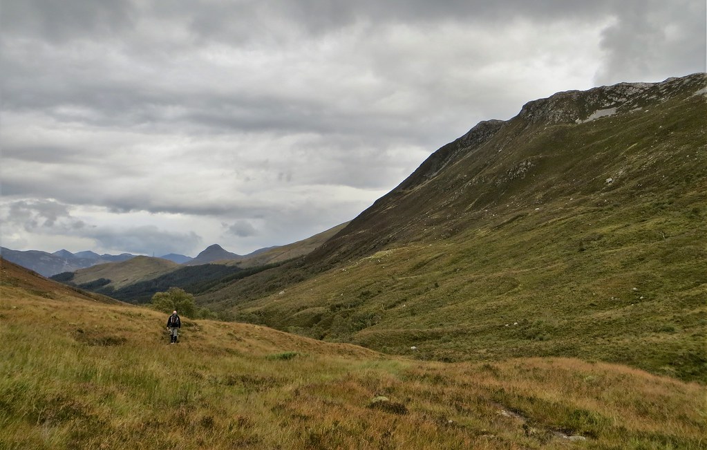
A short walk south through Ballachulish, across the bridge over the River Laroch and a left turn up past the school (where I think we could have parked) saw us on the main track up Gleann an Fhiodh. I had wondered about the feasibility of taking the bike up the Gleann. Despite some evidence of tyre tracks, I would stress that this is not a place for the average walker to take a bike. Although for the most part the track makes for good walking, I would have been pushing more than cycling as it is rough and rutted with plenty of obstacles, including a couple of streams requiring boulder hopping, to negotiate. On foot is certainly the way to approach the hill from this direction though I understand that the less scenic eastern approach offers better access for bikes.
Heading up Gleann an Fhiodh

Beinn a’ Bheithir’s slopes dominate on the rhs

Sgorr a’ Choise

Back to Ballachulish

Boulder-hopping a stream on the track
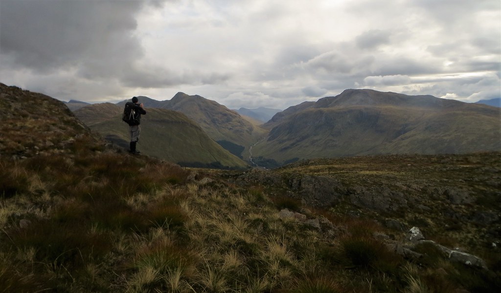
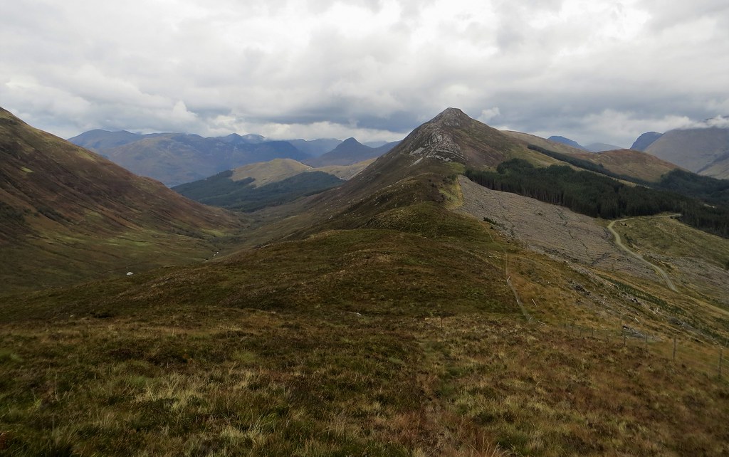
Towards the eastern end of Fraochaidh’s long ridge. The slopes of the 718 point are just visible.

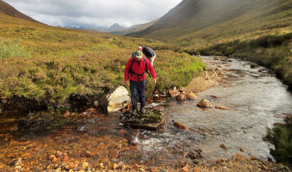
My map showed a path which forked of at a large cairn (068548), but heeding advice we ignored this and looked for a stream crossing a few hundred metres further up the glen. We crossed the River Laroch easily and made our way up heathery slopes utilising animal tracks to skirt an area of natural woodland before we stumbled onto the main cairned track that led to the bealach at 066540. On our return route, several hours later, we followed this track all the way down to the River Laroch to cross at a point marked by 2 small cairns. Note that the lower part of this track is very muddy. If I were returning, I would use the animal tracks route in both directions.
The large cairn on the main track

Crossing the River Laroch. The Pap of Glencoe is in the background.
The way across the River Laroch marked by 2 small cairns. We used this crossing place on our return journey.

This is the ‘recommended’ ascent route to the bealach. We used it on our return. It is very muddy.

Making our way up rough, heathery ground using animal tracks

Heading for the bealach via an area of natural birch woodland. The ground is not as rough as it looks.

Looking back from the woodland. The Mamores are clearing nicely.

On the cairned track just before the bealach.

At the bealach. The stile is part of the right of way to Duror. We turned right heading for the slopes of the 718 point.

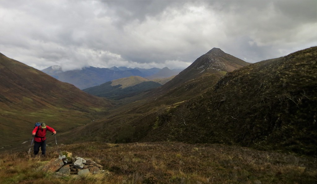
From the bealach we followed the line of fence posts uphill to reach the first of many small tops on the 4km plus ridge. Fraochaidh’s summit ridge soon comes into view – it is a long way with the 718m top to be crossed first. The ridge is dotted with several pretty lochans and soon the views were opening up across Loch Linnhe to our right and into the backyard of Glencoe on our left. It was clear, with Beinn a’ Bheithir the only top that the clag persistently clung to.
Following the fence line just above the bealach. Sgorr a’ Choise looks a fine hill.

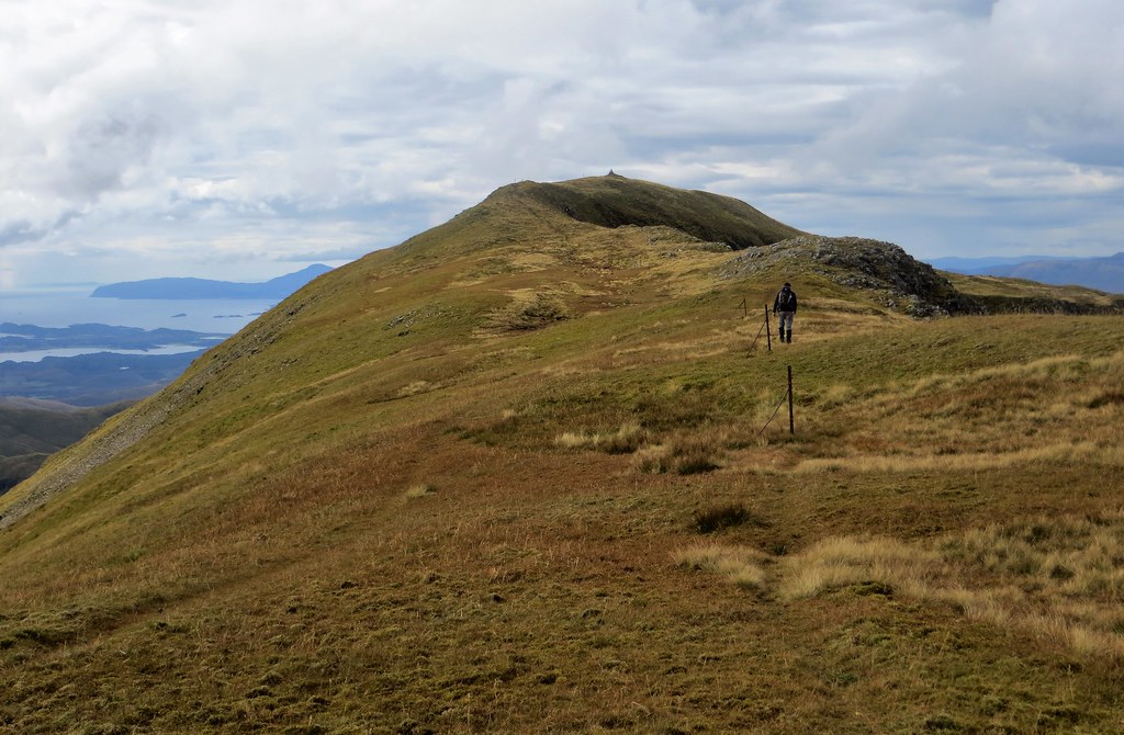
And there it is. A long way off. Fraochaidh is now poking out although the 718 point dominates the shot.

Fraochaidh

Lochans on the ridge with the Morven Hills over Loch Linnhe as the backdrop

Fraochaidh from the undulating ridge
Sgor na h- Ulaidh and Beinn Fhionnlaidh from an unusual angle near the 718 top.
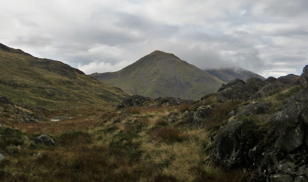
The lochan and distant hill landscape that is typical of this ridge. The hills of the Galmadale horseshoe feature here.

Looking back from close to the 718 top.

The final 2 km make for very pleasant walking. Fine underfoot, interesting scenery and ever developing views. The 200m pull up to the relatively narrow summit ridge is straightforward on a firm eroded track. By this time we had an accompaniment of roaring stags – apart from that, we had the mountain to ourselves.
The final section of the ridge. A slight descent before the pull up to the summit ridge.

Fraochaidh is a scenic hill. The summit is now in sight at the end of its ridge.

Heading up with the blue sky

On the summit ridge. The view down to the mouth of the River Duror – the shorter, but less scenic western approach to Fraochaidh.

Looking back along the summit ridge. Beinn a’ Bheithir is shedding its coat of clag briefly. The Aonach Eagach is perfectly clear, although Bidean is being kissed by the low cloud.

Approaching the summit
The summit feature is a bit of a let down for such a fine mountain with an ugly sculpture of discarded fence posts marking the 879m top. However, this does not detract from outstanding views – the excellent visibility held, it stayed dry and the sky had more than its share of blue.

Views
Hills of Glencoe

Beinn Sgulaird and the distant Cruachan range

A distant Rum and Skye!

The Rum Cuillin zoomed

Sgor na h- Ulaidh, Creise and Beinn Fhionnlaidh

Across the impressive cliffs of Coire Dubh to the north towards misty Beinn a’ Bheithir

Summit shot

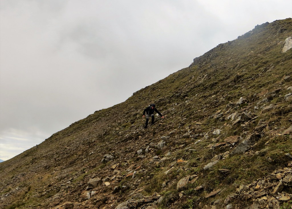
After a linger of close on 30 minutes we retraced our steps. Well, not quite, because we decided to cut across the scree slopes to shorten the dog leg of the summit ridge. Mistake! It was steep and loose – even the sheep dotted about Fraochaidh’s upper slopes looked at us with puzzled faces!
Not a short cut!
Looking back having negotiated a steep descent. It’s a fine hill.

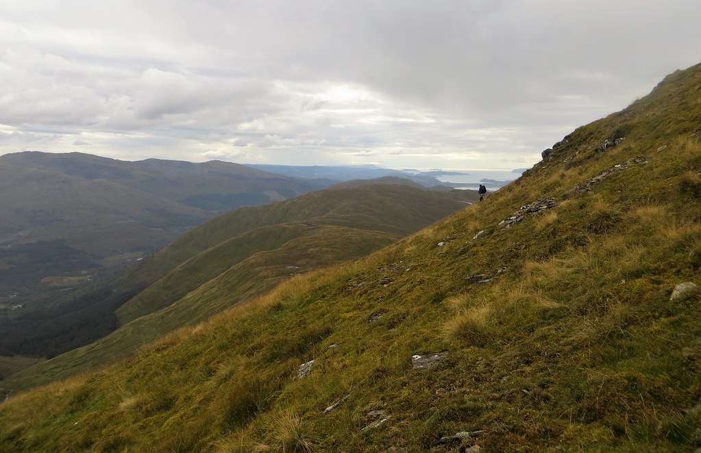
Once back on familiar ground it was a very pleasant return walk, despite a very brief rain shower. Not all out and back routes work, but this one does, as there is so much interest now in front of you. The Mamores were clear – the camera doesn’t do them justice – and the red and white contrast of Mullach nan Coirean and Stob Ban was particularly striking.
Views on the return leg

After a short break at the bealach, we took the direct path back to cross the River Laroch as described earlier, enduring the mud in the lower reaches. An agreeable return on the decent track saw us back at Ballachulish 8 hours 30 minutes after we had set out. It was a good day and one that did not disappoint. The rain finally came on as we reached the car!
A pleasant walk out at the end of the day.
It is a contradiction in terms that Fraochaidh is probably the most accessible remote hill that I have climbed. And it is well worth a return visit.
This is a walk I’d looked forward to. A long up and down ridge into an accessible yet remote top with views of familiar hills from a different perspective. In an evolving ‘low degree of certainty’ weekend weather forecast, I had made the call to set aside Sunday for this long day trip and was a little concerned that the blue skies arrived in Glasgow on the Saturday ahead of prediction. Nevertheless. Sunday saw us head off from the visitor centre carpark in Ballachulish, not in blue skies, but on a clear, dry morning. Despite a bit of mist shrouding some of the tops, it was poised to be a good day.
A short walk south through Ballachulish, across the bridge over the River Laroch and a left turn up past the school (where I think we could have parked) saw us on the main track up Gleann an Fhiodh. I had wondered about the feasibility of taking the bike up the Gleann. Despite some evidence of tyre tracks, I would stress that this is not a place for the average walker to take a bike. Although for the most part the track makes for good walking, I would have been pushing more than cycling as it is rough and rutted with plenty of obstacles, including a couple of streams requiring boulder hopping, to negotiate. On foot is certainly the way to approach the hill from this direction though I understand that the less scenic eastern approach offers better access for bikes.
Heading up Gleann an Fhiodh
Beinn a’ Bheithir’s slopes dominate on the rhs
Sgorr a’ Choise
Back to Ballachulish
Boulder-hopping a stream on the track
Towards the eastern end of Fraochaidh’s long ridge. The slopes of the 718 point are just visible.
My map showed a path which forked of at a large cairn (068548), but heeding advice we ignored this and looked for a stream crossing a few hundred metres further up the glen. We crossed the River Laroch easily and made our way up heathery slopes utilising animal tracks to skirt an area of natural woodland before we stumbled onto the main cairned track that led to the bealach at 066540. On our return route, several hours later, we followed this track all the way down to the River Laroch to cross at a point marked by 2 small cairns. Note that the lower part of this track is very muddy. If I were returning, I would use the animal tracks route in both directions.
The large cairn on the main track
Crossing the River Laroch. The Pap of Glencoe is in the background.
The way across the River Laroch marked by 2 small cairns. We used this crossing place on our return journey.
This is the ‘recommended’ ascent route to the bealach. We used it on our return. It is very muddy.
Making our way up rough, heathery ground using animal tracks
Heading for the bealach via an area of natural birch woodland. The ground is not as rough as it looks.
Looking back from the woodland. The Mamores are clearing nicely.
On the cairned track just before the bealach.
At the bealach. The stile is part of the right of way to Duror. We turned right heading for the slopes of the 718 point.
From the bealach we followed the line of fence posts uphill to reach the first of many small tops on the 4km plus ridge. Fraochaidh’s summit ridge soon comes into view – it is a long way with the 718m top to be crossed first. The ridge is dotted with several pretty lochans and soon the views were opening up across Loch Linnhe to our right and into the backyard of Glencoe on our left. It was clear, with Beinn a’ Bheithir the only top that the clag persistently clung to.
Following the fence line just above the bealach. Sgorr a’ Choise looks a fine hill.
And there it is. A long way off. Fraochaidh is now poking out although the 718 point dominates the shot.
Fraochaidh
Lochans on the ridge with the Morven Hills over Loch Linnhe as the backdrop
Fraochaidh from the undulating ridge
Sgor na h- Ulaidh and Beinn Fhionnlaidh from an unusual angle near the 718 top.
The lochan and distant hill landscape that is typical of this ridge. The hills of the Galmadale horseshoe feature here.
Looking back from close to the 718 top.
The final 2 km make for very pleasant walking. Fine underfoot, interesting scenery and ever developing views. The 200m pull up to the relatively narrow summit ridge is straightforward on a firm eroded track. By this time we had an accompaniment of roaring stags – apart from that, we had the mountain to ourselves.
The final section of the ridge. A slight descent before the pull up to the summit ridge.
Fraochaidh is a scenic hill. The summit is now in sight at the end of its ridge.
Heading up with the blue sky
On the summit ridge. The view down to the mouth of the River Duror – the shorter, but less scenic western approach to Fraochaidh.
Looking back along the summit ridge. Beinn a’ Bheithir is shedding its coat of clag briefly. The Aonach Eagach is perfectly clear, although Bidean is being kissed by the low cloud.
Approaching the summit
The summit feature is a bit of a let down for such a fine mountain with an ugly sculpture of discarded fence posts marking the 879m top. However, this does not detract from outstanding views – the excellent visibility held, it stayed dry and the sky had more than its share of blue.
Views
Hills of Glencoe
Beinn Sgulaird and the distant Cruachan range
A distant Rum and Skye!
The Rum Cuillin zoomed
Sgor na h- Ulaidh, Creise and Beinn Fhionnlaidh
Across the impressive cliffs of Coire Dubh to the north towards misty Beinn a’ Bheithir
Summit shot
After a linger of close on 30 minutes we retraced our steps. Well, not quite, because we decided to cut across the scree slopes to shorten the dog leg of the summit ridge. Mistake! It was steep and loose – even the sheep dotted about Fraochaidh’s upper slopes looked at us with puzzled faces!
Not a short cut!
Looking back having negotiated a steep descent. It’s a fine hill.
Once back on familiar ground it was a very pleasant return walk, despite a very brief rain shower. Not all out and back routes work, but this one does, as there is so much interest now in front of you. The Mamores were clear – the camera doesn’t do them justice – and the red and white contrast of Mullach nan Coirean and Stob Ban was particularly striking.
Views on the return leg
After a short break at the bealach, we took the direct path back to cross the River Laroch as described earlier, enduring the mud in the lower reaches. An agreeable return on the decent track saw us back at Ballachulish 8 hours 30 minutes after we had set out. It was a good day and one that did not disappoint. The rain finally came on as we reached the car!
A pleasant walk out at the end of the day.
It is a contradiction in terms that Fraochaidh is probably the most accessible remote hill that I have climbed. And it is well worth a return visit.
Click to mark this as a great report. Register or Login free to be able to rate and comment on reports (as well as access 1:25000 mapping).
Comments: 3
Beinn Mhic Chasgaig plus – a round of Coire Odhar
Munros: CreiseCorbetts: Beinn Mhic Chasgaig
Date walked: 14/06/2019
Distance: 16km
Ascent: 1335m
Comments: 3
Views: 3249
Arkle and Meall Horn – A Big Northwest Corbett Combo
Corbetts: Arkle, Meall HornDate walked: 12/05/2019
Distance: 27km
Ascent: 1400m
Comments: 4
Views: 2704
-
allangilly
- Munro rounds: 1
- Munros: 167
- Tops: 141
- Corbetts: 147
- Fionas: 28
- Donalds: 16
- Wainwrights: 4
- Hewitts: 1
- Sub 2000: 21
- Islands: 37
- Filter reports
- Trips: 3
- Distance: 65 km
- Ascent: 3540m
- Munros: 1
- Corbetts: 4
- Joined: May 26, 2019
- Last visited: Apr 24, 2024
- Total posts: 5 | Search posts