
The Aonachs: Big & Little
Route: Aonach Beag and Aonach Mòr from Glen Nevis
Munros: Aonach Beag (Nevis Range), Aonach Mòr
Date walked: 19/05/2023
Time taken: 6.13 hours
Distance: 17.95km
Ascent: 1376m
The Aonachs: Big & Little
With a Stag Do in Aviemore starting on the Friday night, but with some superb weather forecast for the Friday day, the only sensible option was to set a 0500 Friday alarm and drive from Aberdeen to Fort William before the chaos commenced. The journey was seamless, and I rocked up at the far Glen Nevis car park just after 0900 and got parked no problem!
For many years I had planned on doing Aonach Beag and Aonach Mor with Carn Mor Dearg and possibly Ben Nevis – but as I needed to be in Aviemore by a reasonable time, my options for shortish day walks were limited and it seemed sensible not to overindulge. Saturday night would cover that particular pastime…
Spring has fully sprung
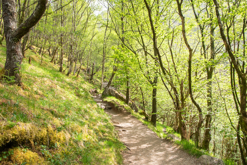
Given it was quite early the walk into Steall falls was peacefully quiet and just about too early in the year for midges. For whatever reason, no matter how many times I have done this section it always feels longer than I remember. The first glimpse of Steall Falls, from that frequently captured angle, remains impressive regardless.
That frequently captured angle

I had now been to Steall Falls on several occasions but never ventured further down the glen. There were plenty of people already stopped at the waterfall and a relatively obscene number of tents – it seems to be a popular spot for the “just about wild camping crew”. Find it hard to fully agree, or see the appeal, but each to their own, and if it is left as-is, then who can complain.
Paying less attention than I should of, I briefly lost the path as it quickly became boggy underfoot. I only know that I lost the path as on the return journey I had a solid path right to the car.
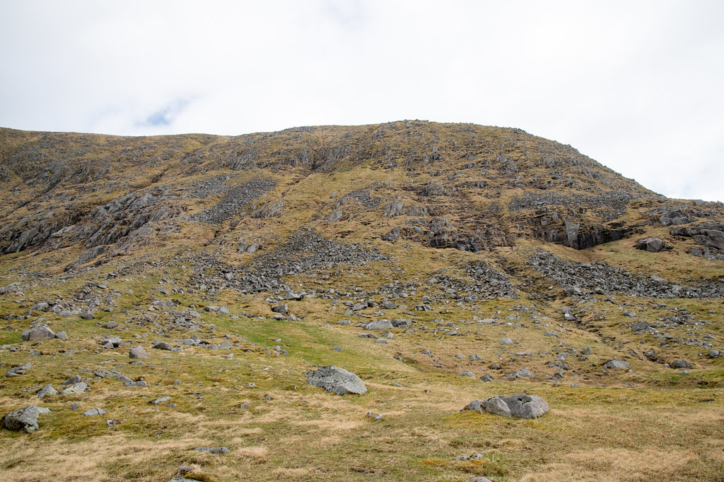
First glimpse of the initial climb, Sgurr a Bhuic

When I reached the Steall ruins I stopped to delayer and get as much water in my system as possible, as I fully expected this to be a sweaty climb.
Ruins up towards Sgurr a Bhuic

Looking back to The Mamores

Exactly as expected. The initial ascent up Sgurr a Bhuic was a tough and sweaty one, but the first few kilometres had warmed the legs up as best as possible, and I was making good progress. The perk of solo walking is you always seem to go much faster. Less talking and more thinking, I guess!
Looking up, aiming for the left side

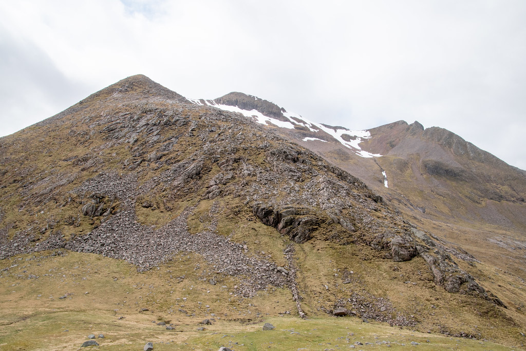
Aonach Beag, the first Munro summit hiding in the clouds

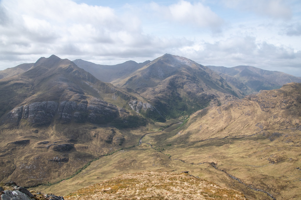
The shoulder up to the 800m mark on Sgurr a Bhuic felt precariously steep and progress had now slowed right down. On the plus side, the view behind was exceptional and the rests to “stop and take in the view” were fully utilised.
The Mamores in all their glory. Steall falls looked tiny from up here! Had one of my best solo nights in the tent up on the Ring of Steall. That’s one of the best parts of good visibility – seeing previous adventures from another vantage point.
The view
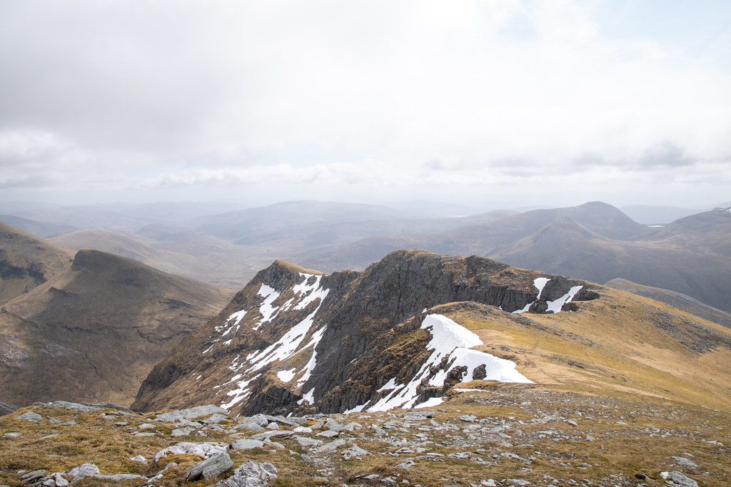
Once above 800m the final section up towards the Munro Top of Sgurr a’ Bhuic was now obvious and not too daunting. I spotted a group just in front who appeared to be skirting around Sgurr a’ Bhuic.
At the time of this walk I hadn’t (yet) decided to “bag the tops”, but as time began passing through this first round, loose panic began to set in of what would I do when I do finish! For this trip, I had decided all along today to follow Walkhighlands recommendation and made the short detour up to the rocky summit.
Sgurr a’ Bhuic on the right

Sweaty selfie from or near the summit

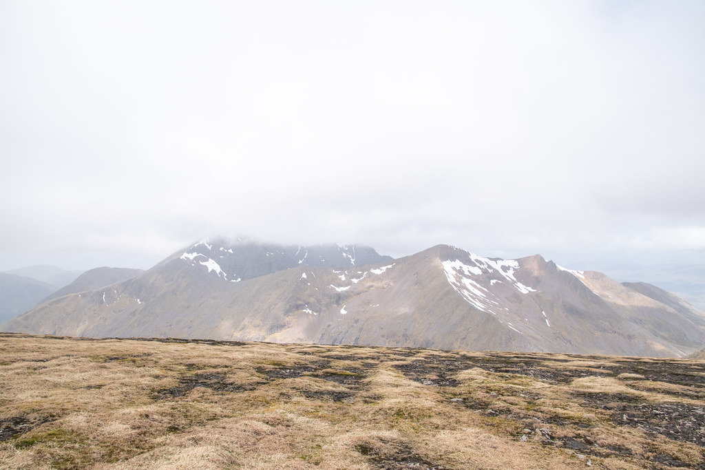
Having savoured the views south to the Mamores, the views towards the Grey Corries were now taking over. Having done the Grey Corries a few years previous I didn’t recognise Sgurr Choinnich Beag from that outing, but also remembered I didn’t have any un-summited Munros to the west.
In hindsight it turns out to be a subsidiary top of Sgurr Choinnich Mor (the final Munro summit on my Grey Corries route). If I hadn’t been time pressured on this outing, I’d have been tempted for an out and back as it looked like an excellent route.
On the plus side as I’ve since started my Tops Journey – it’s a great reason to return!
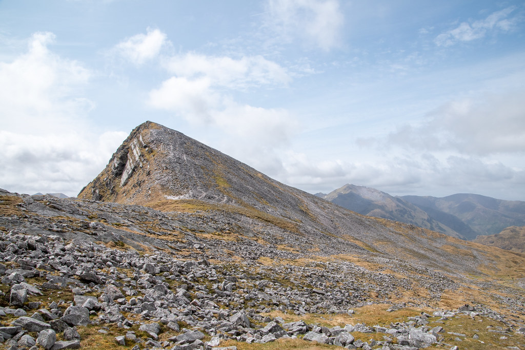
Sgurr Choinnich Beag (far right (not politically…))

The Ben – cloudy, obviously…

The route towards Aonach Beag

The group that bypassed the Top

The way down from Sgurr a’ Bhuic was very loose underfoot and a little steep in parts. The sun was glistening off every rock and I remember wishing I’d taken my sunglasses. I had however taken sun cream, which is normally a curse for the weather, but I decided to take my chances here and reapply.
Looking back up Sgurr a’ Bhuic
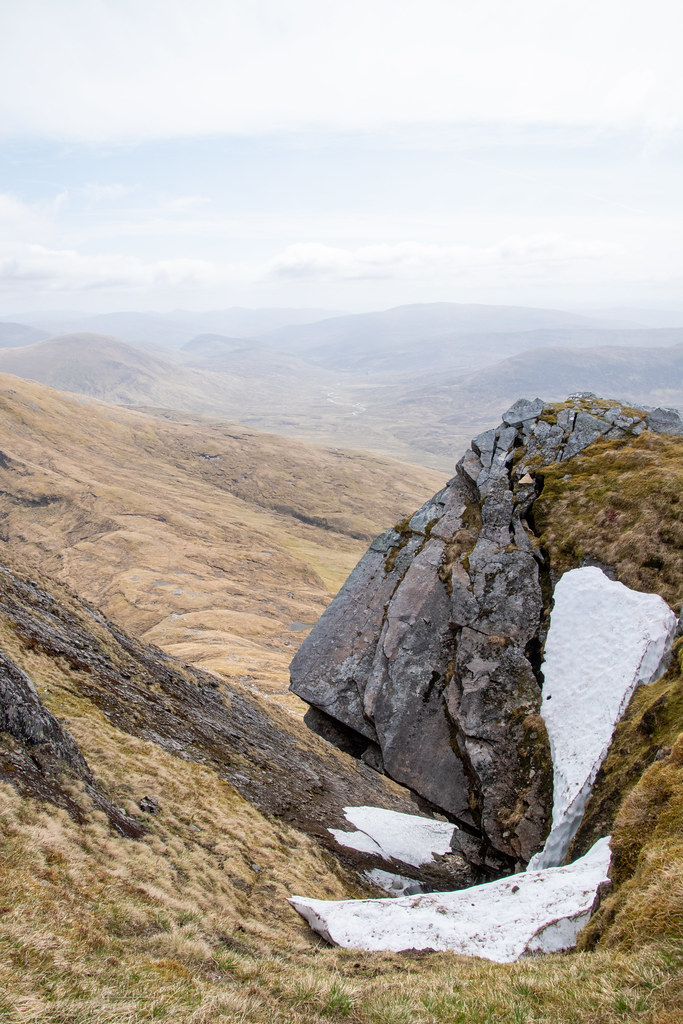
Not sure how many freeze / thaw cycles this LARGE section has left where it is

That was somewhere near Coire a’ Bhuic on OS maps – won’t catch me going up there any time soon.
Next incline was the section up to Stob Coire Bhealaich which was on a solid well-defined path and seemed to go quickly. From the summit of Stob Coire Bhealaich it was clear that I was moving faster than the group of four ahead.
I didn’t want to pass them on the route up Aonach Beag as then get hit with the awkward and unjustifiable feeling that you need to walk faster than planned to build up a gap – it’s hard to describe, but sure you know what I mean. Decided to stop at Stob Coire Bhealaich and have my lunch.
Aonach Beag on the right, Ben Nevis hiding in the background

Left the group to rally on

 [
[
I didn’t stop too long for lunch, but most definitely long enough to require those layers back on. As I was setting off the cloud cover seemed to almost increase instantly. Thankfully it appeared to be sitting just about 1300m – annoying for those on the Ben, but good for us on the Aonach’s!
Making progress up Aonach Beag looking back at the route up. Notice how small Sgurr a’ Bhuic appears (bottom right)
I reached the summit almost exactly at the same time as the group in front. We stopped for a brief chat, and helped them out with a group photo, before deciding to batter on towards Aonach Mor.
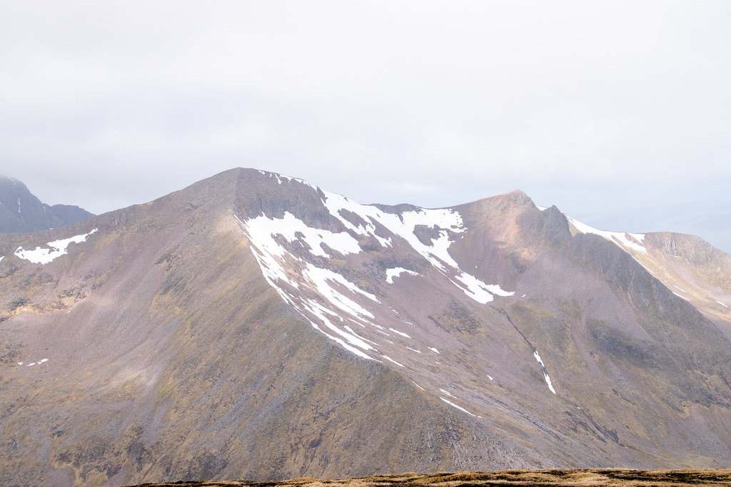
Summit views towards Ben Nevis and Carn Mor Dearg
Carn Mor Dearg (zoomed)
The route between Aonach Beag and Mor seemed like nothing and took hardly any time. I did notice I had a missed call and voicemail. As there was hardly any wind, I decided to have a quick listen. It was a message asking me to phone to doctor “as soon as possible”. Classically they didn’t pick up when I returned the call (fair enough it was a Friday afternoon), but I then spent the next hour or so preparing for the worst!
It turned out to be an admin update… lesson learned – don’t listen to voicemails when out in the hills!
View from Aonach Mor (which I had pessimistically decided would be my last hill before my imminent demise!!!)

If the doctor wasn’t about to kill me off, I had to make sense of the steep and “treacherous” descent down to the bealach between Aonach Mor and Carn Mor Dearg. Retracing steps over the vast space between Aonach Mor and Aonach Beag, the route down to the bealach seemed impossible.
There was a lot of down and not a lot of distance to make that down…
A sole figure in front of me
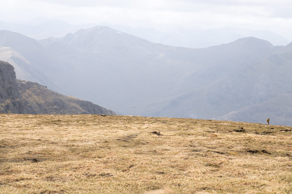
Seeing someone else immediately sparked optimism that I could follow them and hope they were able to find the path.
On trying to find the path the route up to Carn Mor Dearg looked insanely appealing. Too appealing. Quick check of the watch and I was sure I had maybe just enough time. Maybe Aonach Mor wasn’t going to be my last summit!
The ridge up Carn Mor Dearg
Found the path – STEEP!

Finding the path was a relief and relatively easy in good visibility, but with very few features I can see what it would be a navigational challenge in the winter / cloud.
I didn’t see the sole figure from earlier but was clear this was the best route down so started to make slow and slippery progress. The path is clearly well trodden but looking back at photos it really doesn’t show how steep it feels in reality.
Nearly at the bottom
Looking back up – again doesn’t look as steep as it was
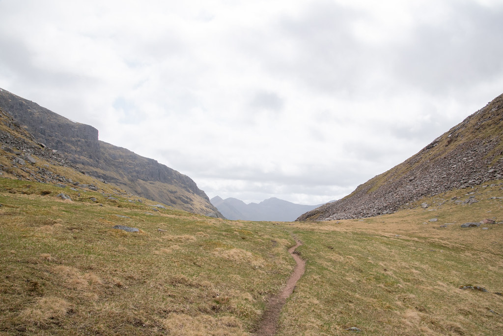
By now it was nearing 2pm. Carn Mor Dearg remained insanely inviting but my knees had taken a battering on the way down and I decided not to push it too far. A relatively enjoyable walk back out down through the Coire back to the Steall ruins.
Start of the long walk out
Looking back up (same direction just 20 minutes walking apart)


On the walk to the Steall ruins I didn’t see a single other person. Yet maybe a mere 1500m away there would be literally hundreds of people making their way up the tourist trap to the summit of the Ben. Amazing what a couple of extra metres height on a map can create. Give me this any day of the week!
I enjoyed my peace and quiet and bumped into a couple when had been just arrived back soaking their feet in the burn – this looked immensely tempting, but I had just started thinking about a fish supper, which clearly proved more tempting!
So, I battered on (pun intended…).
Waterfall near the ruins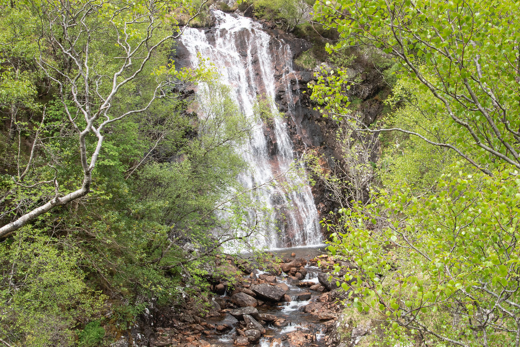
Hopefully just an exercise

Arrived back at the car bang on 1530 – interestingly my stats showed only 40 minutes of non-moving time. This was definitely lower than normal!
Fish supper, smoked sausage chaser and a side of mushy peas – yes please.

Climbed enough “floors” to earn it

No comment on night one of the Stag Do but made it to bed in Aviemore at 0300, just 22 hours after first waking. Tiring day all round, but good for the soul!
I have no reason to back it up, but I had never particularly looked forward to either Aonach Beag/ Mor, and the ski centre side was never going to be used. However, after this trip they excelled. Once passed the Steall falls it was a proper feeling of remoteness surrounded by some giant hills. A superb day out, some perfect high camp opportunities, and I can’t want to get back to add on some of the Tops I missed out on this trip.
Anyway, thanks for reading
Andy
My route
With a Stag Do in Aviemore starting on the Friday night, but with some superb weather forecast for the Friday day, the only sensible option was to set a 0500 Friday alarm and drive from Aberdeen to Fort William before the chaos commenced. The journey was seamless, and I rocked up at the far Glen Nevis car park just after 0900 and got parked no problem!
For many years I had planned on doing Aonach Beag and Aonach Mor with Carn Mor Dearg and possibly Ben Nevis – but as I needed to be in Aviemore by a reasonable time, my options for shortish day walks were limited and it seemed sensible not to overindulge. Saturday night would cover that particular pastime…
Spring has fully sprung
Given it was quite early the walk into Steall falls was peacefully quiet and just about too early in the year for midges. For whatever reason, no matter how many times I have done this section it always feels longer than I remember. The first glimpse of Steall Falls, from that frequently captured angle, remains impressive regardless.
That frequently captured angle
I had now been to Steall Falls on several occasions but never ventured further down the glen. There were plenty of people already stopped at the waterfall and a relatively obscene number of tents – it seems to be a popular spot for the “just about wild camping crew”. Find it hard to fully agree, or see the appeal, but each to their own, and if it is left as-is, then who can complain.
Paying less attention than I should of, I briefly lost the path as it quickly became boggy underfoot. I only know that I lost the path as on the return journey I had a solid path right to the car.
First glimpse of the initial climb, Sgurr a Bhuic
When I reached the Steall ruins I stopped to delayer and get as much water in my system as possible, as I fully expected this to be a sweaty climb.
Ruins up towards Sgurr a Bhuic
Looking back to The Mamores
Exactly as expected. The initial ascent up Sgurr a Bhuic was a tough and sweaty one, but the first few kilometres had warmed the legs up as best as possible, and I was making good progress. The perk of solo walking is you always seem to go much faster. Less talking and more thinking, I guess!
Looking up, aiming for the left side
Aonach Beag, the first Munro summit hiding in the clouds
The shoulder up to the 800m mark on Sgurr a Bhuic felt precariously steep and progress had now slowed right down. On the plus side, the view behind was exceptional and the rests to “stop and take in the view” were fully utilised.
The Mamores in all their glory. Steall falls looked tiny from up here! Had one of my best solo nights in the tent up on the Ring of Steall. That’s one of the best parts of good visibility – seeing previous adventures from another vantage point.
The view
Once above 800m the final section up towards the Munro Top of Sgurr a’ Bhuic was now obvious and not too daunting. I spotted a group just in front who appeared to be skirting around Sgurr a’ Bhuic.
At the time of this walk I hadn’t (yet) decided to “bag the tops”, but as time began passing through this first round, loose panic began to set in of what would I do when I do finish! For this trip, I had decided all along today to follow Walkhighlands recommendation and made the short detour up to the rocky summit.
Sgurr a’ Bhuic on the right
Sweaty selfie from or near the summit
Having savoured the views south to the Mamores, the views towards the Grey Corries were now taking over. Having done the Grey Corries a few years previous I didn’t recognise Sgurr Choinnich Beag from that outing, but also remembered I didn’t have any un-summited Munros to the west.
In hindsight it turns out to be a subsidiary top of Sgurr Choinnich Mor (the final Munro summit on my Grey Corries route). If I hadn’t been time pressured on this outing, I’d have been tempted for an out and back as it looked like an excellent route.
On the plus side as I’ve since started my Tops Journey – it’s a great reason to return!
Sgurr Choinnich Beag (far right (not politically…))
The Ben – cloudy, obviously…
The route towards Aonach Beag
The group that bypassed the Top
The way down from Sgurr a’ Bhuic was very loose underfoot and a little steep in parts. The sun was glistening off every rock and I remember wishing I’d taken my sunglasses. I had however taken sun cream, which is normally a curse for the weather, but I decided to take my chances here and reapply.
Looking back up Sgurr a’ Bhuic
Not sure how many freeze / thaw cycles this LARGE section has left where it is
That was somewhere near Coire a’ Bhuic on OS maps – won’t catch me going up there any time soon.
Next incline was the section up to Stob Coire Bhealaich which was on a solid well-defined path and seemed to go quickly. From the summit of Stob Coire Bhealaich it was clear that I was moving faster than the group of four ahead.
I didn’t want to pass them on the route up Aonach Beag as then get hit with the awkward and unjustifiable feeling that you need to walk faster than planned to build up a gap – it’s hard to describe, but sure you know what I mean. Decided to stop at Stob Coire Bhealaich and have my lunch.
Aonach Beag on the right, Ben Nevis hiding in the background
Left the group to rally on
[I didn’t stop too long for lunch, but most definitely long enough to require those layers back on. As I was setting off the cloud cover seemed to almost increase instantly. Thankfully it appeared to be sitting just about 1300m – annoying for those on the Ben, but good for us on the Aonach’s!
Making progress up Aonach Beag looking back at the route up. Notice how small Sgurr a’ Bhuic appears (bottom right)
I reached the summit almost exactly at the same time as the group in front. We stopped for a brief chat, and helped them out with a group photo, before deciding to batter on towards Aonach Mor.
Summit views towards Ben Nevis and Carn Mor Dearg
Carn Mor Dearg (zoomed)
The route between Aonach Beag and Mor seemed like nothing and took hardly any time. I did notice I had a missed call and voicemail. As there was hardly any wind, I decided to have a quick listen. It was a message asking me to phone to doctor “as soon as possible”. Classically they didn’t pick up when I returned the call (fair enough it was a Friday afternoon), but I then spent the next hour or so preparing for the worst!
It turned out to be an admin update… lesson learned – don’t listen to voicemails when out in the hills!
View from Aonach Mor (which I had pessimistically decided would be my last hill before my imminent demise!!!)
If the doctor wasn’t about to kill me off, I had to make sense of the steep and “treacherous” descent down to the bealach between Aonach Mor and Carn Mor Dearg. Retracing steps over the vast space between Aonach Mor and Aonach Beag, the route down to the bealach seemed impossible.
There was a lot of down and not a lot of distance to make that down…
A sole figure in front of me
Seeing someone else immediately sparked optimism that I could follow them and hope they were able to find the path.
On trying to find the path the route up to Carn Mor Dearg looked insanely appealing. Too appealing. Quick check of the watch and I was sure I had maybe just enough time. Maybe Aonach Mor wasn’t going to be my last summit!
The ridge up Carn Mor Dearg
Found the path – STEEP!
Finding the path was a relief and relatively easy in good visibility, but with very few features I can see what it would be a navigational challenge in the winter / cloud.
I didn’t see the sole figure from earlier but was clear this was the best route down so started to make slow and slippery progress. The path is clearly well trodden but looking back at photos it really doesn’t show how steep it feels in reality.
Nearly at the bottom
Looking back up – again doesn’t look as steep as it was
By now it was nearing 2pm. Carn Mor Dearg remained insanely inviting but my knees had taken a battering on the way down and I decided not to push it too far. A relatively enjoyable walk back out down through the Coire back to the Steall ruins.
Start of the long walk out
Looking back up (same direction just 20 minutes walking apart)
On the walk to the Steall ruins I didn’t see a single other person. Yet maybe a mere 1500m away there would be literally hundreds of people making their way up the tourist trap to the summit of the Ben. Amazing what a couple of extra metres height on a map can create. Give me this any day of the week!
I enjoyed my peace and quiet and bumped into a couple when had been just arrived back soaking their feet in the burn – this looked immensely tempting, but I had just started thinking about a fish supper, which clearly proved more tempting!
So, I battered on (pun intended…).
Waterfall near the ruins
Hopefully just an exercise
Arrived back at the car bang on 1530 – interestingly my stats showed only 40 minutes of non-moving time. This was definitely lower than normal!
Fish supper, smoked sausage chaser and a side of mushy peas – yes please.
Climbed enough “floors” to earn it
No comment on night one of the Stag Do but made it to bed in Aviemore at 0300, just 22 hours after first waking. Tiring day all round, but good for the soul!
I have no reason to back it up, but I had never particularly looked forward to either Aonach Beag/ Mor, and the ski centre side was never going to be used. However, after this trip they excelled. Once passed the Steall falls it was a proper feeling of remoteness surrounded by some giant hills. A superb day out, some perfect high camp opportunities, and I can’t want to get back to add on some of the Tops I missed out on this trip.
Anyway, thanks for reading
Andy
My route
Click to mark this as a great report. Register or Login free to be able to rate and comment on reports (as well as access 1:25000 mapping).
The Black Mount Duo
Date walked: 26/03/2023
Distance: 18.17km
Ascent: 1255m
Comments: 3
Views: 1871
Beinn Bhuidhe on a Fyne March Morning
Date walked: 04/03/2023
Distance: 24.63km
Ascent: 1063m
Views: 574
Beinn Liath Mhor – The Sky of Many Colours
Munros: Beinn Liath MhòrDate walked: 05/02/2023
Distance: 17.18km
Ascent: 1413m
Comments: 1
Views: 852
North Glen Lochay 2 High Camp
Munros: Beinn Heasgarnich, Creag Mhòr (Glen Lochay)Date walked: 24/09/2022
Distance: 29.7km
Ascent: 1532m
Views: 746
Sgurr Alasdair and One Stone Chute to rule them All!
Munros: Sgùrr AlasdairDate walked: 02/06/2022
Distance: 10.58km
Ascent: 992m
Comments: 1
Views: 719
An Dorus Day Out
Munros: Sgùrr a' Ghreadaidh, Sgùrr a' MhadaidhDate walked: 01/06/2022
Distance: 11.38km
Ascent: 915m
Comments: 1
Views: 647
Finally, the Inaccessible Pinnacle
Munros: Inaccessible Pinnacle, Sgùrr na BanachdichDate walked: 31/05/2022
Distance: 10.77km
Ascent: 1028m
Comments: 2
Views: 1087
Beinn Fhada & Hunter’s Pass - It's up there!
Munros: Beinn FhadaDate walked: 27/04/2022
Distance: 19.74km
Ascent: 1121m
Comments: 1
Views: 866
Once in a Lifetime
Munros: Sgùrr a' MhaoraichDate walked: 25/04/2022
Distance: 14.15km
Ascent: 968m
Comments: 8
Views: 1427
-
andygunn23

- Location: Aberdeen
- Mountain: The next one
- Gear: AlpackaRaft - Explorer 42
- Munros: 232
- Tops: 36
- Corbetts: 4
- Fionas: 1
- Islands: 12
- Filter reports
- Trips: 4
- Distance: 77.93 km
- Ascent: 5107m
- Munros: 6
- Trips: 10
- Distance: 178.71 km
- Ascent: 11324m
- Munros: 15
- Trips: 6
- Distance: 123.1 km
- Ascent: 9213m
- Munros: 16
- Corbetts: 1
- Trips: 4
- Distance: 75.5 km
- Ascent: 5878m
- Munros: 8
- Trips: 19
- Distance: 309.6 km
- Ascent: 23228m
- Munros: 36
- Trips: 20
- Distance: 489.9 km
- Ascent: 29922m
- Munros: 57
- Trips: 11
- Distance: 286.7 km
- Ascent: 13908m
- Munros: 33
- Corbetts: 1
- Trips: 8
- Distance: 155.32 km
- Ascent: 6040m
- Munros: 20
- Trips: 9
- Distance: 254.25 km
- Ascent: 6236m
- Munros: 31
- Corbetts: 1
- Joined: Jul 30, 2015
- Last visited: Apr 04, 2024
- Total posts: 121 | Search posts
