
A quick jaunt up Seana Bhràigh
Route: Seana Bhràigh
Munros: Seana Bhràigh
Date walked: 10/06/2021
Time taken: 530 hours
Distance: 16km
Ascent: 360m
For the past few months I have been working on Inverlael Estate where work is being carried out by NatureScot to restore the peatland landscape. I realised that by working here I was in a unique and possibly advantageous position to climb Seana Bhràigh. The Walkhighlands estimate given for the normal route from Inverlael car park is 9-10 hours. However, having studied a map and looked at the distance and terrain I would be faced with, I was confident I could do it in significantly less time and bag myself this remote munro. It was an opportunity not to be missed.
 DSC_0106 by Connor McKinnie, on Flickr
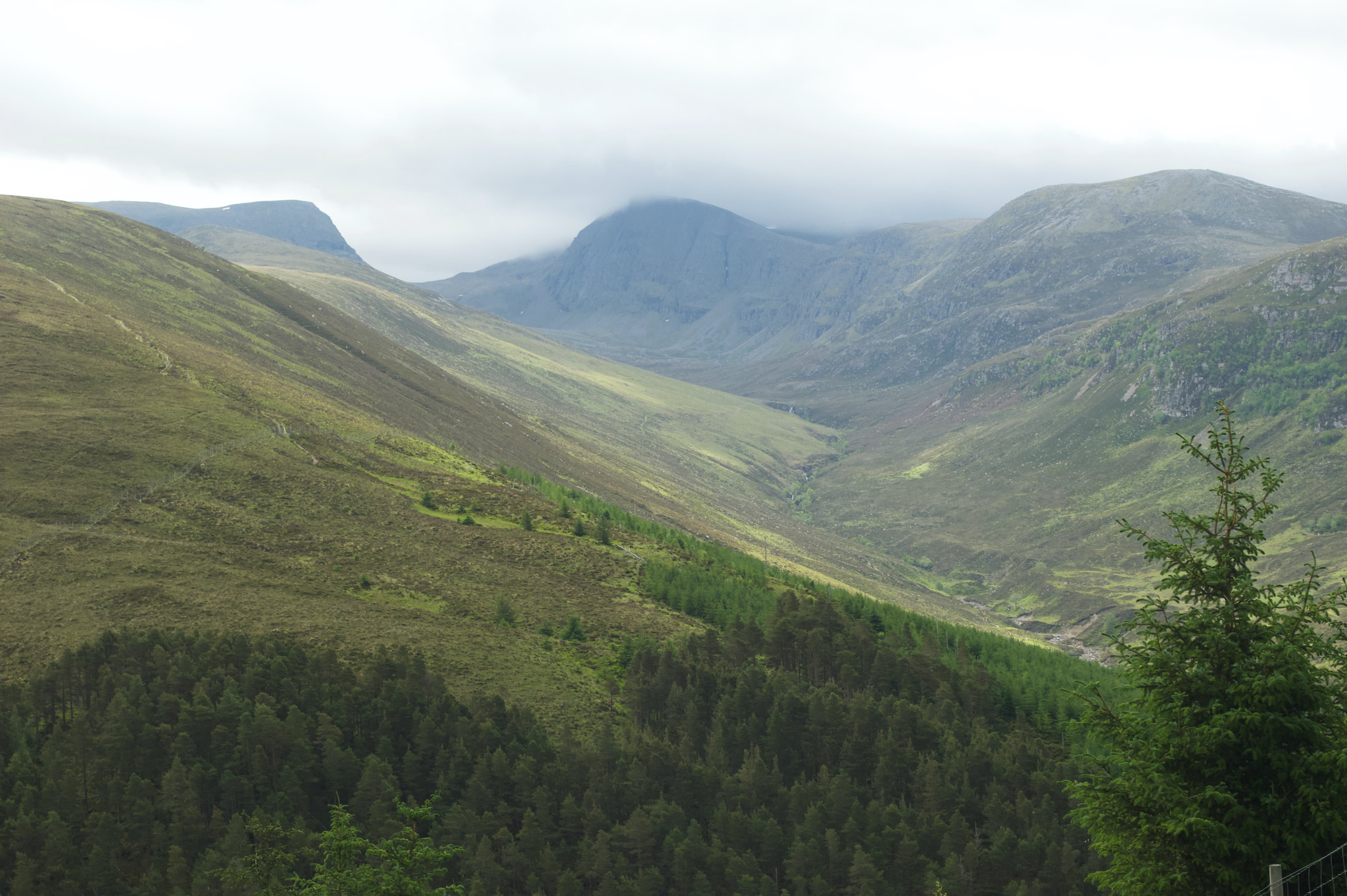
Driving up to the worksite along the very steep track I stopped to look back across at Beinn Dearg which was shrouded in mist. You can see the usual path to Seana Bhràigh on the hill to the left of the photo.
 DSC_0112 by Connor McKinnie, on Flickr
And it was here that my journey began. The diggers carrying out the peatland restoration work can be seen across the hill - the last place most would expect to find these large metal beasts - with Seana Bhràigh behind them in the distance. Years of damage, mostly by unsustainably high numbers of deer trampling across the site, have led to this environment being left heavily damaged and in a poor state. By using diggers to block ditches, create natural dams and re-profile peat hags it is hoped that this landscape can be restored to a healthy peatland habitat - full of bog pools and sphagnum moss which will provide a home for many species of insects, plants and wading birds - such as golden plover and dunlin. The restored peatland itself will also act as a vital carbon sink as Scotland aims to reduce its CO2 emissions.
 DSC_0122 by Connor McKinnie, on Flickr
 DSC_0124 by Connor McKinnie, on Flickr
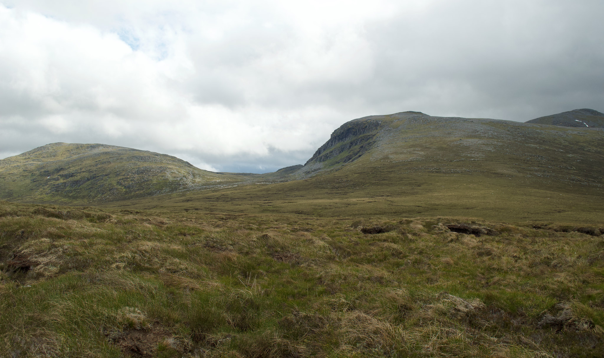
After carrying out my site duties I started my hike at 12pm. I trudged up the boggy slopes of Càrn Mor, passing south of the summit and walked across the open peatland to reach the main path and the official Walkhighlands route as it passes through Coire an Lochain Sgeirich.
 DSC_0128 by Connor McKinnie, on Flickr
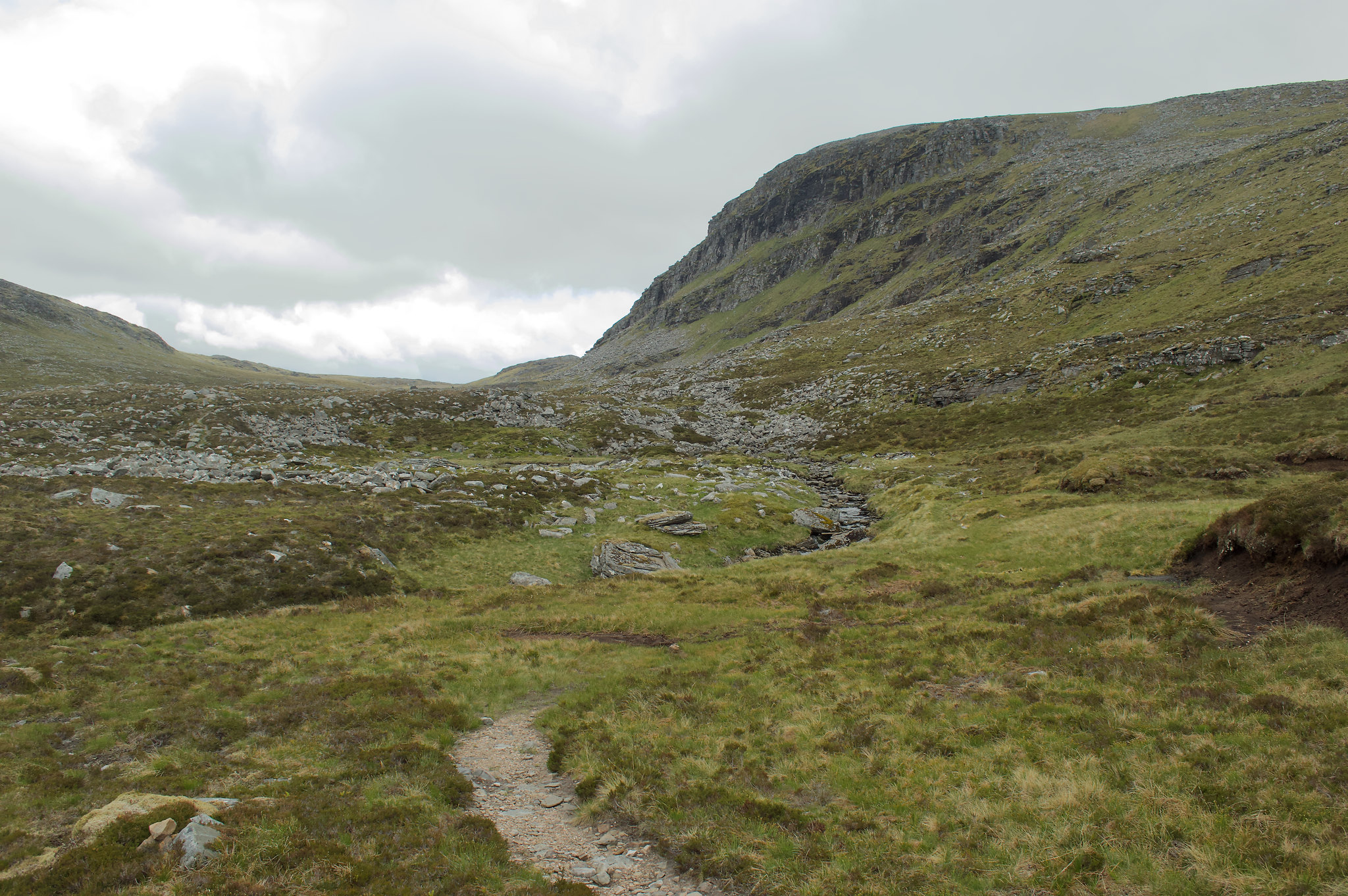
I lost sight of the path - and this would become a familiar theme of the day! Although this didn't concern me as I knew the general direction I was going, it was a bit annoying. Thankfully the munro-baggers of old who had ventured here before me have very handily built cairns sporadically along the route, and often it was the sight of a small cairn which led me back on track. As I continued on I got a tantalising glimpse of the summit through a gap in the hills.
 DSC_0130 by Connor McKinnie, on Flickr
I had reached the descent before the final climb and got my first proper view of the mountain and what I had ahead of me.
 DSC_0138-Pano by Connor McKinnie, on Flickr
Upon reaching Cadha Dearg I was greeted by immense views into the vast valley below, the Gleann à Chadha Dheirg.
 DSC_0133 by Connor McKinnie, on Flickr
Opposite Cadha Dearg is Loch à Chadha Deirg which was looking particularly beautiful with grass and reeds flowing from the water. It was time to start the short and relatively steep climb to the summit.
 DSC_0142 by Connor McKinnie, on Flickr
 DSC_0149 by Connor McKinnie, on Flickr
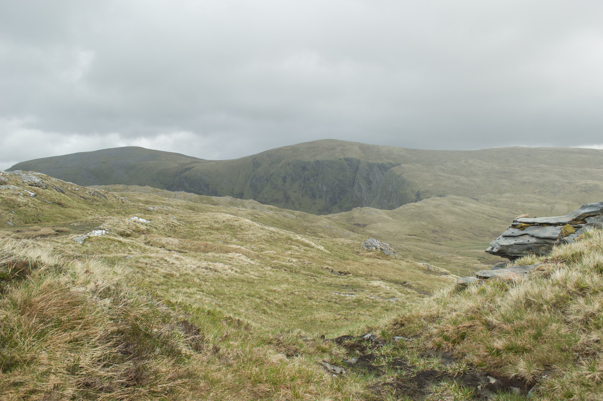
Arriving onto the small plateau and then onto the summit, there were fine views to be had of the mountains of Assynt. And with that I had bagged Seana Bhràigh! It had only taken me approximately 3 hours and at this point I knew I was going to complete my hike much sooner than I thought. My plan to climb the munro via my strategic route had paid off.
 DSC_0146-Pano by Connor McKinnie, on Flickr
Before I departed I walked over to the cliff edge to take some shots of the magnificent Creag an Duine and Loch Luchd Choire - that for me was the photo of the day.
 DSC_0151 by Connor McKinnie, on Flickr
The walk back was made trickier and slightly unpleasant due to the Jupiter-like winds I had to deal with. Again I lost track of the path which sent me up some unorthodox routes at times until I found the trusty cairns. Walkhighlands states that the route can be difficult to find in poor weather and good navigation skills are needed - I couldn't agree more. Had thick mist descended the map and compass would have been vital to getting back home safely, I would hate to think what it would be like out there in those conditions. I ploughed on through the wind and there it was - the familiar sight of the diggers and my vehicle in the distance, with the shadowy mountains of An Teallach in the distance. I arrived back to the site by 1730 - I had completed my route in 5 hours and 30 minutes, much to the amazement of the digger drivers who I just managed to catch as they were leaving site! It's fair to say that I was feeling pretty chuffed with myself for my efforts.
DSC_0106 by Connor McKinnie, on FlickrDriving up to the worksite along the very steep track I stopped to look back across at Beinn Dearg which was shrouded in mist. You can see the usual path to Seana Bhràigh on the hill to the left of the photo.
DSC_0112 by Connor McKinnie, on FlickrAnd it was here that my journey began. The diggers carrying out the peatland restoration work can be seen across the hill - the last place most would expect to find these large metal beasts - with Seana Bhràigh behind them in the distance. Years of damage, mostly by unsustainably high numbers of deer trampling across the site, have led to this environment being left heavily damaged and in a poor state. By using diggers to block ditches, create natural dams and re-profile peat hags it is hoped that this landscape can be restored to a healthy peatland habitat - full of bog pools and sphagnum moss which will provide a home for many species of insects, plants and wading birds - such as golden plover and dunlin. The restored peatland itself will also act as a vital carbon sink as Scotland aims to reduce its CO2 emissions.
DSC_0122 by Connor McKinnie, on FlickrDSC_0124 by Connor McKinnie, on FlickrAfter carrying out my site duties I started my hike at 12pm. I trudged up the boggy slopes of Càrn Mor, passing south of the summit and walked across the open peatland to reach the main path and the official Walkhighlands route as it passes through Coire an Lochain Sgeirich.
DSC_0128 by Connor McKinnie, on FlickrI lost sight of the path - and this would become a familiar theme of the day! Although this didn't concern me as I knew the general direction I was going, it was a bit annoying. Thankfully the munro-baggers of old who had ventured here before me have very handily built cairns sporadically along the route, and often it was the sight of a small cairn which led me back on track. As I continued on I got a tantalising glimpse of the summit through a gap in the hills.
DSC_0130 by Connor McKinnie, on FlickrI had reached the descent before the final climb and got my first proper view of the mountain and what I had ahead of me.
DSC_0138-Pano by Connor McKinnie, on FlickrUpon reaching Cadha Dearg I was greeted by immense views into the vast valley below, the Gleann à Chadha Dheirg.
DSC_0133 by Connor McKinnie, on FlickrOpposite Cadha Dearg is Loch à Chadha Deirg which was looking particularly beautiful with grass and reeds flowing from the water. It was time to start the short and relatively steep climb to the summit.
DSC_0142 by Connor McKinnie, on FlickrDSC_0149 by Connor McKinnie, on FlickrArriving onto the small plateau and then onto the summit, there were fine views to be had of the mountains of Assynt. And with that I had bagged Seana Bhràigh! It had only taken me approximately 3 hours and at this point I knew I was going to complete my hike much sooner than I thought. My plan to climb the munro via my strategic route had paid off.
DSC_0146-Pano by Connor McKinnie, on FlickrBefore I departed I walked over to the cliff edge to take some shots of the magnificent Creag an Duine and Loch Luchd Choire - that for me was the photo of the day.
DSC_0151 by Connor McKinnie, on FlickrThe walk back was made trickier and slightly unpleasant due to the Jupiter-like winds I had to deal with. Again I lost track of the path which sent me up some unorthodox routes at times until I found the trusty cairns. Walkhighlands states that the route can be difficult to find in poor weather and good navigation skills are needed - I couldn't agree more. Had thick mist descended the map and compass would have been vital to getting back home safely, I would hate to think what it would be like out there in those conditions. I ploughed on through the wind and there it was - the familiar sight of the diggers and my vehicle in the distance, with the shadowy mountains of An Teallach in the distance. I arrived back to the site by 1730 - I had completed my route in 5 hours and 30 minutes, much to the amazement of the digger drivers who I just managed to catch as they were leaving site! It's fair to say that I was feeling pretty chuffed with myself for my efforts.
Click to mark this as a great report. Register or Login free to be able to rate and comment on reports (as well as access 1:25000 mapping).
Comments: 1
-
cmckinnie
- Activity: Munro compleatist
- Pub: Castle Tavern, Inverness
- Mountain: Mt Cascade...Canada!
- Place: Mar Lodge
- Gear: My trusty Mammut boots
- Member: Mountaineering Scotland
- Ideal day out: One that takes me through ancient forest
- Munro rounds: 40
- Filter reports
- Trips: 1
- Distance: 16 km
- Ascent: 360m
- Munros: 1
- Joined: Jun 23, 2021
- Last visited: Jun 30, 2021
- Total posts: 1 | Search posts