
An Assynt crossing
Fionas: Suilven
Date walked: 31/07/2022
Time taken: 7 hours
Distance: 21km
Ascent: 1000m
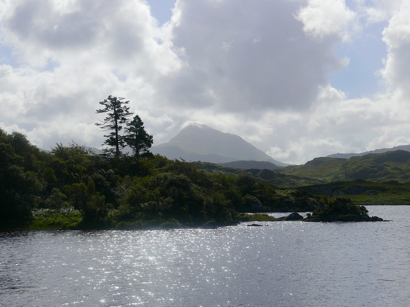
This summer, the last part of our holiday was spent in Elphin, in a cottage with a superb view of Suilven, so it seemed appropriate to go and climb it again. I have to confess that I have favoured other hills in the area for multiple repeats over the years which have a better ratio of hill to walk-in, such as Ben More Coigach, Quinag and Cul Mor.

The view from our cottage
We set off on the normal approach from Glencanisp Lodge. The parking was already quite full, and were expected the hill to be busy, but we soon encountered several teams who were returning from a summit camp who accounted for quite a few of the cars. Just before the lodge, there is a perfect spot for photos across Loch Druim Suardalain.
Canisp
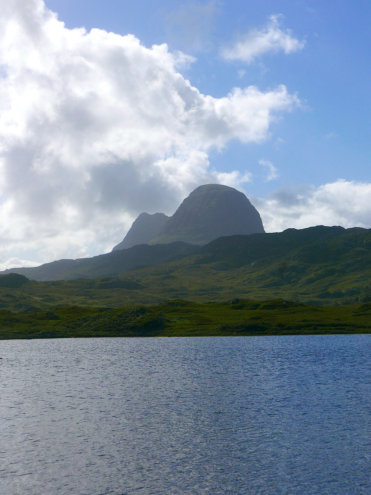
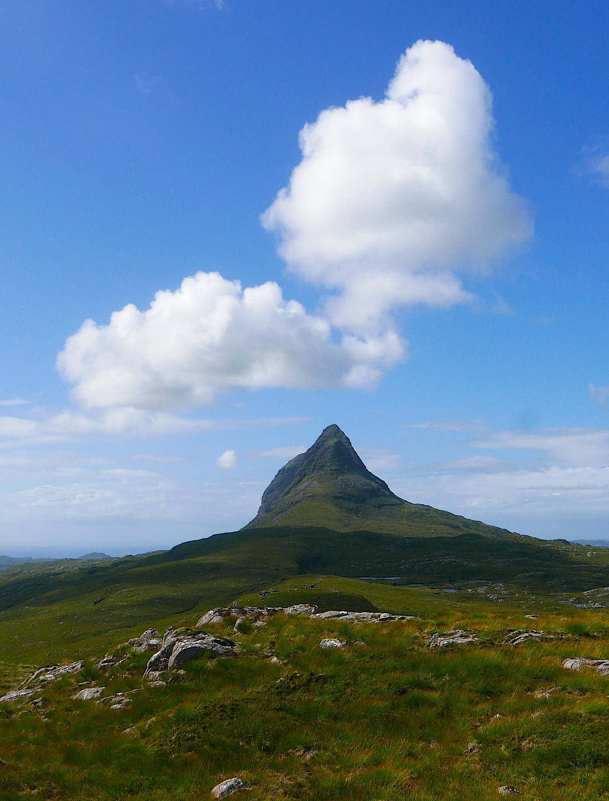
Suilven
The track gives pleasant easy walking, passing Suileag bothy before eventually crossing the river.

Suilven and Loch na h-Airigh Fraoich
A little further on the path to Suilven branches off to the right. This has been significantly renovated from its former bogginess since our last visit! The path passes the lovely Loch a' Choire Dhuibh before rearing up steeply to ascend the gully leading to Bealach Mor. This is now a good set of stone steps, in contrast to the previous eroded scree, and make the steep ground much less of a trial. The views to the north now start to open out.
Quinag and Loch a' Choire Dhuibh
The hard work is now over and it is time to enjoy the fine ridge with a few easy rocky steps, leading to the main summit, Caisteal Liath.

One of the rocky steps

Meall Meadhonach from Caisteal Liath.
We had our lunch break on the summit, propped up against the upturned slab of rock a short way beyond the summit cairn, gazing out at the views to the west. My partner had decided that she was not wanting to do any hard scrambling on this occasion, but was happy to head back to the car on her own while I completed the traverse eastwards to the main road, so we returned to the col and parted company.
The route to the east passes over an unnamed top, before dropping down to another col. On this descent a pair of ptarmigan took off from almost under my feet, while a third sat tight and pretended to be a rock.

Well-camouflaged ptarmigan
The next ascent to Meall Meadhonach is straightforward until the final 20 metres or so, which are defended by two rocky tiers. The first is climbed by some slabby steps, to a detached block. Here I think there are two options - go left and up, or go behind the block and traverse for 20 metres or so before making an awkward step (with neither good hand- nor foot-holds) up the topmost rock tier. I chose the latter, as it was the way I had gone before, but I think the left hand route may be a little easier?
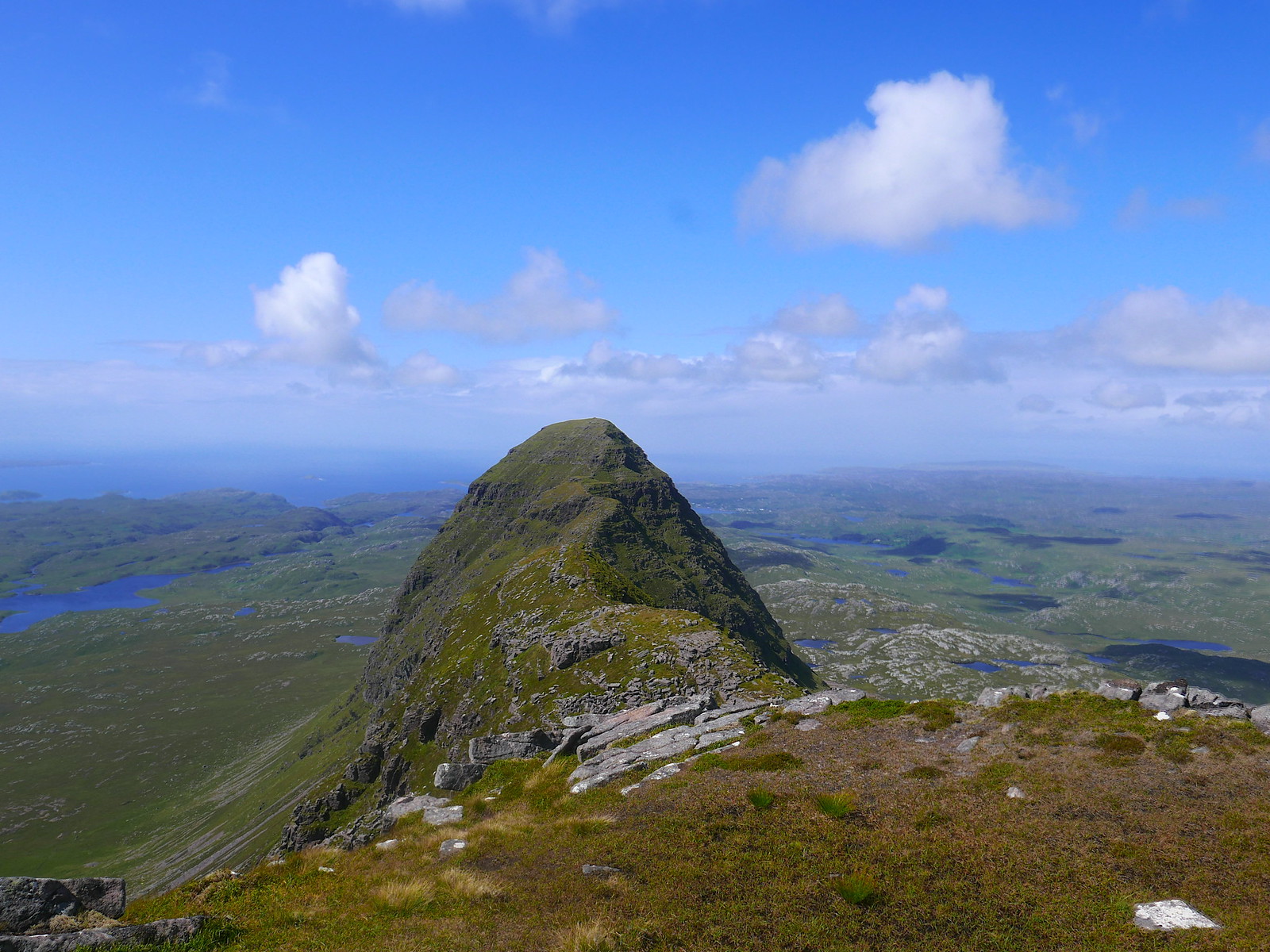
Caisteal Liath from the top of Meall Mheadhonach
The way forward is now much less travelled, without a clear path. The next descent is more of a steep face than a well-defined ridge, and I initially kept too far right, before realising my mistake and traversing back left to pick up a trace of a path in a shallow grassy gully. Soon I was at the col below the towering face of Meall Beag. The route up this is devious and exposed, but easy enough to follow. The hardest move comes first, a step left round a protruding rock with a big drop into the gully below. Despite the sunshine and a breeze, this section was shaded and still a bit damp, so I took it carefully. The route continues leftwards along grass ledges and up a couple of short steps, before turning back right up a short slab and soon reaching the top.

Meall Meadhonach from Meall Beag
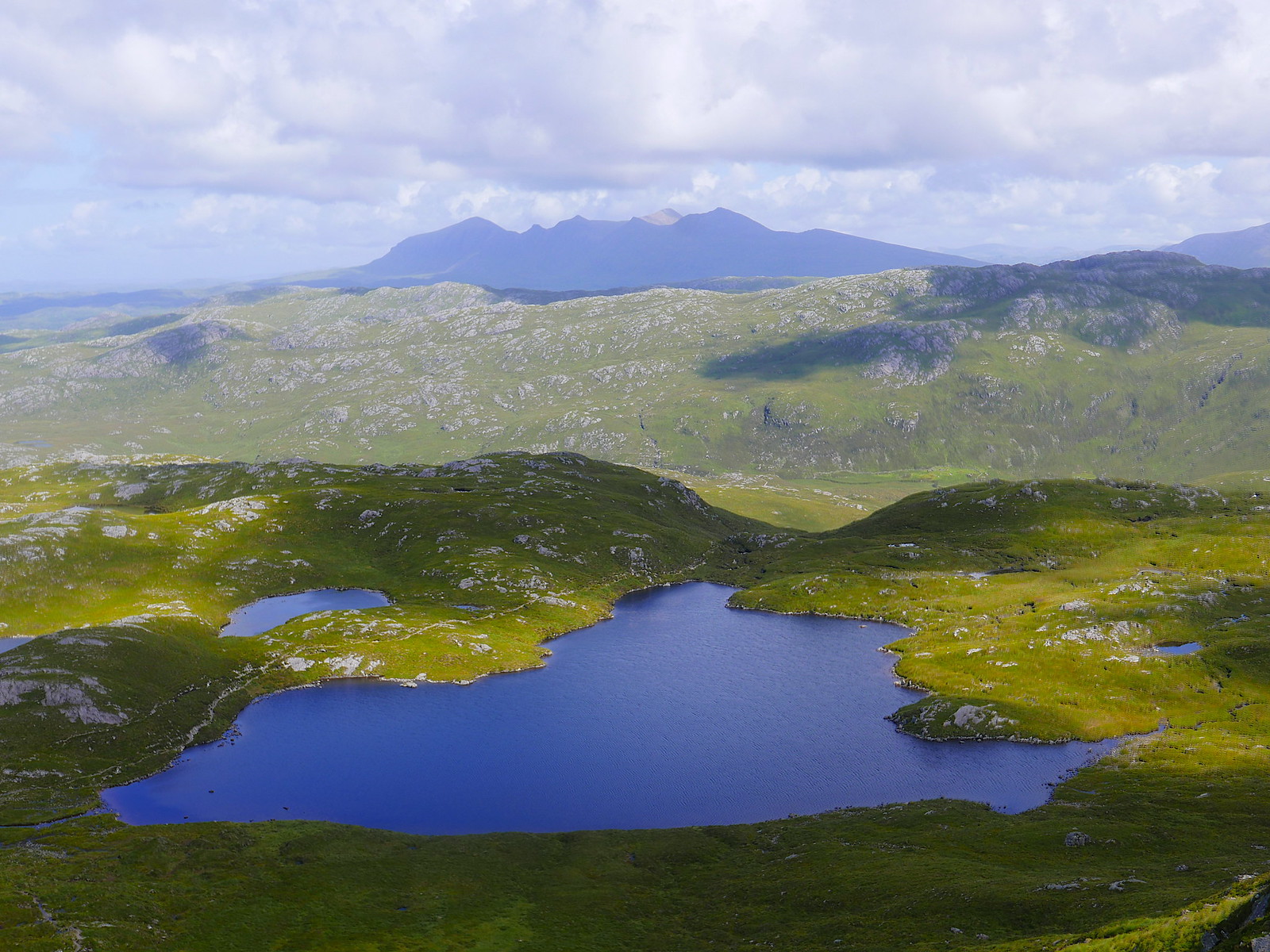
There is now a slight sting in the tail - just beyond the summit of Meall Beag is a narrow neck when gullies cut into both sides of the ridge, requiring an awkward and exposed step down. After this the descent is straightforward - there is one rock band easily avoided on the left-hand side. Soon I was on level ground, and facing a choice of onward route - bear left to reach the main path east of Loch na Gainich, bear right to reach another path near Bracklach, or stick to the highest ground over Meall na Braclaich. Given the fine weather I opted for the last of these as it promised the best views and the going did not look too rough. Thankfully this proved the case in the main - a mixture of grass and sandstone slabs with only the occasional boggy bit. Every so often I had to stop and admire the end-on prospect of Suilven gradually receding into the distance.
Below Meall Beag

Meall Beag with Meall Meadhonach towering behind
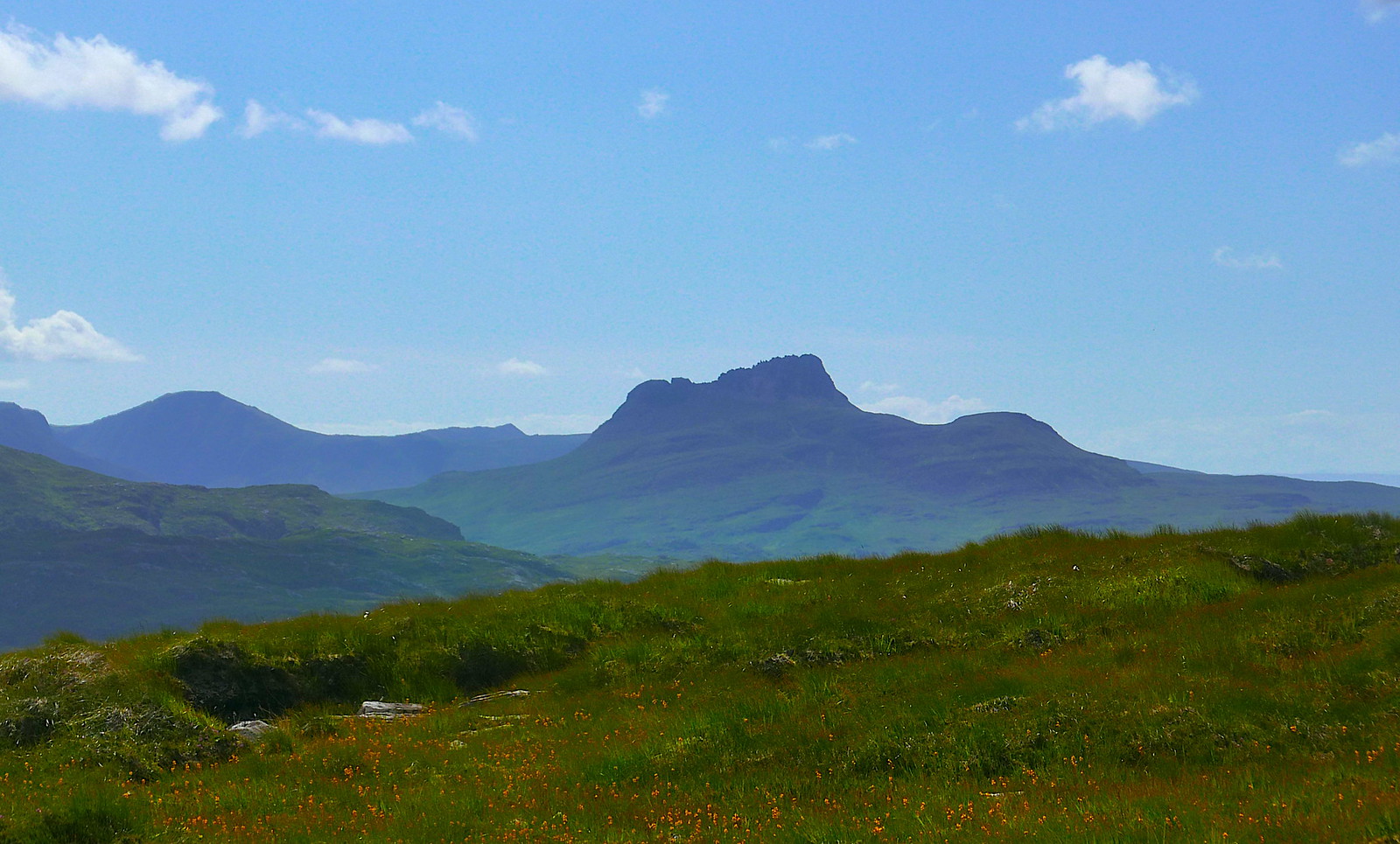
Stac Pollaidh

Looking back from Meall na Braclaich
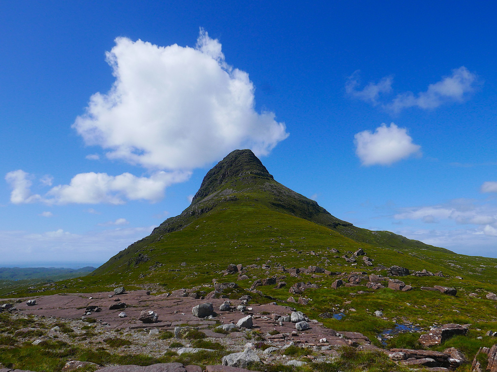
Suilven making her own personal cloud!
The last kilometre before reaching the path does get a bit rougher, so I was initially glad to reach it near the end of Lochan Fada, only to discover that it is itself pretty hard going, little more that a vague line between cairns, across bogs and quartzite stones. After a couple of ups and downs, the "path" descends to the shores of the Cam Loch, where it improves somewhat, and the views are still a magnificent distraction.
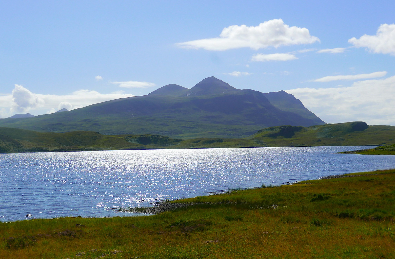
Cul Mor across Cam Loch
At the end of the loch I missed the path turning away from the shore, and ended up on the main road a couple of hundred metres too far south, but no matter: my partner had just arrived at the parking spot to pick me up.
So now I think I have experienced the very best of Suilven: a very satisfying end-to-end route in perfect weather. I'd recommend this to anyone who doesn't mind some exposed scrambling and can set up the transport logistics!
The view from our cottage
We set off on the normal approach from Glencanisp Lodge. The parking was already quite full, and were expected the hill to be busy, but we soon encountered several teams who were returning from a summit camp who accounted for quite a few of the cars. Just before the lodge, there is a perfect spot for photos across Loch Druim Suardalain.
Canisp
Suilven
The track gives pleasant easy walking, passing Suileag bothy before eventually crossing the river.
Suilven and Loch na h-Airigh Fraoich
A little further on the path to Suilven branches off to the right. This has been significantly renovated from its former bogginess since our last visit! The path passes the lovely Loch a' Choire Dhuibh before rearing up steeply to ascend the gully leading to Bealach Mor. This is now a good set of stone steps, in contrast to the previous eroded scree, and make the steep ground much less of a trial. The views to the north now start to open out.
Quinag and Loch a' Choire Dhuibh
The hard work is now over and it is time to enjoy the fine ridge with a few easy rocky steps, leading to the main summit, Caisteal Liath.
One of the rocky steps
Meall Meadhonach from Caisteal Liath.
We had our lunch break on the summit, propped up against the upturned slab of rock a short way beyond the summit cairn, gazing out at the views to the west. My partner had decided that she was not wanting to do any hard scrambling on this occasion, but was happy to head back to the car on her own while I completed the traverse eastwards to the main road, so we returned to the col and parted company.
The route to the east passes over an unnamed top, before dropping down to another col. On this descent a pair of ptarmigan took off from almost under my feet, while a third sat tight and pretended to be a rock.
Well-camouflaged ptarmigan
The next ascent to Meall Meadhonach is straightforward until the final 20 metres or so, which are defended by two rocky tiers. The first is climbed by some slabby steps, to a detached block. Here I think there are two options - go left and up, or go behind the block and traverse for 20 metres or so before making an awkward step (with neither good hand- nor foot-holds) up the topmost rock tier. I chose the latter, as it was the way I had gone before, but I think the left hand route may be a little easier?
Caisteal Liath from the top of Meall Mheadhonach
The way forward is now much less travelled, without a clear path. The next descent is more of a steep face than a well-defined ridge, and I initially kept too far right, before realising my mistake and traversing back left to pick up a trace of a path in a shallow grassy gully. Soon I was at the col below the towering face of Meall Beag. The route up this is devious and exposed, but easy enough to follow. The hardest move comes first, a step left round a protruding rock with a big drop into the gully below. Despite the sunshine and a breeze, this section was shaded and still a bit damp, so I took it carefully. The route continues leftwards along grass ledges and up a couple of short steps, before turning back right up a short slab and soon reaching the top.
Meall Meadhonach from Meall Beag
There is now a slight sting in the tail - just beyond the summit of Meall Beag is a narrow neck when gullies cut into both sides of the ridge, requiring an awkward and exposed step down. After this the descent is straightforward - there is one rock band easily avoided on the left-hand side. Soon I was on level ground, and facing a choice of onward route - bear left to reach the main path east of Loch na Gainich, bear right to reach another path near Bracklach, or stick to the highest ground over Meall na Braclaich. Given the fine weather I opted for the last of these as it promised the best views and the going did not look too rough. Thankfully this proved the case in the main - a mixture of grass and sandstone slabs with only the occasional boggy bit. Every so often I had to stop and admire the end-on prospect of Suilven gradually receding into the distance.
Below Meall Beag
Meall Beag with Meall Meadhonach towering behind
Stac Pollaidh
Looking back from Meall na Braclaich
Suilven making her own personal cloud!
The last kilometre before reaching the path does get a bit rougher, so I was initially glad to reach it near the end of Lochan Fada, only to discover that it is itself pretty hard going, little more that a vague line between cairns, across bogs and quartzite stones. After a couple of ups and downs, the "path" descends to the shores of the Cam Loch, where it improves somewhat, and the views are still a magnificent distraction.
Cul Mor across Cam Loch
At the end of the loch I missed the path turning away from the shore, and ended up on the main road a couple of hundred metres too far south, but no matter: my partner had just arrived at the parking spot to pick me up.
So now I think I have experienced the very best of Suilven: a very satisfying end-to-end route in perfect weather. I'd recommend this to anyone who doesn't mind some exposed scrambling and can set up the transport logistics!
Click to mark this as a great report. Register or Login free to be able to rate and comment on reports (as well as access 1:25000 mapping).
Comments: 5
Lockdown wanderings - Braid Hills and Blackford Hill
Date walked: 11/04/2020Distance: 10.5km
Ascent: 300m
Comments: 5
Views: 3167
1, 2
Beinn Eighe Scrambles - In Victorian Footsteps
Date walked: 18/10/2019
Distance: 14km
Ascent: 1200m
Comments: 19
Views: 10063
Stortinden (Efjorden), Norway
Date walked: 06/10/2019Distance: 5km
Ascent: 600m
Comments: 5
Views: 2839
Årsteinhornet, Norway
Date walked: 29/09/2019Distance: 19km
Ascent: 1100m
Views: 1636
Skavneskollen, Norway
Date walked: 25/07/2019Distance: 14km
Ascent: 1200m
Views: 1881
Rombakstøtta, Norway
Date walked: 23/07/2019Distance: 15km
Ascent: 1000m
Comments: 1
Views: 2059
Siriskolten, Norway
Date walked: 22/07/2019Distance: 8.5km
Ascent: 650m
Views: 1630
Rundfjellet, Norway
Date walked: 20/07/2019Distance: 8.5km
Ascent: 750m
Views: 1647
Rånkeipen, Norway
Date walked: 19/07/2019Distance: 10km
Ascent: 1200m
Views: 1887
-
jmarkb

- Location: Edinburgh
- Interests: Hillwalking, rock climbing, winter climbing, ski touring, photography, running(sometimes), yoga.
- Activity: Mountaineer
- Camera: Panasonic LX100
- Munro rounds: 1
- Corbett rounds: 1
- Munros: 246
- Corbetts: 105
- Fionas: 91
- Donalds: 32
- Sub 2000: 46
- Filter reports
- Trips: 1
- Distance: 21 km
- Ascent: 1000m
- Fionas: 1
- Trips: 1
- Distance: 10.5 km
- Ascent: 300m
- Trips: 13
- Distance: 157 km
- Ascent: 13170m
- Munros: 1
- Trips: 5
- Distance: 39.2 km
- Ascent: 4420m
- Trips: 1
- Distance: 15.5 km
- Ascent: 1000m
- Munros: 1
- Trips: 3
- Distance: 41 km
- Ascent: 2975m
- Munros: 2
- Corbetts: 1
- Fionas: 2
- Trips: 1
- Distance: 10.5 km
- Ascent: 620m
- Corbetts: 1
- Trips: 12
- Distance: 210.5 km
- Ascent: 13490m
- Munros: 4
- Corbetts: 4
- Fionas: 2
- Sub2000s: 3
- Trips: 13
- Distance: 146.8 km
- Ascent: 12560m
- Munros: 2
- Corbetts: 2
- Fionas: 2
- Sub2000s: 1
- Trips: 1
- Distance: 15 km
- Ascent: 750m
- Corbetts: 1
- Joined: Oct 28, 2011
- Last visited: Apr 19, 2024
- Total posts: 5882 | Search posts
