
Gask Hill|Sidlaw Hills
Date walked: 04/04/2017
Time taken: 1 hour
Distance: 4.38km
Ascent: 209m
I'm writing a report of a hill many of you probably haven't heard of... Gask Hill
For the last few weeks, Gask Hill has been a daily routine for me
Today I've decided to share the story.
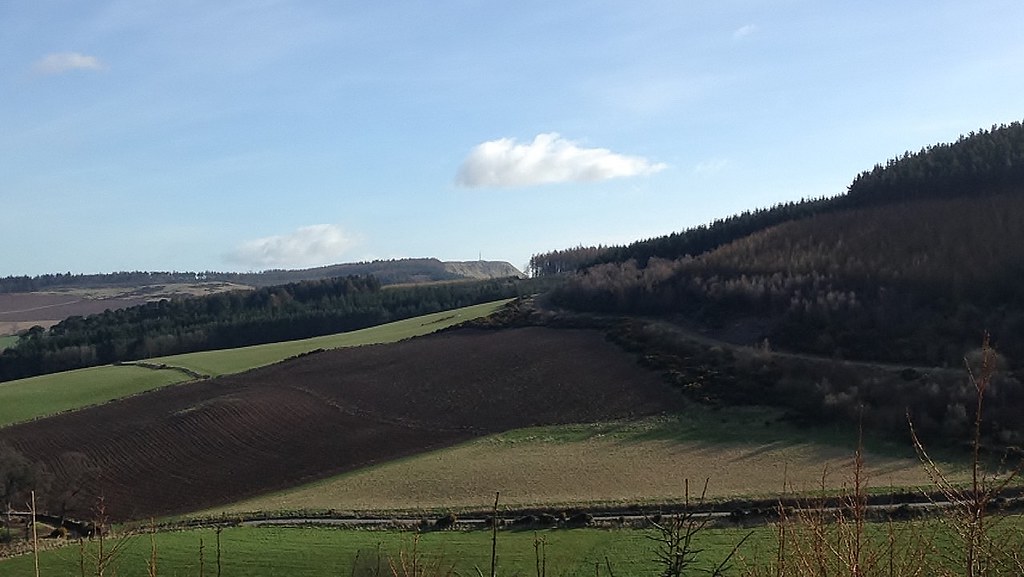
GASK HILL - as seen from North Corston
 IMG_2895 by Marc Pattullo, on Flickr
BACKGROUND INFORMATION
Gask Hill is Sub2000 Marilyn in Perth and Kinross, found within the Sidlaw Hills.
It's summit is at 358m/1,175ft making it the 8th highest Sidlaw Hill.
It's a very unpopular hill and is one of the least climbed in the Sidlaw Hills
The walk starts off at a small layby, big enough for about 2 cars (at the absolute most!) off the side of the road towards Abernyte from Pleasance Road, Coupar Angus. The layby is just outside the entrace to Balloglack.
 IMG_2915 by Marc Pattullo, on Flickr
(Co-ordinates for Car Park: 56.507905, -3.229530)
Balloglack Entrance
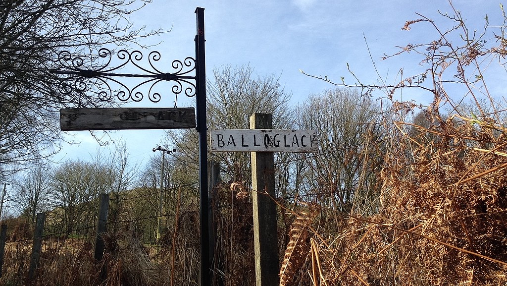 IMG_2898 by Marc Pattullo, on Flickr
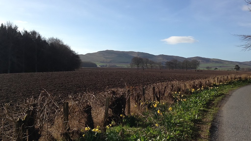
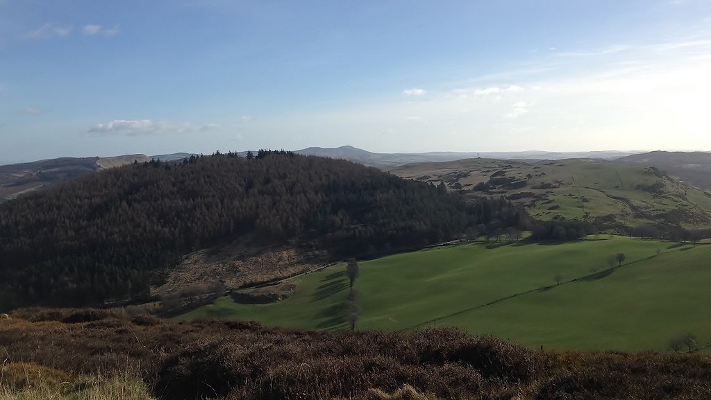
The walk starts off with a fantastic land rover track which take you about halfway up the hill, with great views to other Sidlaw Hills to one side and over to Glenshee and further
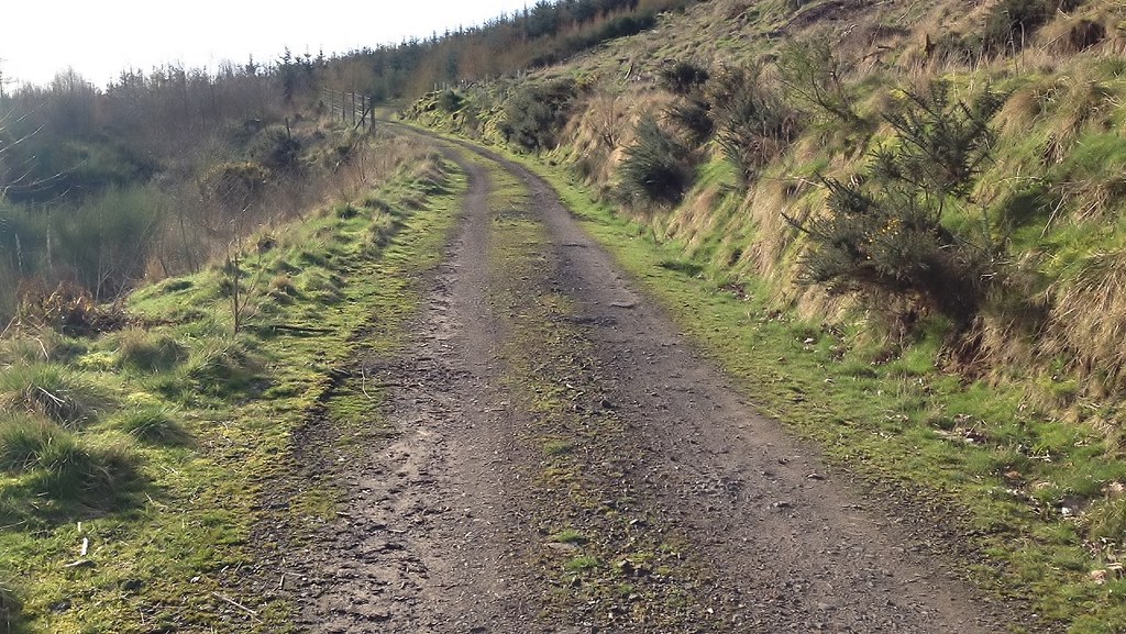 IMG_2899 by Marc Pattullo, on Flickr
Lundie Craigs
 IMG_2900 by Marc Pattullo, on Flickr
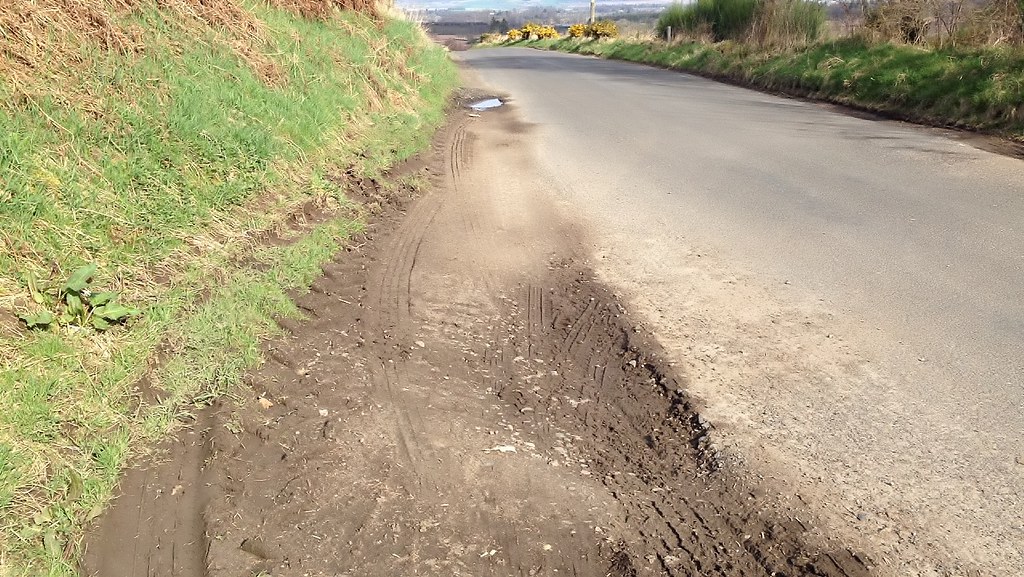
The path steadily turns into a large dirt track
 IMG_2903 by Marc Pattullo, on Flickr
After a while the path begins to turn into a rugid, somewhat boggy (Due to the number of tributaries leading into the Kettins Burn), grassy path which at points becomes quite steep and boggy but nothing to major
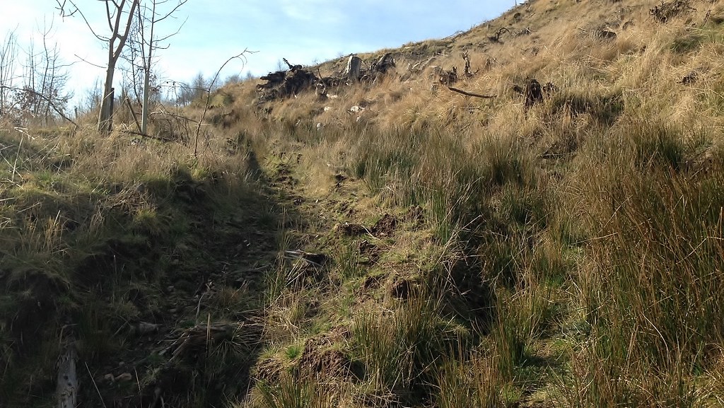 IMG_2905 by Marc Pattullo, on Flickr
Once beating the grassy path, it comes to a very steep and small trail which leads you around a large mound and towards the summit ridge, the path goes through deep heather and is barely noticeable at times, but it is there!
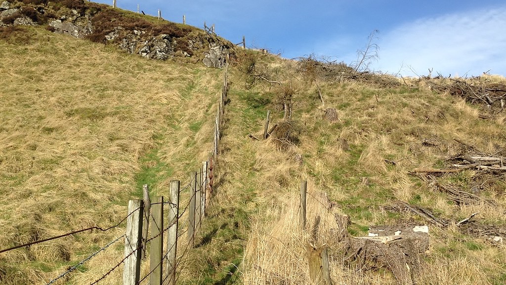 IMG_2907 by Marc Pattullo, on Flickr
The small trail with the summit ahead.
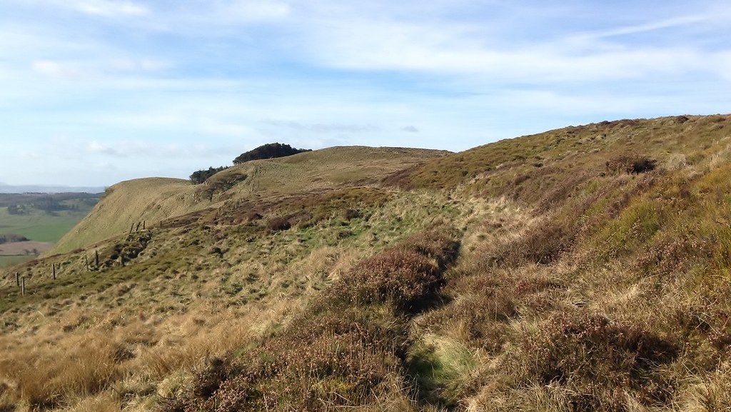 IMG_2910 by Marc Pattullo, on Flickr
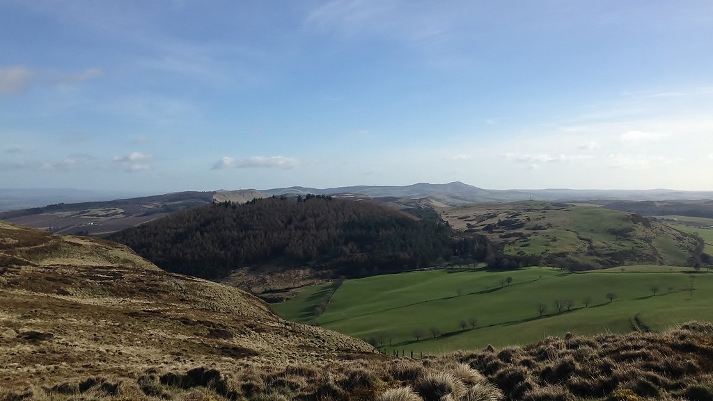
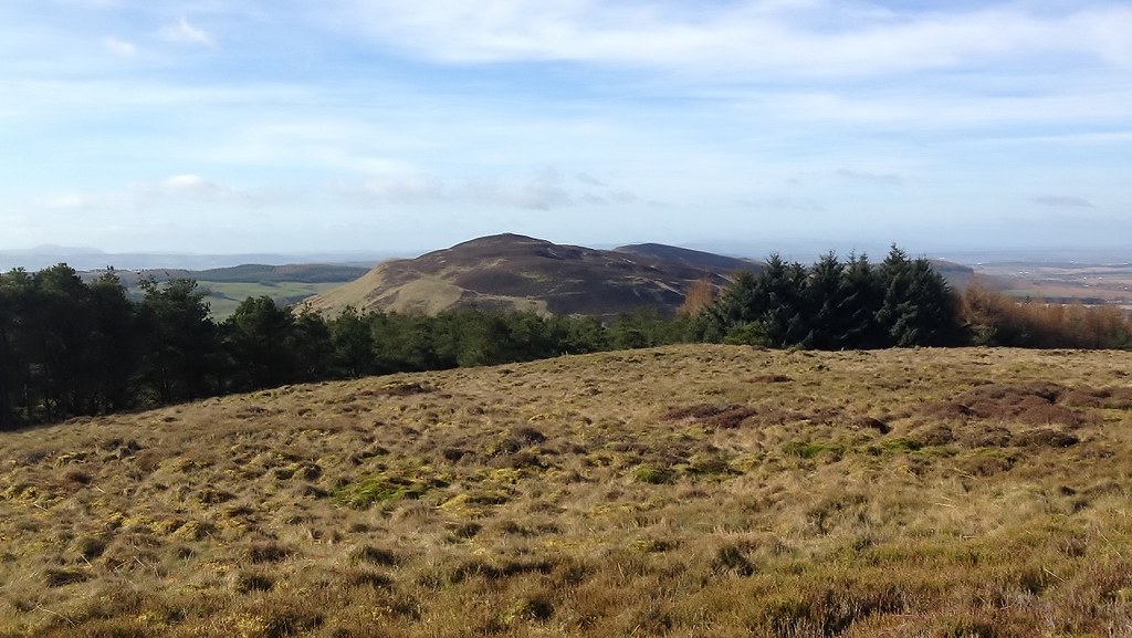
The summit ridge allows you to become higher than neighbouring Northballo Hill.
This opens up a long view which extends to the highest Sidlaw Hill, Craigowl Hill.
 IMG_2909 by Marc Pattullo, on Flickr
Aiver Hill
 IMG_2908 by Marc Pattullo, on Flickr
Following the small trail leads you behind the summit mound to the pathless walk to the summit.
The summit is clearly marked at the highest point (358m/1,175ft), with a small cairn covered in sticks with a large stick poking out the centre of the cairn. (Which I built only yesterday as it had nothing marking the summit, which was annoying me a little!)
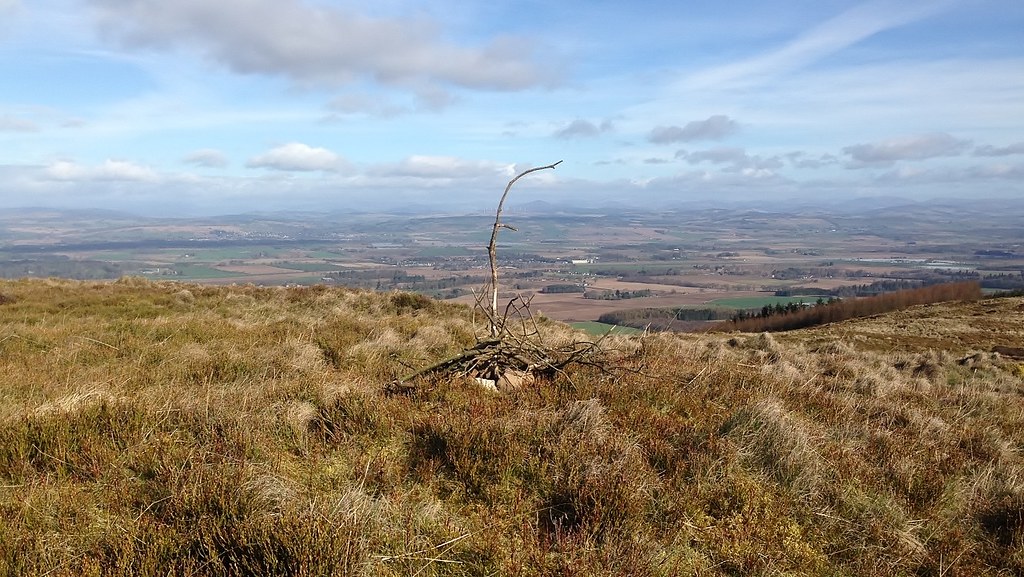 IMG_2911 by Marc Pattullo, on Flickr
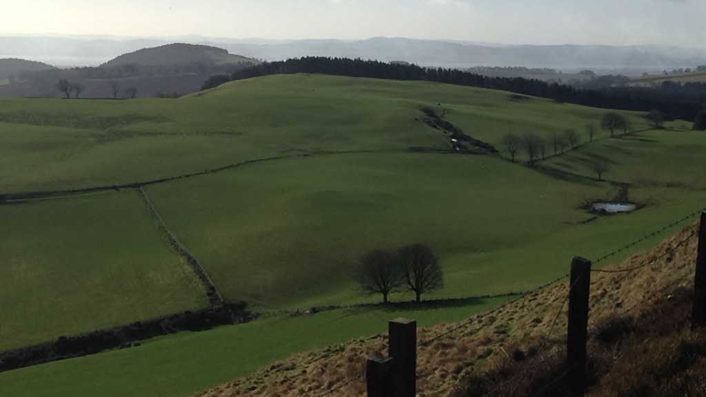
The views from the summit are fantastic with great views of Southballo Hill & Ballo Hill to the right, Northballo Hill in the centre, Lundie Craigs to the left and Craigowl Hill being further away in the distance.
 IMG_2912 by Marc Pattullo, on Flickr
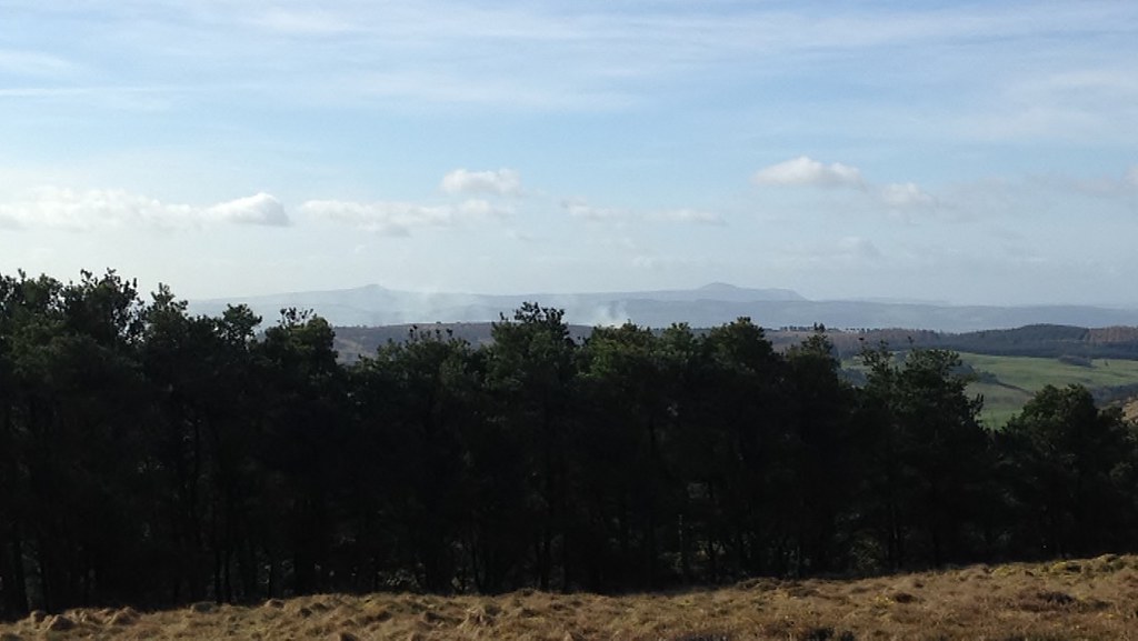
Behind you there is an opening in the trees which gives you an amazing view of the King's Seat and on a good day you can make out the white trip point at the summit with Black Hill just making it in the photo behind it.
 IMG_2913 by Marc Pattullo, on Flickr
If you look even further you can make out East and West Lomond in the silhouette
 IMG_2914 by Marc Pattullo, on Flickr
Hopefully this gives you a better look at this hill!
After a number of weeks of walking up the hill, I personally think the route I take is the quickest, shortest and easiest route up the hill.
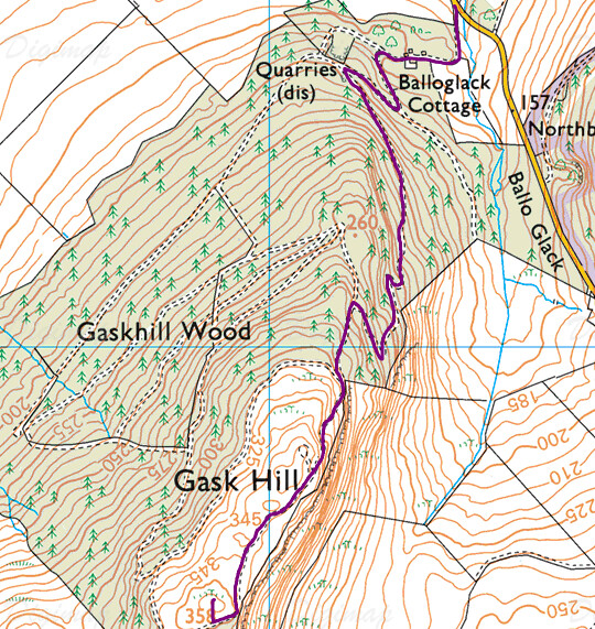 Route by Marc Pattullo, on Flickr
If you have a spare hour to an hour and a half, I recommend you give this hill a walk
PLEASE NOTE
- On a wet day, the path will become really boggy at parts and slippy on steeper, grassy parts nearer the summit
- Most fences nearer the summit have 2 rows of barbed wire
- There is a large number of branches and chopped trees left around the hillside, due to the cutting down of Gaskhill Woods
- There is a large number of pheasants from bottom to top with a small number of deer nearer the summit ridge
- On cloudier days the path may be hard to see, but cloud isn't much of an issue on the hill
For the last few weeks, Gask Hill has been a daily routine for me
Today I've decided to share the story.
GASK HILL - as seen from North Corston
IMG_2895 by Marc Pattullo, on FlickrBACKGROUND INFORMATION
Gask Hill is Sub2000 Marilyn in Perth and Kinross, found within the Sidlaw Hills.
It's summit is at 358m/1,175ft making it the 8th highest Sidlaw Hill.
It's a very unpopular hill and is one of the least climbed in the Sidlaw Hills
The walk starts off at a small layby, big enough for about 2 cars (at the absolute most!) off the side of the road towards Abernyte from Pleasance Road, Coupar Angus. The layby is just outside the entrace to Balloglack.
IMG_2915 by Marc Pattullo, on Flickr(Co-ordinates for Car Park: 56.507905, -3.229530)
Balloglack Entrance
IMG_2898 by Marc Pattullo, on FlickrThe walk starts off with a fantastic land rover track which take you about halfway up the hill, with great views to other Sidlaw Hills to one side and over to Glenshee and further
IMG_2899 by Marc Pattullo, on FlickrLundie Craigs
IMG_2900 by Marc Pattullo, on FlickrThe path steadily turns into a large dirt track
IMG_2903 by Marc Pattullo, on FlickrAfter a while the path begins to turn into a rugid, somewhat boggy (Due to the number of tributaries leading into the Kettins Burn), grassy path which at points becomes quite steep and boggy but nothing to major
IMG_2905 by Marc Pattullo, on FlickrOnce beating the grassy path, it comes to a very steep and small trail which leads you around a large mound and towards the summit ridge, the path goes through deep heather and is barely noticeable at times, but it is there!
IMG_2907 by Marc Pattullo, on FlickrThe small trail with the summit ahead.
IMG_2910 by Marc Pattullo, on FlickrThe summit ridge allows you to become higher than neighbouring Northballo Hill.
This opens up a long view which extends to the highest Sidlaw Hill, Craigowl Hill.
IMG_2909 by Marc Pattullo, on FlickrAiver Hill
IMG_2908 by Marc Pattullo, on FlickrFollowing the small trail leads you behind the summit mound to the pathless walk to the summit.
The summit is clearly marked at the highest point (358m/1,175ft), with a small cairn covered in sticks with a large stick poking out the centre of the cairn. (Which I built only yesterday as it had nothing marking the summit, which was annoying me a little!)
IMG_2911 by Marc Pattullo, on FlickrThe views from the summit are fantastic with great views of Southballo Hill & Ballo Hill to the right, Northballo Hill in the centre, Lundie Craigs to the left and Craigowl Hill being further away in the distance.
IMG_2912 by Marc Pattullo, on FlickrBehind you there is an opening in the trees which gives you an amazing view of the King's Seat and on a good day you can make out the white trip point at the summit with Black Hill just making it in the photo behind it.
IMG_2913 by Marc Pattullo, on FlickrIf you look even further you can make out East and West Lomond in the silhouette
IMG_2914 by Marc Pattullo, on FlickrHopefully this gives you a better look at this hill!
After a number of weeks of walking up the hill, I personally think the route I take is the quickest, shortest and easiest route up the hill.
Route by Marc Pattullo, on FlickrIf you have a spare hour to an hour and a half, I recommend you give this hill a walk
PLEASE NOTE
- On a wet day, the path will become really boggy at parts and slippy on steeper, grassy parts nearer the summit
- Most fences nearer the summit have 2 rows of barbed wire
- There is a large number of branches and chopped trees left around the hillside, due to the cutting down of Gaskhill Woods
- There is a large number of pheasants from bottom to top with a small number of deer nearer the summit ridge
- On cloudier days the path may be hard to see, but cloud isn't much of an issue on the hill
Click to mark this as a great report. Register or Login free to be able to rate and comment on reports (as well as access 1:25000 mapping).
Comments: 2
Gods own Land
Munros: Gleouraich, Spidean MialachDate walked: 02/05/2015
Distance: 12km
Ascent: 1130m
Comments: 3
Views: 3660
First Argyll Munro!
Munros: Beinn SgulairdDate walked: 18/04/2015
Distance: 13km
Ascent: 1240m
Comments: 6
Views: 5534
It's Still Winter in Monadhliath
Munros: Geal Chàrn (Monadhliath)Date walked: 12/04/2015
Distance: 12.5km
Ascent: 625m
Comments: 2
Views: 3126
Easter cracker at Arrochar
Munros: Ben Vorlich (Loch Lomond)Date walked: 05/04/2015
Distance: 13.5km
Ascent: 945m
Views: 2563
Back to the Hills, What a Start!!!
Munros: Maol Chean-deargDate walked: 14/03/2015
Distance: 14km
Ascent: 932m
Comments: 7
Views: 4693
High in the Skye!
Munros: Inaccessible Pinnacle, Sgùrr Alasdair, Sgùrr Mhic ChòinnichDate walked: 13/09/2014
Distance: 13.53km
Ascent: 1471m
Comments: 9
Views: 6736
Meall a'Bhuiridh & Creise a 100th Munro Classic!
Munros: Creise, Meall a' BhùiridhDate walked: 23/08/2014
Distance: 10.67km
Ascent: 1110m
Comments: 5
Views: 5074
A Derry good day in The Cairngorms
Munros: Beinn Mheadhoin, Derry CairngormDate walked: 09/08/2014
Distance: 30.81km
Ascent: 1211m
Comments: 10
Views: 8245
2 from Inverlochlarig!
Munros: Beinn Tulaichean, Cruach ÀrdrainDate walked: 28/07/2014
Distance: 12.53km
Ascent: 1025m
Comments: 2
Views: 3462
-
mountainboy12

- Location: Coupar Angus, Perth and Kinross, Scotland
- Interests: Climbing Mountains, Football
- Activity: Stravaiging
- Pub: dont drink
- Mountain: Inaccessible Pinnacle
- Place: Cairngorms
- Gear: Ice-Axe and Crampons
- Member: Perth Based Mountaineering Club & Talk Highlands
- Camera: Samsung WB150
- Ambition: Seven Summits/ Mt Everest
- Munros: 260
- Corbetts: 5
- Fionas: 1
- Sub 2000: 7
- Filter reports
- Trips: 1
- Distance: 4.38 km
- Ascent: 209m
- Trips: 5
- Distance: 65 km
- Ascent: 4872m
- Munros: 6
- Trips: 16
- Distance: 345.33 km
- Ascent: 18967m
- Munros: 31
- Corbetts: 1
- Trips: 17
- Distance: 318.5 km
- Ascent: 16631m
- Munros: 32
- Corbetts: 1
- Sub2000s: 2
- Trips: 10
- Distance: 824 km
- Ascent: 50556m
- Munros: 85
- Corbetts: 3
- Fionas: 1
- Sub2000s: 3
- Joined: Oct 15, 2012
- Last visited: Sep 09, 2018
- Total posts: 172 | Search posts
