
Creag nan Leachda - Glen Beg loop
Date walked: 19/07/2020
Time taken: 4 hours
Distance: 11.43km
Ascent: 586m
I was surprised that this route didn’t have multiple walk reports already submitted, as it’s next to Braemar. We’d previously attempted this walk in winter but no access was allowed, I think due to some estate business with the deer. We started at Keiloch car park, and crossed the old military road and the old Bridge of Dee.
 Old Dee Bridge by sgurr_a, on Flickr
The estate track winds up under the Sron a Bhruic cliffs, and soon there's a track that forks off steeply to the right. This looks like it was once a well-trodden track, but now is overgrown with heather and populated by ant colonies. Potentially prime tick area with the long grass and heather overhanging.
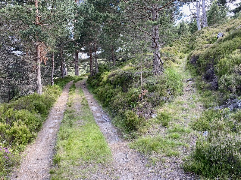 Path to the right by sgurr_a, on Flickr
The track soon comes to a brand-new deer fence with a latched gate. The heather is thick and tussocky, but there is a path that tracks the fence up to higher ground. The heather soon thins out, and the ridge can be followed up to the larger cairn. This isn't the true summit, but gives panorama views of the Cairngorm massif, the Ben Avon barns, Lochnagar and the two Morvens.
 Path tracks new deer fence by sgurr_a, on Flickr
 Tors, Barns and Clachs by sgurr_a, on Flickr
 Not the summit by sgurr_a, on Flickr
Next is an unnamed Lochan, an ∞ pool hiding in a dip beside the summit. This would be good for a paddle, or a summit camp, or even some fishing. I've heard that years ago some high lochans were stocked by the estates is a bid to have the highest fishing grounds.
 Unknown lochan by sgurr_a, on Flickr
The true summit lies ~50m to the southeast. Not much of a cairn, but a small tor gives some shelter. We then trod down to the Glenbeg Burn, the managed heather making the walking easy.
The upper parts of Glenbeg burn are great, and as there's no well-heeled path so I imagine they’re little visited. Ideal for a post-hill paddle. Fallen pines that are a sun-bleached ivory colour line the river, which leads to the scandi-style royal cabin.
 Glenbeg pools by sgurr_a, on Flickr
Easy track home.
Old Dee Bridge by sgurr_a, on FlickrThe estate track winds up under the Sron a Bhruic cliffs, and soon there's a track that forks off steeply to the right. This looks like it was once a well-trodden track, but now is overgrown with heather and populated by ant colonies. Potentially prime tick area with the long grass and heather overhanging.
Path to the right by sgurr_a, on FlickrThe track soon comes to a brand-new deer fence with a latched gate. The heather is thick and tussocky, but there is a path that tracks the fence up to higher ground. The heather soon thins out, and the ridge can be followed up to the larger cairn. This isn't the true summit, but gives panorama views of the Cairngorm massif, the Ben Avon barns, Lochnagar and the two Morvens.
Path tracks new deer fence by sgurr_a, on FlickrTors, Barns and Clachs by sgurr_a, on FlickrNot the summit by sgurr_a, on FlickrNext is an unnamed Lochan, an ∞ pool hiding in a dip beside the summit. This would be good for a paddle, or a summit camp, or even some fishing. I've heard that years ago some high lochans were stocked by the estates is a bid to have the highest fishing grounds.
Unknown lochan by sgurr_a, on FlickrThe true summit lies ~50m to the southeast. Not much of a cairn, but a small tor gives some shelter. We then trod down to the Glenbeg Burn, the managed heather making the walking easy.
The upper parts of Glenbeg burn are great, and as there's no well-heeled path so I imagine they’re little visited. Ideal for a post-hill paddle. Fallen pines that are a sun-bleached ivory colour line the river, which leads to the scandi-style royal cabin.
Glenbeg pools by sgurr_a, on FlickrEasy track home.
Click to mark this as a great report. Register or Login free to be able to rate and comment on reports (as well as access 1:25000 mapping).
-
sgurr_a
- Location: ABZ
- Occupation: ENG
- Interests: Tors, Barns and Clachs
- Activity: Mountain Walker
- Mountain: Mheadhoin
- Place: Assynt
- Gear: Big boots
- Member: Mountaineering Scotland
- Camera: G7XII, iPhone
- Ideal day out: High lochan wild camp
- Munros: 143
- Corbetts: 18
- Islands: 40
- Filter reports
- Trips: 1
- Distance: 11.43 km
- Ascent: 586m
- Joined: Apr 10, 2018
- Last visited: Sep 02, 2023
- Total posts: 15 | Search posts