
Fjords , Whisky and Boulders
Date walked: 24/08/2017
Hi folks , Im not really one for walk reports but thought I would share my latest adventure.
Please excuse any bad grammar and punctuation
It all started off while out on a job in the Atlantic working on a subsea pipeline.
I got talking to one of the Norwegian guys I was working with and as I always do I turned the conversation to all things mountain , and as it turned out like a lot of Norwegians he was an avid hiker.
He told me about the Hytta system in Norway and straight away I knew I had to go and experience this.
I've dreamed about going to Norway for years but like most of my dreams I've always found an excuse not to follow them.
Not anymore I thought and after a bit of research online I booked a ticket for Alesund and started dreaming of the Sunnmore alps.
Coming into Alesund the view from the plane over the fjords and surrounding mountains was amazing.
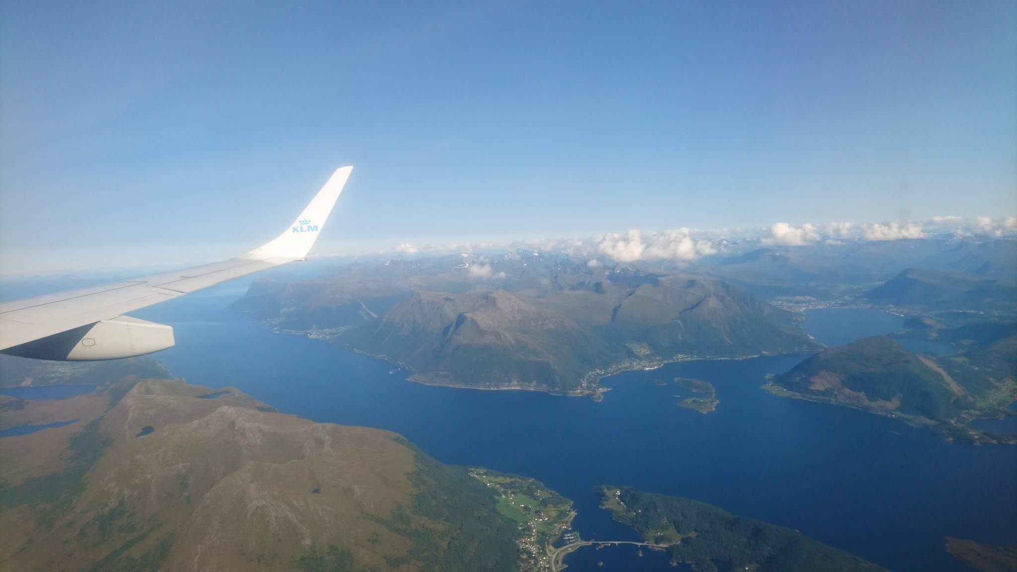 DSC_1954 by rod addison, on Flickr
After a night in a campsite on the outskirts of Alesund I jumped on a bus around lunch time and headed for a small village called Brunstad.
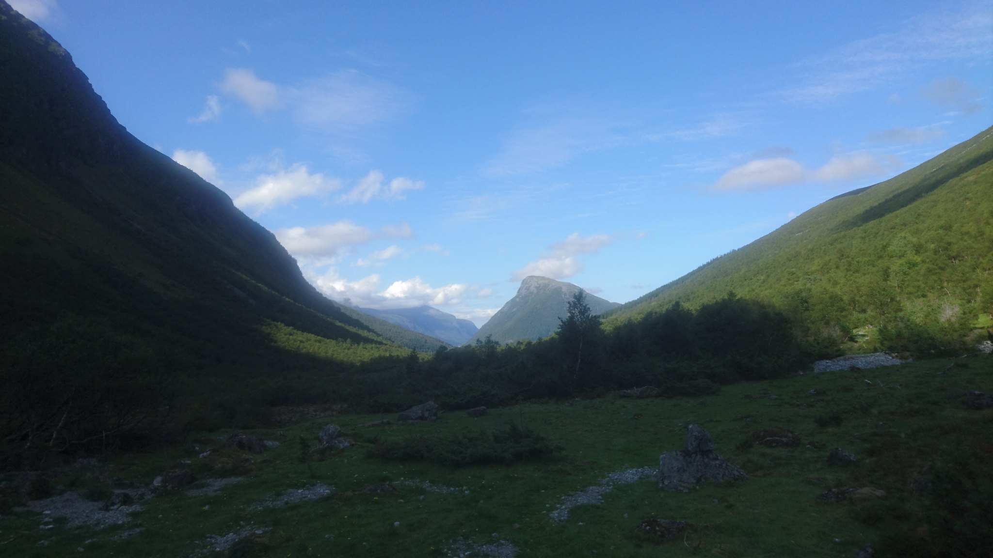
I got off the bus around an hour and a half later and was instantly blown away with what I saw.
Standing in the middle of this amazing alpine valley surrounded by snow covered mountains I was finally here , it looked like heaven.
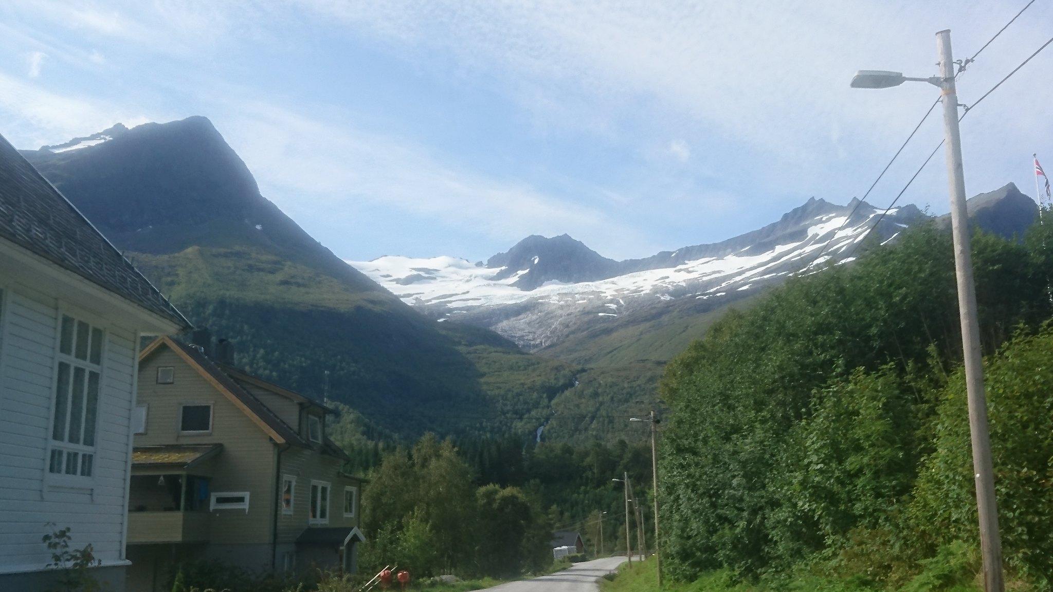 DSC_1991 by rod addison, on Flickr
 DSC_1996 by rod addison, on Flickr
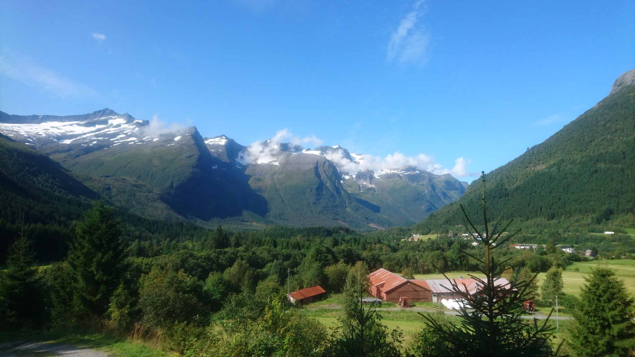
After a quick check of the map I found the start of the trail where I met a couple sitting in their garden enjoying the midday sun.
They told me I had a 4 to 5 hour hike ahead of me most of which would be easy walking .
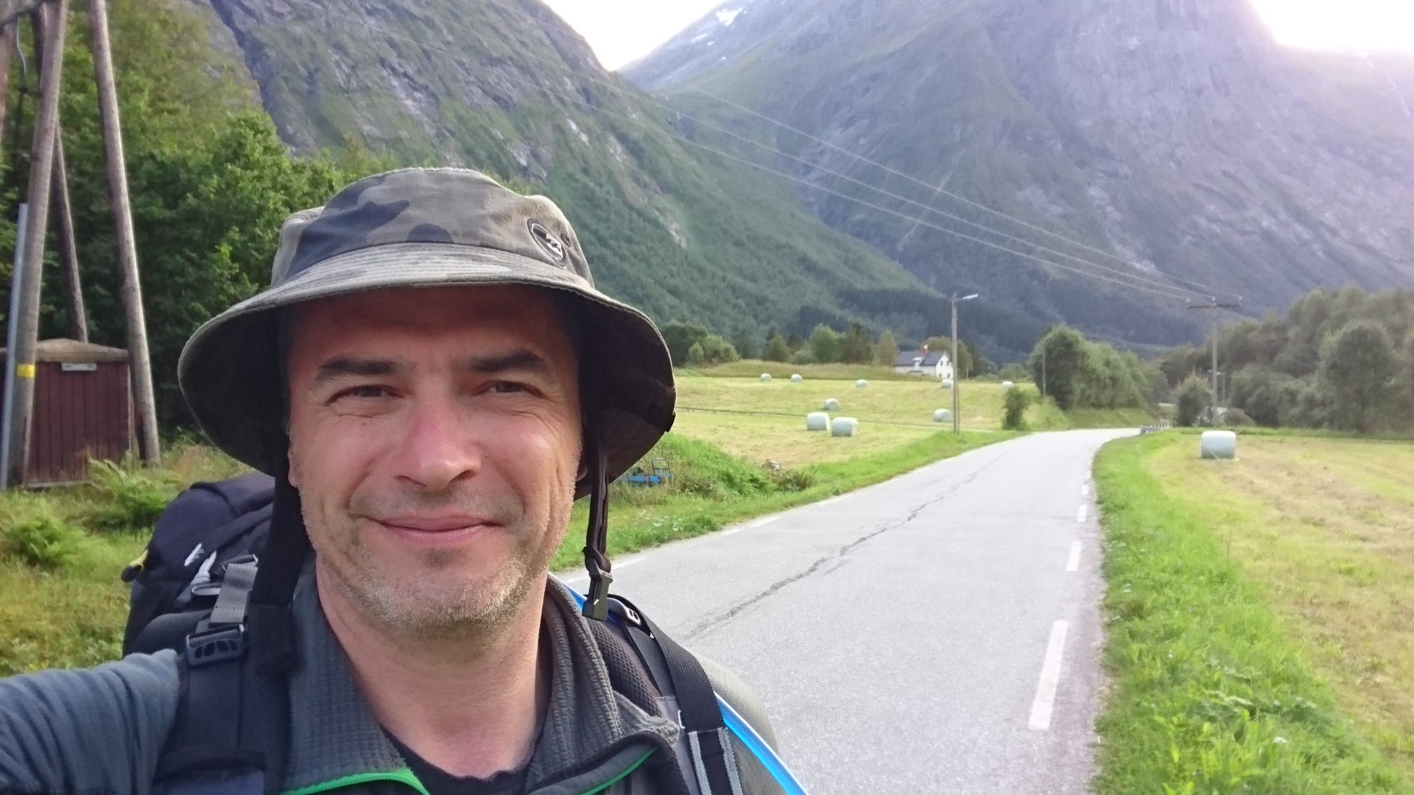
Feeling pretty good about it all I set off up the first part of the trail which was a farm track up a pretty reasonable incline.
Half an hour in I was dripping with sweat and feeling the strain of the weight of my pack.
I'd noticed going through check-in at Aberdeen my pack was 12KG on the scales and now after stocking up with 3 litres of water , enough food for 3 or 4 days and a bottle of 12 year old Aberlour I knew I had some serious work ahead.
The farm track ended about an hour later at a farm surprisingly enough
It had a real alpine feel about it and the flock of sheep with their bells around their necks clattered and clanged as they scattered out of my path.
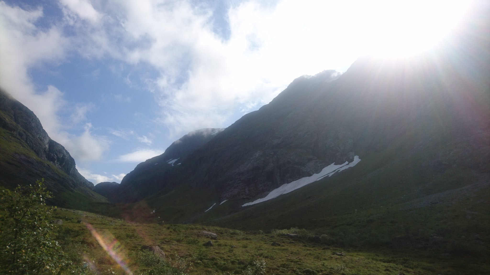
The next part of the trail wasn't that obvious but after a few minutes looking around I could see a path leading off into the pine forest in front of me.
This was really hard going , the path consisted of football sized boulders in a sea of mud which would have required a lot of care even without a 40lb backpack , I felt glad I hadn't given in to the idea of leave my walking sticks at home to save weight. They were an absolute life saver.
Eventually after what seemed like an eternity I broke out of the trees and got a good look at what lay ahead.
 DSC_2006 by rod addison, on Flickr
 DSC_2005 by rod addison, on Flickr
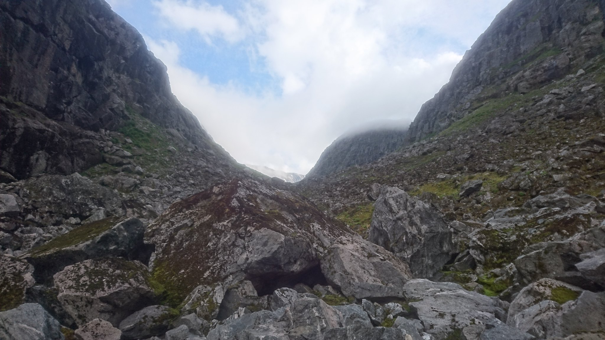
There wasn't much of a path but the terrain had evened out and the walking looked easy ....... well at least for the next 20 mins or so.
Up ahead there was a bit of a climb up a small rise / waterfall / bog.
Once on top of here my heart sank a little at the sight of the task in hand.
 DSC_2020 by rod addison, on Flickr
 DSC_2021 by rod addison, on Flickr
 DSC_2015 by rod addison, on Flickr
 DSC_2022 by rod addison, on Flickr
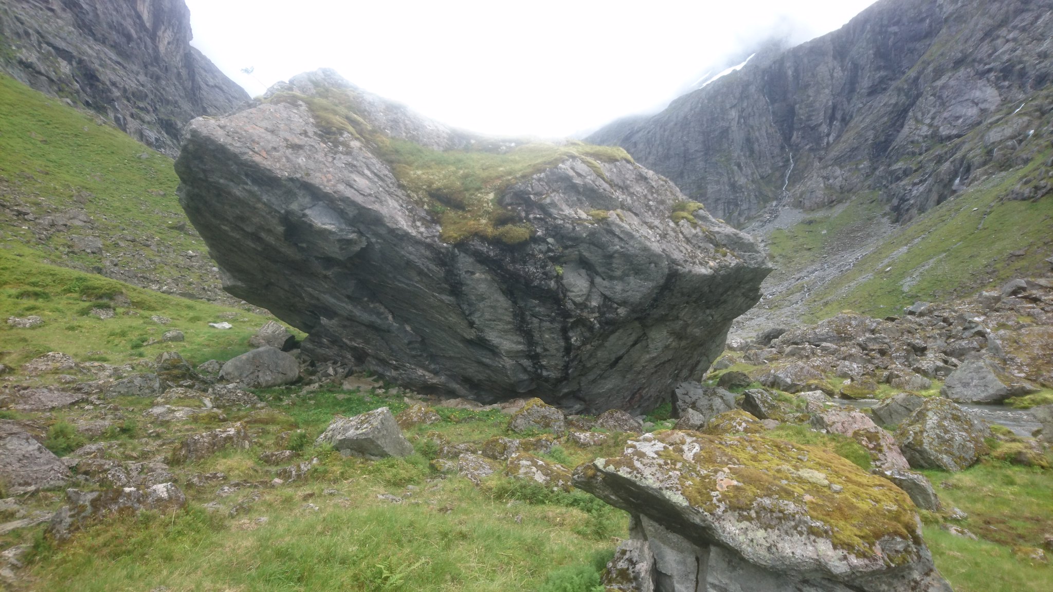
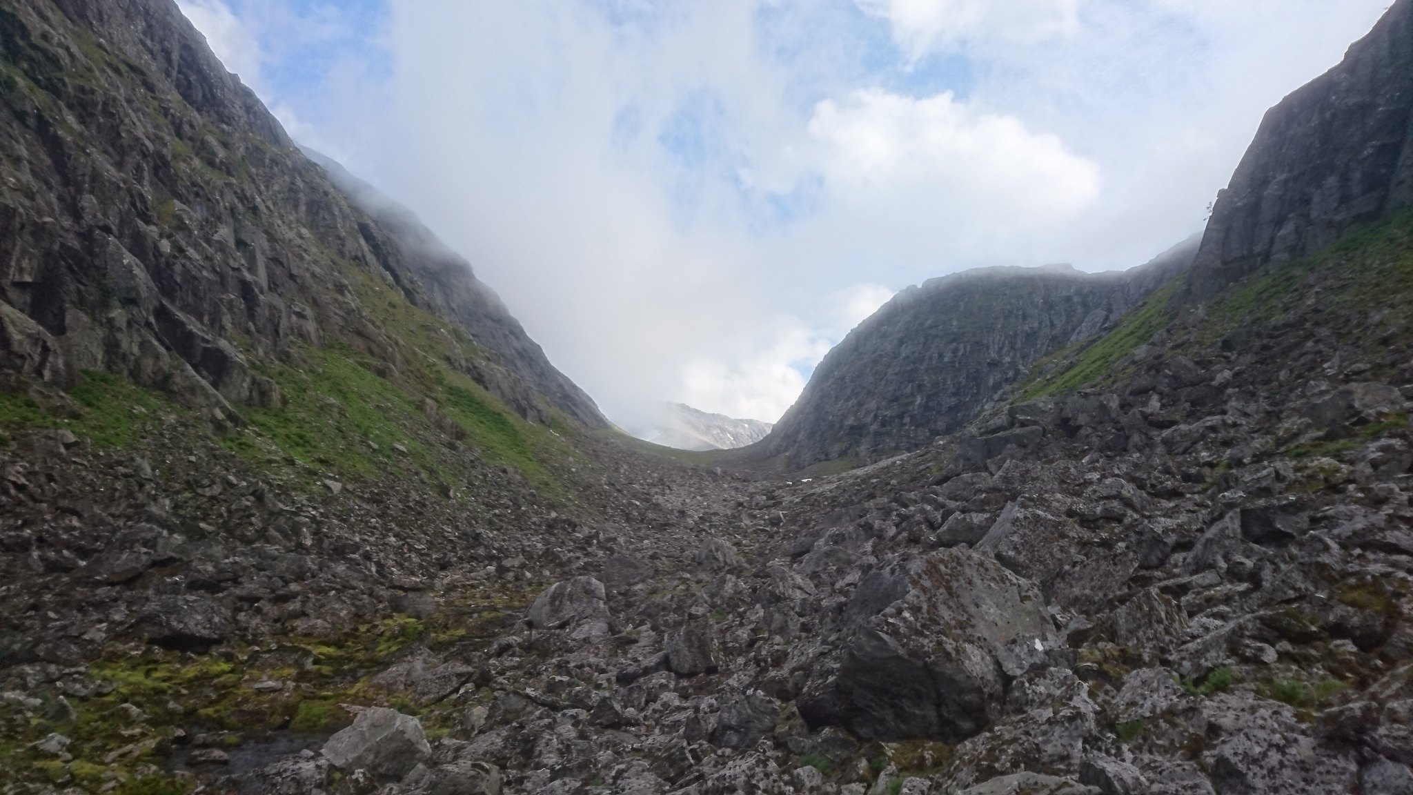
Boulders ......... more boulders .........lots of boulders , you get the idea.
After about an hour into the boulder field I was absolutely exhausted and beginning to wonder what the hell I was doing here I knew in some sick way I was really enjoying this
Now I was looking around for places to stash some of my kit to lighten my load and pick up on the way back , but I was heading into the unknown and knew this wasn't an option.
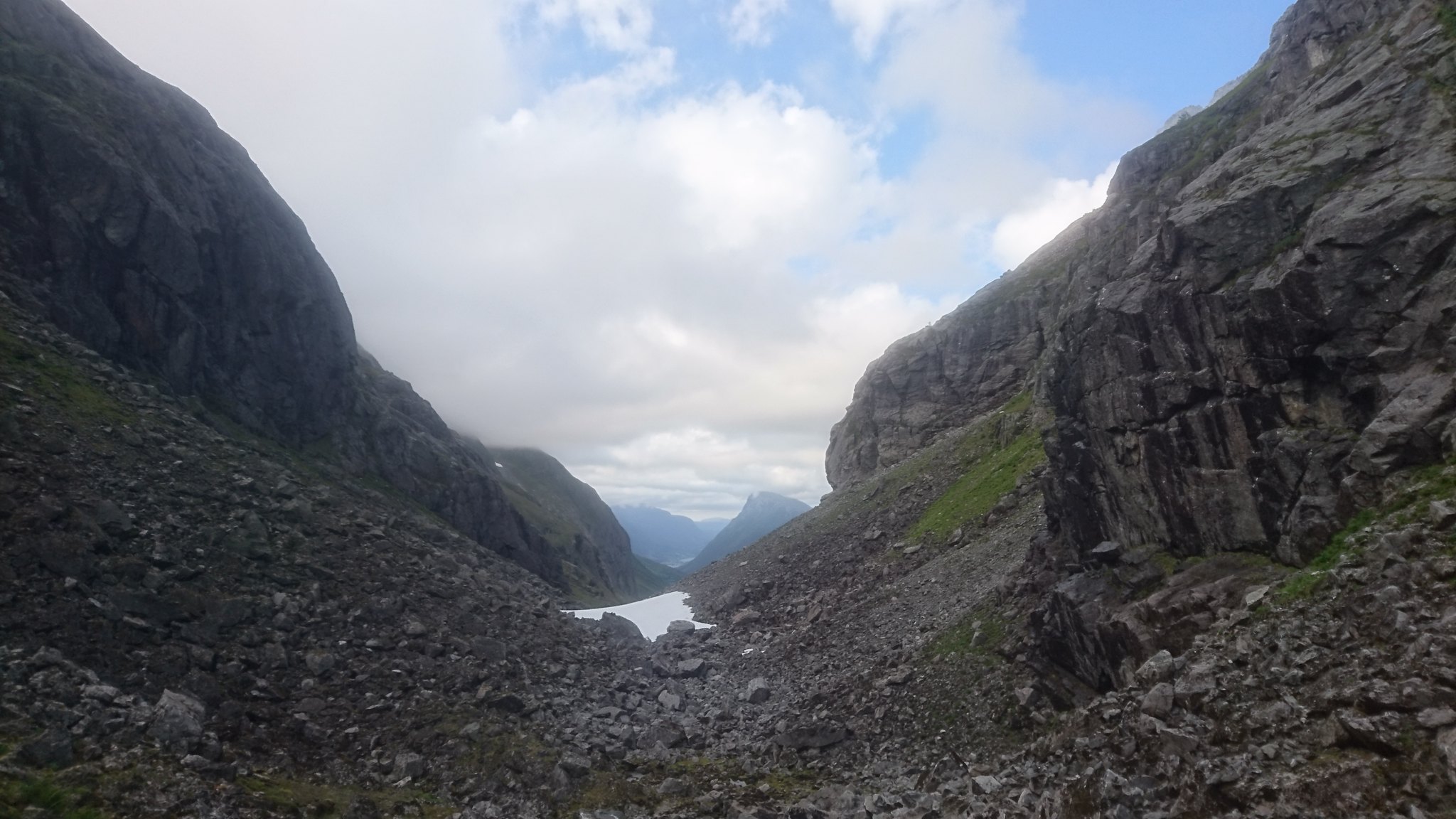
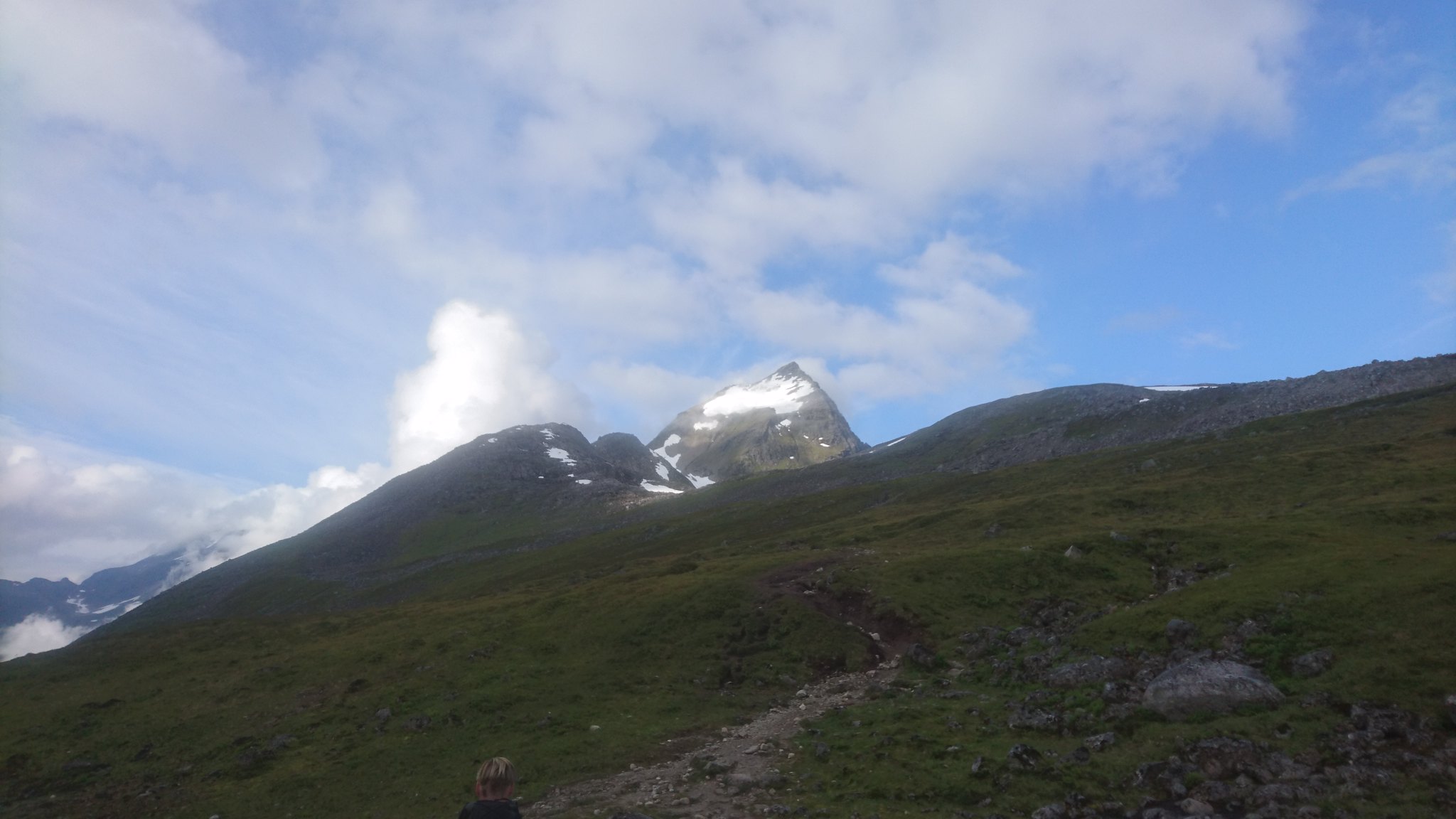
It took almost 2 hours to get through that boulder field and reach the top of the valley , i stopped for a well earned rest and took on some calories.
 DSC_2025 by rod addison, on Flickr
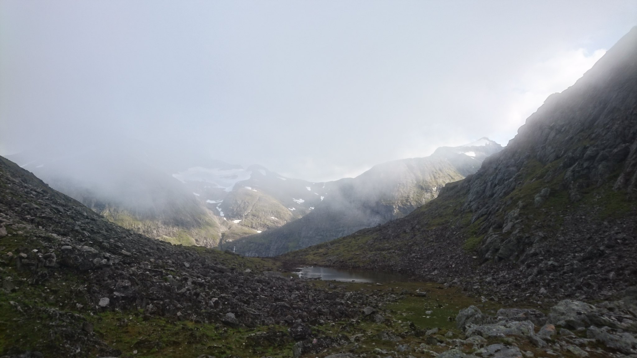
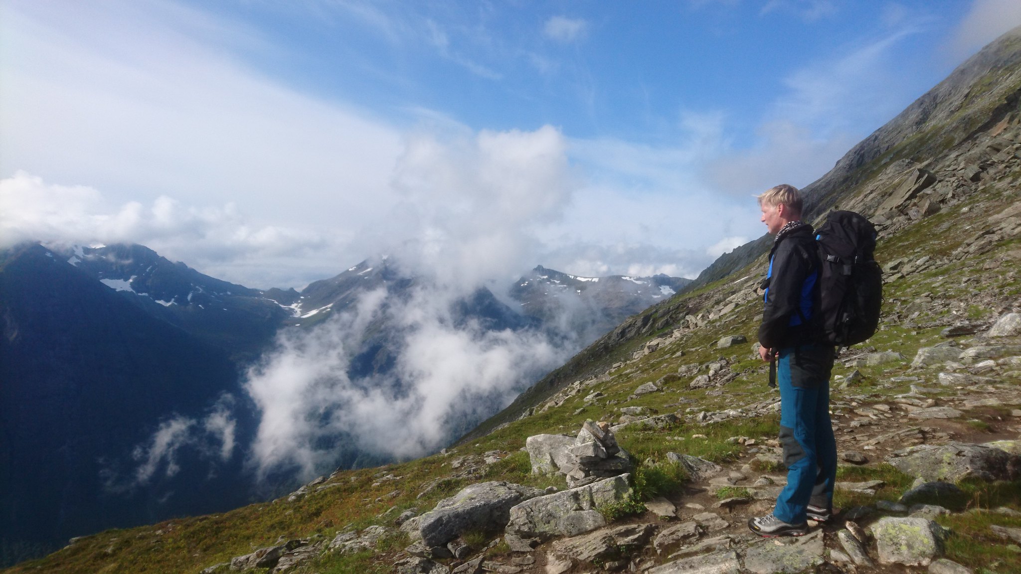
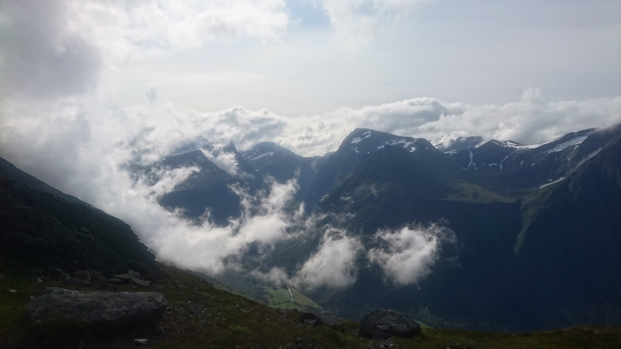
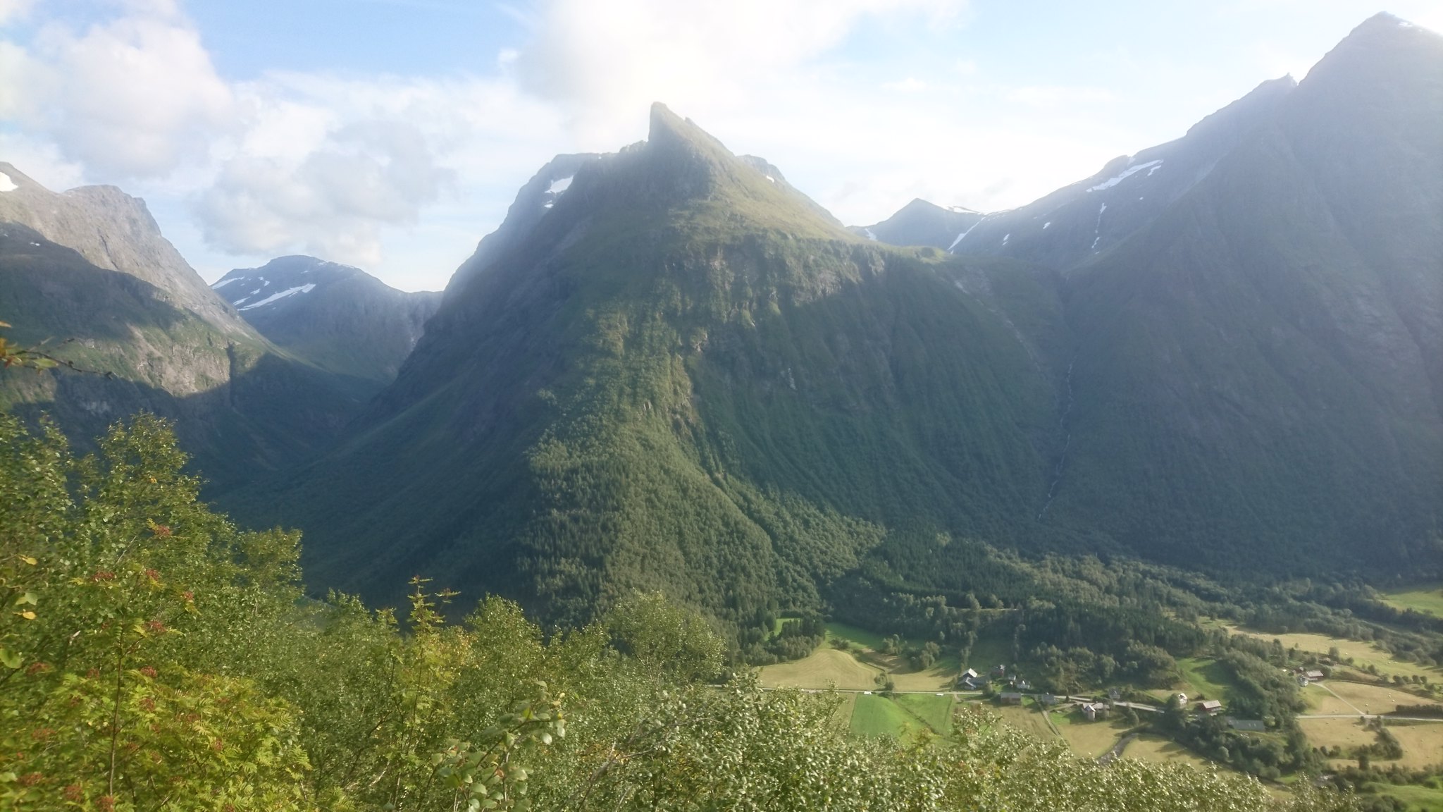
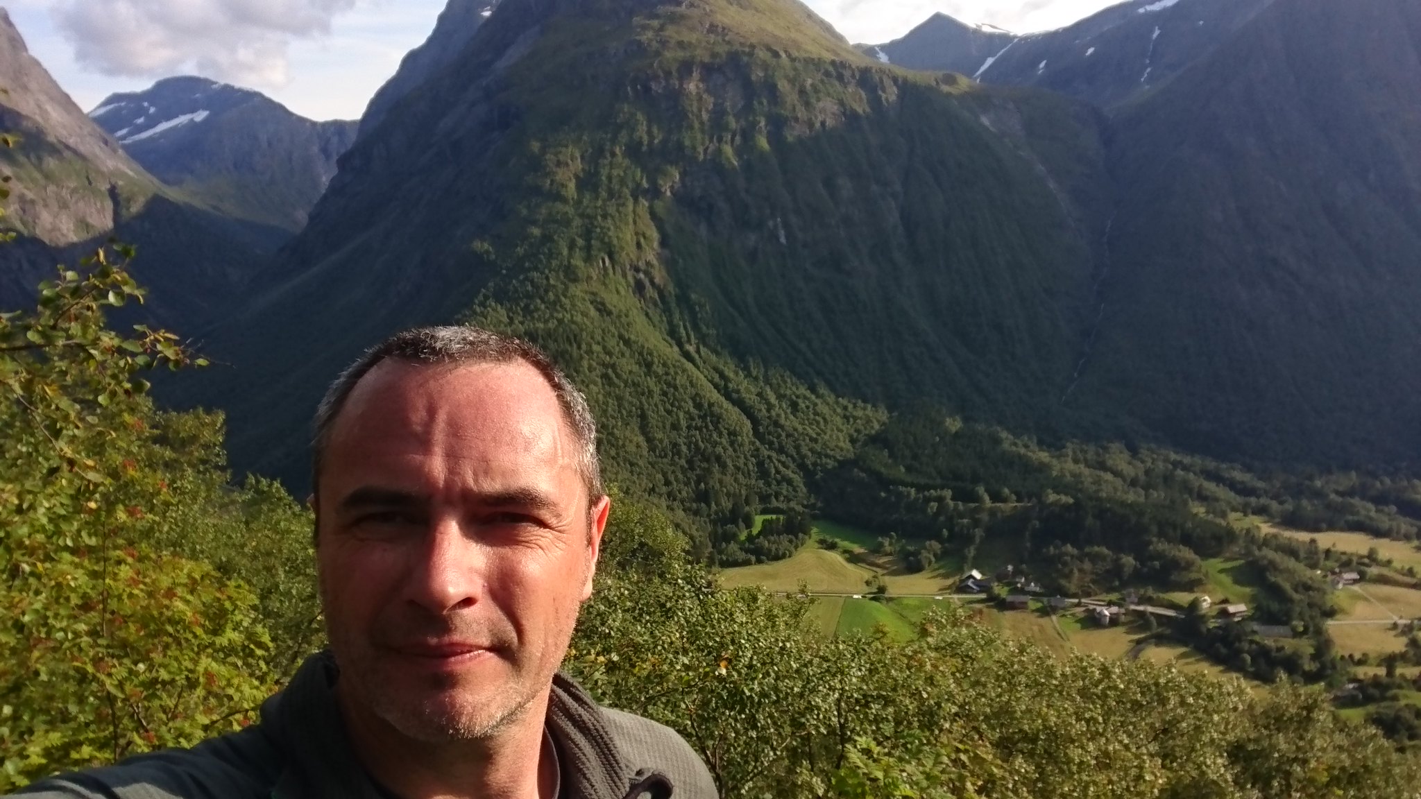
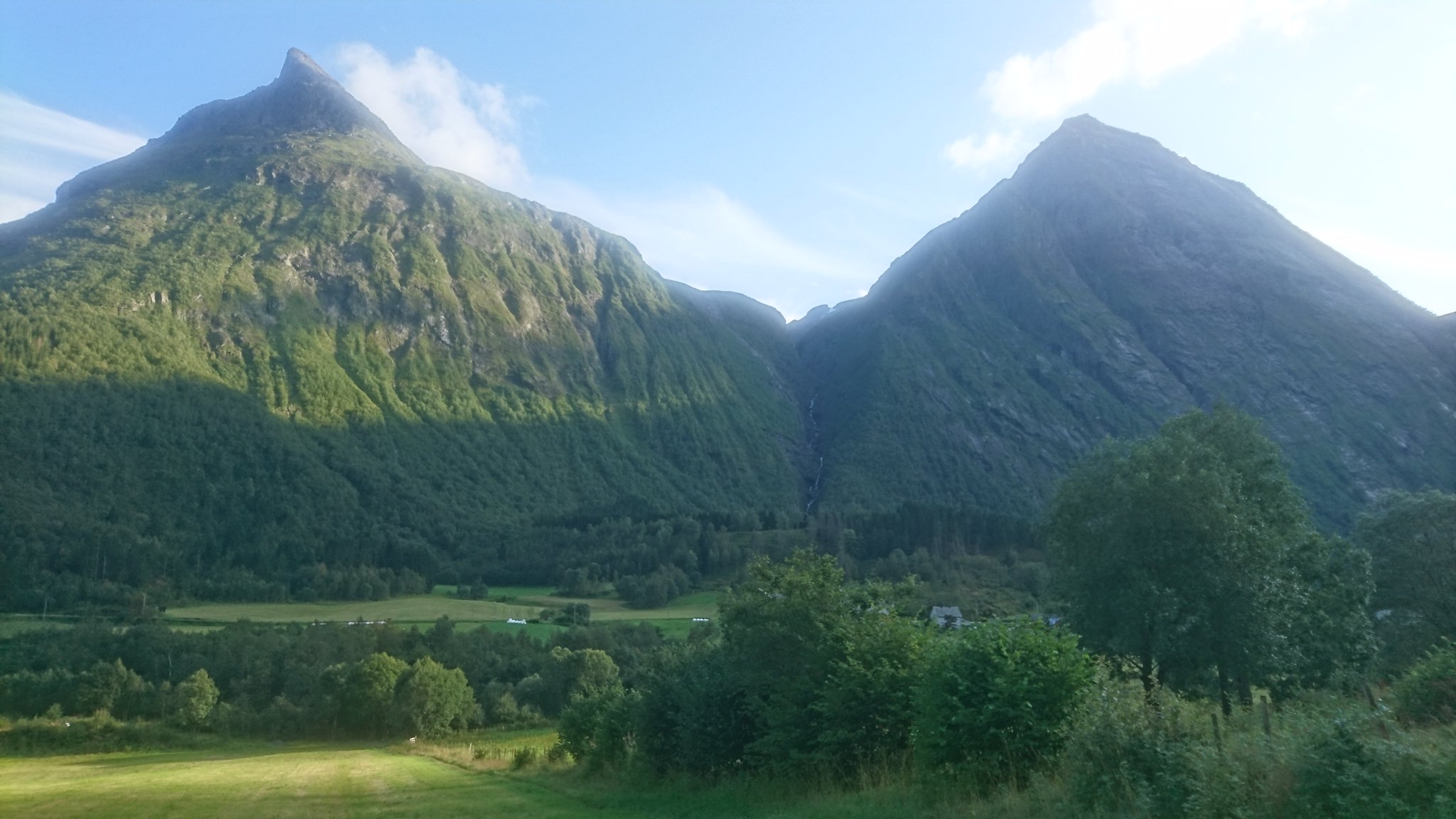
The view down into the next valley was awesome and I could now make out my objective Patchellhytta about 2 miles up to the right.
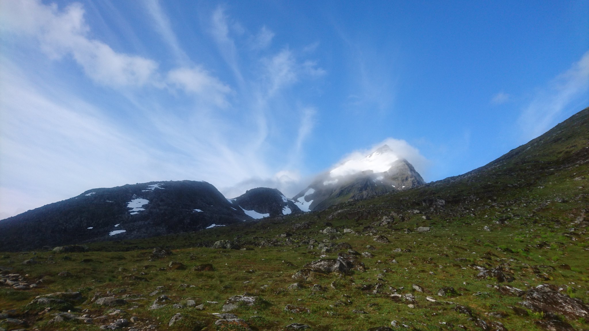
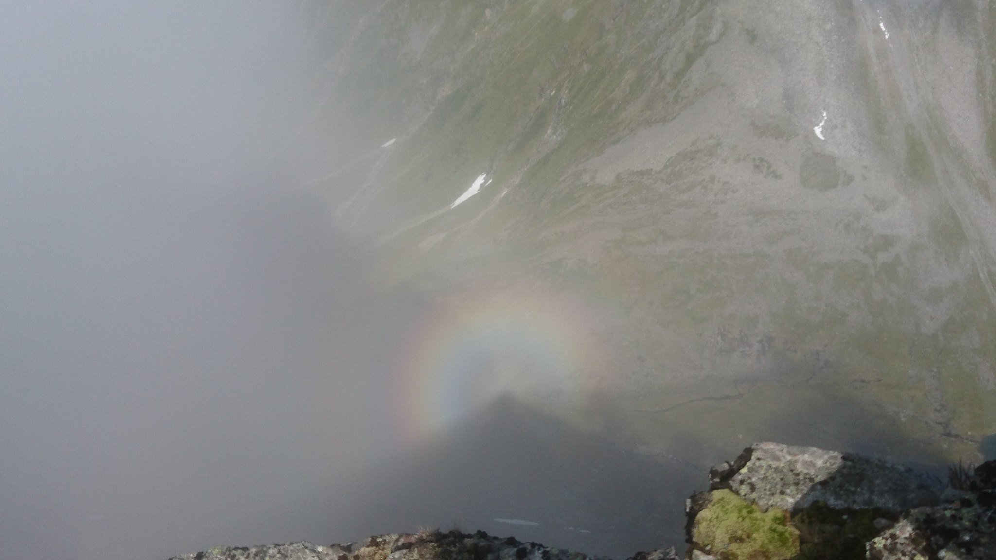
About half a mile from Patchellhytta I got my first view of the mighty Slogen which I was planning to climb the next day.
It looked like an erupting volcano as the cloud poured off the peak , i wondered if I'd even have the energy tomorrow to climb it.
 DSC_2036 by rod addison, on Flickr
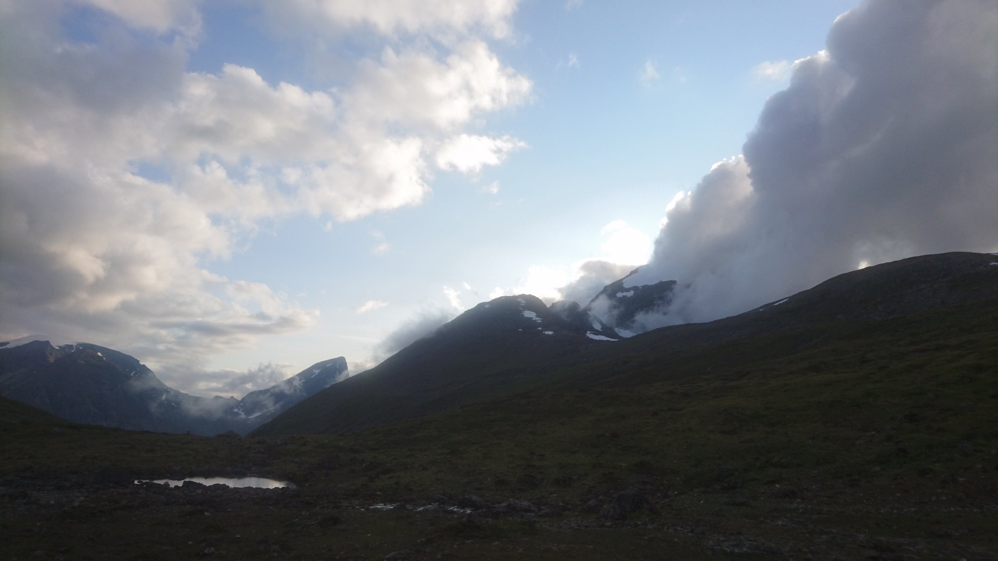
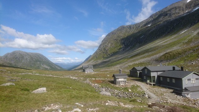
And at last after 6 hours and 9 excruciating miles I had reached Patchellhytta.
 DSC_2089 by rod addison, on Flickr
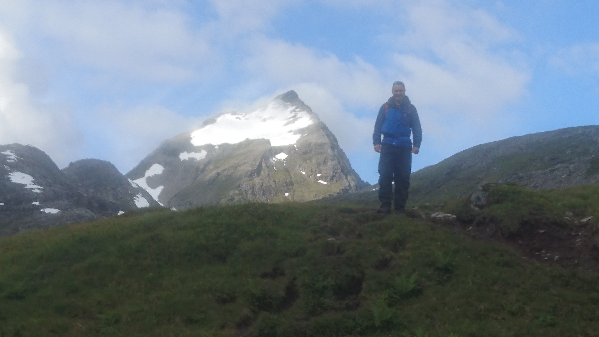
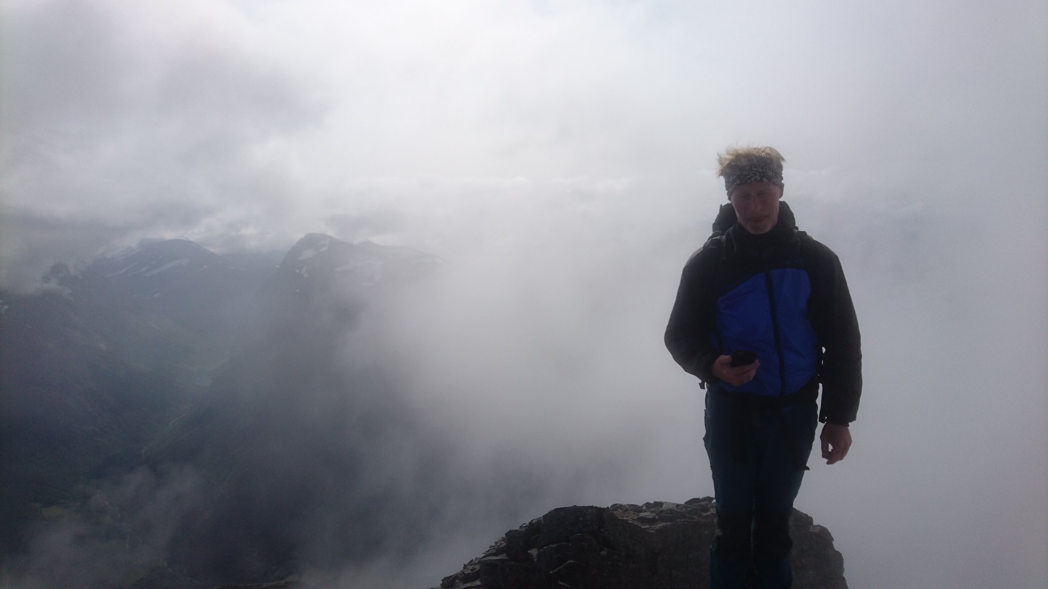
After a great night in the hytta with some new found friends drinking whisky and some strange Danish spirit which name eludes me I stepped outside in the early morning and got a clear look at Slogen.
Wow , it looked like a serious mountain and it made me slightly nervous
 DSC_2042 by rod addison, on Flickr
 DSC_2041 by rod addison, on Flickr
 DSC_2043 by rod addison, on Flickr
During the previous evening one of my fellow whisky fans Jan had agreed we would climb Slogen together the next day , he told me it was fairly straight forward apart from a the last section to the summit which was "a bit tricky" as he put it.
Off we went after a good breakfast.
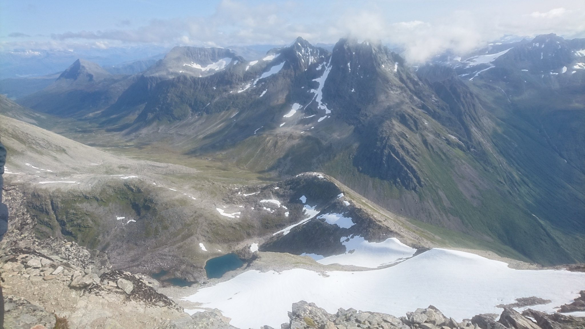
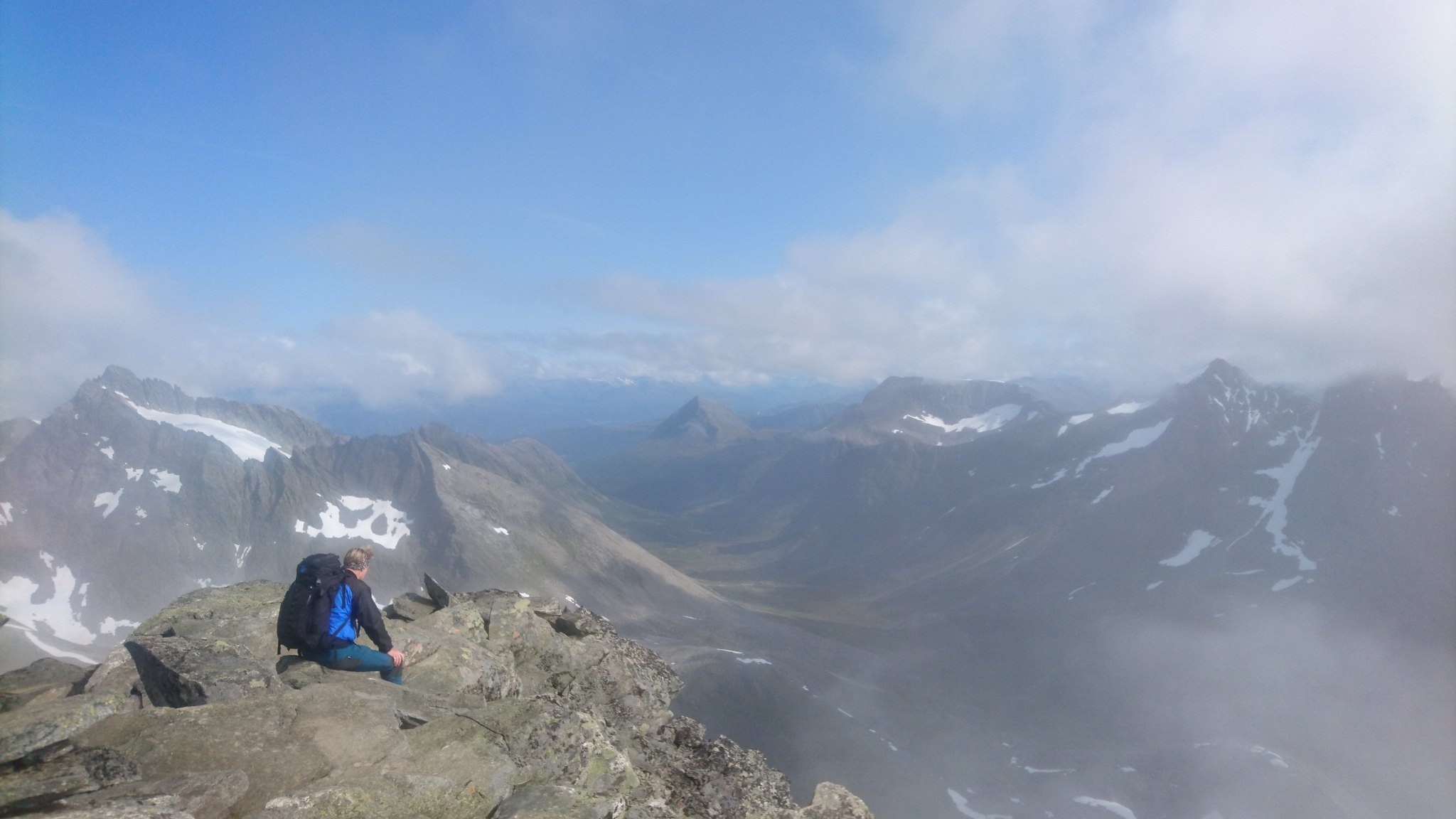
After an hour or so we made it up onto the first ridge which lead to the main bulk of the mountain , the views were absolutely breathtaking
 DSC_2050 by rod addison, on Flickr
 DSC_2048 by rod addison, on Flickr
 DSC_2052 by rod addison, on Flickr
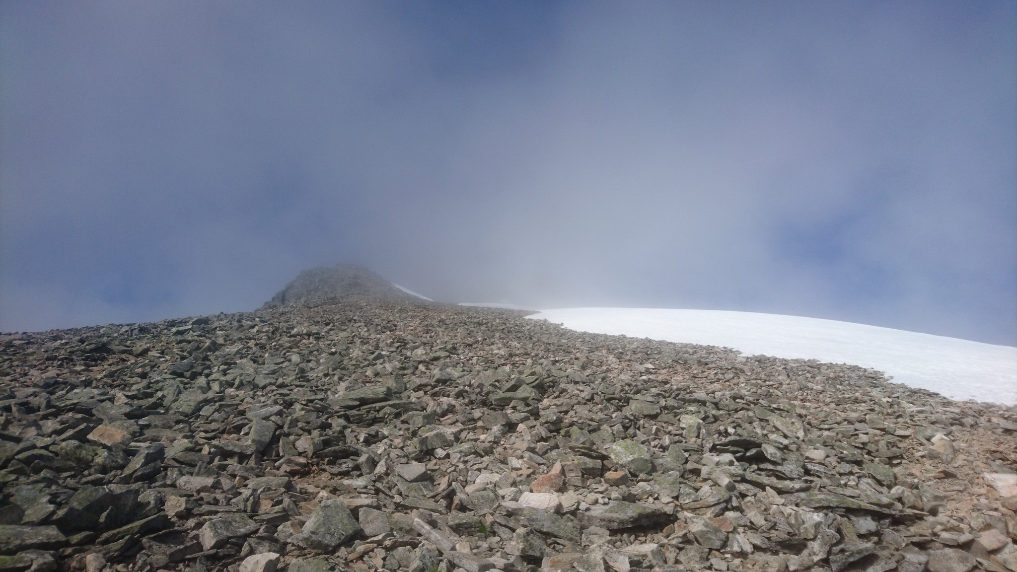
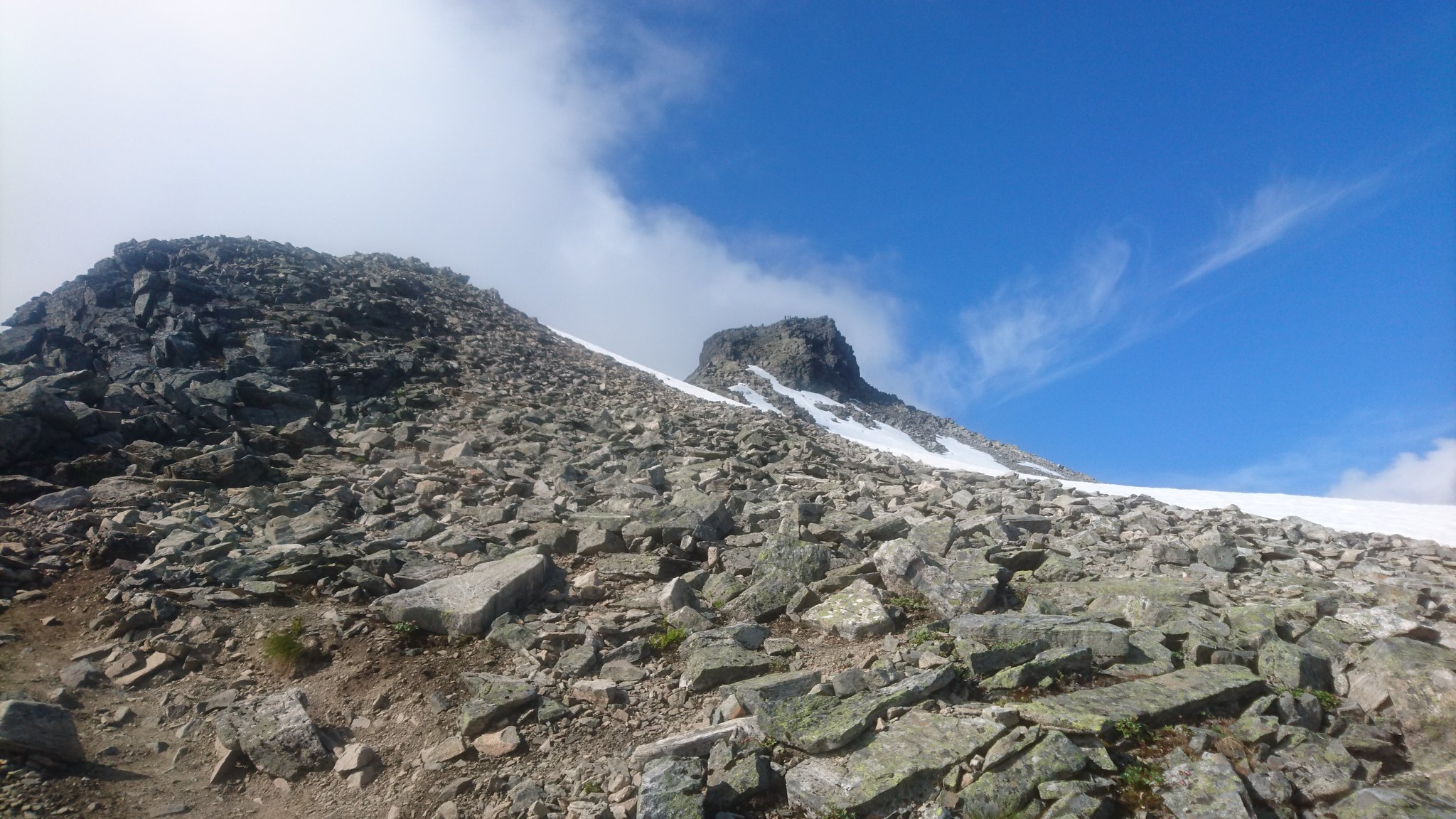
The path ahead was very steep with lots of scree as we climbed up the side of the snow line.
Occasionally there was bits of path but a lot of care had to be taken.
The whisky from the night before was making it difficult , not really what you would call a hangover but i definitely wasn't firing on all cylinders , I was totally drenched by this point but was loving every minute.
 DSC_2054 by rod addison, on Flickr
I could now make out the peak and what would be the final scramble to the summit. It didn't look to bad from here.
 DSC_2086 by rod addison, on Flickr
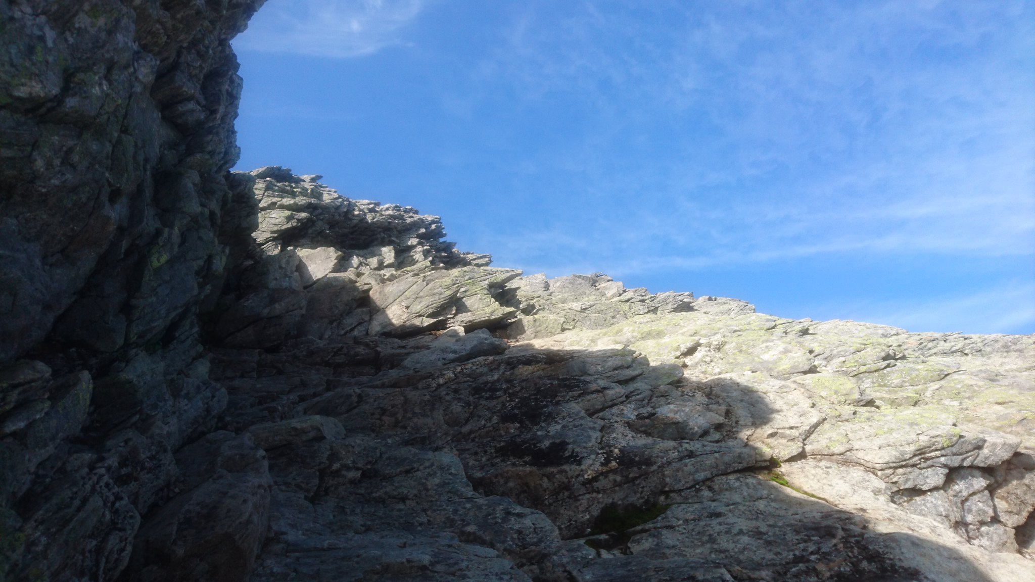
To be completely honest the next part took me very much out of my comfort zone , the pictures don't do it any justice at all , my heart was beating out my chest as I scrambled up the last section to the summit , it was very airy .
 DSC_2083 by rod addison, on Flickr
 DSC_2082 by rod addison, on Flickr
 DSC_2075 by rod addison, on Flickr
 DSC_2059 by rod addison, on Flickr
 DSC_2056 by rod addison, on Flickr
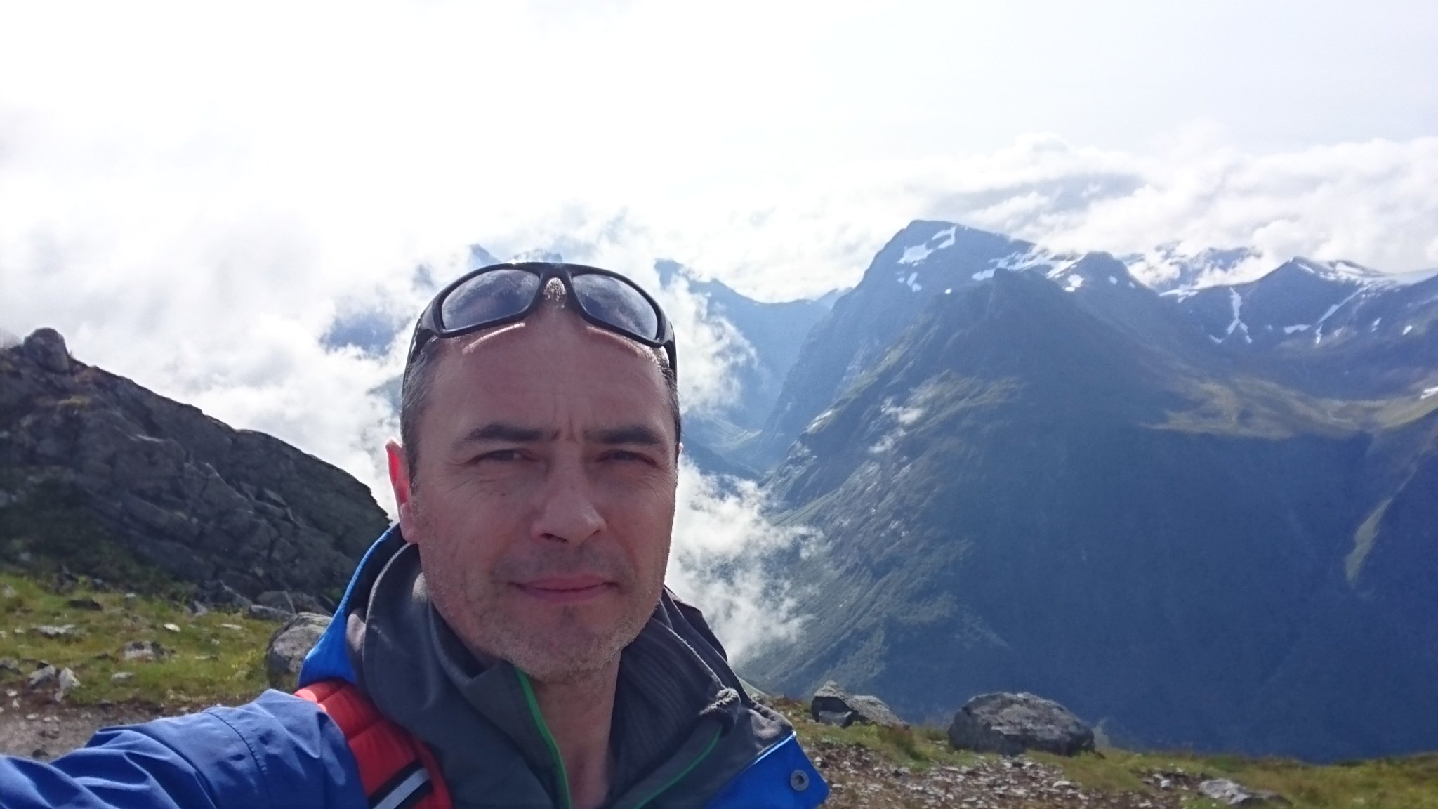
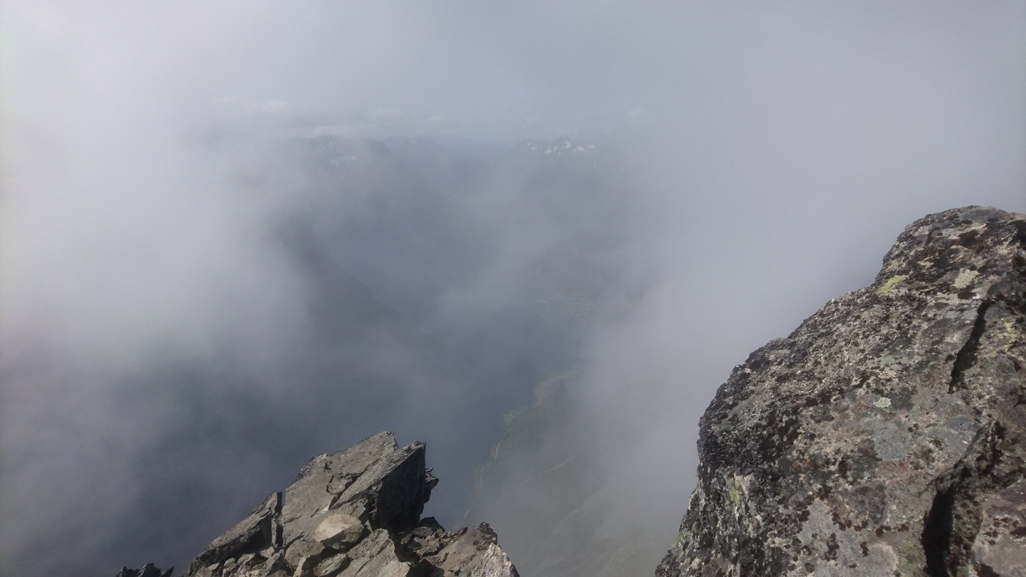
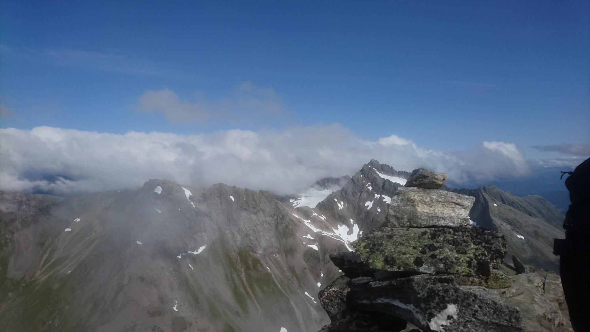
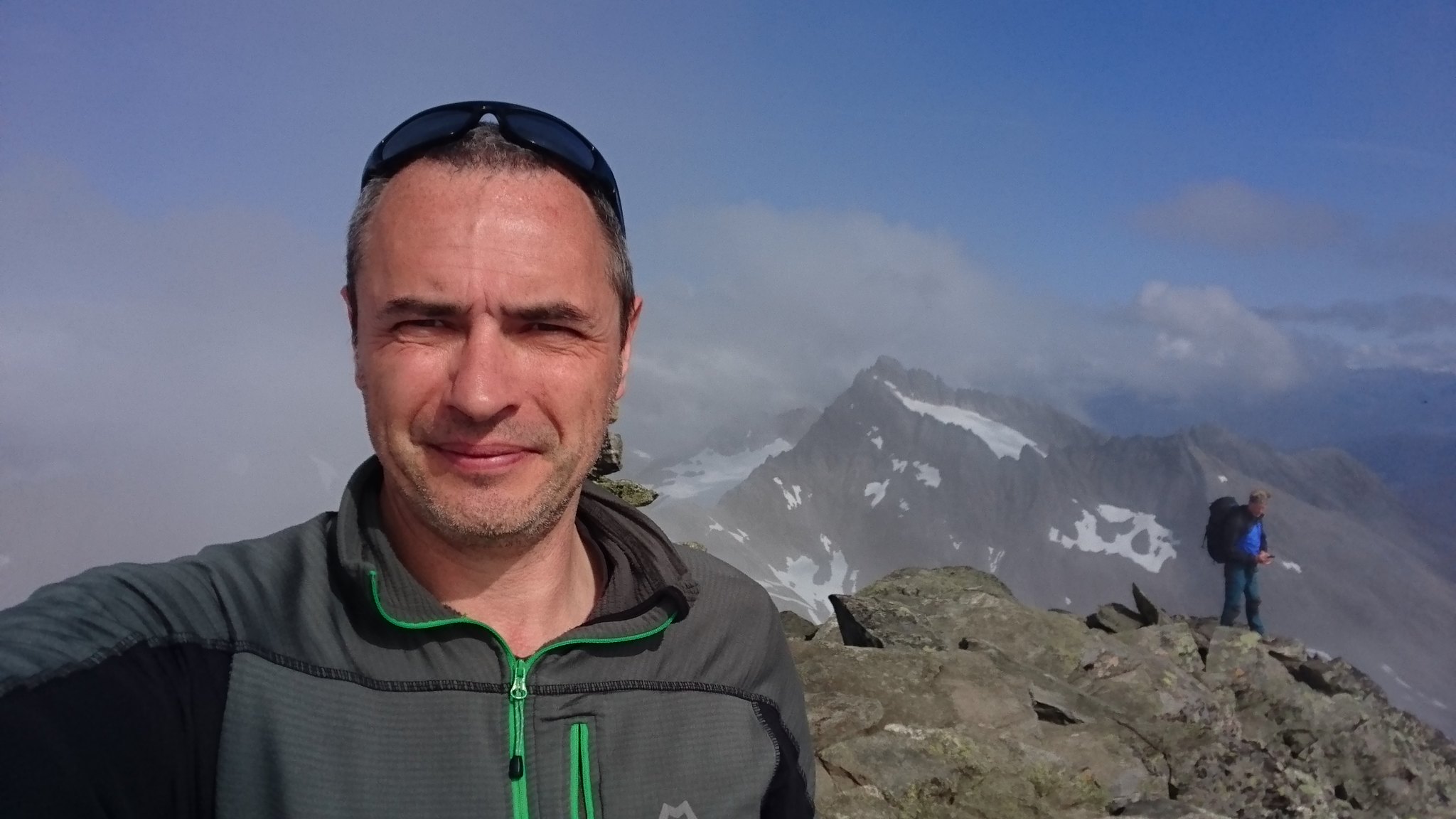
2 and a half hours later we were on the summit at 5131ft I was shaking with adrenaline , excitement and just a tiny bit of fear as I looked over the west edge straight down almost 5000ft into the valley below .
Its really not that much higher than Nevis but with the footprint of the summit and the sheer drops over the edges it felt so much more.
 DSC_2057 by rod addison, on Flickr
 DSC_2061 by rod addison, on Flickr
 DSC_2069 by rod addison, on Flickr
 DSC_2063 by rod addison, on Flickr
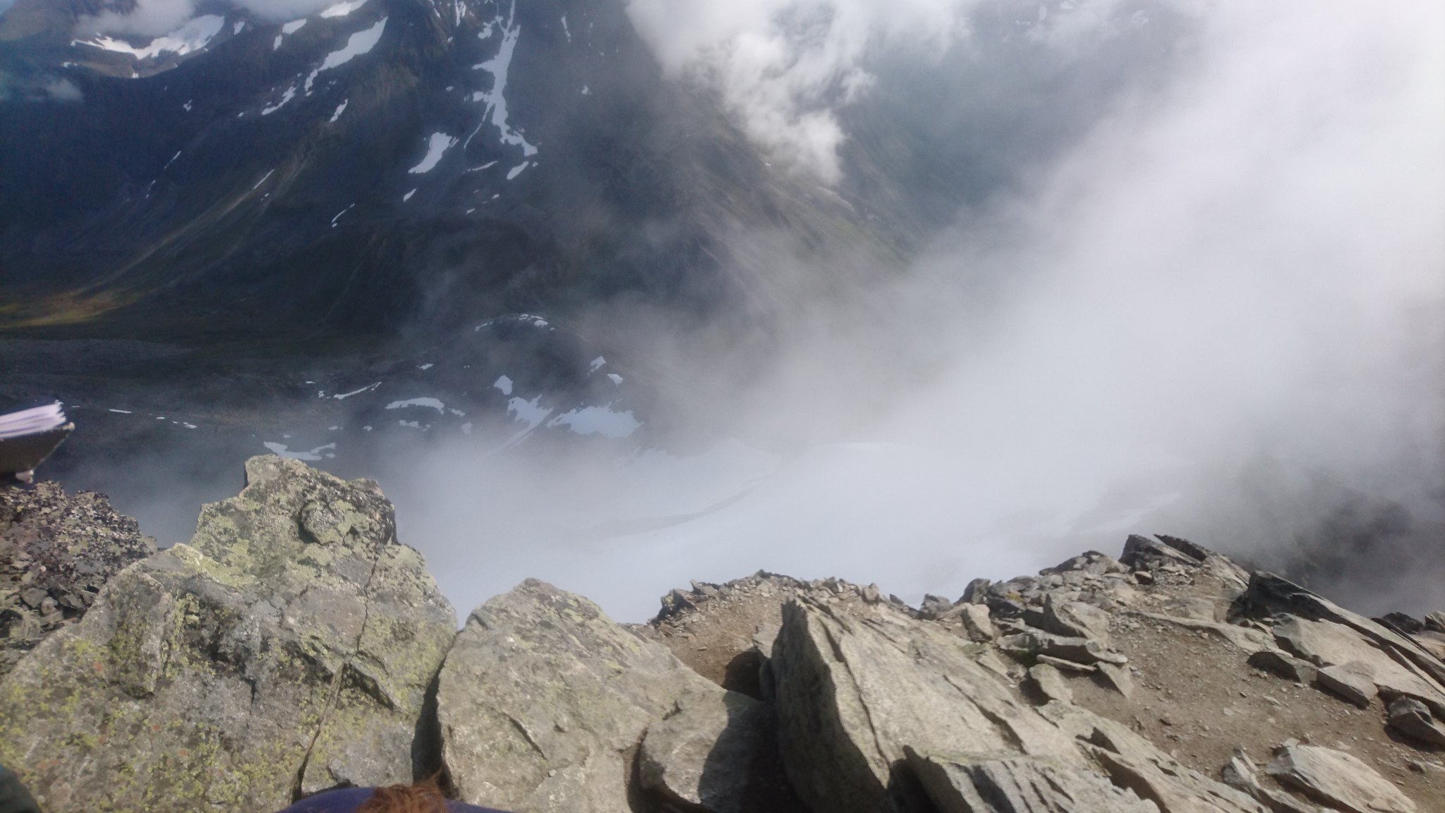
We spent around 40 minutes on the summit. It was surprisingly warm and the wind had dropped to almost nothing.
It was absolutely perfect
A few folk came and went including one guy with a drone , see video below.
 Slogen 24.8. 2017 by rod addison, on Flickr
" />
We descended back down to Patchellhyta and Jan and I parted company as he left down the valley towards the town of Stranda.
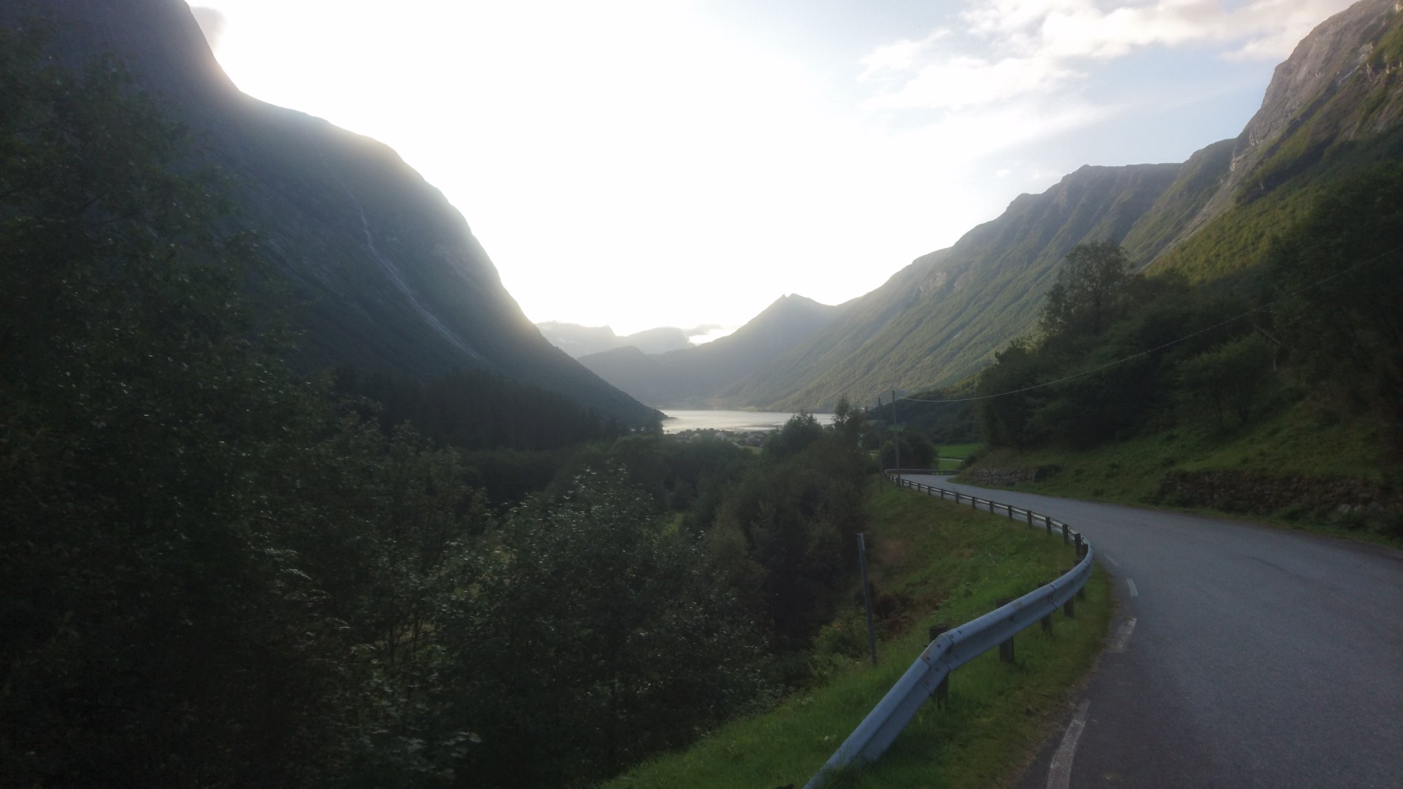
I had half an hours rest in the hytta , stocked up on some calories and coffee and headed down into the next valley where I knew i would find a hotel for the night .
It was a seriously steep descent . My legs were burning and my feet were screaming at me to stop.
 DSC_2094 by rod addison, on Flickr
 DSC_2096 by rod addison, on Flickr
 DSC_2103 by rod addison, on Flickr
2 hours after leaving Patchellhytta I eventually made it down onto the valley floor and had a 2km walk along a beautifully flat road to the hotel 9 hours in total for the day , I was knackered to say the least but very happy
 DSC_2106 by rod addison, on Flickr
 DSC_2109 by rod addison, on Flickr
 DSC_2114 by rod addison, on Flickr
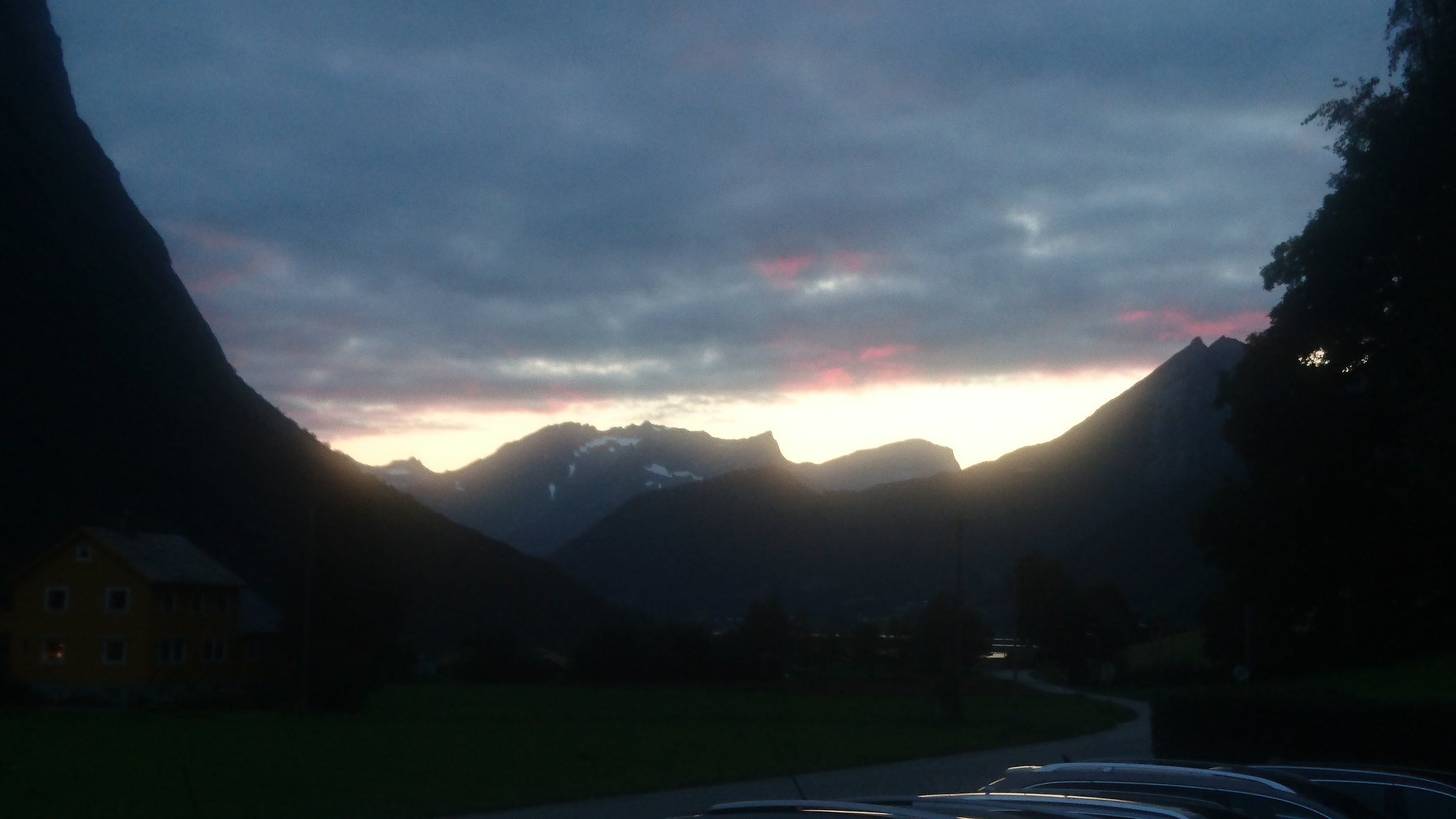
The next day I managed to get a lift to Geirangerfjord (thanked my lucky stars as i could barely walk ) and sat there all day overlooking the fjord and chilling out .
What an amazing place , I cant wait to go back .
Hope you enjoyed my report
Please excuse any bad grammar and punctuation
It all started off while out on a job in the Atlantic working on a subsea pipeline.
I got talking to one of the Norwegian guys I was working with and as I always do I turned the conversation to all things mountain , and as it turned out like a lot of Norwegians he was an avid hiker.
He told me about the Hytta system in Norway and straight away I knew I had to go and experience this.
I've dreamed about going to Norway for years but like most of my dreams I've always found an excuse not to follow them.
Not anymore I thought and after a bit of research online I booked a ticket for Alesund and started dreaming of the Sunnmore alps.
Coming into Alesund the view from the plane over the fjords and surrounding mountains was amazing.
DSC_1954 by rod addison, on FlickrAfter a night in a campsite on the outskirts of Alesund I jumped on a bus around lunch time and headed for a small village called Brunstad.
I got off the bus around an hour and a half later and was instantly blown away with what I saw.
Standing in the middle of this amazing alpine valley surrounded by snow covered mountains I was finally here , it looked like heaven.
DSC_1991 by rod addison, on FlickrDSC_1996 by rod addison, on FlickrAfter a quick check of the map I found the start of the trail where I met a couple sitting in their garden enjoying the midday sun.
They told me I had a 4 to 5 hour hike ahead of me most of which would be easy walking .
Feeling pretty good about it all I set off up the first part of the trail which was a farm track up a pretty reasonable incline.
Half an hour in I was dripping with sweat and feeling the strain of the weight of my pack.
I'd noticed going through check-in at Aberdeen my pack was 12KG on the scales and now after stocking up with 3 litres of water , enough food for 3 or 4 days and a bottle of 12 year old Aberlour I knew I had some serious work ahead.
The farm track ended about an hour later at a farm surprisingly enough
It had a real alpine feel about it and the flock of sheep with their bells around their necks clattered and clanged as they scattered out of my path.
The next part of the trail wasn't that obvious but after a few minutes looking around I could see a path leading off into the pine forest in front of me.
This was really hard going , the path consisted of football sized boulders in a sea of mud which would have required a lot of care even without a 40lb backpack , I felt glad I hadn't given in to the idea of leave my walking sticks at home to save weight. They were an absolute life saver.
Eventually after what seemed like an eternity I broke out of the trees and got a good look at what lay ahead.
DSC_2006 by rod addison, on FlickrDSC_2005 by rod addison, on FlickrThere wasn't much of a path but the terrain had evened out and the walking looked easy ....... well at least for the next 20 mins or so.
Up ahead there was a bit of a climb up a small rise / waterfall / bog.
Once on top of here my heart sank a little at the sight of the task in hand.
DSC_2020 by rod addison, on FlickrDSC_2021 by rod addison, on FlickrDSC_2015 by rod addison, on FlickrDSC_2022 by rod addison, on FlickrBoulders ......... more boulders .........lots of boulders , you get the idea.
After about an hour into the boulder field I was absolutely exhausted and beginning to wonder what the hell I was doing here
Now I was looking around for places to stash some of my kit to lighten my load and pick up on the way back , but I was heading into the unknown and knew this wasn't an option.
It took almost 2 hours to get through that boulder field and reach the top of the valley , i stopped for a well earned rest and took on some calories.
DSC_2025 by rod addison, on FlickrThe view down into the next valley was awesome and I could now make out my objective Patchellhytta about 2 miles up to the right.
About half a mile from Patchellhytta I got my first view of the mighty Slogen which I was planning to climb the next day.
It looked like an erupting volcano as the cloud poured off the peak , i wondered if I'd even have the energy tomorrow to climb it.
DSC_2036 by rod addison, on FlickrAnd at last after 6 hours and 9 excruciating miles I had reached Patchellhytta.
DSC_2089 by rod addison, on FlickrAfter a great night in the hytta with some new found friends drinking whisky and some strange Danish spirit which name eludes me I stepped outside in the early morning and got a clear look at Slogen.
Wow , it looked like a serious mountain and it made me slightly nervous
DSC_2042 by rod addison, on FlickrDSC_2041 by rod addison, on FlickrDSC_2043 by rod addison, on FlickrDuring the previous evening one of my fellow whisky fans Jan had agreed we would climb Slogen together the next day , he told me it was fairly straight forward apart from a the last section to the summit which was "a bit tricky" as he put it.
Off we went after a good breakfast.
After an hour or so we made it up onto the first ridge which lead to the main bulk of the mountain , the views were absolutely breathtaking
DSC_2050 by rod addison, on FlickrDSC_2048 by rod addison, on FlickrDSC_2052 by rod addison, on FlickrThe path ahead was very steep with lots of scree as we climbed up the side of the snow line.
Occasionally there was bits of path but a lot of care had to be taken.
The whisky from the night before was making it difficult , not really what you would call a hangover but i definitely wasn't firing on all cylinders , I was totally drenched by this point
DSC_2054 by rod addison, on FlickrI could now make out the peak and what would be the final scramble to the summit. It didn't look to bad from here.
DSC_2086 by rod addison, on FlickrTo be completely honest the next part took me very much out of my comfort zone , the pictures don't do it any justice at all , my heart was beating out my chest as I scrambled up the last section to the summit , it was very airy .
DSC_2083 by rod addison, on FlickrDSC_2082 by rod addison, on FlickrDSC_2075 by rod addison, on FlickrDSC_2059 by rod addison, on FlickrDSC_2056 by rod addison, on Flickr2 and a half hours later we were on the summit at 5131ft
Its really not that much higher than Nevis but with the footprint of the summit and the sheer drops over the edges it felt so much more.
DSC_2057 by rod addison, on FlickrDSC_2061 by rod addison, on FlickrDSC_2069 by rod addison, on FlickrDSC_2063 by rod addison, on FlickrWe spent around 40 minutes on the summit. It was surprisingly warm and the wind had dropped to almost nothing.
It was absolutely perfect
A few folk came and went including one guy with a drone , see video below.
Slogen 24.8. 2017 by rod addison, on Flickr" />
We descended back down to Patchellhyta and Jan and I parted company as he left down the valley towards the town of Stranda.
I had half an hours rest in the hytta , stocked up on some calories and coffee and headed down into the next valley where I knew i would find a hotel for the night .
It was a seriously steep descent . My legs were burning and my feet were screaming at me to stop.
DSC_2094 by rod addison, on FlickrDSC_2096 by rod addison, on FlickrDSC_2103 by rod addison, on Flickr2 hours after leaving Patchellhytta I eventually made it down onto the valley floor and had a 2km walk along a beautifully flat road to the hotel
DSC_2106 by rod addison, on FlickrDSC_2109 by rod addison, on FlickrDSC_2114 by rod addison, on FlickrThe next day I managed to get a lift to Geirangerfjord (thanked my lucky stars as i could barely walk
What an amazing place , I cant wait to go back .
Hope you enjoyed my report
Click to mark this as a great report. Register or Login free to be able to rate and comment on reports (as well as access 1:25000 mapping).
Comments: 3
beinn ghlas and ben lawers
Date walked: 20/06/2011Comments: 6
Views: 3615
tarmachan sunshine
This post is not published on the Walkhighlands forumMunros: Meall nan Tarmachan
Date walked: 29/09/2010
Views: 859
windy hike up driesh
This post is not published on the Walkhighlands forumMunros: Driesh
Date walked: 15/09/2010
Ascent: 947m
Views: 860
mayar
This post is not published on the Walkhighlands forumMunros: Mayar
Date walked: 02/05/2010
Distance: 12km
Views: 928
-
theduksguts

- Interests: fishing / snowboarding / general adventures in scotland
- Activity: Munro compleatist
- Mountain: lots of them
- Place: glencoe
- Gear: Scarpa boots
- Munros: 66
- Filter reports
- Trips: 1
- Trips: 1
- Trips: 3
- Distance: 12 km
- Ascent: 947m
- Munros: 3
- Joined: Apr 04, 2010
- Last visited: Apr 12, 2024
- Total posts: 43 | Search posts
