
Snowdonia: Solo Rhinogydd Traverse and Wild Camp
Hewitts: Diffwys, Moel Ysgyfarnogod, Rhinog Fach, Rhinog Fawr, Y Llethr
Date walked: 27/08/2011
Time taken: 48 hours
Distance: 39.2km
Ascent: 2728m
Rhinogydd Traverse Route:
Wild camps at:
SH638224
SH658303
This was a long hike through a very special, rugged and relatively unfrequented part of Snowdonia.
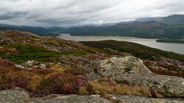
After arriving in Barmouth on the train the path led steeply onto a craggy little hill called Garn, which had fine views across the Mawddach Estuary and down to Barmouth Bridge:

I then continued along the crest of the ridge, climbing over walls where necessary until a few miles in I pitched at about 550m altitude. I originally planned to camp just below Diffwys, but I arrived later than I anticipated and in the fog decided it would be wise to pitch lower down:
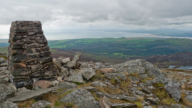
After an early start, the following morning I soon reached the summit of Diffwys:
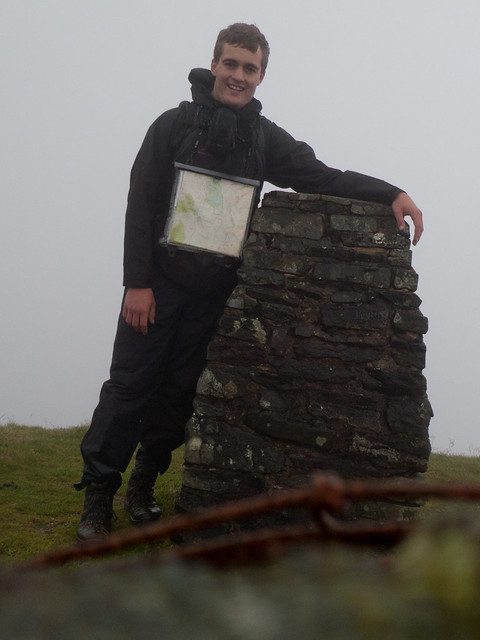
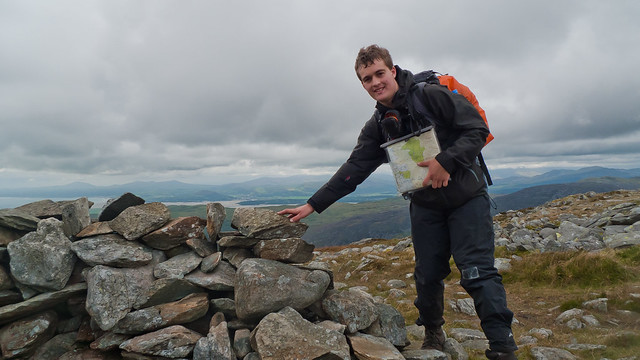
And a bit further along the ridge it became clear I wasn't the only nutter up there!
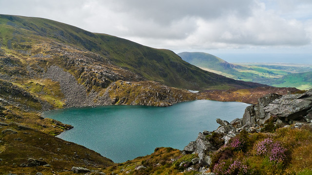
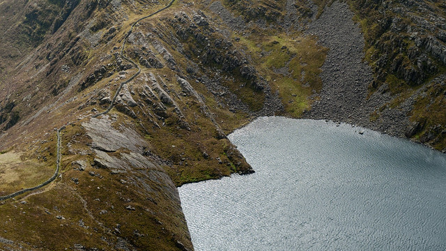
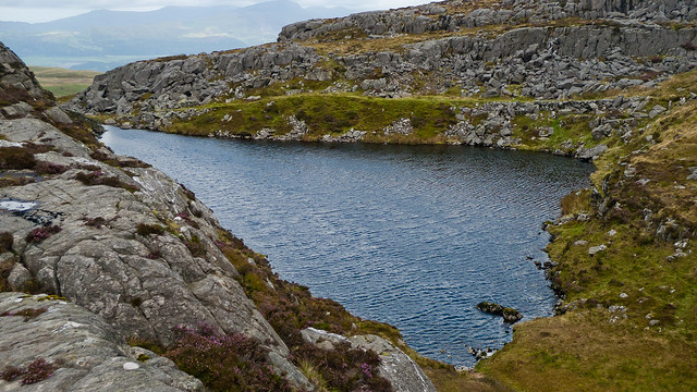
After the unremarkable summit of Y Llethr, the weather - and scenery - changed dramatically with stunning views to Llyn Hywel, below Rhinog Fach:
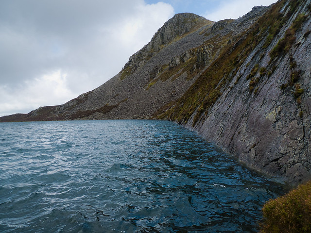
The descent of Rhinog Fach was rocky and very slow but I was able to follow a 'path' - or recent footprints, at least - all the way down. I refilled my water bottles from a spring at the bottom before heading up the beautifully wild slopes of Rhinog Fawr.
View back to Rhinog Fach from Rhinog Fawr:
View to Y Llethr:

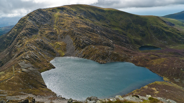
The ascent of Rhinog Fawr was relatively straightforward but slow going until I reached the summit:
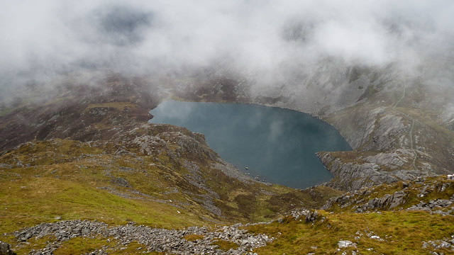
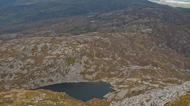
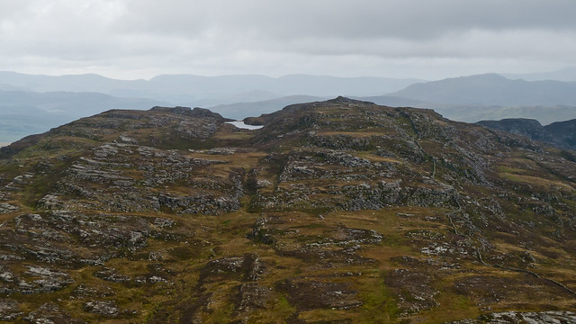
From the summit of Rhinog Fawr I could see across Llyn Du to the very wild and rough 'badlands' which would be the focus of the following day's walk:
View from near the top of the Roman Steps:

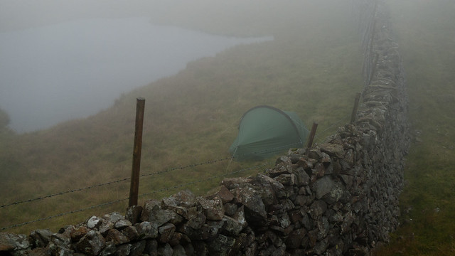
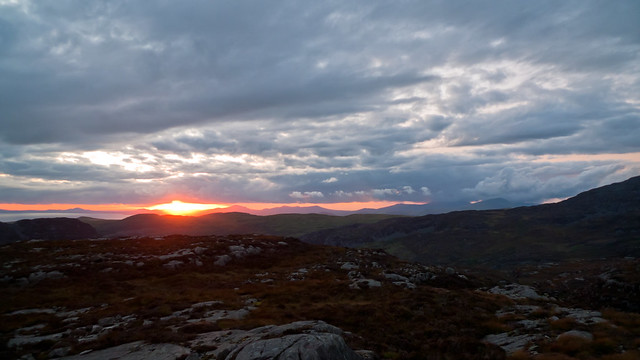
A little later I pitched at Llyn Morwynion, which has a wonderful wild camping spot. Truly stunning and peaceful! There was a beautiful sunset from the nearby hills, too:
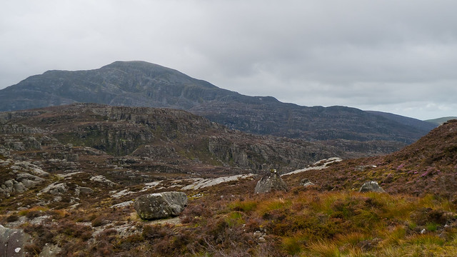
The next day, after another early start I was off into the 'badlands'. The terrain was very rough, but not dangerously so, and I found the navigation simple although it would probably be a nightmare in poor visibility! Most of the time there were little bits of wall to follow and using the OS map it was possible to precisely pinpoint my location between craggy areas which were accurately marked.
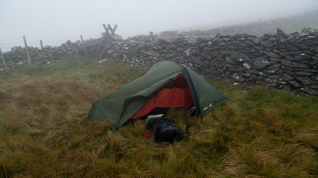
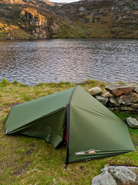
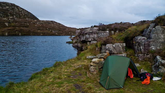
My tent in the morning, at Llyn Morwynion:
Walls of Mordor?

Llyn Twr-Glas, from Craig Wion:
Wild view back to Rhinog Fawr:
A final steep climb led up the escarpment to Clip summit, before I continued over the ridge across Moel Ysgyfarnogod and Foel Penolau to Moel y Gyrafolen before heading back towards Penryhdeudraeth.
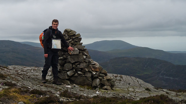
Clip summit:
View back to Craig Wion:
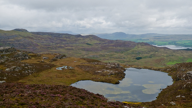
The other Llyn Du, below Moel Ysgyfarnogod:
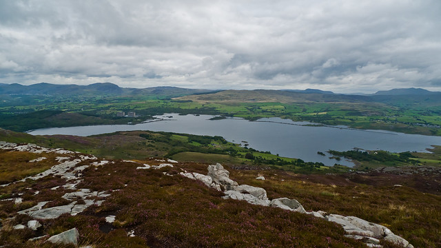
Llyn Trawsfynydd from Moel Y Gyrafolen:
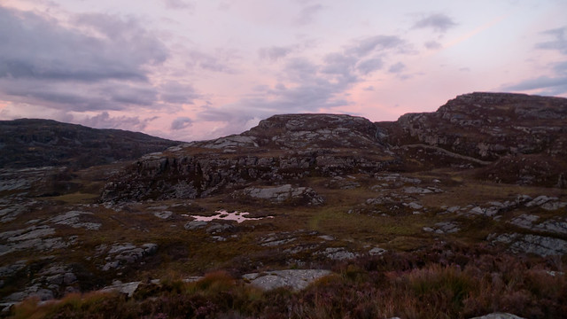
Stunning view from Cwm Moch:

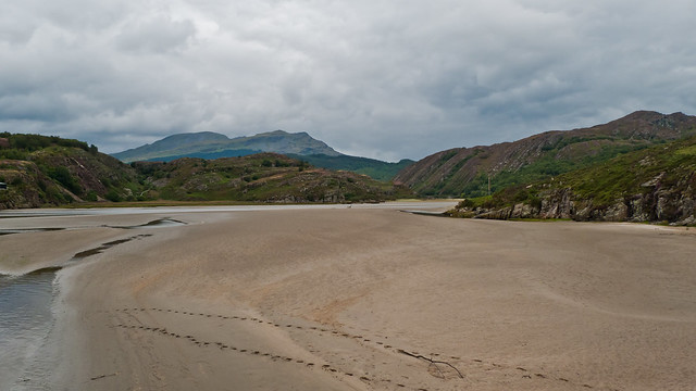
I anticipated that the walk back to Penrhyndeudraeth would be simple, but near Nant Pasgan-Bach on the way to Yr Onen there was a fiendish footpath which was seemingly impossible to follow! I ended up falling above my knees into a bog, which was slightly scary! Eventually I regained the proper footpath and reached the little hill above Llyn Tecwyn Uchaf where I took a moody shot looking towards the Moelwyns:
Afterwards navigation and terrain was easy and I reached the Dwyryd Estuary and Penrhyndeudraeth in time for the 4pm train back to Cheltenham:
All in all a wonderful range of hills, especially if you really want to escape (I only saw about 10 people on the entire trip)! The highlight is the section from Y Llethr to Moel Ysgyfarnogod, and Llyn Hywel in particular is spectacular.
Wild camps at:
SH638224
SH658303
This was a long hike through a very special, rugged and relatively unfrequented part of Snowdonia.
After arriving in Barmouth on the train the path led steeply onto a craggy little hill called Garn, which had fine views across the Mawddach Estuary and down to Barmouth Bridge:
I then continued along the crest of the ridge, climbing over walls where necessary until a few miles in I pitched at about 550m altitude. I originally planned to camp just below Diffwys, but I arrived later than I anticipated and in the fog decided it would be wise to pitch lower down:
After an early start, the following morning I soon reached the summit of Diffwys:
And a bit further along the ridge it became clear I wasn't the only nutter up there!
After the unremarkable summit of Y Llethr, the weather - and scenery - changed dramatically with stunning views to Llyn Hywel, below Rhinog Fach:
The descent of Rhinog Fach was rocky and very slow but I was able to follow a 'path' - or recent footprints, at least - all the way down. I refilled my water bottles from a spring at the bottom before heading up the beautifully wild slopes of Rhinog Fawr.
View back to Rhinog Fach from Rhinog Fawr:
View to Y Llethr:
The ascent of Rhinog Fawr was relatively straightforward but slow going until I reached the summit:
From the summit of Rhinog Fawr I could see across Llyn Du to the very wild and rough 'badlands' which would be the focus of the following day's walk:
View from near the top of the Roman Steps:
A little later I pitched at Llyn Morwynion, which has a wonderful wild camping spot. Truly stunning and peaceful! There was a beautiful sunset from the nearby hills, too:
The next day, after another early start I was off into the 'badlands'. The terrain was very rough, but not dangerously so, and I found the navigation simple although it would probably be a nightmare in poor visibility! Most of the time there were little bits of wall to follow and using the OS map it was possible to precisely pinpoint my location between craggy areas which were accurately marked.
My tent in the morning, at Llyn Morwynion:
Walls of Mordor?
Llyn Twr-Glas, from Craig Wion:
Wild view back to Rhinog Fawr:
A final steep climb led up the escarpment to Clip summit, before I continued over the ridge across Moel Ysgyfarnogod and Foel Penolau to Moel y Gyrafolen before heading back towards Penryhdeudraeth.
Clip summit:
View back to Craig Wion:
The other Llyn Du, below Moel Ysgyfarnogod:
Llyn Trawsfynydd from Moel Y Gyrafolen:
Stunning view from Cwm Moch:
I anticipated that the walk back to Penrhyndeudraeth would be simple, but near Nant Pasgan-Bach on the way to Yr Onen there was a fiendish footpath which was seemingly impossible to follow! I ended up falling above my knees into a bog, which was slightly scary! Eventually I regained the proper footpath and reached the little hill above Llyn Tecwyn Uchaf where I took a moody shot looking towards the Moelwyns:
Afterwards navigation and terrain was easy and I reached the Dwyryd Estuary and Penrhyndeudraeth in time for the 4pm train back to Cheltenham:
All in all a wonderful range of hills, especially if you really want to escape (I only saw about 10 people on the entire trip)! The highlight is the section from Y Llethr to Moel Ysgyfarnogod, and Llyn Hywel in particular is spectacular.
Click to mark this as a great report. Register or Login free to be able to rate and comment on reports (as well as access 1:25000 mapping).
Comments: 6
Carneddau and Glyderau from Llanrwst - Day 2
Date walked: 29/07/2011
Distance: 25.8km
Ascent: 1413m
Comments: 1
Views: 4314
Carneddau and Glyderau from Llanrwst - Day 1
Date walked: 28/07/2011
Distance: 23.3km
Ascent: 1521m
Comments: 2
Views: 4311
Southern Black Mountains from Abergavenny
Date walked: 04/06/2011
Distance: 30.6km
Comments: 5
Views: 7887
My first munro - Ben More on Mull
Date walked: 13/08/2010
Distance: 9km
Ascent: 966m
Comments: 6
Views: 11628
Glen Rosa Horseshoe including A'Chir
Corbetts: Beinn Tarsuinn, Cìr Mhòr, Goat FellDate walked: 09/08/2010
Distance: 20km
Ascent: 960m
Comments: 5
Views: 13891
Creag an Loin, Glen Banchor
Date walked: 26/07/2010Distance: 7km
Comments: 3
Views: 3853
1, 2
Liathach Traverse (bypass path)
Date walked: 23/07/2010
Distance: 11km
Ascent: 1300m
Comments: 16
Views: 21565
An Incredible Evening and Sunset from Beinn Damh
Corbetts: Beinn DamhDate walked: 22/07/2010
Distance: 12km
Ascent: 903m
Comments: 8
Views: 7013
Isle of Rum Day 2: Guirdil Bothy and Bloodstone Hill
Date walked: 20/07/2010Distance: 21km
Ascent: 400m
Comments: 7
Views: 18950
-
trickeyja
- Activity: Munro compleatist
- Mountain: Liathach
- Place: Torridon
- Filter reports
- Trips: 4
- Distance: 118.9 km
- Ascent: 5662m
- Hewitts: 14
- Trips: 7
- Distance: 96 km
- Ascent: 5429m
- Munros: 3
- Corbetts: 5
- Joined: Aug 09, 2010
- Last visited: Dec 04, 2014
- Total posts: 38 | Search posts