
Heatwaves and blizzards in the North East
Corbetts: Geal Charn (Dorback)
Fionas: Beinn Tharsuinn (Ardross), Creag Mhór (Balquhidder), Meall Mór (Easter Ross)
Date walked: 14/04/2024
Distance: 50km
Ascent: 2240m
Our final weekend before the HebWay walk and I thought we should do something fairly innocuous. I'd have liked to stay close to home, but the weather was rubbish in the West and the only nearby hills needing done urgently were vicious thugs in the Trossachs, which wouldn't have been great for Allison's various aches and pains - we were trying to avoid further injury. So after consulting the runes, we set off for Alness, where Meall Mór and Beinn Tharsuinn lurked, unticked. We could include Geal Charn over at Dorback on the way back down the road. Straightforward hills, lots of track. What could go wrong?
Not a bad drive up on Thursday evening - car temperature gauge said it was 19 degrees at one point. Turning twilight when we arrived at Eilanach Lodge at the start of Glen Glass. There used to be parking for a few cars just by the main gate - there are cones up now and "Turning Only, No Parking" signs. Had to drive back a bit to the metal gates for the wind farm, where you might get 2 cars in without obstructing anything. Got saddled up and ready to go - last time we were here we found a rather poor pitch at the side of the forest track, so tonight we were on the look out for something better, which we found in the trees pretty near the start of the walk. We were sheltered, but could hear the wind whipping through the trees higher up. Not a bad night's sleep.
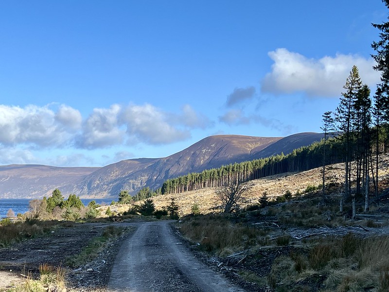
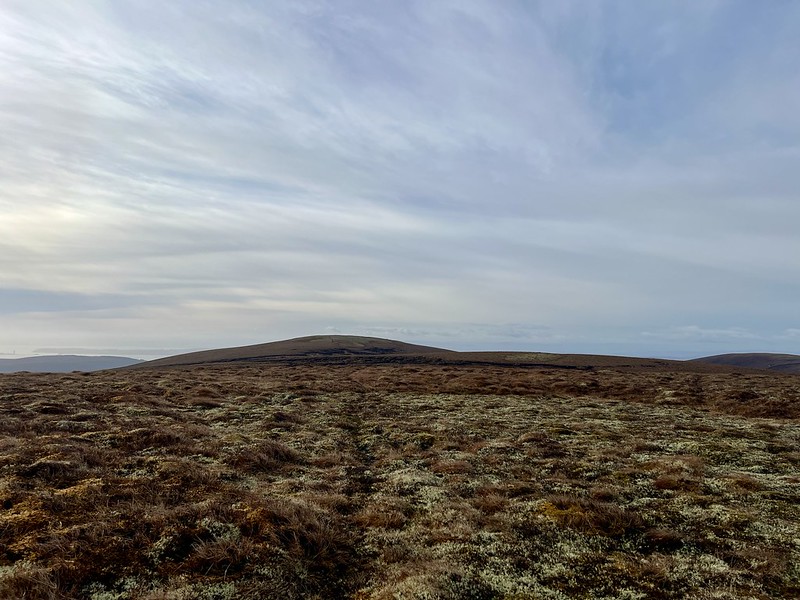
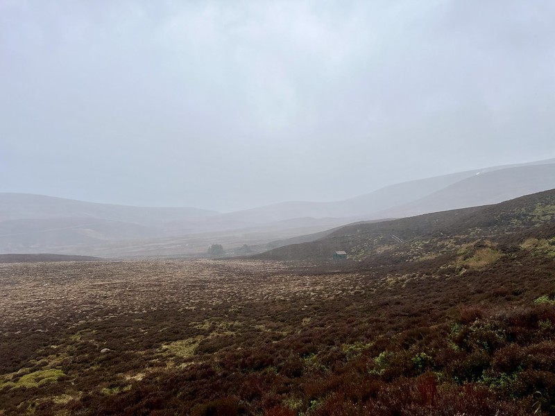
Up reasonably early - Allison wasn't feeling great - cold/flu like symptoms, tired. We had track to lead us much of the way, quite steep and a bit manky in places, but track none the less. We stayed on it a bit too much, having to cut back downhill from one of the turbines to reach the bealach. Then it's peat hags for a while until deer tracks wend through the rough stuff. The wind was strong, but it was a warm day compared to recently. Across Loch Glass, Wyvis had lost almost all its snow - quite a change from the white beast we saw a fortnight ago.
Wyvis
 IMG_1453 by Al, on Flickr
Meall Mór
 IMG_1460 by Al, on Flickr
 IMG_1461 by Al, on Flickr
Must be spring
 IMG_1462 by Al, on Flickr
 IMG_1463 by Al, on Flickr
Looking over to Beinn Tharsuinn
 IMG_1464 by Al, on Flickr
 IMG_1465 by Al, on Flickr
Carn Chuinneag in distance
 IMG_1466 by Al, on Flickr
Wyvis
 IMG_1467 by Al, on Flickr
I had planned to continue over Meall Beg and drop down to the head of the loch, returning along the shores, but the path looked a bit boggy on this side (in contrast to the good track on the south side) so we endeavoured to return by our outward route. Neither of us noticed that we'd missed the turn off to the left and had descended about 100m down the right hand path into Coire Ruighe Fearchair before we noticed. Rather than re-ascend, we continued on the path we were on, which did cost us a bit extra distance. Back at the car not much after 2pm, noting that there were about 5 other cars clustered about our parking spot, some definitely causing a potential obstruction. Mind you - if the estate needlessly close off a suitable parking area, what can you expect?
From here it was on to Beinn Tharsuinn. We've done this twice from the parking spot at the gravel pit at Strath Rory - I wanted to try a different approach, one more suited to adding on the Simm of Cnoc an t-Sithean Mor, which could be accessed from Strath Ruisdale, somewhere new for us. A long, straight road, past the Ardross Distillery, then onto rougher road to the end of the public road, where there's plenty parking at the start of a wind farm track. We had to navigate a flock of sheep who were on the road, running along in front of us - sometimes they'd head up onto the grassy verge, only to return back to the road when we thought we were going to get past. We parked up and set off, without any real idea if we'd get camped. We could either have an early stop or do the hill tonight...
Wind farm track all the way to where there's a dam marked on the map. We found an ok stop to pitch beside the river and put up our new tent. I'd been thinking about how to manage the HebWay with our little Nick, which has a very small vestibule, making cooking difficult if it's adverse weather. And condensation can be a problem if repeatedly wet...so time for a new addition to the tent family, an Anjan 2. Better space inside, a vestibule that's twice as big and virtually the same weight/size. So it was the inaugural pitch tonight. We had our tea and I was swithering whether to head up to the summit - Allison was feeling pretty crap and decided she wasn't going, when the rain began. That was enough to dissuade me from going anywhere, just get.an early night. The new tent performed well in many respects, but was quite noisy in the wind. Part of that was getting used to new noises, part was because one guy was a bit loose.
 IMG_1469 by Al, on Flickr
 IMG_1470 by Al, on Flickr
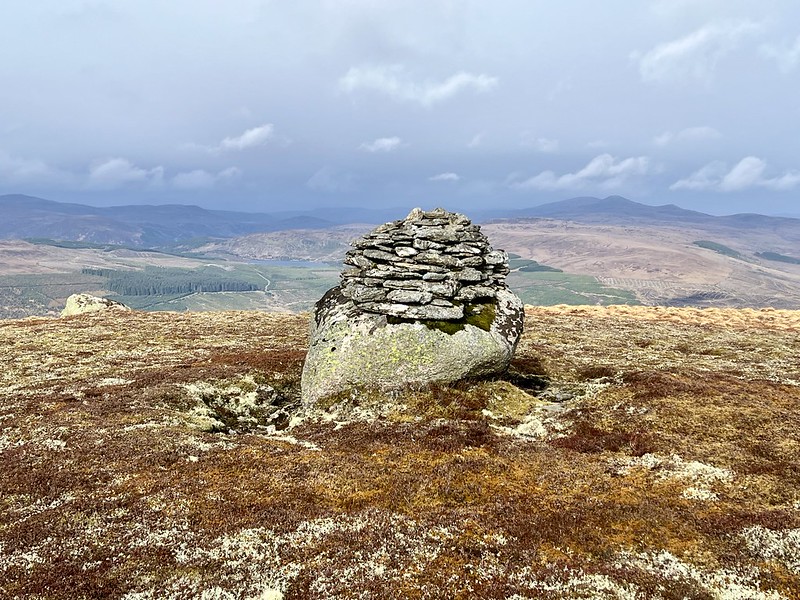
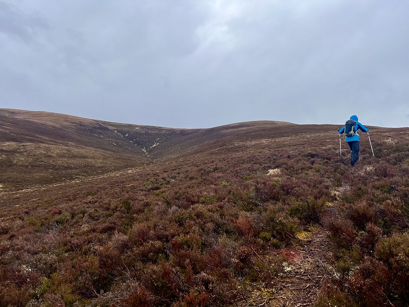
Morning came, Allison was feeling worse. I set off myself sometime before 8, delighted to find the wind farm track continues (though not shown on the map) right up to the turbines. I cut across the ground in between and headed for Sithean a'Choin Bhain which was not bad going. However the terrain from there to the summit was endless peat hags which became tiring. A nice morning, weather coming up from the south, wind colder than yesterday. From the top I dropped down into more peat hags to make my way over to the Simm. Disturbed a stag and his hinds who looked irked as they galloped off, then up to the boulder capped with a cairn. From here the SE summit looked significantly higher, despite HillBagging telling me I was at the top. I decided to head out to the other top, finding the closer I got to it, the higher the one I'd left started to appear. Damn! Had to go back to the 659m top to drop down the hillside towards the tent. Allison was still in bed, not feeling very human. We packed up and decided to head over to Dorback today.
 IMG_1471 by Al, on Flickr
 IMG_1472 by Al, on Flickr
 IMG_1473 by Al, on Flickr
Simm
 IMG_1474 by Al, on Flickr
 IMG_1475 by Al, on Flickr
 IMG_1476 by Al, on Flickr
 IMG_1478 by Al, on Flickr
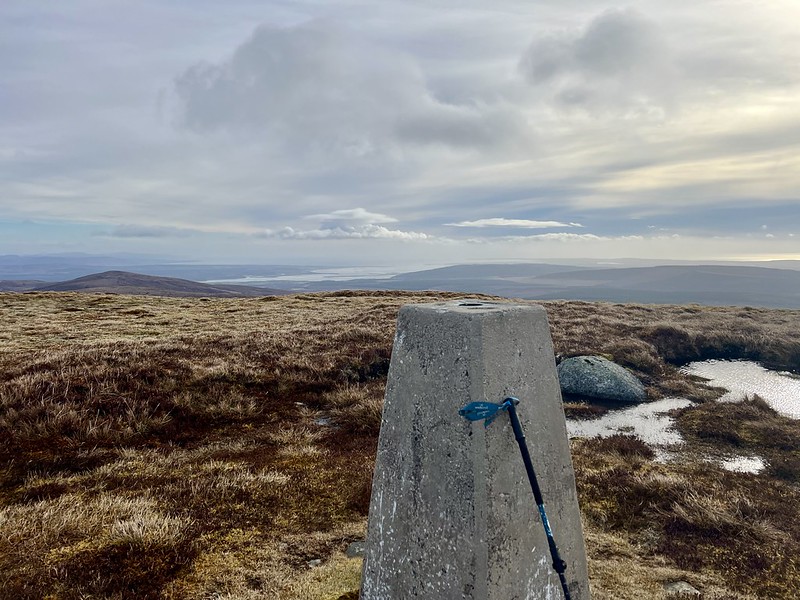
We arrived at Dorback about 12.30. No parking left at the road end, but a space by the gate leading down to the route if you don't mind verge parking on lumpy ground. We had our lunch in the car. Allison was undecided what she was doing, but she needs this Corbett and I suggested she'd be as well trying and seeing how she went - she was doubtful her legs would hold her. Nevertheless we set off, taking the WH route - the past twice we've followed that route but clockwise - today we went anticlockwise as WH suggests - easier that way, particularly if the wind's on your back as it was with us. I had intended to do Carn na h-Ailig too, but that was sacrificed today.
 IMG_1480 by Al, on Flickr
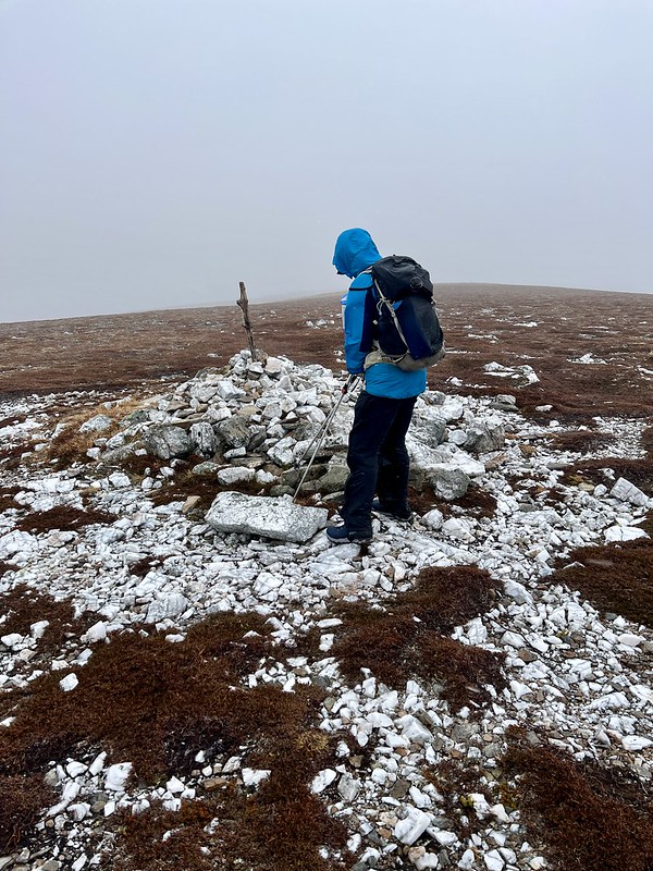
We met a party of three older guys returning as we set out to cross the stream. Past the derelict cottage, following the track as it slowly wends towards the shoulder of Geal Charn. Wind was strong and cold, rain horizontal at times. A brief burst of sunshine as we stumbled up the heathery slope, then smitten by a blizzard as we reached the summit plateau. At least it was coming from behind us. Paused at the cairn for all of three seconds before continuing along the fence line, which is more imaginary than actual...there are a few decayed posts on the ground. We could see someone ahead of us, going towards Geal Charn Beag by the look of it. We headed down over more peat hags and tussocks, Allison managing despite her illness. We could see the other walker going down the south side of the stream whilst we were on the north - near the bottom he seemed to disappear. We got to the track and marched along towards the lodge, where we met a guy who asked us if we'd seen another climber - fitting the description of the man we'd seen - he was over 80 and determined to get to the summit. At least we could pinpoint on the map where we'd last seen him and the chap headed along the track to see where he was. Hopefully ok.
Lovely weather
 IMG_1481 by Al, on Flickr
 IMG_1482 by Al, on Flickr
Looking like grouse poo, this is a Dark Tussock caterpillar
 IMG_1483 by Al, on Flickr
Ben Rinnes
 IMG_1484 by Al, on Flickr
 IMG_1485 by Al, on Flickr
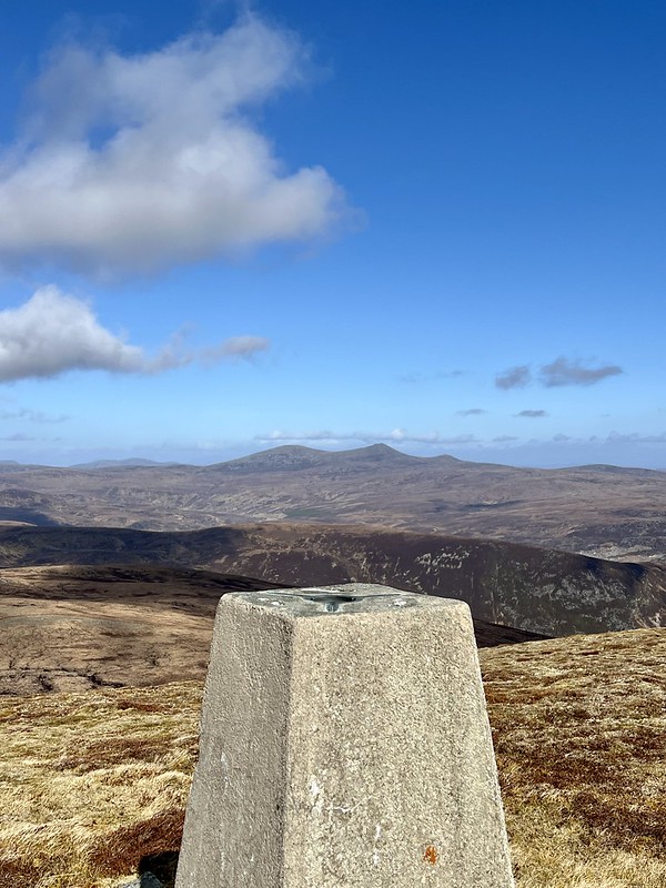
Summit Geal Charn
 IMG_1487 by Al, on Flickr
 IMG_1488 by Al, on Flickr
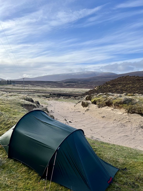
I asked Allison what she wanted to do. We could head home tonight, we could camp now and hopefully get some rest and recuperation ...she opted for the latter and we found a rather sloping pitch not far from where the car was. Another very windy pitch and heavy rain just as we were seeing up. A cold night too, quite a lot of new snow on the tops in the morning.
 IMG_1490 by Al, on Flickr
My plan for today was to head down to Balquhidder and do Creag Mhor, with or without Beinn Stacath. A beautiful morning as we left Dorback, lot of new snow on the Monadliath as we drove past. Weather steadily deteriorated as we drove south, into heavy rain.
Intended route:
Actual route
Got to Balquhidder at lunchtime again - Allison opted to come along up Creag Mhor and decide what we were doing at the summit. Third time up this hill, third time by the same route, which I'm never keen on. Steep grassy slopes, intermittent rain and wind. Always annoying getting to the summit itself, which is further away than you feel it should be. Sitting on the summit block I asked what she wanted to do, as we looked down at the route to Beinn Stacath. Whilst keen to do the route, she felt that it was probably sensible to call it a day here, which I think was right, especially as the weather deteriorated once again as we started to descend. Now the focus is whether A is going to be fit enough for the HebWay at the end of this week
 IMG_1491 by Al, on Flickr
 IMG_1492 by Al, on Flickr
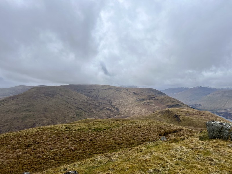
Beinn Stacath from summit Creag Mhor
 IMG_1493 by Al, on Flickr
...
Not a bad drive up on Thursday evening - car temperature gauge said it was 19 degrees at one point. Turning twilight when we arrived at Eilanach Lodge at the start of Glen Glass. There used to be parking for a few cars just by the main gate - there are cones up now and "Turning Only, No Parking" signs. Had to drive back a bit to the metal gates for the wind farm, where you might get 2 cars in without obstructing anything. Got saddled up and ready to go - last time we were here we found a rather poor pitch at the side of the forest track, so tonight we were on the look out for something better, which we found in the trees pretty near the start of the walk. We were sheltered, but could hear the wind whipping through the trees higher up. Not a bad night's sleep.
Up reasonably early - Allison wasn't feeling great - cold/flu like symptoms, tired. We had track to lead us much of the way, quite steep and a bit manky in places, but track none the less. We stayed on it a bit too much, having to cut back downhill from one of the turbines to reach the bealach. Then it's peat hags for a while until deer tracks wend through the rough stuff. The wind was strong, but it was a warm day compared to recently. Across Loch Glass, Wyvis had lost almost all its snow - quite a change from the white beast we saw a fortnight ago.
Wyvis
IMG_1453 by Al, on FlickrMeall Mór
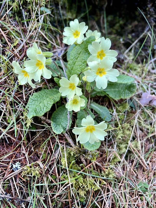
IMG_1460 by Al, on FlickrIMG_1461 by Al, on FlickrMust be spring
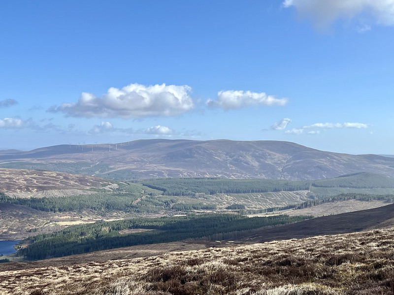
IMG_1462 by Al, on FlickrIMG_1463 by Al, on FlickrLooking over to Beinn Tharsuinn
IMG_1464 by Al, on FlickrIMG_1465 by Al, on FlickrCarn Chuinneag in distance
IMG_1466 by Al, on FlickrWyvis
IMG_1467 by Al, on FlickrI had planned to continue over Meall Beg and drop down to the head of the loch, returning along the shores, but the path looked a bit boggy on this side (in contrast to the good track on the south side) so we endeavoured to return by our outward route. Neither of us noticed that we'd missed the turn off to the left and had descended about 100m down the right hand path into Coire Ruighe Fearchair before we noticed. Rather than re-ascend, we continued on the path we were on, which did cost us a bit extra distance. Back at the car not much after 2pm, noting that there were about 5 other cars clustered about our parking spot, some definitely causing a potential obstruction. Mind you - if the estate needlessly close off a suitable parking area, what can you expect?
From here it was on to Beinn Tharsuinn. We've done this twice from the parking spot at the gravel pit at Strath Rory - I wanted to try a different approach, one more suited to adding on the Simm of Cnoc an t-Sithean Mor, which could be accessed from Strath Ruisdale, somewhere new for us. A long, straight road, past the Ardross Distillery, then onto rougher road to the end of the public road, where there's plenty parking at the start of a wind farm track. We had to navigate a flock of sheep who were on the road, running along in front of us - sometimes they'd head up onto the grassy verge, only to return back to the road when we thought we were going to get past. We parked up and set off, without any real idea if we'd get camped. We could either have an early stop or do the hill tonight...
Wind farm track all the way to where there's a dam marked on the map. We found an ok stop to pitch beside the river and put up our new tent. I'd been thinking about how to manage the HebWay with our little Nick, which has a very small vestibule, making cooking difficult if it's adverse weather. And condensation can be a problem if repeatedly wet...so time for a new addition to the tent family, an Anjan 2. Better space inside, a vestibule that's twice as big and virtually the same weight/size. So it was the inaugural pitch tonight. We had our tea and I was swithering whether to head up to the summit - Allison was feeling pretty crap and decided she wasn't going, when the rain began. That was enough to dissuade me from going anywhere, just get.an early night. The new tent performed well in many respects, but was quite noisy in the wind. Part of that was getting used to new noises, part was because one guy was a bit loose.
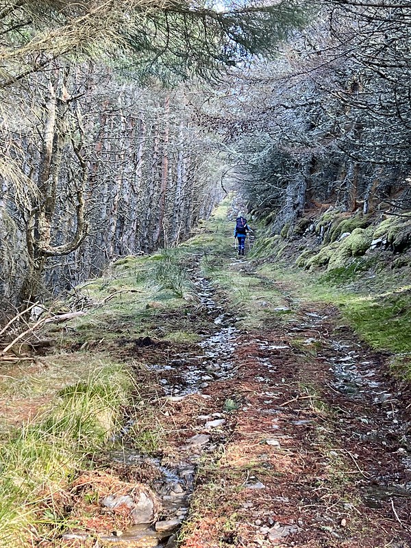
IMG_1469 by Al, on FlickrIMG_1470 by Al, on FlickrMorning came, Allison was feeling worse. I set off myself sometime before 8, delighted to find the wind farm track continues (though not shown on the map) right up to the turbines. I cut across the ground in between and headed for Sithean a'Choin Bhain which was not bad going. However the terrain from there to the summit was endless peat hags which became tiring. A nice morning, weather coming up from the south, wind colder than yesterday. From the top I dropped down into more peat hags to make my way over to the Simm. Disturbed a stag and his hinds who looked irked as they galloped off, then up to the boulder capped with a cairn. From here the SE summit looked significantly higher, despite HillBagging telling me I was at the top. I decided to head out to the other top, finding the closer I got to it, the higher the one I'd left started to appear. Damn! Had to go back to the 659m top to drop down the hillside towards the tent. Allison was still in bed, not feeling very human. We packed up and decided to head over to Dorback today.
IMG_1471 by Al, on FlickrIMG_1472 by Al, on FlickrIMG_1473 by Al, on FlickrSimm
IMG_1474 by Al, on FlickrIMG_1475 by Al, on FlickrIMG_1476 by Al, on FlickrIMG_1478 by Al, on FlickrWe arrived at Dorback about 12.30. No parking left at the road end, but a space by the gate leading down to the route if you don't mind verge parking on lumpy ground. We had our lunch in the car. Allison was undecided what she was doing, but she needs this Corbett and I suggested she'd be as well trying and seeing how she went - she was doubtful her legs would hold her. Nevertheless we set off, taking the WH route - the past twice we've followed that route but clockwise - today we went anticlockwise as WH suggests - easier that way, particularly if the wind's on your back as it was with us. I had intended to do Carn na h-Ailig too, but that was sacrificed today.
IMG_1480 by Al, on FlickrWe met a party of three older guys returning as we set out to cross the stream. Past the derelict cottage, following the track as it slowly wends towards the shoulder of Geal Charn. Wind was strong and cold, rain horizontal at times. A brief burst of sunshine as we stumbled up the heathery slope, then smitten by a blizzard as we reached the summit plateau. At least it was coming from behind us. Paused at the cairn for all of three seconds before continuing along the fence line, which is more imaginary than actual...there are a few decayed posts on the ground. We could see someone ahead of us, going towards Geal Charn Beag by the look of it. We headed down over more peat hags and tussocks, Allison managing despite her illness. We could see the other walker going down the south side of the stream whilst we were on the north - near the bottom he seemed to disappear. We got to the track and marched along towards the lodge, where we met a guy who asked us if we'd seen another climber - fitting the description of the man we'd seen - he was over 80 and determined to get to the summit. At least we could pinpoint on the map where we'd last seen him and the chap headed along the track to see where he was. Hopefully ok.
Lovely weather
IMG_1481 by Al, on FlickrIMG_1482 by Al, on FlickrLooking like grouse poo, this is a Dark Tussock caterpillar
IMG_1483 by Al, on FlickrBen Rinnes
IMG_1484 by Al, on FlickrIMG_1485 by Al, on FlickrSummit Geal Charn
IMG_1487 by Al, on FlickrIMG_1488 by Al, on FlickrI asked Allison what she wanted to do. We could head home tonight, we could camp now and hopefully get some rest and recuperation ...she opted for the latter and we found a rather sloping pitch not far from where the car was. Another very windy pitch and heavy rain just as we were seeing up. A cold night too, quite a lot of new snow on the tops in the morning.
IMG_1490 by Al, on FlickrMy plan for today was to head down to Balquhidder and do Creag Mhor, with or without Beinn Stacath. A beautiful morning as we left Dorback, lot of new snow on the Monadliath as we drove past. Weather steadily deteriorated as we drove south, into heavy rain.
Intended route:
Actual route
Got to Balquhidder at lunchtime again - Allison opted to come along up Creag Mhor and decide what we were doing at the summit. Third time up this hill, third time by the same route, which I'm never keen on. Steep grassy slopes, intermittent rain and wind. Always annoying getting to the summit itself, which is further away than you feel it should be. Sitting on the summit block I asked what she wanted to do, as we looked down at the route to Beinn Stacath. Whilst keen to do the route, she felt that it was probably sensible to call it a day here, which I think was right, especially as the weather deteriorated once again as we started to descend. Now the focus is whether A is going to be fit enough for the HebWay at the end of this week
IMG_1491 by Al, on FlickrIMG_1492 by Al, on FlickrBeinn Stacath from summit Creag Mhor
IMG_1493 by Al, on Flickr...
Click to mark this as a great report. Register or Login free to be able to rate and comment on reports (as well as access 1:25000 mapping).
Big Winds in Ardgour
Date walked: 07/04/2024
Distance: 47km
Ascent: 2355m
Views: 240
Easter in Alladale - plus a remote bothy visit.
Fionas: Beinn Tharsuinn (Deanich), Càrn a' Choin Deirg, Càrn Salachaidh, Meall a' Chaorainn (Easter Ross)
Date walked: 01/04/2024
Distance: 85km
Ascent: 3307m
Comments: 3
Views: 358
Some Grahams around Perthshire
Date walked: 24/03/2024
Distance: 61km
Ascent: 2714m
Views: 281
Bagging around Cannich
Fionas: Beinn a'Mheadhoin, Càrn Gorm
Date walked: 17/03/2024
Distance: 40km
Ascent: 2695m
Views: 286
Ice Cold on Vurich
Fionas: Creag a'Mhadaidh
Date walked: 10/03/2024
Distance: 61km
Ascent: 1950m
Views: 398
Out of Puff in Ardgour
Fionas: Glas Bheinn (Kinlocheil), Meall nan Damh, Stob Mhic Bheathain
Date walked: 03/03/2024
Distance: 38km
Ascent: 2240m
Views: 412
Skye Mountain Magic
Sub 2000s: Sgùrr na Strì
Date walked: 25/02/2024
Distance: 47km
Ascent: 2275m
Comments: 4
Views: 734
Remote Grahams, Bothy Nights
Date walked: 18/02/2024
Distance: 44km
Ascent: 2000m
Comments: 6
Views: 980
Over the Corran Ferry
Fionas: Beinn Mheadhoin (Morvern), Beinn na Cille
Date walked: 11/02/2024
Distance: 42km
Ascent: 3150m
Views: 546
-
weaselmaster
- Location: Greenock
- Occupation: Idle and old
- Interests: Searching for meaning
- Activity: Hill Bagger
- Mountain: Foinaven
- Place: Assynt and beyond
- Gear: Satmap Active 12
- Member: MCofS MBA JMT RHB
- Camera: iPhone 13 / Sony RX100
- Ideal day out: One that lasts at least 72 hours...
- Munro rounds: 2
- Corbett rounds: 2
- Fiona rounds: 2
- Donald rounds: 2
- Munros: 277
- Tops: 221
- Corbetts: 217
- Fionas: 195
- Donalds: 73+30
- Wainwrights: 15
- Hewitts: 33
- Sub 2000: 391
- Islands: 28
- Long Distance routes: West Highland Way Cape Wrath Trail
- Filter reports
- Trips: 14
- Distance: 756 km
- Ascent: 36336m
- Corbetts: 11
- Fionas: 38
- Donalds: 33
- Sub2000s: 1
- Trips: 51
- Distance: 3123.8 km
- Ascent: 151785m
- Munros: 12
- Corbetts: 54
- Fionas: 163
- Donalds: 19
- Sub2000s: 9
- Hewitts: 2
- Trips: 53
- Distance: 3136.5 km
- Ascent: 155385m
- Munros: 59
- Corbetts: 65
- Fionas: 92
- Donalds: 8
- Sub2000s: 2
- Trips: 43
- Distance: 2399 km
- Ascent: 129611m
- Munros: 135
- Corbetts: 62
- Fionas: 25
- Sub2000s: 8
- Trips: 60
- Distance: 1982.7 km
- Ascent: 85039m
- Munros: 13
- Corbetts: 2
- Fionas: 8
- Donalds: 2
- Sub2000s: 190
- Trips: 57
- Distance: 2933 km
- Ascent: 180392m
- Munros: 11
- Corbetts: 193
- Fionas: 34
- Donalds: 1
- Sub2000s: 27
- Trips: 61
- Distance: 3090.77 km
- Ascent: 206176m
- Munros: 271
- Corbetts: 16
- Fionas: 10
- Donalds: 9
- Sub2000s: 32
- Trips: 76
- Distance: 2994.86 km
- Ascent: 175243m
- Munros: 67
- Corbetts: 12
- Fionas: 72
- Donalds: 81
- Sub2000s: 97
- Hewitts: 13
- Wainwrights 12
- Trips: 78
- Distance: 2035.42 km
- Ascent: 124390m
- Munros: 18
- Corbetts: 5
- Fionas: 142
- Donalds: 71
- Sub2000s: 24
- Hewitts: 15
- Trips: 68
- Distance: 2453.94 km
- Ascent: 164961m
- Munros: 77
- Corbetts: 126
- Fionas: 17
- Donalds: 8
- Sub2000s: 2
- Trips: 64
- Distance: 2406.7 km
- Ascent: 166291m
- Munros: 109
- Corbetts: 112
- Fionas: 16
- Donalds: 10
- Trips: 64
- Distance: 1894.46 km
- Ascent: 127277m
- Munros: 219
- Corbetts: 17
- Fionas: 4
- Donalds: 3
- Sub2000s: 1
- Trips: 24
- Distance: 254.33 km
- Ascent: 16304m
- Munros: 26
- Corbetts: 5
- Trips: 1
- Corbetts: 1
- Donalds: 1
- Joined: Aug 22, 2012
- Last visited: Apr 16, 2024
- Total posts: 2433 | Search posts