Summary
This final stage crosses the last moorland on the walk then a mix of farmland and woodland until a short cliff top section at the coast before finishing at Cockburnspath where there is a shop and nearby bus stop.


Terrain
Mostly good paths, tracks and roads.
Getting there
Start
Longformacus.
Public Transport
Bus to Cocksburnpath, none at Longformacus.
Start Grid Ref
NT693572

Stage 1
At Longformacus turn south to head away from the bridge soon passing the village hall. Turn left onto a road signed for Whitchester. Follow this for 1.75km then turn right over a stile onto a path heading uphill keeping the fence on your left with good open views behind. After leaving the fence the ground gets rougher underfoot, aim towards the wind turbines, on a raised path at times, keeping an eye out for the waymarkers. Having been heading SE the route now bears left to aim W towards a small block of forestry. There is only a faint path in places. Pass to the left of this small block of trees and go through a gate to follow the path along the edge of Owl Wood.

Stage 2
After a short distance turn left over a stile and at Commonside Wood turn right through a gate to cross a field diagonally left - the GPS/Walkhighlands app is useful as livestock sometimes knock over the waymarkers. In open grazing land head towards a prominent finger post to your left before descending to Lodge Wood. Go through a gate here and stay on the main track to emerge at the B6355 road. Turn left for a short distance then turn right uphill to climb a steep track next to a wood. Pass a sign for Windy Windshiel, an ancient settlement, and soon bear left to go through a gate and stay on the lower grassy path to cross a field keeping high next to the forestry on your right.

Stage 3
After a gate and stile stay on the right edge of the field to reach a wooden gate and the wild wooded ravine of Robber's Cleugh. Follow the path through this area and another 2 gates before emerging on a forest track, turn right. The Way runs through the forest above the Whiteadder River for 2km before leaving the trees and following the main track as it heads through fields and alongside the river. After leaving the river the track climbs gently, ignore a couple of tracks off to the right to descend to reach the road at Abbey St Bathans. Cross the road and pass the church on your right; the Rest House used to be a bunkhouse but closed many years ago.

Stage 4
Cross the bridge over the river and turn right. Follow the riverside path, crossing a footbridge and soon emerging at a minor road. Here another footbridge on the right leads to more houses and the excellent Woodlands Cafe (limited opening check website), otherwise the Southern Upland Way continues by turning left along the road soon passing a cottage. After a gate it becomes a track, keep straight on near a ford passing through farmland and then woodland. After climbing through the trees take a sharp signed turn left and then soon turn right now in open ground to head uphill and through a gate to cross fields. Keeping to the right edge of the fields of Whiteburn Farm pass a memorial cairn to the WWI airfield that once stood here.

Stage 5
A stile leads to a track which soon reaches the road with farm buildings ahead. Take the path just to the left to skirt round the farmyard before continuing across fields to reach another road. Turn left along it for a short distance before turning right to follow a track towards Blackburn Mill. When the track bends left up towards the buildings continue ahead through the gate and turn left keeping the hedge on your left. At the top of the field another gate leads to a straight track and eventually a row of cottages. Pass these and follow the road past Blackburn and then stay on the road through undulating farmland until it reaches the busy A1 road.

Stage 6
Turn left and follow the verge until a sign shows where to cross to pick up a grassy path on the far side. This soon picks up an old section of road which bends right to cross the railway line. Turn left after this to follow a track through Penmanshiel Wood. After 1km the Southern Upland Way turns sharp right at a clear forest track junction. The route then climbs steeply (keeping right at an unsigned fork) through the forestry plantation before passing a bench and descending again. There were once sea views on this section but the trees have grown and if you prefer to stay on flatter ground it is possible to stay on the lower track and rejoin the route later. After the routes rejoin the path turns left to reach Pease Bridge on the A1107 road.

Stage 7
Take a short dogleg right to pick up a path on the far side of the road that descends through Pease Dean Wildlife Reserve. Wooden steps lead down through the trees to reach a bench, turn left here and cross two footbridges. After the second bridge turn right and the path leads to the road opposite Pease Bay caravan park. There is a shop here, otherwise turn left to head uphill on the road soon turning right at a gate to follow the coast path. The path dips down before wooden steps, climbs them and then heads along the cliffs with good views back to Pease Bay and then another sandy cove.

Stage 8
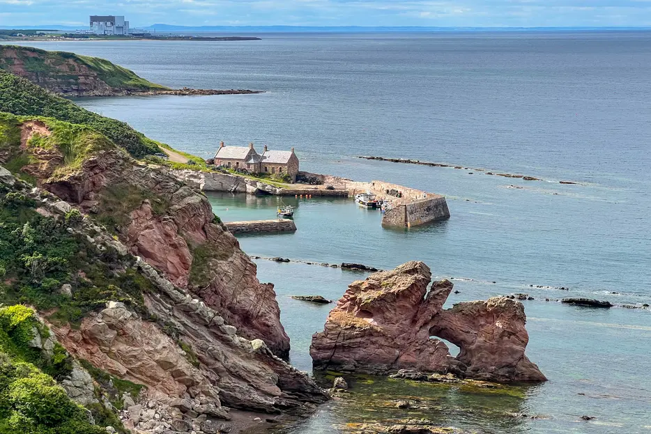
Soon the picturesque harbour and buildings at Cove come into view ahead. Just before the cliff top path arrives at the first houses, the route turns left to head inland on a field path.

Stage 9
This joins a track - bear right to immediately reach a minor road, turn left along it briefly, then turn right to pass a row of cottages. The track continues and passes under the rail line, swings right to passunder the A1 road and then bends left again. It curves right in a field to reach the road at the edge of Cocksburnpath. Turn left into the village, then take the next right by the Southern Upland Way shelter, continuing up the road to reach the ancient mercat cross at the heart of the village. There is an excellent community-run shop just along Callander Place (opposite the primary school and next to the village hall), whilst the bus stop is back at the main road near the shelter.

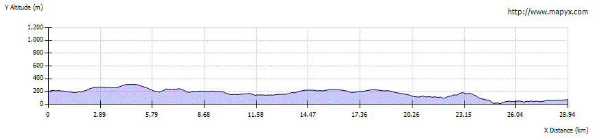
Route Profile