
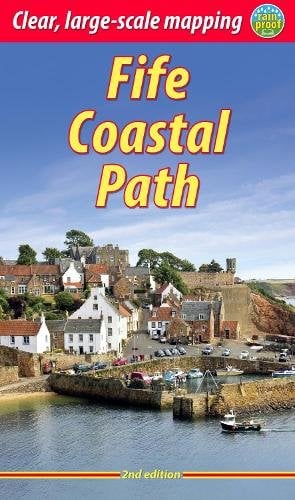
Fife Coastal Path
Linking the Forth and Tay Estuaries, the Fife Coastal Path runs for over 183km though the varied landscapes of Fife. The route links some of Scotland's most picturesque former fishing villages as well as the home of golf - St Andrews with its ancient University. In between are miles of golden beaches, attractive woods and nature reserves but the route also threads its way through industrial towns such as Kirkcaldy and Leven. History is everywhere, from the winding gear of the former collieries to ruined castles and the pictish and prehistoric carvings in the Wemyss caves.
| Stage descriptions | Length | Time | Done |
|---|---|---|---|
| Kincardine to North Queensferry | 27km | 6 - 8 hours |  |
| North Queensferry to Burntisland | 18.5km | 4.5 - 5.5 hours | |
| Burntisland to East Wemyss | 19km | 4.5 - 5.5 hours | |
| East Wemyss to Lower Largo | 11.5km | 3 - 3.5 hours | |
| Lower Largo to St Monans | 14km | 3 - 4 hours | |
| St Monans to Anstruther | 5.75km | 1.5 - 2 hours | |
| Anstruther to Crail | 6.75km | 1.5 - 2 hours | |
| Crail to Kingsbarns | 9.5km | 3 - 3.5 hours | |
| Kingsbarns to St Andrews | 13.5km | 3 - 4 hours | |
| St Andrews to Newport on Tay | 29km | 6 - 8 hours | |
| Newport-on-Tay to Newburgh | 28.5km | 7 - 8 hours | |
THE CHALLENGE
The route is well waymarked and offers straightforward walking. Some sections can be muddy underfoot. The stretches between Crail and St Andrews (via Kingsbarns), and from Balmerino to Newburgh, are long and relatively remote, giving rougher going than the rest of the route.

BAGGAGE TRANSFERS AND WALKING PACKAGES
Click to find organised Fife Coastal Path walking holiday packages and baggage transfer providers.ACCOMMODATION AND SERVICES ALONG THE WAY
The Fife Coastal Path runs around coastline which has many towns and villages for most of the route, with good services and accommodation available fairly frequently. The one exception is the final stage, which runs through the hills of North Fife away from the coast - this section is comparatively remote.
BOOKSHOP: GUIDES & MAPS
PUBLIC TRANSPORT
There are good bus services throughout Fife, with buses available to all the start and end points of the stages listed above.
In addition, there are rail stations at North Queensferry, Inverkeithing, Aberdour, Burntisland, Kinghorn, Kirkcaldy and Leven, with a further station at Leuchars late in the route.
Timetables for all the routes can be found on Traveline Scotland.
Users' walk reports for the Fife Coastal Path
There are 613 Walkhighlanders who have completed the Fife Coastal Path. To record if you have completed the route, you must register and be logged in. Our users have contributed 17 public walk reports for the route. These are ordered below with the most popular ones first.
Share your report for the chance to win gear every month