Summary
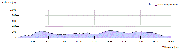
The first stage of the Affric-Kintail Way climbs up from Drumnadrochit through Craigmonie woods before following forestry and farm tracks to the hamlet of Shenval. The route then heads through several forestry sections with some good views before finally descending into Cannich with shop, campsite, cafe, pub, buses.


Terrain
Waymarked paths and forest tracks. Farm livestock near Shenval, dogs to be kept under tight control.
Getting there
Start
Drumnadrochit.
Public Transport
Buses from Inverness to Drumnadrochit and Cannich.
Start Grid Ref
NH508299

Stage 1
The Affric Kintail Way officially begins at the large car park in Drumnadrochit, by the Loch Ness Hub and toilets. Turn right out of the car park and follow the main road for approximately 300 metres until a crossroads - there is a footpath sign on a lamp post here for Craigmonie and Balmacaan. Turn right and follow Pitkerrald Road for another 200m where the road forks. Take the left hand track (signed for Craigmonie Woodland walks) which climbs gently uphill with woodland on the right. Follow the track past a house and keep straight ahead until the edge of the woods where there are two giant redwood trees, with a dilapidated information board up on the right. Leave the track by heading up to the right here past the board, following an earth path into the woods. This soon forks - take the right branch.

Stage 2
The path soon joins a larger one coming in from the left; continue ahead, following the green and red waymarkers. The path levels off and gives glimpses of Loch Ness through the silver birch trees. When the path forks take the right hand path (green waymakers) heading slightly downhill. The path follows the side of Glen Urquhart, giving views of the houses at Easter Milton and Allanmore. You may hear woodpeckers and spot red squirrels; pine martens are rarer but also resident in the area. Keep to the level path, ignoring a track to the left. After crossing a small bridge the path swings left uphill, climbing fairly steeply to pass the Milton viewpoint, where there are seats and an information board on the left. Continuing up the main path, turn right at a junction, signed for Glencoiltie Loop.

Stage 3
The route rises, drops to a footbridge, then climbs again steeply. Eventually a sharp bend is reached; turn left here, following the main track, which climbs more gradually to a junction beneath a bench with a view out to Loch Ness. Turn right - signed for Corrimony. A good forestry track now undulates through the forest, with good views out over Glen Urquhart at times. After a high point the track gradually descends over several kilometres, eventually coming alongside the river.

Stage 4
Keep ahead through a gate at a junction to reach a forestry car park and picnic area. Continue until a sign and then turn left (signed for Shenval and Corrimony). The track leads west soon going heading through a gate and heading gently uphill. After a short distance Loch Meiklie comes into view and there are more glimpses of this as the track continues through the forestry.

Stage 5
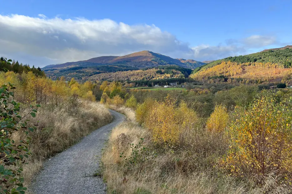
Where a track heads up off to the left continue straight ahead as the route undulates through the thick spruce plantation. At a crossroads continue ahead and ignore a smaller path down to the right. Eventually a signed (Corrimony) junction is reached, turn sharp right to head downhill here. Keep left to follow the bend in the track and soon go through a gate onto a farm track. Here the first views of the Affric mountains can be seen ahead. Follow the, sometimes muddy, track round to the left and across the bridge and through the gate to reach the houses at Shenval.

Stage 6
Follow the road past the houses, at the junction (defibrilator on the left) turn right to soon reach the A831. Cross the road and take the track just left of the bus stop, this soon becomes a wide path climbing uphill. At a signed junction turn right onto a track and then straight across a minor road passing through 2 gates to continue uphill on a track. The route snakes uphill before eventually bending left to face the Affric mountains in the distance. Continue, passing some lovely native pine trees before reaching a T junction, turn right then immediately left onto a path which runs downhill next to a stream. Pass through a set of double gates and stay on the route as it becomes a track and reaches the A831 at a gate. Turn right along the road for a short distance before taking the signed route on the left side of the road before Millness is reached.

Stage 7
This wide path runs between two fences, turns right and eventually reaches a footbridge over another burn. Cross this and follow the path as it leads to the left, eventually reaching a forestry track. Follow this winding track for just under 2km, then turn right (signed) onto a well-made path. This eventually leads to another track - turn right here to follow this downhill. Before it meets the road turn left onto another section of well-made path, with good views over the glen. The path eventually reaches a minor road - turn right along this, then left at the junction to cross the river and approach the village - the campsite and excellent Bog Cotton Cafe are passed on the left. To reach the shop, pub and bus stop, continue and turn left at the T junction.
Next stage: Cannich to Affric

Route Profile