
Summary
This route begins with an exploration of the fishing village of Burghead, taking in the harbour and the historic Pictish Fort. It then follows a stretch of coastline along a disused railway, before returning inland via Clarkly Hill with views across the Moray Firth.


Terrain
Streets, good paths, gentle climb
Getting there
Start
Burghead.
Public Transport
Buses to Burghead from Elgin.
Start Grid Ref
NJ113686

Stage 1
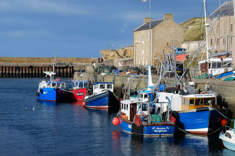
There is parking in Burghead at the campsite / beach car park signed off left from the southwest side of the town. Begin by heading on a path that joins the shore road to reach the harbour. From here walk around the edge of the harbour, which is often busy with fishing boats, and was designed and built by Thomas Telford in the 1800s. Follow the road to the north end of the harbour and once past the last building climb the ramped steps, turning left past the vehicle barrier before climbing the stone steps with the chain handrail.

Stage 2
From the top of these steps there is a great view down over the harbour and the beach and dunes of Burghead Bay all the way to Findhorn. When the first white house is reached turn left up narrow steps to its left. A path continues to Burghead visitor centre located in the old white tower where you can climb the steps for a better view. This was once part of an ancient pictish fort.

Stage 3
Continue to the right of the fort, crossing a grassy park with a row of benches along its left edge. At the road at the far end turn left downhill. The green mound on the right is the site of the Burghead Clavie, a spectacular annual fire festival held each year on 11th January. After being carried through the streets the flaming Clavie (a barrel full of staves) is finally burnt out on the mound. Ignore the next street on the right, but just before reaching the seafront road you can detour to the right and then turn right down an alley to visit an impressive ancient chambered well thought to be used for early Christian baptisms (key usually from the Pictish fort).

Stage 4
Return to the road and then turn right along the shorefront houses. Keep left onto a track to keep by the sea at a fork, and keep going to pass to the left of the huge maltings plant owned by drinks giant Diageo. This, together with a similar plant nearby, provides much of the raw ingredient for spirits including whisky distilled nearby. Immediately after the factory keep left to join the old railway - now part of the Moray Coast Trail.

Stage 5
Follow the tarred cycle path as it passes through low cuttings and at other times the coast is visible. Note the Cumminston Stacks off to the left - small sea stacks that have become a well known area for rock-climbers. Pass under a bridge and go straight ahead at a cross-tracks (a turn here is a short cut to Clarkly Hill). Continue ahead until after going under the second bridge, then take the next signed path signed for the Clarkly Hill Circular. The path soon bends round to cross over the railway line and head uphill to the road.

Stage 6
Turn left at the road and then immediately right to cross it and follow a track uphill. To the left Hopeman is visible. Before the top of the hill turn right following a sign to take a grassy path between fields along a high ridge. From here there are good views over the Moray Firth, with the pointed peak of Morven in Caithness often visible, although the views ahead are a bit spoilt by the large masts. Part way along there are a couple of signed paths on the left marked for viewpoints, though the views are obscured and the detours not really worthwhile.

Stage 7
Instead continue until the path emerges on a track by Clarkly Hill cottages, then follow this down to the main road at a junction with the cemetery opposite. Turn left and then soon take a right into Headland Rise. Follow this road until it meets the main road heading into Burghead. Turn right and follow the main road back to the start of the walk, taking the first left to reach the campsite / beach car park.

Route Profile
