
Summary
Badbea is the haunting site of a now abandoned settlement. Though beautiful, it is a windswept and bleak spot. Following the Highland Clearances people were forced to live here, having been cleared from the fertile straths inland.


Terrain
Well worn though rough path down to the Monument; optional continuation is on faint paths through the heather.
Getting there
Start
Signed car park on south side of the A9.
Public Transport
Buses on A9.
Start Grid Ref
ND084204

Stage 1
There is a signed car park on the south side of the A9. An information board here gives some information on why people were forced to live in such unforgiving places as Badbea - basically to free up the fertile straths for sheep-farming - a very profitable activity for the Lairds to help feed the looms of the industrial revolution far to the south. Begin the walk by heading through the gate and keeping straight on at the fork. The path climbs slightly before the sea comes into view and it begins to descend the rough heather moorland.

Stage 2
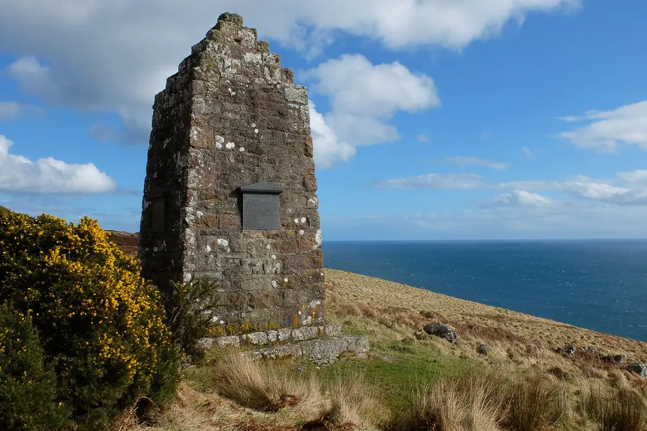
Soon a stone monument is seen ahead and the path descends to reach it. It records the names of the residents of the village, having been built by David Sutherland, the son of a Badbea resident who had eventually emigrated to New Zealand. The easiest option from here is to retrace your steps; continuing the walk means crossing rough heather moorland and requires some navigation. For this, pass to the right of the monument to reach another information board.

Stage 3
Several of the ruined houses are in view just ahead. The first residents of Badbea arrived in 1793 but most arrived in 1802, many from Strath Ousdale, a more fertile spot nearby, whilst others came from Strath Kildonan running inland from Helmsdale. By the 1850s the population was falling as families left in search of a better life, and by 1903 the village was empty. The monument was built in 1911 by David Sutherland who had returned to Scotland in 1901. Turn left at the board to follow a very faint path contouring the slopes to the north.

Stage 4
Further tumbledown ruins are passed whilst looking back one can see the steep sea-cliffs below the village. According to legend Badbea was so windswept that those living here had to tether their cattle, their hens and even their children to prevent them being blown over the cliffs (so still keep well clear of these dangerous cliffs today). Eventually some slightly better preserved remains of houses are reached, one with a low stone lintel still in place. Turn left uphill here, aiming for a gap in the drystone wall. Pass through this and then pick up the remains of a track heading diagonally left across the heather moor. Turn left along this to return to the car park.

Route Profile
