
Summary
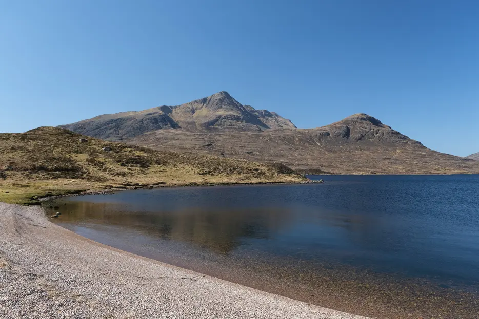
This superb circular day walk heads out from Incheril via the Heights of Kinlochewe to visit remote Lochan Fada in the Fisherfield Forest. The rougher return route involves a river crossing and a final descent down beautiful Gleann Bianasdail to return via Loch Maree - best kept for dry weather.


Terrain
Good track initially, then rougher paths, boggy by Lochan Fada. Crossing the river at the head of Gleann Bianasdail may be impossible in spate. Rougher return path down Gleann Bianasdail.
Are you REALLY ready for winter hills?
Hillwalking when there is snow lying requires an ice-axe, crampons and knowledge of how to use them safely. The description here is for summer conditions.
See our Winter Skills page for basic information on the essential skills, techniques and knowledge needed for winter.
Getting there
Start
Car park at Incheril.
Public Transport
Kinlochewe is served by buses from Inverness; 1km walk to reach the start at Incheril.
Start Grid Ref
NH037623

Stage 1
There is a car park at the end of the minor road in Incheril (near Kinlochewe). Leave the car park the way you drove in, then turn left to continue along the lane, with a footpath sign for Dundonnell. Pass in front of a final house and pass through a gate onto a track. Follow this alongside the pretty Abhainn Bruachaig river, passing a hydro building before reaching the Heights of Kinlochewe - scattered houses and estate buildings.

Stage 2
When the track forks head left up a good track that climbs up to enter Gleann na Muice. Descend to cross a bridge and climb again still on the track. At the 8km point continue ahead on a narrower path ignoring an ATV track heading steeply uphill to the right.

Stage 3
The path undulates with great views opening up of the mountains ahead. Pass a couple of small lochs - Loch Gleann na Muice and Loch an Sgeireach, before descending towards the southeast end of the much larger Lochan Fada.

Stage 4
As the shore of the loch is reached turn left, crossing a burn and heading along the pebbly beach. The now fainter path resumes at the far end, climbing slightly away from the loch briefly before returning to the shores. The going is boggy in places as the path fades before reaching the outflow of the loch, the Abhainn an Fasaigh.

Stage 5
This river flows down from Lochan Fada to Loch Maree through Gleann Bianasdail - but first you must cross it. Although wide, this can be done using stones in dry conditions, but in wet weather the stones may be submerged and you may have to turn back and retrace your steps. Assuming you can make the crossing safely, a clearer path continues on the far side, soon swinging left away from the loch.

Stage 6
This stalkers path gives a grand view down the deep glacial trench that is the upper end of Gleann Bianasdale, before curving right to gain more height and keep well away from the ravine. After crossing the Allt Leacach just below an attractive waterfall the main climbing of the day is over. Continue along the path that contours the slopes of the glen, eventually gradually losing height. Care is needed at one point where the original stalkers path has been washed away by a small burn -this can be negotiated with care.

Stage 7
Eventually the path slopes right down to the floor of the glen, and continues by the river and later a fence. When the path forks ignore the right branch heading uphill and instead keep to the path nearer the river. The next section is supremely beautiful, with many old pine trees above a series of gorges, waterfalls and pools in the river. Great care is needed however as the path crosses steep ground and is rough and rocky in places. Eventually the path descends to meet a larger path at a t-junction - turn left here, soon crossing a footbridge over the river.

Stage 8
The going is now a little easier, though some sections can be boggy after wet weather. Keep left of the shores of Loch Maree. The grassy path / track rounds Camas an Trusdair, passing the remains of some ruined buildings and soon leaving the loch behind. The route is a little rougher in places, keeping well above the Kinlochewe River. When it reaches a fence line the path keeps left of the fence, ignoring a gate, and climbing slightly. When a house comes into view the path continues towards the woodland to its right - the start of the walk at the car park at Incheril is hidden by these trees.

Route Profile
