Joyous, that is, for the lucky folk standing on the higher ground. For anyone standing on the lower ground it’s another matter entirely. Because in cold murky car parks up and down the land, hillwalkers are staring bleary-eyed at the way ahead. At ridges, switchbacks and headwalls rising up into the gloom.
Trudging up a foggy ridge in full expectation of summiting a viewless, cold, rocky lump isn’t everyone’s idea of fun, so on mornings like I wouldn’t blame anyone for calling it a day and heading for the nearest pub. If it’s horrid down here, surely it’s going to be even worse up there?
Most of the time, it is. But very occasionally, it isn’t. The Mountain Weather Information Service will sometimes forecast cloud inversions but, as we trudge up our chosen hill, most of us are probably oblivious to quite how good our day is about to get. And that’s no bad thing, because sometimes the surprise makes the experience that much more spectacular.

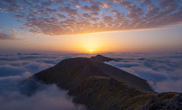
What a view to wake up to! Sunrise from Gleouraich
Walking through the inversion layer
You’re trudging up a cold, misty hillside. You’ve been doing so for hours, but you now get the sense that the cloud you’re walking in is just that little bit brighter than it was a few minutes ago. Not quite so grey. Still, you’re not convinced, because even dull cloud can be bright on the eyes, so your instant reaction is to look upwards in search of blue sky.
Nope, nothing. It looks just as grey as it has all morning. Head down, you carry on.
As you plod upwards, looking at your feet, you see you’re casting a slight shadow. That’s weird! You look up again, and this time you can see the sun. It’s faint and dull but it’s definitely the sun. Obscured by thick cloud, it’s dull enough to look at directly before it disappears and the murk returns.
You climb still higher. After a few more minutes of murk, the brightness returns. This time when you look skyward you can see a slight blue tinge. You dare to hope. Will the summits be poking out of the cloud!? Will the last ten minutes of ascent bring you out of the cloud completely?
You can’t help but feel spurred on and your pace quickens, your heart racing with excitement. You know you are not quite at the summit but you also know there’s not a lot of ‘up’ left. What will you run out of first? Hill or cloud? Oh please let it be the latter!
For those final ten minutes the cloud teases you, alternating between brightness and murk. You get a sudden break of bright, direct sunshine. As your shadow again appears on the ground, you look upwards and outwards. Wisps of cloud are passing overhead but the sky is definitely blue. The sun feels warm after the gloomy climb, and you get your first tantalising glimpse outwards.
Oh, but then a bank of cloud surges around you. Damn! Murk returns, and you climb the last 20 metres upwards. In the space of a few seconds the cloud thins, your shadow comes into sharp focus and, as you climb still higher, you eventually run out of cloud. Once clear of it you look out to see a beautiful carpet of cotton wool as far as the eye can see. Everywhere you look, dark peaks and ridges are poking out of the carpet like islands in an ocean.
With a bright sun overhead and the reflected glare from the cloud below, the world before you is insanely bright and vivid. Like looking out over the Greenland ice cap.
The air is clearer than you’ve ever seen. The distant outlines are so sharp they could cut you. You feel like you can see from one side of Scotland to the other, and you probably can! You’re looking down on the top of the cloud and it’s incredible! It creates an exquisite illusion of isolation and detachment from the world below, and you can’t help but stand there, gawp, and ponder just how few people in Scotland that day are sharing this unique experience. The vast majority of the population are languishing down below in cold and murk, completely unaware of the alternative world on offer up high. You think to yourself…..THIS, is why I do what I do. THIS is why I go hillwalking, for experiences like this.

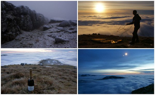
Easily my most memorable cloud inversion and Hogmanay! 31st December 2008 atop Sgorr Dhonuill – Beinn a’ Bheithir.
You mutter an expletive to yourself. The sight is so magnificent, so mesmerising and yes, so warm that you really don’t want to descend back down into the greyness. You squeeze as much out of the experience as you can, staring at it, taking photos of it, searing it into your memory before descending into the cold, fuzzy grey world below.
When you get home, you’re as high as a kite. Your face feels warm and you can’t help smiling. You look at your photos from the summit. Nah, they don’t do it justice. They NEVER do it justice.
How they form
The general rule in weather is that the air gets colder the higher up you go. Summits are colder than glens. But sometimes this rule gets reversed, or ‘inverted’.
When this ‘temperature inversion’ occurs, cold air at the earth’s surface gets trapped below warmer air. That band of warmer air is actually fairly thin and, if you climbed up through it, it would eventually start getting colder again. But that narrow band is enough to determine where clouds can form and, crucially, how high their tops can rise.
Warm air is less dense than cold air, so when air at the earth’s surface is warmed by the sun, it can’t help but rise up through the cooler air above. As it does so it expands, cools, condenses into water droplets and forms clouds. Clouds can build high into the sky if conditions allow, but in a temperature inversion the clouds’ upwards development is brought to an abrupt halt.
Even though the cold air at the ground has been warmed by the sun, when it meets the inversion layer it is still much colder than the air into which it is rising. It is more dense and therefore cannot progress any further upwards. So it sinks, locking the cold air at the surface until such time as the sun warms it to the same temperature as the air above, or windy conditions mix the two bodies of air together. It’s a bit like filling a bath using a hot tap and a cold tap. You won’t get a constant temperature throughout the tub unless you mix it up with your hand.
If the rising air is moist, the visible manifestation of the inversion is cloud forming at low altitudes or even on the ground, with higher terrain poking though into the sunshine.
Low level fog
Temperature inversions originate from several different weather set-ups, but the most common type of inversion we experience is called ‘surface (or radiation) inversion’. This is where most of our fog comes from.

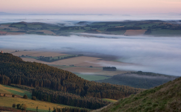
Fog over Fife, seen from East Lomond
As soon as the sun sets, the earth’s surface starts radiating its heat back into the atmosphere. On a still, cloudless night, the ground loses heat so rapidly that it cools any air it’s in contact with, but the air higher up remains unaffected and therefore stays warmer than the air below it. Because cold air is unable to hold as much moisture as warm air, its water vapour condenses and forms water droplets, or fog.
The fog layer can be a lone, thin wispy band over a field or it can be a couple of hundred metres thick, but the effect is greatest on calm, still mornings when the air remains in situ long enough be to be cooled.
Glens are especially good for fog because, after the sun has set, cold air sinks downwards off the hills. In the mornings this can result in thick valley fog that laps up at the ridges and summits themselves. On calm mornings it is only the warming from the sun that can dissipate it, so in sun-kissed lowland areas the fog can clear quite quickly, but in deep, narrow glens where the sun doesn’t reach, it can persist all day. As solar energy is key in ‘burning off’ a surface inversion, it’s a phenomenon that is more common in the colder months.
Anticyclonic murk
The most spectacular and persistent cloud inversions are those that are caused by high pressure systems, or anticyclones, sitting over the UK – called ‘subsidence inversions’.
In an anticyclone, the vast dome of air aloft sinks and becomes compressed, and as it does so it warms. This can trap cooler air at the ground, and in the still conditions you get during high pressure, the two bodies of air remain undisturbed and therefore don’t mix.
If the dividing line between the warm and cold air occurs at a very low altitude, the ‘inversion layer’ can result in the same appearance as valley fog. But in my experience it tends to be around 1km in altitude and therefore results in a dull murky haze at low levels, with a band of cloud higher up above the glens themselves, usually affording only the highest munros a cloud-free view. These inversions also tend to create astonishing differences in temperature between glen and summit.
They are much more long-lived than fog-producing surface inversions, which are typically broken each morning only to return the next night. If high pressure persists in the winter months and the air is still, the sun isn’t able to warm the cold air below and the inversion can last for days, across both day and night.
Beautiful as these inversions are, it’s not just the clouds that get ‘capped’ by the inversion layer. Pollutants and aerosols get trapped near the earth’s surface too. That’s why you sometimes see a thin band of yellow or brown haze at or below the inversion layer, and why the air is superbly clear above it.

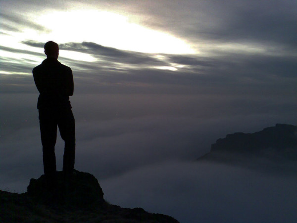
You don’t need a big mountain to get above the fog. Ropey phone self portrait on Arthur’s Seat in Edinburgh.
My warmest inversion
Uppermost in my memory is a walk I took in the Grey Corries back in February 2006, and it remains the most pronounced inversion I’ve ever experienced.
Anticyclonic murk had persisted for days. It was -6C in the glens and there was a thick frost covering everything. The world below was frozen and deathly still as I first climbed up to the small outlier of the range, Stob Ban. I couldn’t see a thing, so I’d almost resigned myself to calling it a day. But once at the summit I had that teasing sense of brightness above. I still couldn’t see anything but I knew that its neighbour, Stob Coire Claurigh, the highest hill in the Grey Corries, was a clear 200m higher and would surely be poking through the cloud.
The promise of warmth and cotton wool saw me race up that monster of a hill, but I wasn’t expecting the extreme change in temperature over a short distance. In the space of maybe 50 steps, it went from subzero to plus 10. And in the glare of the sun it was even warmer. Through the cloud, it was t-shirt weather up top. It was so surreal, so pleasurable, that I abandoned plans of further summits and just sat at the top of that one for 90 minutes, taking it all in. Incredible!
My most memorable inversion
It was 31st December 2008. Tired of Edinburgh’s street party and the noise of the city, my partner and I instead headed north, and set off up Beinn a’ Bheithir near Ballachulish. The climb up was freezing cold, misty and frosty. Bizarre rocky outcrops loomed out of the mist as we climbed higher….and then we unexpectedly broke through an inversion layer at 950m.
Jaws on the floor, we pitched the tent perhaps 10 metres from the 1001m summit of Sgorr Dhonuill. The sun sank into the fluffy white ocean as we did so, only to be replaced by the moon and Venus in conjunction. By midnight the inversion had lifted and we were treated to a panoramic view of countless firework displays being set off along the west coast. Inversion, sunset, champagne, great company. Unforgettable!

