Summary
The penultimate stage of the Southern Upland Way crosses the southern slopes of the the Lammermuirs, a vast area of rolling moorland hills managed for grouse shooting and sheep. The route visits the spectacular cairns at Twin Law before descending to the Watch Water reservoir.


Terrain
Open pastures at first requiring careful route-finding, then paths and tracks, with final section on minor road.
Getting there
Start
Lauder.
Public Transport
Bus to Lauder at start, no public transport to/from Longformarcus at the end.
Start Grid Ref
NT530474

Stage 1
Head south along the main road from the centre of Lauder; if you didn't visit the market place, the Southern Upland Way joins in from Factor's Park. Continue along East High Street briefly until a tarmac lane leads off to the left between gateposts. This leads into the grounds of Thirlestane Castle. Go down the hill, and at the angled cross-roads at the bottom go straight across (bearing slightly right). The lane leads to a bridge over the Leader Water.

Stage 2
Cross the bridge and then follow the path that turns left on the far side, then right away from the river. Pass through two pedestrian gates to cross a track and climb slightly to pass through another gate. When the path reaches a t-junction, turn left. There are now good views back towards Thirlestane Castle, which was built in the sixteenth century but extended in the nineteenth - it is open as an attraction. When the muddy track swings right, go straight ahead on the path through the trees. The woodland is left at another gate, and then the path meets a track - turn right along this.

Stage 3
When it meets a road, go straight across, then stay on the track when it curves left after passing a metal barn at Wanton Walls. Continue along the track, climbing past a mast and through a belt of trees. At a track junction turn right, then turn left at the edge of the trees. Pass through a gate and then turn left along the edge of the pathless grassy pasture. Keep following the wall (on your left) as it curves round to reach a stile. Cross this, and then keep ahead through the open field, aiming for a SUW marker post set in a cairn. This section requires careful navigation. Look out for the next marker post, also set in a cairn, slightly downhill. Pass this and aim for the gates where a track passes through the belt of trees at the Snawdon Burn.

Stage 4
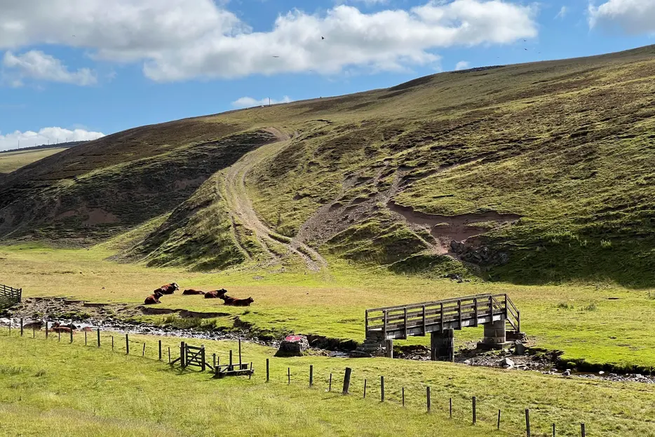
Go through the first gate here, but then bear left over a stile rather than over the cattle grid ahead. A path leads to a pedestrian gate - go through this and then turn right. After a farm gate, continue ahead through open pasture once more, with a wall on your right. After 300m a marker indicates where to veer left away from the wall, passing another cairn with a marker post. Follow the faint path to a stile, crossing this and keeping ahead. Keep to the left of the stones at the top of a ravine that slopes down to the Blythe Water. After passing the stones, continue to another stile, then bear right downhill towards the footbridge over the Blythe Water, crossing a stile to reach it.

Stage 5
Cross the bridge, then take the rough track that climbs uphill, diagonally to the left. Further marker posts lead to a gate in a drystane wall. Pass through and continue ahead, coming alongside a fence on your right. Cross this at a stile but continue along the far side of it, crossing a grassy track and then a drystane wall at a stile. Eventually the route reaches a clear surfaced track at Scoured Rig - turn left along this. It soon descends towards the farmhouse at Braidshawrig, set in an open glen. Just before you reach the farmhouse, turn right up a stony track.

Stage 6
Follow this track uphill, ignoring a fork off right. The route now leads across open moorland, heavily managed for grouse-shooting but having a wild and remote feel. The cottongrass is spectacular in the early summer. Go through a gate, and ignore another track off right. The route passes a metal shed; after this, ignore a track off left. Eventually the track ends at a fence on a ridgeline; turn right here along a path (formerly a track). This leads through a gate and continues to reach the huge cairns at Twin Law which have been in view for several kilometres.

Stage 7
The cairns stand off to either side from a trig point. Each is built upon a wide stony base with a pathway cut into it, and each has a seat set into the side - the further cairn has a visitor log book. Local legend has it that the cairns stand on the site of a battle fought here between the Scots and the Saxons; they commemorate two brothers who unknowingly fought each other and died here.

Stage 8
From the cairns continue on the obvious path, now descending gently ESE with a view to the Watch Water reservoir. Pass through a gate in a stone wall and continue the descent, now with a fence on your right. When the path reaches a tarmac track turn left along it. Cross a bridge over the Watch Water, and then take the next track which turns off to the right. This passes through a gate and then leads to Scarlaw Farm.

Stage 9
Pass the farm and continue along the now tarmac road, with the Water Water reservoir to your right. Pass a fishing hut, then follow the road as it descends to pass along below the earth dam. Beyond this it climbs a little, giving views to the prominent conical hills of Dirrington Great and Little Law. Keep left on the tarmac when a track joins from the right. After just over another 2.5km the lane leads to a junction in Longformacus. There are no services here; the next stage continues by turning right.
Next stage: Longformacus to Cocksburnpath

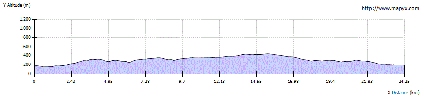
Route Profile