Summary
This superb circular walk begins from Clash Wood near Tomnavoulin. It climbs up past Craighead to traverse the moorland summit ridge of Càrn Daimh before descending back to the start; there are superb views for much of the route.


Terrain
Waymarked paths and tracks with varied terrain underfoot; some sections through the heather can be wet.
Getting there
Start
Clash Wood car park, near Tomnavoulin.
Public Transport
None to start; Tomnavoulin has infrequent bus links with Aberlour (and then Keith or Elgin).
Start Grid Ref
NJ208264
Summits Climbed
- Sub 2000
- Càrn Daimh

Stage 1
Park at the Clash Wood car park off the minor road which branches from the B9008 at the north end of Tomnavoulin. An information board gives details of both this walk and a short ramble around the wood itself. Begin the walk along the track which leads into the woods beside the board. After a short distance, turn left (yellow waymarker) onto a path that gently slopes down through the trees and then continues along the edge of the wood. Eventually the path passes through two pedestrian gates to reach a track. Keep almost in the same direction ahead, following the left fork on the track.

Stage 2
Further on ignore a small track on the left and continue to eventually pass the buildings at Westertown. Beyond here follow the main track as it dog-legs left (using the bridge to avoid the ford). Continue along the track, which climbs steadily, passing through further gates. When the main driven track swings right into a field ignore this and keep ahead on a fainter grassy trod to a gate ahead. In the next open pasture, keep straight ahead uphill with fences to your right. Looking back there are great views towards Ben Rinnes. Continue straight ahead through three further gates, eventually approaching and finally entering a plantation.

Stage 3
When a signposted junction is reached, turn right (signed for Ballindalloch). The next part of the walk follows part of the route of the Speyside Way. The route continues through the trees, ignoring a track off to the left, to eventually reach a gate and open country once more with beautiful and extensive views.

Stage 4
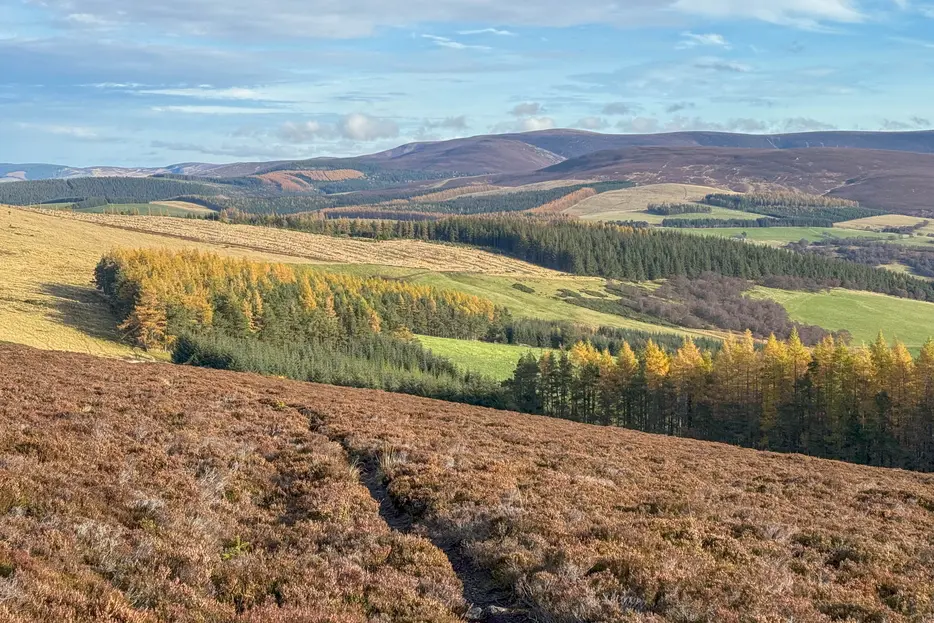
The route now follows a track along the open ridge towards the summit of Càrn Daimh. This section is a delight in fine weather, with open views to the Cromdales on your left, and Ben Rinnes and Corryhabbie Hill to the right. Continue ahead to eventually reach the view indicator and cairn at the summit.

Stage 5
Do not cross the fence line, instead continuing along the line of the Speyside Way just to its right. When the path comes alongside another plantation there is a junction. The path off right here (signed Tomnavoulin) is a short cut, but our route continues straight ahead. Further on (near the end of the plantation) the path reaches a pedestrian gate in fence. Do not go through the gate, leaving the Speyside Way at this point and instead turning right across the rougher heather, keeping the fence to your left. The path is initially indistinct but becomes clearer.

Stage 6
The path climbs gently; when it forks keep left, staying close to the fence as it doglegs to the left and then right again. The route is now heading downhill, with great views over Glenlivet ahead. When there is a stile over the fence turn left to cross it and follow the path that continues diagonally downhill.

Stage 7
Continue until the path descends towards gap in the plantation ahead. Don't descend through the gap, instead keeping above the trees on your right. The path becomes clearer and then becomes a track, but it's often very muddy with livestock. Go through a gate, ignoring a track heading up left and continue ahead, eventually passing into the trees and then returning to the car park.

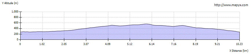
Route Profile