
Summary
This enjoyable ramble follows the waymarked Drumin Community Circuit and takes in a section of the River Livet as well as a visit to the ruins of Drumin Castle.
Please read the WARNING below before setting out on this route.


Terrain
Mix of grassy, woodland paths and some minor road.
Getting there
Start
Bridge of Livet (nr Bridgend).
Public Transport
There is a bus stop (shelter) at the Bridge of Livet but buses here are very infrequent.
Start Grid Ref
NJ194299

WARNING
The walk cannot currently be completed as the road bridge at end of Stage 2 is closed to traffic and pedestrians until July 2027.
The information shown above is the latest we have. If you have an update then please email us.
Stage 1
There is a small car park beside the cemetery by the Bridge of Livet, on the B9136 between the bridge and the junction with the B9008. Begin the walk by walking across the old bridge which, now open to pedestrians only, has good views down to the river below. On the far side turn immediately right and cross the road (to the right of the Cairngorms National Park sign), taking the path on the opposite side which is signed both as the Drumin circular walk and the George Smith Smugglers' Trail. The Smugglers Trail follows the same route as this walk but begins from the nearby Glenlivet Distillery. Smith, like many others, had an illicit distilling business but became the first person in the area to go legal and obtain a licence, founding the Glenlivet Distillery.

Stage 2
The path passes a bench and curves round to follow the richly-wooded River Livet downstream. Soon it reaches a footbridge, cross to continue the walk along the far bank. There are two pairs of gates in quick succession - these are used to let cattle reach the river for a drink - please ensure you close them behind you. Eventually the path heads up to the right and meets a minor road; turn left along this and cross the road bridge.

Stage 3
Immediately on the right is a car park for Drumin Castle (and an alternative start point for this walk). The circuit continues along the road, but first turn into the car park and take the pedestrian path which starts beside a boulder with an information plaque mounted on it (left of the main info board). The path curves round the foot of the mound on which stands the remains of Drumin Castle. The path dips slightly before climbing beside a fence and eventually doubling back to reach the top of the mound. A sign indicates a path to the right that visits the walled garden at the foot of the castle.

Stage 4
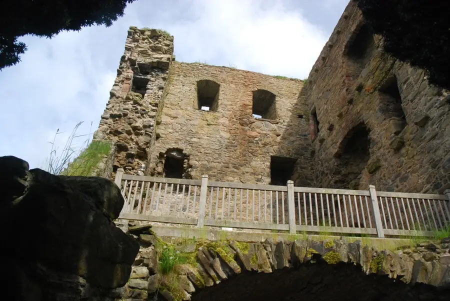
After this detour, return to the path which immediately forks again. The left fork is the continuation of the walk, heading back down to the car park, but first continue ahead to reach the entrance to the Drumin Castle ruins. The vaulted lower floor can be entered, and steps lead up to the first floor above. Thought to date back to the 14th century, the castle was one of three owned by Alexander Stewart, son of King Robert II; Alexander was notorious for his harsh justice and he became known as the Wolf of Badenoch. Return to the path that leads down to the car park, and turn right along the road. When this leads up to a junction, bear left onto the slightly larger road, passing the doctors' surgery.

Stage 5
A short distance further on a waymarker sign indicates where the route turns right on a track into Drumin Woods. Keep left at each of two forks, finally turning left onto a path (signed). This runs along the edge of the wood with views towards the former Drumin smithy. Turn right when the path emerges onto a road and then immediately left alongside another stretch of woodland. The path veers left between two fences at the end of the wood, and then approaches and runs parallel to a minor road before joining it. Just before the road reaches a t-junction turn right onto a track that cuts straight back to the route near the start; keep right across the old Livet Bridge to return to the car park.

Route Profile
