Summary
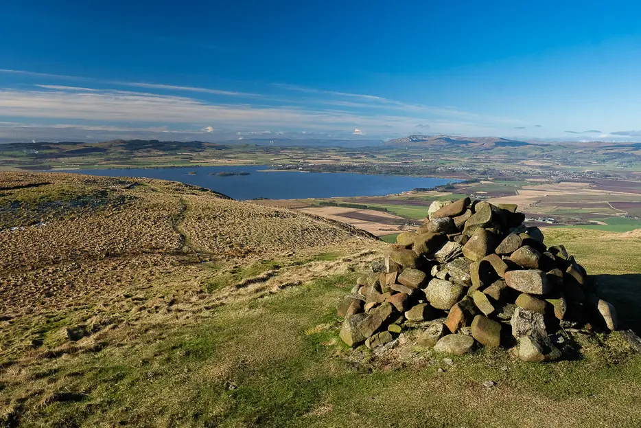
This short but steep hillwalk climbs up the more interesting side of Bishop Hill, giving superb views over Loch Leven.


Terrain
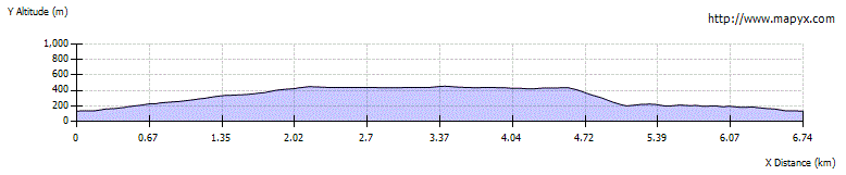
Good path for the ascent, steep at times; route less obvious on the plateau. Descent route is very steep and requires careful navigation - return by ascent route if in doubt.
Getting there
Start
Orwell and Portmoak church car park.
Public Transport
Bus to Scotlandwell.
Start Grid Ref
NO182019
Summits Climbed
- Sub 2000
- Bishop Hill

Stage 1
Park at the Portmoak church car park, which is available for walkers unless there is a service taking place (in which case you need to find a space in the village). Begin the walk by carefully crossing the busy road and turning right along the pavement on the far side. After a short distance a footpath sign (for Kinnesswood and Bishop Hill) indicates where to turn left up steps into Kilmagad Wood. At the top of the steps keep ahead on the grassy path with a fence on the right.

Stage 2
At the top corner of the fence the path bends left. Already there are good views out across Loch Leven. Above an open area, with a bench in it, go up to the sign post and turn right on a good path to begin the steep climb in earnest. This first cuts right up the slope, and then cuts left, passing a bench, before continuing up a wider slope when the gradient relents a little.

Stage 3
Pass through a pedestrian gate to leave the wooded area, and continue on the main path up the more open moorland, ignoring smaller branch paths on the left. The 'golf ball' like structure seen high above the forestry is a radar station. When the ground steepens the path zig-zags up climbing into a grassy hollow; from here take the path that heads east up to the top of the grassy mound of Munduff Hill. From here the views are simply superb.

Stage 4
Looking north from here, the top of Bishop Hill is revealed to be a suprisingly extensive plateau. Follow a path northwards, descending and continuing across this plateau - there are many possible variants. It eventually meets the main route between Bishop Hill and West Feal at a junction by a gate. Pass through the gate, then a second gate and continue on a fainter grassy track that aims towards the summit dome of Bishop Hill, forking left onto a path on the way up to continue up through another gate to reach the summit.

Stage 5
The well-built cairn enjoys magnificent views to the west, looking over Loch Leven towards the Ochils. To begin the descent follow the grassy path southwest.

Stage 6
The path eventually reaches a gate. Pass through this and continue on the main grassy track southwards for another 200m or so until a small path heads off to the right. This leads to the edge of the plateau, and then bends left to continue along the top of the slope. Ignore paths heading down off the hill to the right, instead continuing along the plateau edge to pass through a gap in a stone wall and then make a rising traverse above a crag. Beyond this the path continues towards a grassy mound - but before reaching this, look out for a grass path heading right at NO183034.

Stage 7
Turn right down this path, which descends grassy ground in a slight dip to reach the top of some crags. Bear left here for a short distance until the path leads down a steep gully between the rocks, with the village of Kinnesswood visible far below (pictured). Descend this gully with great care, and continue down the grassy path beyond which keeps descending steeply until some utilities buildings are reached just above the village, with a waymarker post for the Michael Bruce Way.

Stage 8
At the marker post do not descent the steps, instead turning left onto a path with a fence on your right. This path undulates across the hillsides, giving some good views. Ignore a gate on the right giving access to a golf course, instead continuing along the path until it enters Kilmagad Wood via another gate. The path now continues through the trees until it meets the outward route at the signpost mentioned in stage 2. From here follow the outward path until it turns right to return to the start, or head through the gate to shortcut down to the church and car park.

Route Profile