
Annandale Way
The Annandale Way runs from the top of the valley at Annandale Head in the hills north of the town of Moffat to the mouth of the River Annan and the Solway Firth.
Annandale Head is the start of the route but it lies away from roads so the first day of the Annandale Way is a loop north from Moffat, climbing from the banks of the River Annan to heather moorland and rolling hills with the dramatic deep scoop of the Devil's Beef Tub prominent before descending back to the town. After Moffat the route makes its way south through farmland, forest and moorland, with a variant that takes in Lockerbie. The two routes rejoin, continuing past Hoddom Castle to continue to the coast mostly along the banks of the River Annan before reaching the Solway Firth.
| Stage descriptions | Length | Time | Done |
|---|---|---|---|
| Devil's Beef Tub circuit from Moffat | 22.5km | 5 - 6 hours |  |
| Moffat to St Ann's | 13km | 3.5 - 4 hours | |
| St Ann's to Lochmaben | 17km | 4 - 4.5 hours | |
| Lochmaben to Hoddom Castle | 21.5km | 4.5 - 5.5 hours | |
| Hoddom Castle to the Solway Firth | 16.5km | 4 - 4.5 hours | |
| Lockerbie variant | |||
| St Ann's to Lockerbie | 21.6km | 4.5 - 5.5 hours | |
| Lockerbie to Hoddom Castle | 13.8km | 3.5 - 4 hours | |
THE CHALLENGE
The Annandale Way utilises a mix of footpaths, country roads and forest and farm tracks with some cross-country sections. It is mostly a low-level route, though the first stage and the section up to Joe Graham's Monument are more challenging.
The route is mostly clearly waymarked, apart from at a couple of points highlighted in the text; the waymarks may be attached to fence posts, gates, trees or boulders. If you don't see one scan the area - some are not obvious at a glance. There are many gates en route, mostly metal ones with levers or large latches. These stand out from the usual farm gates tied up with twine and can be spotted across a field before you see a waymark.

BAGGAGE TRANSFERS AND WALKING PACKAGES
Click to find organised Annandale Way walking holiday packages and baggage transfer providers.ACCOMMODATION AND SERVICES ALONG THE WAY
There are shops, hotels and bed and breakfast accommodation in Moffat, Lochmaben, Lockerbie and Annan.
The other stages can be more problematic. There is a campsite at Castle Hoddom (as well as at Moffat, Lochmaben and Annan), but if not camping it is recommended to ask your accommodation provider if they will pick you up and drop you off at the end points of the other stages, unless planning on long walks to head right through from Moffat to Lochmaben or Lockerbie, and from the latter towns to Annan.
BOOKSHOP: GUIDES & MAPS
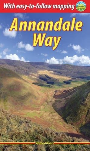
PUBLIC TRANSPORT
Moffat has a bus link from Lockerbie, which has a rail station. Annan also has both rail and bus links.
For the other stages, it is possible to catch a bus to the end of stage 2 / start of stage 3 on the A701 north of St Ann's - the service links Dumfries and Moffat.
There is no bus to Hoddom Castle - the nearest public transport here is a local bus from Lockerbie to Hoddom Cross.
Timetables for all the routes can be found on Traveline Scotland.
Users' walk reports for the Annandale Way
There are 142 Walkhighlanders who have completed the Annandale Way. To record if you have completed the route, you must register and be logged in. Our users have contributed 11 public walk reports for the route. These are ordered below with the most popular ones first.
| Title | Author | Date walked | Likes |
|---|---|---|---|
| Annandale Way in 5 days south to north from one base | Hoybeuy | 14/05/2024 | 5 |
| Annandale way in a day | Lara Smith | 22/05/2017 | 4 |
| Annandale Way: Part 1 - The Drenching. | nxmjm | 13/06/2010 | 4 |
| Moffat to St Ann’s: The Drenching part 2 | nxmjm | 04/07/2010 | 3 |
| Annandale Way South to North | JamesDunion | 14/05/2019 | 2 |
| St Anns to Lochmaben: Annandale way Section 3 | nxmjm | 08/08/2010 | 2 |
| Last Section of Annandale Way. | muraistrick | 03/04/2016 | 1 |
| Castles, carvings and cloudless skies: Annandale Way Part 4 | nxmjm | 15/08/2010 | 1 |
| Annandale Way: The final section | nxmjm | 05/09/2010 | 1 |
| The Crooked Road and Rowan Tree | nxmjm | 22/08/2010 | 1 |
| annandale way | rabnud | 22/10/2017 | 0 |
Share your report for the chance to win gear every month