Summary
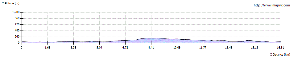
This very varied circular route explores and links up the green spaces on the southern fringes of Glasgow; it includes the best views over the city from the Cathkin Braes. The route was devised and waymarked by Glasgow Ramblers and Glasgow Countryside Rangers.

Grade

Bog Factor
Terrain
Pavements, formal paths in parks and woodland, and rougher informal paths. The route is waymarked (yellow/black arrows) but some posts are hard to spot, using the WH app will help; can be very muddy in places.
Getting there
Start
Netherlee, Glasgow.
Public Transport
Bus to Netherlee for start. Buses or trains can be used to approach many parts of the route.
Start Grid Ref
NS577588