Summary
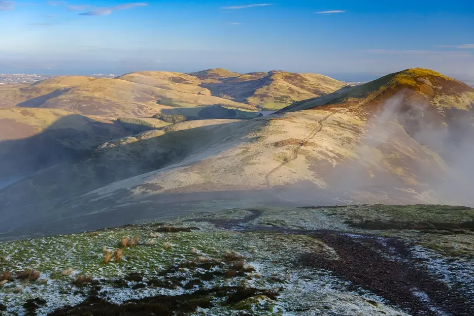
Scald Law is the highest of the Pentlands; this classic approach reaches it via a very fine switchback ridge, taking in the shapely Carnethy Hill along the way. The return follows the minor road by the Loganlea and Glencorse Reservoirs.
Grade

Bog Factor

Rating
Distance
Time
(in summer)
Ascent
Terrain
Clear hill paths; some rough sections
Are you REALLY ready for winter hills?
Hillwalking when there is snow lying requires an ice-axe, crampons and knowledge of how to use them safely. The description here is for summer conditions.
See our Winter Skills page for basic information on the essential skills, techniques and knowledge needed for winter.
Getting there
Start
Flotterstone Ranger Centre.
Public Transport
Bus to Flotterstone Inn.
Start Grid Ref
NT232630
Summits Climbed
- Sub 2000
- Scald Law

Stage 1
There is a car park (charge) by the Ranger Centre, just off the A702 by the Flotterstone Inn. The ranger centre - usually manned - is a great place to start any visit to the Pentlands with heaps of information available. Begin the walk along the path starting on the left side of the centre; this avoids the road for the first section and passes a memorial to CTR Wilson, a locally born man who won the Nobel Prize for Physics. Look out for a track on the left, signed for Scald Law. Another signpost for Scald Law indicates a path through a gate on the left. Take this, crossing a footbridge and then turning right on the far side. The route now begins the long ascent to Turnhouse Hill, climbing up and down along a ridge over two hummocks.

Stage 2
The route then bears right alongside a fence before going through a gate and continuing to climb, soon heading through another gate. The path now heads up the hillside towards a group of trees. The views back from here are superb, whilst to the right a glimpse of Glencorse Reservoir is backed by Castlelaw. Continue steeply upwards; the main path bypasses the first top to reach the ridge at Turnhouse Hill. A grand traverse now stretches ahead with superb views off to either side.

Stage 3
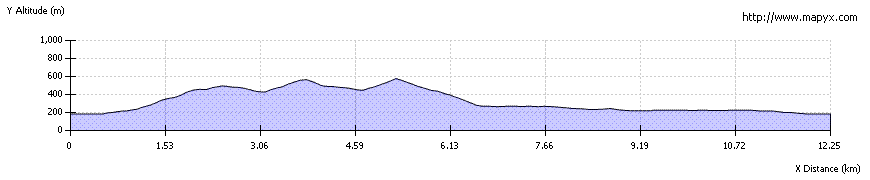
The route passes over two summits and then descends, losing around 80m down to a bealach where the ridge is crossed by a fence. Pass through a gate to begin the ascent to Carnethy Hill - the second highest of the Pentlands and a shapely hill. The summit is marked by a sprawling cairn and is a wonderful viewpoint for all directions, both ahead to Scald Law with the Kips to its right, back towards Edinburgh and Allermuir Hill, or across the strath towards the Moorfoot Hills.

Stage 4
Continue along the ridge path which now loses around 130m of height as it leads to the next bealach, again marked by a fence. An old right of way - the Kirk Road - crosses the ridge here. To the left it leads down to a layby on the A702, but the route to the right - to the top end of Loganlea Reservoir - is used as the descent route of this walk. If you have the energy, however, you'll want to continue along the ridge first to take in Scald Law, the highest of the Pentlands, before returning to this point.

Stage 5
For Scald Law, cross the fence and follow the path which has a few marker posts at first. The climb is fairly steady and uneventful, with the best view being back over Carnethy Hill, until the gradient eases onto the summit area of Scald Law. The top is marked by a trig point; the view is similar to that from Carnethy, though the two peaks of East and West Kip are better seen from here (or better still slightly further along the ridge). It is possible to extend the walk over the Kips; to return to the route described here there is a path from the western side fo West Kipp which heads around the northern slopes before descending more steeply the reach the glen above the Howe.

Stage 6
Otherwise, retrace your steps to the bealach between Scald Law and Carnethy Hill, and from here follow the Monk's Road path to the NW, keeping to the east side of the fence at first before crossing it at a ladder stile. Continue the descent, passing through a gap in another fence and reaching the floor of the glen by the house at The Howe. Here pick up the track that runs along the north side of the burn, signed for Flotterstone.

Stage 7
This soon becomes a tarred road. It runs along the side of Loganlea Reservoir, one of several in the Pentlands that helps to supply Edinburgh with drinking water - it is also popular with fishermen. Beyond this the road runs beside the Logan burn to reach the larger Glencorse reservoir. Continue beside this, eventually curving round by a line of Scots pines. The road leads all the way back to the start at Flotterstone, though some of the tarmac could be avoided by taking a signed path and track on the right that leads back via the old filter beds.

Route Profile