
Summary
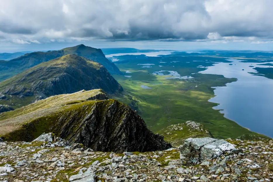
Beinn Lair is clearly seen when driving along Loch Maree, but this watery barrier makes it one of Scotland's remotest hills. Its hidden northern side is much more spectacular, with extensive and vast cliffs, whilst the views from the edge of its summit plateau are simply sensational. The shortest approach (without a boat) is the route given here from Poolewe; most choose to break the journey with a wildcamp by the head of the Fionn Loch, or a stay at the nearby open shelter at Carnmore Stable. Bike is also a good option - easy cycling to the woods above Kernsary, then muddy track and single track path to Fionn Loch suitable for MTBs.
Grade

Bog Factor

Rating
Distance
Time
(in summer)
Ascent
Terrain
Track, then excellent stalkers path all the way to the Bealach Mheinnidh. Upper slopes pathless, rocky and wet in places.
Are you REALLY ready for winter hills?
Hillwalking when there is snow lying requires an ice-axe, crampons and knowledge of how to use them safely. The description here is for summer conditions.
See our Winter Skills page for basic information on the essential skills, techniques and knowledge needed for winter.
Getting there
Start
Car park in Poolewe.
Public Transport
Bus to Poolewe.
Start Grid Ref
NG858808
Summits Climbed
- Corbett
- Beinn Lair

Stage 1
Turn down the minor road from the north side of the bridge in Poolewe; there is then a small car park on the left. Begin the epic approach walk by continuing along this tarred minor road, which soon becomes a private one. The road follows the beautifully wooded Poolewe River at first; there are two gates, but if locked there are stiles alongside. When the road forks, take the left track - signed Kernsary Estate. The now rougher track climbs a little and gives views across Loch Kernsary.

Stage 2
At a second fork go left over the bridge and follow the track up to Kernsary. Fork right again uphill to leave the yard at the gate, then at the edge of the forestry turn right onto a track into the trees. The track becomes boggy in places on this section; at a burn crossing, there is a footbridge to the left if the waters are in spate. Stay on the track - ignoring the path shown on OS maps which no longer exists; the track eventually becomes a path and leaves the forest at a gate and stile. Continue over the open moorland on an excellent stalkers path. Beinn Airigh Charr dominates at first, but after cresting a rise all the peaks around Fionn Loch come into view.

Stage 3
Ignore a smaller path forking back right. The path now passes the north side of Loch an Doire Crionaich below the impressive crags of Martha's Peak, named after a sheperdess reputed to have fallen to her death. Beinn Lair looks impressive from here, its great northern precipices beginning to be revealed at last. Eventually the path leads to the right above the Abhainn an t'Strathain Buidhe, and forks - a well made branch not shown on maps shortcuts down to cross the burn if not in spate, whilst the old path detours 500m south to reach a footbridge (turn left after this to meet where the routes rejoin).

Stage 4
Continue on the path as it climbs slightly and then begins to slowly descend towards the head of the Fionn Loch at Polt Fraochain, with truly stunning mountain architecture all around. For those breaking the walk, the best wildcamp spots are near the head of the loch on both sides of the causeway, or you could cross the causeway to reach the stable just west of Carnmore house which is a very basic open shelter. Otherwise turn right onto a much narrower path just before a burn. This path aims southwest at first before zig-zagging up towards the Bealach Mheinnidh.

Stage 5
The path crosses to the west side of the Allt Poll Fraochain before passing to the left of a rocky knoll just below the bealach; ignore a path that cuts off left for the Bealach a' Chruin. Once the great cliffs of Beinn Lair have been outflanked just short of the highest point on the path, leave the path and aim NE up the rough, wet and rocky slopes keeping above the rim of the great cliffs on your left. There are soon stunning views back over Meall Mheinnidh and then across the causeway to Carnmore and the mountains beyond.

Stage 6
Continue up the slope, keeping safely to the right of the edge. Eventually the cliffs curve round and force you to head east, climbing over a low bump. The views back over Meall Mheinnidh and Beinn Airigh Charr to the sea beyond are sensational; continue over a bump before the ascent resumes.

Stage 7
There is a cairn at the very edge of the cliffs at 830m that has the most perfect position for the view northwards over the great rock peaks of the Fisherfield forest.

Stage 8
Continue across the flatter plateau to reach the true summit cairn - a massive and solidly-built affair, but whose views lack the depth of those from the cliff edge. Slioch, though, looks very fine from this unfamiliar angle.

Stage 9
The return walk is back the same way - all 20km of it. Most walkers prefer to stay overnight around the head of the Fionn Loch and perhaps combine with other hills such as Beinn a' Chaisgein Mòr on a multi-day trip.

Route Profile
