
Summary
This circular route from Dulnain Bridge explores Curr Wood to the south and west of the village, including a visit to the Speyside Centre and views over Strathspey to the Cairngorms.


Terrain
Woodland paths, tracks and minor roads.
Getting there
Start
Car park behind community hall in Dulnain Bridge.
Public Transport
Bus to Dulnain Bridge.
Start Grid Ref
NH998249

Stage 1
The walk begins from the centre of Dulnain Bridge; there is a car park behind the community hall. Begin by heading out from the car park onto the main road and turning right as far as the Post Office. Here turn left onto the road signed for Skye of Curr, crossing the bridge over the Dulnain. Then take the next right onto Fraser Road.

Stage 2
After 250m turn right onto a track signed 'Old Laundry Path'. This leads past several more houses on the fringes of the woods. The track narrows to a path and continues through the trees. At a signpost turn right onto a woodland path, signed for the River Dulnain. The path soon comes alongside the attractive river, before swinging back left into the woods.

Stage 3
At a signed crossroads turn right along the track once more (signed for Skye of Curr). The track is muddy in places; after 750m a junction is reached - take the left branch here (waymarked), soon reaching the minor road through the Skye of Curr. Turn right along the road. This area was laid out as crofts by local landowner Sir James Grant, with long, narrow fields running away from the road, and scattered housing.

Stage 4
Before reaching the A95, turn left on a track leading to the Speyside Centre. This garden centre-cum visitor attraction includes a small cafe. To continue the walk, follow the sign into the overflow and coach parking area, and head to the far end of this. Take the track that leaves to the right, then immediately turn left (cairn) onto a clear path through the woods. This winds to and fro, crossing several small bridges, before emerging at what was once the main road, now an overgrown tarmac lane bypassed by the modern A95 (to which it is linked by a stile). Ignore the stile and turn left along this lane.

Stage 5
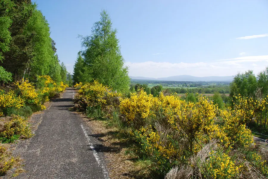
The old main road provides pleasant walking, with gorse alongside backed by some towering Scots pines, whilst the vegetation has begun to creep across the tarmac surface. Keep straight on when a track crosses the route. There are extensive views across to the Spey with the Cairngorms beyond on the next stretch, before a drivable section of road is reached after some boulders. Fork left uphill onto a tarred track a short distance further on. When a cattle grid is reached, the track ahead is into a private garden - instead turn left uphill on an unmarked grassy track into Curr Wood.

Stage 6
Curr Wood provides some superb habitat and is home to red squirrels and capercaillie, but it is perhaps best known for its wild flowers. This is the most important site in the UK for the rare Twinflower; the woods are also home to Creeping Ladies Tresses, a tiny orchid. Keep straight ahead at a crossways, continuing ahead and passing a bench and a gate. The path continues until it almost reaches the edge of a quarry. At this point it climbs left, heading uphill and soon swinging right once more to pass above the quarry.

Stage 7
Once past the quarry the route meets a clearer track; turn left along this, and follow it until it meets a tarmac road, with a view to the River Spey ahead. Turn left along the road, passing the houses of Mid Curr and Easter Curr. The main road into Dulnain Bridge it then met at a t-junction - you can either turn left along this back into the village, or instead turn left immediately before the junction (at the Give Way sign) to instead follow a grassy track through the woods parallel to the road. At a fork keep right, then keep straight ahead when the main route curves left to emerge past a derelict church onto a housing estate. Keep ahead on the gravel driveway to reach a road, then turn right and then left to return to the heart of the village.

Route Profile
