Summary
Culross was one of the historic starting points for medieval pilgrims making the journey to St Andrews. This first stage leads from the picturesque village to head along the coast and then on a pleasant route inland to reach Dunfermline and its great Abbey.


Terrain
Cycle paths, minor roads, farm tracks and clear paths.
Getting there
Start
West car park, Culross.
Public Transport
Bus to Culross; train and bus to Dunfermline.
Start Grid Ref
NS984858

Stage 1
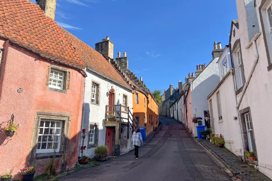
The official start of the Fife Pilgrim Way is adjacent to the West car park in Culross, where there is an info board about the route. Begin the walk by taking the path alongside the playpark to reach the centre of this historic burgh - the best preserved 17th and 18th century settlement in Scotland. Culross Palace (an NTS property) is off to the left from the cobbled section of the main street; our route passes the Tolbooth with its clocktower, then bears left to head up Back Causeway just beyond, signed for the Abbey. Pass the Mercat Cross, and continue up picturesque Tanhouse Brae with its beautiful old cottages.

Stage 2
At a junction keep ahead up Kirk St. Look out for Cat's Close - an alleyway off to the right through a gap in the wall; turn along this. The alley leads to a junction - the Pilgrim Way turns right here, but first you can visit Culross' own pilgrim destination - the Abbey - by detouring to the left. The Abbey was a Cistercian monastery built in the 13th century; in ruins, it is now managed by Historic Scotland. After visiting, return to the path junction and this time take the other path, that slopes downhill and emerges at the main road (Low Causeway). Turn left along the pavement, ignoring the turning on the right for the east car park.

Stage 3
After just under 500m turn right down Station Path. Use the level crossing to cross the railway, then turn left on the far side by the coast. Almost immediately the path forks - take the left branch and continue along the cyclepath (Fife Pilgrim waymarker). The cyclepath cuts off the reclaimed former industrial site around Preston Island; ignore a further path off right. Continue until a marker post (Newmills, Torryburn etc.) indicates a right turn. This path leads up and then swings left to cross a footbridge over the railway. Turn right down steps on the far side, then right again at the bottom. Soon the cyclepath curves left and meets the tarmac road - turn right along the pavement.

Stage 4
Continue for 350m, joining the main road and crossing a bridge. On the far side of this turn right down a lane. At the bottom of this turn left along a cyclepath. When this meets a road, keep right along it, passing the houses, then fork right to continue on a cyclepath once more, by the coast. When this swings left inland, turn right onto a tarmac path, passing a playpark and alongside houses to emerge back on the road. Keep ahead along the road, passing under a railway bridge. Keep along the pavement, with a playpark overlooking the sea to your right. Here you leave the Fife Coastal Path (which keeps by the sea here), and instead keep along the Main Street of Torryburn, heading inland.

Stage 5
Ignore several turnings on the right, continuing along the pavement of the B9037 to leave the village and then pass Torryburn cemetery. When the road bends slightly left to cross over the railway, leave it and instead take the track off right. The track passes the sewage works (on your left) and then becomes a path, eventually emerging on the A985 at a pedestrian gate. Cross with care and take the track opposite. When this forks by an old oak tree keep left. The lane crosses a railway bridge and then descends into Cairneyhill. At a t-junction turn right along the main road through the village, passing a shop. After 800m - at the edge of the village - turn left along a lane signed 'The Hilton Road / Crossford'. Keep along this lane, ignoring a branch off right, and curving round a wood on your right, becoming a path. When you reach a gate before the house at Hilton, turn right onto a path that keeps around the right edge of the gardens.

Stage 6
Beyond the house the path bends left through the wood and meets a track once more - turn right along this. Ignore a turning off left, keeping ahead along the track. If the day is clear, you get a first glimpse of Dunfermline Abbey from here. At Pitconochie, keep left to avoid the farmyard, ignoring the left turn (for Dean Plantation) and instead rejoining the main track beyond. The track eventually descends through woodland and meets a road in Crossford - cross and take the street opposite. Keep ahead when the main road curves right, then take the tarmac lane on the left - signed for Dean Plantation and Milesmark, Dunfermline). This descends slightly and rises to the farm at Berry Law.

Stage 7
Turn right at the junction - signed for Dunfermline - and pass to the left of the farm buildings. The route becomes a grass track now; keep ahead at a junction, now on a narrow footpath between some lovely hedgerows. Continue straight ahead until the path meets the A907 on the edge of Dunfermline. Turn right here and then immediately left along Cameron Street.

Stage 8
Continue along this until a t-junction with Maitland Street, then turn right. Follow this through a cross-roads until it meets the very busy A907. Cross this with care and head into Pittencrieff Park straight ahead between the gateposts. This beautiful park has resident peacocks, and is known to locals as 'The Glen'. Ignore a path off right and two off to the left, continuing until the corner of the Glen Pavilion building, which includes a cafe. Turn left here, passing the toilets to head under a bridge and keep straight on.

Stage 9
The path leads to St Catherine's Wynd at the edge of the park, with the main entrance of Dunfermline Abbey straight ahead. Founded as a priory, Dunfermline was declared an abbey by King David I and became a royal mausoleum. There's a charge to enter the very fine Romanesque nave. Scotland's national hero, Robert the Bruce, is interred here, though his heart was buried at Melrose Abbey; his name is carved proudly into the tower. This is the end of the first stage of the Pilgrim Way.
Next stage: Dunfermline to Loch Ore.

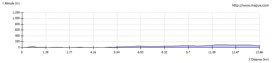
Route Profile