Summary
Good paths lead along the shore from Portencross before the coastal path skirts the site of Hunterston Power Station which dominates the area. The pretty seafront at Fairlie is followed by a section of shared cyclepath past the marina and onto the resort of Largs.


Terrain
Surfaced roads and cycle paths, promenades and farm tracks.
Getting there
Start
Portencross car park.
Public Transport
None to start - nearest bus West Kilbride 2km from start. Bus/train at Largs.
Start Grid Ref
NS176487

Stage 1
There is no public transport to Portencross, so if using buses or trains you'll need to either double up the previous stage, or pick up the route having started from West Kilbride. Begin the walk by continuing along the minor road from the Portencross car park. After passing several houses turn left to visit the well-preserved peel tower of Portencross Castle, built in the 14th century and occupied until 1739 when a storm damaged the roof.

Stage 2
The castle has a fascinating history, located halfway between Dundonald and Rothesay, King Robert II was a frequent visitor. Continue along the shore path past several cottages to reach the harbour. From here a surfaced path climbs a little to pass through a gap between rocks.

Stage 3
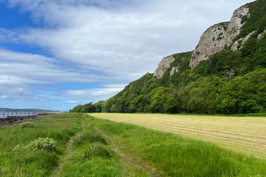
Continue along the track with great views to Little Cumbrae and Millport on Great Cumbrae beyond, and the sandstone cliffs of Ardneil Hill to your right. When the farm track swings right, continue on the coastal path ahead. This delightful stretch ends at a kissing gate, leading to a car park and a jetty.

Stage 4
The massive towers of the decommissioned Hunterston A Nuclear Power Station now dominate. Continue along the pavement beside the road, passing the reception. During the decommissioning period, many people still work both here, and also on the decommissioning of the neighbouring Hunterson B.

Stage 5
Stay on the pavement by the road as it curves left and then continues along the coast. As the main access road bends to the right, keep ahead to instead join another access road - this time a link to the now derelict oil rig construction yard that projects into the narrows. Despite all this, the area is an important winter feeding ground for waders and seabirds.

Stage 6
Before the main road is reached, fork left onto a cyclepath into the trees, signed for Fairlie and Largs. This soon comes alongside the A78, then diverges from it again, running through pleasant woodland. At the roundabout for Clydeport Hunterston (to the left) - go straight ahead. The road passes under the railway and then reaches Fairlie. Continue along the pavement, then fork left to reach a small waterside picnic area at Burnfoot. Cross the footbridge and continue along the footpath beneath the seawall as the properties at Fairlie are passed. At the jetty turn inland up the ramp and turn left along Bay Street. Bear right at the end of the street to cross the railway and keep left to follow the pavement.

Stage 7
Cross the road opposite Fairlie Bowling Club and pick up a shared cyclepath which runs straight ahead before turning left through a tunnel under the railway before continuing between the railway and marina boundary fence. When a car park is reached on your left turn left and then bear right to cross a road and continue on the coast path soon reaching the Pencil. This monument commemorates the Battle of Largs in 1263 which finally expelled the Vikings from western Scotland.

Stage 8
Continue along the shore path soon reaching the promenade around Largs Bay passing a skate park, ice cream kiosk and public toilets and then crossing the bridge over the GoGo Water. Stay on the seafront (shops and railway station are in the centre of Largs just to the right) and pass the ferry terminal. Continue until the car park is reached towards the northern end of town, with large Viking sculptures. The famed Nardini's icecream parlour is nearby on the opposite side of the road.
Next stage: Largs to Skelmorlie

Route Profile