
Summary
This stretch of the Clyde Walkway sees the walk becoming much more rural. It continues upriver through farmland, woods and nature reserves.


Terrain
Mix of tracks and paths; some rougher sections by the river bank.
Getting there
Start
Strathclyde Loch watersports centre.
Public Transport
There are buses to the entrance to Strathclyde Country Park, and trains to Motherwell 1.5km away. Near Maudslie Bridge it may be possible to catch a bus between Lanark and Hamilton.
Start Grid Ref
NS732564


Stage 1
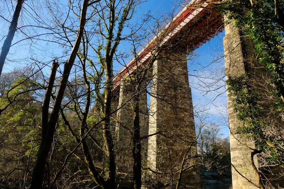
Start from the Watersports Centre at the south end of Strathclyde Loch. To begin the walk head out along the access road, and after crossing the loch outflow turn right to take the surfaced cyclepath across a grassy area to a small car park. From here bear right to go under the bridge which carries A723 Motherwell/Hamilton road over the Clyde (if the water is too high you can take a short diversion to the left). Follow the path which heads up steps and curves left past houses before turning right onto a path which heads back to the north bank of the river from where the large Ross House can be seen on the far side. Soon the path passes beneath the impressive Ross Viaduct, and enters the Baron's Haugh Nature Reserve.

Stage 2
The original route following the riverbank through the reserve was destroyed by floods, so it is necessary to keep left at a fork 500m after the viaduct, to keep the wetlands on your right. Ignore paths off on either side (those on the right are detours to hides) and continue until a gate and surfaced lane, where you turn right. After passing the buildings continue past the old graveyard, then follow the path as it turns left and crosses a footbridge over the Dalziel Burn. On the far side turn right to follow the path, lined with chestnut trees, to return to the banks of the Clyde. Now turn left through a pedestrian gate to keep to the left of the eroded riverbank, eventually again to the river. At the edge of the Reserve go through the metal gate to stay on the riverside along an avenue of mature lime trees leading to Adders' Gill, where water was extracted from the river to supply some of Motherwell's former steelworks.

Stage 3
Here the red waymarked main path leaves to the left; to continue on the Clyde Walkway keep ahead, bearing right off the main path to head through a metal kissing gate. A broad path then leads uphill - leave this at a corner to turn right again, passing through another kissing gate to head back down near to the river bank. The next section is often flooded in winter - if so take the alternative signed route up through the woods to Shields Drive and through the edge of Netheron before rejoing the riverbank between Upper and Lower Carbarns Farms.

Stage 4
Otherwise continue by the river - or atop a raised embankment at first. After just under a couple of kilometers a stile and steps lead up to a metal gate. Go through this and then turn right along surfaced lane (where the winter flood route rejoins).

Stage 5
When this swings left towards Lower Carbarns Farm leave it and go through the gate and along the path straight ahead. Soon there is a good view towards the derelict Cambusnethan House, built in 1820 on the site of the former summer residence of the Bishops of Glasgow. Soon the path remerges on a surfaced lane. At the end of the farm track continue on a path by the river - passing a bridge carrying pipes over the Clyde.

Stage 6
Soon the path turns left through a kissing gate to head away from the river, following and then crossing a burn and up through Highmainshead Wood to reach a crossroads of paths. Turn right along the track, passing a few houses. Eventually the lane emerges on the very busy A71 above Garrion. Go straight across this busy junction to head downhill on the B7011 opposite (signed Law and Brownlee). Follow the verge (care needed as lots of traffic!) down to Cardies Bridge and take the signed path on the right into Mauldslie Woods. The route now returns to the river - and becomes much more pleasant with the busy roads out of earshot at last.

Stage 7
The path climbs uphill briefly at one point - ignore the wooden steps straight ahead and keep bearing right on the earth path to return to the river. At the next path junction turn right to stay nearer to the river and descend through the woods to come alongside it once more.

Stage 8
The riverbank now leads to Mauldslie bridge at the A72 where there is a bus stop on the Hamilton/Lanark route in the small village of Rosebank 1km along the road to the left where there is also a shop.
Next stage: Maudslie Bridge to Lanark

Route Profile
