
Summary
Tinto, with its easy access from Glasgow and the central belt, is one of the most popular hills in Scotland when climbed via its main path from the north. This alternative may appeal to experienced hillwalkers looking for a quieter day as it ascends the much steeper and rougher southern slopes.
Grade

Bog Factor

Rating
Distance
Time
(in summer)
Ascent
Terrain
The approach is across often wet and muddy fields. Higher up on the steeper slopes the path has fallen into disuse and is not clear throughout.
Are you REALLY ready for winter hills?
Hillwalking when there is snow lying requires an ice-axe, crampons and knowledge of how to use them safely. The description here is for summer conditions.
See our Winter Skills page for basic information on the essential skills, techniques and knowledge needed for winter.
Getting there
Start
Entrance to Wiston Lodge track, Wiston.
Public Transport
None to start.
Start Grid Ref
NS956322
Summits Climbed
- Fiona
- Tinto

Stage 1
There is space for a couple of cars to park carefully where the drive to Wiston Lodge branches off the minor road near Wiston. As the lodge is reached, bear left to pass its side rather than heading round the front. The lodge is a fine old building, now a residential centre for young people. Follow the track as it passes to the left of some wooden buildings into the woods. When the track forks, head up the drive ahead (signed 'Tinto') alongside a tall row of trees, passing to the right of a traditional cottage.

Stage 2
Pass the cottage and then, when the track forks near a water works building, go straight ahead onto a narrow path to reach a gate and stile giving access to a field. Cross the stile and continue straight ahead through the field, keeping the woodland on the right. There are good views of Tinto straight ahead. The ground is boggy underfoot. When the trees end continue ahead, passing through another gate and keeping to the left side of a drystone dyke (or wall).

Stage 3
Continue in the same direction, passing through two more gates. At the end of the drystone wall the walk continues now on the right hand side of a fence. When the fence turns left go straight ahead, now across moorland. Pap Craig looks impressive from here; Tinto is hidden behind it. The route begins to climb, aiming to the right of Pap Craig, and good views open up. The path has fallen into disuse and is indistinct in places, but careful navigation should enable most of the wide, grassy zig-zags to be followed, though a couple of scree chutes cut across them in places. Eventually it zig-zags close to the left of a fence before reaching the flatter saddle or bealach between Pap Craig and Tinto.

Stage 4
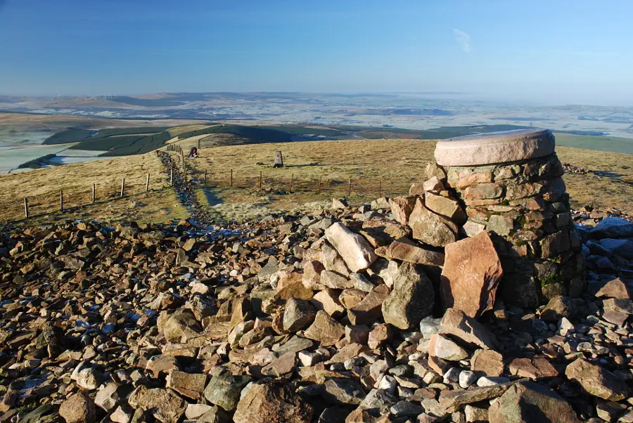
The path shown on OS maps now swings west across the southern slope of Tinto before climbing up from the far side. This section has become lost in steep scree, and it is much easier to instead aim more directly for the summit, keeping close to a double fence - this is steep but easier going than the old route. Finally the summit is reached by stepping over a low wire fence. It is marked by a massive cairn thought to date from the Bronze Age.

Stage 5
The position of Tinto on the fringes of both the Southern Uplands and the Central Belt make it a superb viewpoint. If returning to a car at Wiston, retrace the outward route. If transport permits it is possible to instead traverse the hill by following the well-worn and very popular Tinto ascent route from the north.

Route Profile
