
Summary
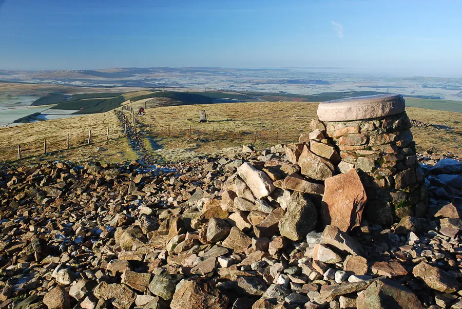
A great little hill with commanding views of the Clyde Valley and a massive summit cairn. A very popular landmark, the route is easy to follow and reasonably gentle.
Grade

Bog Factor

Rating
Distance
Time
(in summer)
Ascent
Terrain
Straightforward and very wide, clear path.
Are you REALLY ready for winter hills?
Hillwalking when there is snow lying requires an ice-axe, crampons and knowledge of how to use them safely. The description here is for summer conditions.
See our Winter Skills page for basic information on the essential skills, techniques and knowledge needed for winter.
Getting there
Start
Tinto Hill car park.
Public Transport
Regular bus service along A73 from Lanark and Biggar - alight at Fallburn.
Start Grid Ref
NS964374
Summits Climbed
- Fiona
- Tinto

Stage 1
The car park for Tinto is just off the A73 south of Lanark, at Fullburn on the south side of the main road. From the car park follow the clear path through the gate and up past a memorial bench. The width of the path is testament to the popularity of this hill. Soon the remains of a roman fort are passed on the left, however this is easier to make out from higher up the path where the double ring formation can easily be made out.

Stage 2
As the path climbs, a fainter path goes off to the right, keep on the main route as it curves around the side of the hill and soon passes a cairn over to the left which marks the ridge of Totherin Hill at 479 metres - ignore the path which leads across to it. The gradient eases off and the path heads up through the heather with good views. The path soon forks, the older route passing above Maurice's Cleuch to the right whilst the newer left hand route gives better going.

Stage 3
Keep on the main, wide path, ignoring tracks off to the left and continuing towards the massive summit cairn. Carnethy Hill Running Club organise an annual hill race on Tinto, usually in November, with race winners getting to the top and back in about half an hour. The hill is also popular with hanggliders and paragliders.

Stage 4
The final section to the summit follows a fence line and steepens near the top, at 707 metres, the highest hill for some distance which makes it a great all round viewpoint. There is a new view indicator, and on a clear day it is possible to see into the Trossachs to the north and the English border to the south. The trig point is nearby just across the fence.

Stage 5
This route returns to the start by the same outward path. However it is possible to descend to Wiston on a much steeper and rougher route with some scree if transport can be arranged. Follow the description for Tinto from Wiston and reverse the route. Although shorter, because the route is steeper and in some places, slightly hard to follow, it usually takes about the same time as the return to Fullburn.

Route Profile
