Summary
The spectacular original Forth Bridge has long been an icon of Scotland, carrying the mainline railway across the Firth of Forth. It was joined by the road bridge in 1964 - now only used by buses, taxis, cyclists and walkers - and then the striking Queensferry Crossing completed in 2017. This walk - which crosses the footway on the road bridge - offers great views of the Forth as well as the bridges. The route is linear but starts and finishes at the rail stations on either side of the Firth; there are regular services so you can return to the start by taking a train over the Rail Bridge. Note that the bridge is closed to walkers at times of high wind.


Terrain
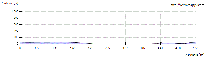
Pavements and cycle paths; some flights of steps.
Getting there
Start
Dalmeny Rail station.
Public Transport
Train to Dalmeny station; return train from North Queensferry.
Start Grid Ref
NT129778

Stage 1
The walk is described from Dalmeny Station to North Queensferry Station, though you can just as easily walk the other way; there is a regular train service between the stations. If you must arrive by car, there is parking at Dalmeny Station. From the station car park, head to the mini roundabout near the entrance, and turn left along Station Road. After passing Queensferry High School, take the next left onto Ashburnham Road. This leads through a housing estate, soon curving round to the right to become Rosebery Avenue. Continue along this, ignoring all turnings on either side, until it ends at a t-junction with the busy B907. Turn right here, use the crossing, then turn immediately left onto Viewforth Place (cycle route signs).

Stage 2
At another t-junction, again turn right and then immediately left, now onto Hugh Russell Place. Continue ahead on the footpath at the end, passing along the edge of a housing development. Soon the Forth Bridges car park is seen over to the right - head across into this. From the far end of the car park there's a great viewpoint for the road and rail bridges. To continue the walk, bear left across the car park, passing to the left side of the toilets, and down steps to reach the footpath on the near side of the dual carriageway across the bridge.

Stage 3
Turn right along the footpath (the cycleway is the left half) out onto the Forth Road Bridge. Though it was completed only in 1964 and opened by the Queen, it can no longer handle heavy traffic and remains open only to buses and taxis - as well as cyclists and walkers. The path rises gently as it climbs towards the first of the support towers. When it opened, the span of 1006 metres between the two towers was the fourth longest in the world - and the longest outside the United States.

Stage 4
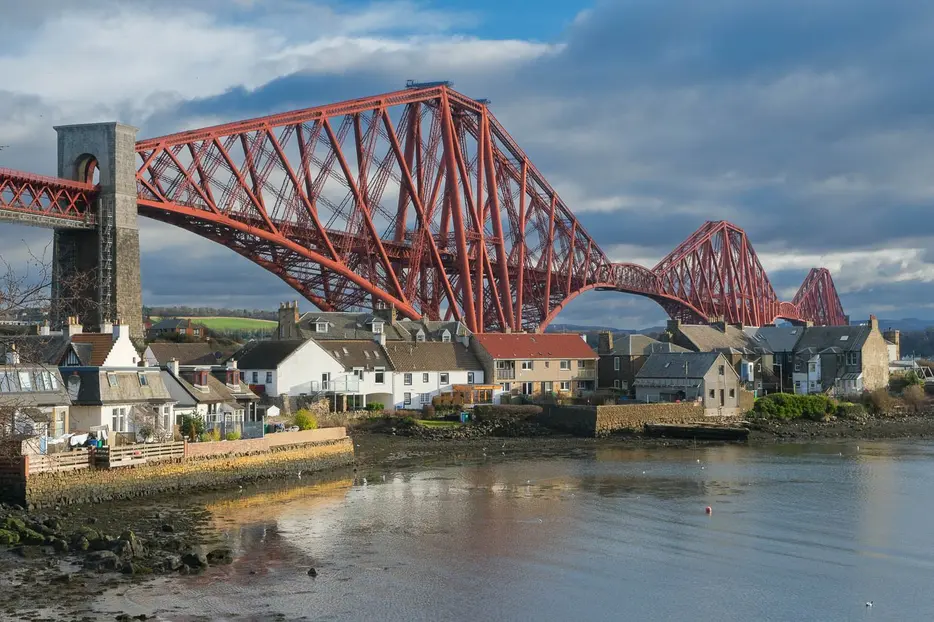
However, the Road Bridge really pales in comparison to the main attraction alongside it - the iconic red Forth Bridge carrying the railway just to the east. There are superb views of this engineering marvel, which opened in 1890. It was the world's first major steel structure, a key milestone in civil engineering, and is still the world's longest cantilever bridge. Since 2015 it has been designated as a World Heritage Site. Note also the remains of the fortifications on the tiny island of Inchgarvie beneath; it housed coastal defence guns until the 1930s, and has previously housed a castle and a prison.

Stage 5
Across the other side of the Road Bridge are the graceful towers and supports of its replacement, the striking Queensferry Crossing. This was completed in 2017. 2.7km long, it is the world's longest three-tower, cable-stayed bridge and by far the largest to feature cables which cross mid-span. It carries the M90 motorway and is not accessible to walkers or cyclists.

Stage 6
The second tower is eventually passed and the walkway leads downhill towards the Fife side of the bridge. There are great views looking back over North Queensferry. Eventually a long flight of steps is reached - turn right to descend these to the road below, then turn left along the pavement to head into North Queensferry.

Stage 7
This historic village was the site of the ferry across the Forth which was in use until completion of the road bridge in 1964. Continue into the village, then take a left sharp uphill along the Brae. Follow this lane, and when it levels off bear right to pass under the railway. North Queensferry station is on the left just beyond; there are usually regular rail services to get you back to Dalmeny.

Route Profile