walkhighlands


Annandale Way now on Walkhighlands

The Annandale Way is a new long distance route that runs from the top of the valley at Annandale Head in the hills north of the town of Moffat to the mouth of the River Annan and the Solway Firth. A full online description of the route, with photos, OS mapping and GPS track, is now available, free of charge, on Walkhighlands. The route was walked by renowned long distance walker and author, Chris Townsend, for Walkhighlands, earlier in the Spring. Writing on his blog, Chris Townsend said, “Just finished a six day walk along the Annandale Way, an interesting…

Read more ›
Posted in News, Walkhighlands news

Dave MacLeod urges Mountain Rescue to get Tweeting

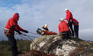
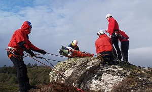
Dave MacLeod, one of Scotland’s top climbers, has suggested mountain rescue teams could use social media to publicise accounts of rescues in order to raise funds. Writing on his blog, Dave MacLeod raised a number of interesting issues about fundraising and his desire to see rescue teams do more to use their experience to tell walkers and climbers of known accident black spots and common issues that lead to people getting into trouble on the hills. Responding to requests to publicise and endorse funding appeals by mountain rescue teams on social media sites like Twitter, Dave MacLeod likened this approach…

Read more ›

Posted in News

New Rescue Team for Outer Hebrides

A new Search and Rescue team will provide emergency help to walkers and climbers in the Western Isles. The newly-formed Hebrides Search and Rescue has now been officially recognised by the Mountain Rescue Council of Scotland. The 18 strong team are based in Stornoway but will cover the whole of the Outer Hebrides and are equipped with two landrovers and have the use of a rescue boat. All the team members are keen hillwalkers, with three qualified medics, as well as a number of members who have been involved in mountain rescue elsewhere in mainland UK. John Norfolk, founder and…

Read more ›

Posted in News

Last minute chance to learn navigation and GPS skills

There are a few last minute places left on navigation and GPS skills courses taking place this weekend at Cairngorm Mountain near Aviemore. The one day courses are run by the Mountaineering Council of Scotland and are open to everyone. The aim of the navigation course taking place on Saturday 11 June is to increase your confidence in finding your way on the hill, learn the skills of map reading and compass bearings and to pick up handy hints and techniques to locate yourself on the hill in poor visibility. The GPS course on the following Sunday (the courses can…

Read more ›

Posted in News

Win copies of Pathways

Walkhighlands has teamed up with Guardian Books to offer the chance to win 4 copies of the new book Pathways. From the processional routes of ancient Britain to Victorian promenades along the sea-front, Britain’s pathways are inextricably woven into our landscape and history. In this new book, David Stewart and Nicholas Rudd-Jones set out to explore some of the most evocative and beautiful tracks and ways that criss-cross the nation, explaining how they came about and what they tell us about the people who made them. As they do so, they give both the keen and casual walker a very…

Read more ›

Posted in Walkhighlands news

Canal walk across Scotland

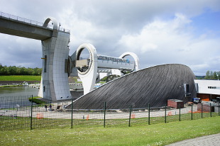
Fancy crossing Scotland’s central belt on foot without having to get entangled in motorways, housing complexes, shopping malls or industrial estates? Following the towpaths of the Forth and Clyde Canal and the Union Canal provides a fantastic green and watery corridor across Scotland passing the impressive Falkirk Wheel, remains of the Antonine Wall built by the Romans, and clues to Scotland’s industrial heritage as well as numerous nature reserves and surprisingly quiet countryside. Walkhighlands now hosts the only online in-depth description of this route which is soon to be promoted as one of 20 long distance walks to be known…

Read more ›

Posted in News, Walkhighlands news

Invergarry footbridge gets makeover

The historic Invergarry footbridge over the River Garry, cited as an important early example from the “pioneering” days of steel in construction, has been saved from collapse by Forestry Commission Scotland. The elegant, B-listed bridge spans 60m over the dramatic River Garry and has been a feature in the landscape ever since it was constructed in 1892. However, the worst ravages of the Scottish weather had taken its toll and some of the steel trusses were badly corroded and the bridge had been shut for over two years. Kenneth Knott, the Environment Forester for Lochaber Forest District, said: “The bridge…

Read more ›

Posted in Access issues, News

Police name Ben Nevis walker

Police have confirmed the details of a man who died whilst walking with a friend on Ben Nevis on Sunday 29 May 2011 above the Half Way Lochan. Arnaud Alexandre Romain Albagnac was 22 years old and came from Aveyron in France. A report has been submitted to the Procurator Fiscal which is usual in these circumstances.

Posted in News

Big Spring Clean returns to the mountains

The Ski Club of Great Britain’s annual resort clear up, the Big Spring Clean, returns to Scottish ski resorts for a fourth year on Sunday 12 June. This year volunteers will not only be tackling the damaging litter left on the slopes by mountains users at CairnGorm Mountain and the Nevis Range but also, new for 2011, at Glenshee. Last year 122 helpers turned out to gather up litter at CairnGorm and the Nevis Range with a total of 60 bags of rubbish collected. The Ski Club works with the resorts to ensure volunteers cover areas most frequented by winter…

Read more ›

Posted in Nature

National Park's windfarm objection

The Cairngorms National Park Authority has objected to the proposed Allt Duine windfarm in the eastern Monadhliath mountains near Kingussie and Kincraig. The National Park’s planning committee decided unanimously to object to the plan for 31 turbines by RWE_N Power Renewables. The site is on land owned by the Alvie, Dalraddy and Dunachton estates and follows the boundary of the national park. Although the turbines would be outwith the National Park, with the nearest turbine about 5km from Kincraig, service roads, tracks and cabling would have to be built in the National Park. Officials from the Cairngorms National Park said…

Read more ›

Posted in Access issues, Nature


Share on 

Share this  

You should always carry a backup means of navigation and not rely on a single phone, app or map. Walking can be dangerous and is done entirely at your own risk. Information is provided free of charge; it is every walker's responsibility to check it and to navigate safely.