
During the summer of 2014, The Nevis Landscape Partnership will lead an innovative project to survey previously unexplored areas of the North Face of Ben Nevis. The project, funded by Heritage Lottery Fund, Scottish Natural Heritage, The Highland Council and Mammut aims to find new topographic, geological and biological data.

“This exciting project brings together film makers, botanists, climbers and geologists to discover some of the mountain’s remaining secrets. We will also raise public awareness of mountain environments, their arctic-alpine habitats and the threats posed by climate change” said Nevis Partnership Manger, Tristan Semple.
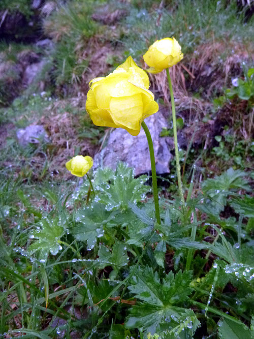
The North Face Survey will provide new information on the distribution of the rare arctic-alpine flora found on Ben Nevis. Previously unexplored areas of the North Face will be recorded through an innovative partnership between conservation bodies, ecologists, professional climbing guides, national governing bodies and equipment manufacturer Mammut.
“This is a really interesting project and a great way for us to learn more about the mountain we cherish” said Mike Pescod, IFMGA Mountain Guide, who will be responsible for managing the team of climbers doing the survey. “The more we know about Ben Nevis, what lives and grows there and its geological makeup, the more we will enjoy climbing there. The experience will be greater due to a better understanding of its nature. We will also learn what we will need to do to make sure it stays as good as it is now.”
The North Face of Ben Nevis, which extends to roughly 125Ha of rock and steep scree and can only be accessed safely using ropes, has never before been surveyed for its flora. It is anticipated that a number of new locations of the rare species already recorded will be found, and it is possible that some species not hitherto recorded on Ben Nevis may be found. This will allow a much more accurate assessment of the presence and abundance of the rare plants and will therefore lead to a more focused approach to management and a greater likelihood of securing their survival.
In order to conduct the survey, a number of professional climbers will be trained in the identification of the relevant flora. They will then use their mountaineering skills to safely access the whole of the North Face to look for plants. Clean, dry rock will generally be avoided and the focus will be on the loose, damp ground where these species are most likely to be found. Botanists will be on hand to assist in the survey and identification of the plants, and will be taken to the richest locations by the climbers.
Mountaineering principles will be followed throughout the survey. No fixed or permanent anchors will be placed or left behind. Any old slings, ropes or other discarded climbing materials will be cleared away unless it is in regular use.
The new data will enhance that which already exists for the Ben Nevis SSSI feature “vascular plants” and will enable a more accurate assessment of the threats, mitigation and adaptation so that management action can be targeted where it is most needed.
Ben Nevis and some of its satellite hills provide unique habitats for rare arctic-alpine flora. The importance of this flora is reflected in the Ben Nevis SSSI feature for vascular plants. Some of the key locations that are already known about are at risk from trampling damage related to recreational activity but are also potentially threatened by changing climate. While the feature is currently in favourable condition, failure to locate some of the original populations and the fragility of the very few known locations could easily lead to the feature falling into unfavourable condition, which would be contrary to the Scottish Government’s targets for designated site condition.
The whole event will take place over a week from Monday 11th to Friday 15th August 2014. Images of the plants and information about their habitats, needs and threats, will be uploaded onto the Nevis Landscape Partnership website, where the information can be accessed and augmented by other climbers and members of the public in the future. This will assist in building a better understanding of montane ecology, the threats of climate change and the need for dynamic conservation among all those who access the information.
Climbers and walkers warned of possible rock fall
During the survey (Monday 11th to Friday 15th August 2014) there will be an increased risk of rock fall in the areas that the climbers are surveying. These areas are not likely to be regularly climbed routes. However the approach slopes to some climbs will be affected.
Staff will be in place during the survey to inform climbers and walkers of the precise location of the surveyors each day. Access to climbs will be possible at all times however your understanding is appreciated with this important work. Surveyors will be in radio communication with staff at the base and access through affected areas will be possible at all times.
The survey organisers ask that people do not move, remove or tamper with any fixed ropes on the North Face of Ben Nevis during this period. They are temporary and everything will be removed at the end of the survey.
If you have any queries about the survey, how it might affect your plans or access to routes please email Mike Pescod