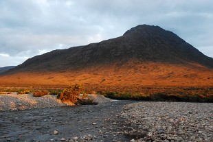
Beinn a’Chlaidheimh – one of the celebrated peaks of the Fisherfield Forest, perhaps the remotest mountain region in Scotland – looks set to lose its status as a Munro following a new height survey.
The heights of three spectacular mountains in the area – also known as the Great Wilderness – were re-measured during July by members of The Munro Society. Ruadh Stac Mor was confirmed to remain as a Munro at 918m, whilst the spectacular Beinn Dearg Mor was measured at 906m and remains as a Corbett. But Beinn a’Chlaidmeimh – 916m on current Ordnance Survey maps – was measured up at just under the critical 3000 foot threshold (914.4m) at a height of 913.96m. If accepted by the Scottish Mountaineering Club – which maintains both the Munro and Corbett lists – this would see the hill reclassified as a Corbett. The club has issued the following statement: “The Scottish Mountaineering Club has been notified of these survey results and has undertaken to consider the implications for Munro’s and Corbett’s tables when the Ordnance Survey update its map of the area.”
The measurement process involved the latest satellite technology and the surveying party had to carry an extra 12kg of equipment in addition to the normal mountain kit on each of the three measuring expeditions. Because the satellite data must be recorded for a minimum of 2 hours – actually 3 hours on Beinn a’Chlaidheimh – none of the expeditions took less than 12 hours. There were two days of sun and showers and one day of rain and mist.
A spokesperson from The Munro Society said: “In measuring the heights of mountains just below and just above 3000ft (914.4m), we believe we are following in the tradition of accurate measurement established by Sir Hugh Munro who first produced the ‘Munro’s Tables’ in 1891. Munro and his friends relied on aneroid barometers, the technology of the time; in 2011 we use satellite technology to achieve yet greater accuracy, but we seek the same objective. Munro never set down complete criteria for Munro status before his death in 1919, but it has always been accepted that 3,000ft (914.4m) was the primary requirement.”
“By the use of satellite technology The Munro Society hopes that any residual doubt or speculation regarding the heights of the nine mountains it has had surveyed since 2007 has been removed.”
If confirmed by the SMC, the change would mean that there are 282 Munros – separate mountains in Scotland over 3000 feet high. Ascent routes and mapping for all the Munros are included on the Walkhighlands website. The ascent of Beinn a’Chlaimdheimh is part of the classic Fisherfield Six route – one of the greatest tests for many completing a round of the Munros.
The news is being discussed on this Forum thread.

