Summary
This is a glorious section of the Cateran Trail, exploring the landscape of the glen before climbing over a high moorland pass. The descent to the Spittal of Glenshee gives good views of the surrounding mountains.


Terrain
Moorland tracks and paths, small streams to cross, exposed and muddy in places.
Are you REALLY ready for winter hills?
Hillwalking when there is snow lying requires an ice-axe, crampons and knowledge of how to use them safely. The description here is for summer conditions.
See our Winter Skills page for basic information on the essential skills, techniques and knowledge needed for winter.
Getting there
Start
Kirkmichael.
Public Transport
Bus between Kirkmichael and Blairgowrie (not Sun). Bus (Ember) from Blairgowrie/Braemar to Spittal of Glenshee.
Start Grid Ref
NO096686

Stage 1
This stage of the Cateran Trail starts in Kirkmichael on the west side of the river, heading alongside a row of cottages (on your right) from the old schoolhouse - and signed 'Cateran Trail - Spittal of Glenshee 9'. Ignore the riverside footpath which heads down to the right, instead continuing on the lane signed for Enochdu. When the track splits in three, take the middle route, then keeping right at each of two forks, the second by a wooden chalet. As a white house is approached, fork left onto a grassy path and head through a gate to head into the woods.

Stage 2
A small loch can be seen on the right. The woods are left behind at a gate; cross the grassy field ahead, bearing right to pick up a track that leads towards and passes the impressive white house of Dalreoch. Continue ahead onto a track, and when this bends right to reach a larger track cross it to continue over the old stone bridge. This rejoins a lane; continue ahead until the buildings of Enochdu.

Stage 3
Turn left past a row of cottages and bear right to emerge in a parking area with recycling bins and an information board. Go straight across the main road and follow the track signed for Spittal of Glenshee. This climbs gently, keep to the left at the entrance to Dirnanean Highland Garden which is open in the summer. Continue straight ahead to pass some barns on your left and at Home Farm the track heads behind the house and then left through the farmyard. Go through the gate to follow the track uphill. Stay on the main track going through a walker's gate as the views open up with a fire tower visible ahead. Soon turn left at a clear junction and go through a gate to enter the forestry. Look out for the marker posts with carved heads of the Caterans, roaming cattle thieves, and local clansmen, who often fought with them.

Stage 4
Cross the Allt Dubhagan on a bridge and continue through the forest until a gate leads onto the open moorland. The next stretch is more exposed than the rest of the Cateran Trail and can be tough in poor weather. The clear track climbs gently encircled by the hilltops of Ben Earb, Creag an Dubh Shluic, and Meall Uaine. Ignore a smaller track off right and eventually a hidden hut is reached on the left which walkers can use, although it would be a draughty place to spend a night. Named the Lunch Hut, Queen Victoria rested here with John Brown on 13 October 1863 on one of their pony jaunts from Balmoral.

Stage 5
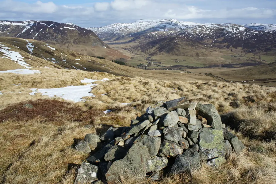
The route continues on the track, keeping right where a fainter vehicle track goes left, crossing the burn and aiming for the An Lairig pass, the lowest point between Creag an Dubh Shluic and Meall Uaine. A smaller burn is crossed on the steady climb to the top, the going is often very wet underfoot. Go through the gate at the top of the pass and enjoy the view with high mountains providing the backdrop to the green farmland around the Spittal of Glenshee.

Stage 6
The descent down Coire Lairige is straightforward although boggy in places. Further down the path heads through a gate and runs alongside a tumbling burn with a stone wall on the left. The buildings at the Spittal become clearer and the turf-roofs of chalets are passed on the left before the path heads through a gate to reach the road at the Spittal of Glenshee. There is only self catering accommodation here now although you may be able to arrange pick up and drop off by local B&B's and hotels.
Next stage: Spittal of Glenshee to Glen Isla

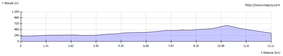
Route Profile