
Summary
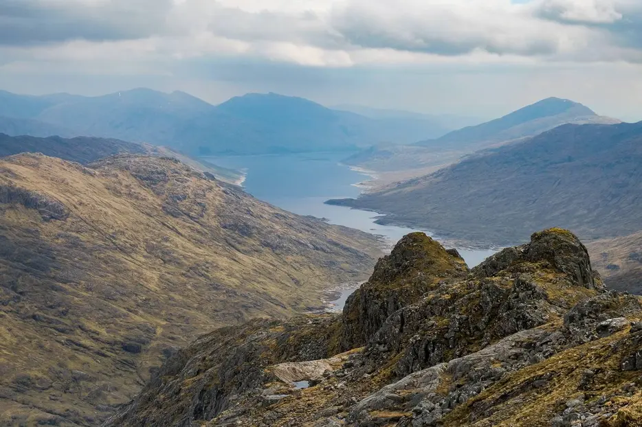
Ben Aden - or Beinn an Aodain to give its correct Gaelic name - is one of the remotest Corbetts. Although surrounded by higher Munros this is a hill of real character; rocky, steep and rugged, the ascent provides a real challenge for many. The approach along the shores of Loch Quoich makes it possible to ascend in a day, but requires a decent spell of dry weather before attempting, as the crossing of the Abhainn Chosaidh is impossible in spate conditions and the start of the walk also requires a long detour if water levels are high.
Grade

Bog Factor

Rating
Distance
Time
(in summer)
Ascent
Terrain
Very rough and - in places - wet underfoot, with potentially hazardous river crossings.
Hillwalking in Winter
Please note that hillwalking when there is snow lying requires an ice-axe, crampons and the knowledge, experience and skill to use them correctly. All route descriptions and difficulties given here are for summer conditions. See our Winter Skills page for basic information on the essential skills, techniques and knowledge needed for winter hillwalking.
Getting there
Start
Start of old track down towards Loch Cuaich at NG993034.
Public Transport
None.
Start Grid Ref
NG993034
Summits Climbed
- Corbett
- Ben Aden


Stage 1
There is room to park several cars where a track heads south off the road at NG993034, without blocking access to the track (which has a locked chain). It is well worth arriving here the night before to check conditions; the route we describe heads down the track, turning left along the old track near the Caolie Water, and then right to follow a faint track to the site of a former bridge over the river that dates before the reservoir was built. In very dry conditions the water can be forded immediately downstream of the remains of the old bridge, but in wet conditions this is impassable, and the whole area is under the waters of Loch Cuaich when the reservoir levels are high. If impassable, the walk instead starts by heading west along the tarmac road for around 800m until it is possible to ford the Caolie Water by the remains of another old broken bridge; then continue along the far side until the route described can be joined - this adds at least an hour to the day.

Stage 2
The remains of the old track soon become lost, but there is a rough path that continues just above the rocky shores of Loch Cuaich. This is boggy going and wet grass is a problem in high summer. Continue for several kilometres until the boggy path passes through an old fenceline and heads down to the Abhainn Chosaidh. This river can be crossed easily after a good dry spell, but is quite impassable when in spate.

Stage 3
Once on the far side continue on the boggy path above Loch Cuaich. After another 500m or so the line of the old track emerges from the reservoir. Although now becoming waterlogged in places, much of this provides dry going and can make for much faster progress on this next leg of the walk. There are excellent views of the mountains across the water, with Sgùrr Mòr dominant at first and the summit cone of Sgùrr na Ciche instantly recognisable.

Stage 4
As the track continues Ben Aden comes into view. Cross the top of the dam above Lochan an Cruadhach, and continue ahead to then cross a second dam - there are great views to Ben Aden over to the right.

Stage 5
On the far side of the second dam head straight uphill over a low rise then descend to pick up the old footpath to the Mam Unndalainn - turn right along this to pass around the south side of the rocky knoll that rises by the dam. The path then descends NW and continues west towards Lochan nam Breac. When the waters of the Allt Coire na Cruaiche come tumbling down on your left leave the path and instead head uphill beside this burn.

Stage 6
It soon becomes easiest to cross to the NW side of the burn. Rugged going continues to lead up into Coire na Cruaiche, where the steepness relents for a time. A more sporting ascent of Ben Aden - with some scrambling - can be had by heading up onto the mountain's ENE ridge, continuing over several rocky knobbles up to the summit. Our route avoids any scrambling, continuing by the burn - cross back to the SW side just below where the burn falls over a band of rocks. Continue up the mostly grassy ground on this side of the burn.

Stage 7
As the burn peters out the route continues in the same general direction, heading up a mostly grassy ramp with fallen boulders to the left of a prominent rocky crag on the skyline. Continuing up the ramp it eventually emerges on the ridge. There's now only one rocky tower left between here and the summit; you can scramble fairly easily over it, or go part way up it and then avoid it on a grassy shelf on the left side that climbs and then regains the ridge further on.

Stage 8
The summit is a short distance further along the ridge. Despite the higher mountains all around the view is a good one, with a vista down to the head of Loch Nevis and a grand perspective on the rocky Rough Bounds of Knoydart all around. Perhaps the best part of the view is looking back over the towers of the ENE ridge to distant Loch Cuaich.

Stage 9
The exhilaration of reaching one of the Corbett baggers' most prized summits is tempered by the thought of the long, long walk back down and out along the shores of Loch Cuaich, retracing the outward route the whole way.

Route Profile
