Summary
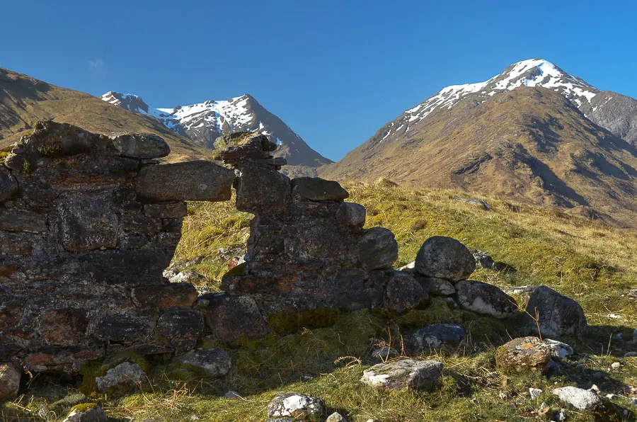
This fine pair of Corbetts lies above the end of the tortuous road up Loch Arkaig. Sgùrr Mhurlagain is approached along a grassy ridge to a dramatic summit; Fraoch Bheinn gives steeper going. Both mountains offer superb views over both the loch and the surrounding hills.
Grade

Bog Factor

Rating
Distance
Time
(in summer)
Ascent
Terrain
Some boggy ground at mid height, pathless above. Sgùrr Mhurlagain is approached along a grassy ridge; Fraoch Bheinn gives steeper going.
Hillwalking in Winter
Please note that hillwalking when there is snow lying requires an ice-axe, crampons and the knowledge, experience and skill to use them correctly. All route descriptions and difficulties given here are for summer conditions. See our Winter Skills page for basic information on the essential skills, techniques and knowledge needed for winter hillwalking.
Getting there
Start
Car park at end of public road up Loch Arkaig.
Public Transport
None to start.
Start Grid Ref
NM987915
Summits Climbed
- Corbett
- Sgùrr Mhurlagain
- Corbett
- Fraoch Bheinn


Stage 1
There is a car park at the end of the roller-coaster road along the north side of Loch Arkaig. Begin the walk by heading through the gate along the track which is the continuation of the road. A small ruin on the left is all that remains of a barracks complex dating from the time of the Jacobite rebellion. Keep right at the fork in the track, signed for Morar and Tomdoun. Continue briefly until a signpost (Tomdoun 18m) indicates a grassy track climbing steeply to the right. This is on the west side of the Allt Dearg - not the east side as shown on some OS maps.

Stage 2
The views back improve as the track climbs; keep right at an indistinct fork where some ATV tracks continue straight uphill. The track swings left again before reaching a second fork sometimes marked with a tiny pile of stones, just before a lump of higher ground ahead, the track heading straight on looks like the main track. Again turn right; the going now becomes very boggy as the track levels off and goes slightly downhill for a short while, heading east and passing a gate on your left and then running alongside a fence (crossed on the return) eventually crossing the Dearg Allt. On the far side follow the boggy trod as it leads up towards the Feith a' Bhrolaich over lumpy ground. Pick a good point to leave the track and head up the pathless slopes to the east, gaining the southwest ridge of Sgùrr Mhurlagain.

Stage 3
Continue up the very broad, grassy ridge which becomes dry underfoot. As height is gained there are superb views down the length of Loch Arkaig. The terrain becomes a little rockier before a flat shoulder is reached, followed by a final pull up the summit ridge.

Stage 4
At the ridge, the gentle slopes of the ascent are suddenly left behind as a dramatic view down into the northern corrie is revealed. The summit cairn is a short distance to the east, and is a wonderful viewpoint. Return the same way back down to the Feith a' Bhrolaich.

Stage 5
On the way down examine the eastern flank of Fraoch Bheinn to spot the ascent route. After crossing the boggy bealach, head up into the shallow, indistinct Coire na Cloiche Bige. Higher up follow a wide grassy rake with a few boulders that trends left below the craggier summit slopes. This leads up to the south ridge.

Stage 6
Now follow the ridge as it climbs steeply to reach the tiny summit cairn. Although set back further from the cliffs, this is another fine viewpoint.

Stage 7
It is worth wandering around a little or even detouring to the north summit to take in the full views. Head back down the south ridge, continuing down it past the point where you came up.

Stage 8
Eventually a second deep notch in the ridge is reached. From here the easiest going is to keep a little left (east) of the ridge line, before making a final descent to the track used during the ascent. Cross the fence to rejoin this and turn right to retrace your steps back to the start heading slightly uphill at first before the track bears left downhill, keep left to return to the main track at the signpost where you turn left for the final section.

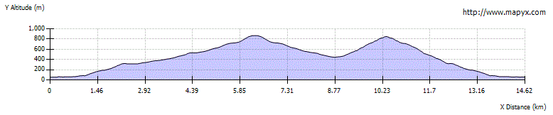
Route Profile