Summary
From humble beginnings the River Ayr is now a wide, powerful waterway driving mills and coursing through rocky gorges and elegant estate policies. The final stretch by the river is closed, with an untidy diversion along minor roads.


Terrain
Well-made aggregate footpaths and surfaced roads.
Getting there
Start
Sorn.
Public Transport
Sorn no longer has a bus service; nearest bus is at Catrine.
Start Grid Ref
NS551266

Stage 1
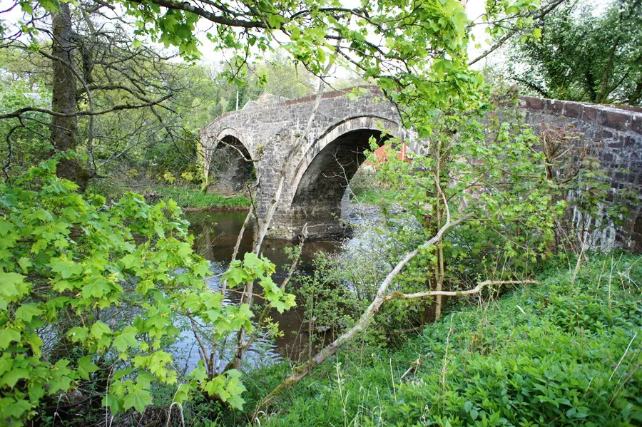
The walk begins from the west end of the village - head west and cross Sorn Old Bridge, a sandstone structure dating from the early 1700s and still in use by vehicles today. Turn right at the far side and head uphill along the quiet road, where you will eventually be offered views across the fields and river to Sorn Castle. Changing hands on a fairly regular basis, the building is currently owned by the MacIntyre family. Interestingly, legend has it that the part of the castle nearest the river was built freestanding so that in the event of the bank being undercut this section alone would fall into the river and spare the remainder of the property. A footpath leaves the road on the right through a kissing gate and follows the field boundary before heading down into woodland alongside the river.

Stage 2
Continue along the south side of the river on a muddy footpath along wooded slopes. Eventually dropping slightly to follow the river closely the path skirts Daldorch House, a residential home run by the National Autistic Society. Soon the various water-management structures associated with the large mill complex that was once located in Catrine come into view. Cross the river at a footbridge, bear left and enter Catrine Voes local nature reserve. The Voes (reservoirs) were once used to store water prior to being released to drive the large mill wheel, and now form a habitat for a variety of wildlife. Follow the path through the Voes to emerge at a road junction - head in either direction to descend to Laigh Road and, keeping left, reach the main road through Catrine.

Stage 3
Turn right along St Germain Street to reach Mill Square, then turn left along Bridge Street to cross the river at Timmer Bridge in front of the A M Brown Institute. Turn right and cross Bogend Burn by a footbridge to reach a surfaced minor road running past a row of bungalows. Remain on the road until it curves left towards the sewage works, where a footpath continues straight ahead to follow the river. A good footpath runs through woodland before heading up a flight of steps and continuing along the clifftop. The path slopes down a wooded valley before passing underneath Howford Bridge carrying the A76. Ignore a path heading left to Catrine House and drop down to cross the Old Howford Bridge, built in 1750 and in use for 200 years. Continue along the former main road past a pair of sandstone abutments that once supported a footbridge in the policies of the former Ballochmyle estate.

Stage 4
A short distance later bear left to enter the woodland beneath the road. Just after a footbridge is a vertical cliff-face bearing prehistoric cup and ring markings alongside more recent graffiti - one in particular dated 1751 - and reckoned to be one of the best examples of these markings in the UK. The path wanders through the wooded valley high above the river and passes underneath the immense Ballochmyle Railway Viaduct which incorporates the longest masonry railway arch ever built at 55.17 metres. From the viaduct follow the path until it emerges from the woods and leads through farmland to reach a minor road at Haugh Farm. At the time of writing the official waymarker post had been helpfully 'relocated' to behind a group of wheelie bins, but simply turn right and follow the road north towards Mauchline until Haughyett Farm.

Stage 5
Turn left and follow the minor road to Barskimming Road, where a left turn will take one past Woodlands Farm before taking a footpath on the right. This footpath runs across farmland, tightly corralled between two fences as it skirts around the private Barskimming estate policies. Navigation is therefore extremely straightforward, if not a little tedious. The route runs alongside a group of trees surrounding a flooded quarry, source of much of the sandstone used to construct the buildings of Glasgow. After passing through a dark plantation and further farmland the footpath eventually reaches the B743 outside Failford. Turn left and follow the road into the village, being aware of the narrow verges that make traffic avoidance tricky. The small village of Failford consists of little more than a row of low almshouses, one of them housing the Failford Inn which incorporates a microbrewery. Leave the road via a footpath at the west end of the village and drop down into an attractive gorge with a plethora of information boards and maps - an area managed by the Scottish Wildlife Trust and known as the Ayr Gorge Woodland.

Stage 6
Cross a small stream and head up a flight of steps. Follow the path left/south and enjoy the easy walking and obvious waymarking as the river slowly glides over vast sandstone slabs below. Eventually the path returns to the riverside for a distance, before a further flight of steps leads up to the reserve boundary. Follow the field margins downhill to the river once more, now in more open countryside.

Stage 7
The riverside route to Stair has been blocked by a landslide, so the route now takes an awkward diversion away from the river towards Daldorch Farm. After joining the access track, this is followed to a minor road north of Wellflat Bank. Turn left along the road to the B730, then left again to rejoin the original route north of Milton; reaching Stair is now a short detour further along the road. Note that the former Stair Inn has now been converted into housing and is no longer an option for staying the night or for food.
Next stage: Stair to Ayr
Route: Phil Turner

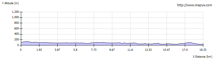
Route Profile