
Summary
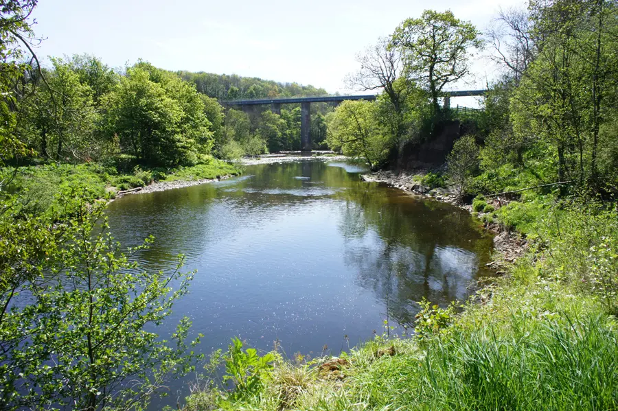
This final section of the River Ayr Way follows the river through open farmland and estate policies before entering the historic county town of Ayr and reaching journey's end at Ayr Harbour.


Terrain
Well-made aggregate footpaths and surfaced roads.
Getting there
Start
Milton by Stair Bridge.
Public Transport
No public transport to Stair, but Ayr at the end of the route has excellent bus and rail services.
Start Grid Ref
NS436235

Stage 1
Head away from Stair Bridge into the tiny settlement of Milton, passing the Stair Bridge Toll Cottage on the right, and follow the B730 to a small layby on the left as the road swings right. Take the path through fields before returning to the riverside 600m downstream of the bridge. Directly across the river at this point is an old whetstone mine at Dalmore. The path follows the river closely for some distance along the floodplain located beneath the impressive Enterkine House on Holm Bank to the north. Now housing a fine restaurant, the Enterkine estate has been owned by the Cunninghame family since the mid seventeenth century and was the location of The Fete Champetre referred to by Robbie Burns in a song of the same name.

Stage 2
Pass underneath the Enterkine Viaduct, erected in 1872 to carry the Ayr to Cumnock railway line but now utilised by coal wagons from the various opencast mines nearby. Continue onwards to Gadgirth Bridge but remain on the north side of the river to enter the woodland east of Annbank. There are several small paths heading to the village, but ignore these to reach a small picnic area on the former site of Annbank House, former dower house of the Cunninghames of Enterkine before being demolished in the 1970s. Annbank was created in the 1860s by a mining company to house workers, though the majority of the original housing was replaced in the 1930s with local authority housing. There is a small shop in the village, as well as Annbank United's football ground. Leaving the picnic area follow Dunlop Avenue to the main road and turn left along Braeside to Mill Road which is a left turn heading southeast. The track continues left past an old nursery to reach the buildings forming Privick Mill. Take a path on the right to skirt around the buildings and rejoin the river atop a steep bank.

Stage 3
On the opposite bank can be found the remains of the Old Ha', a castle located on a rocky outcrop projecting out into the river. Today little remains other than a few small sections of wall. Beneath this outcrop the river is forced between rocks creating a deep pool known as Auld Ha' Weel claimed to be the deepest on the river at over 16 metres. This section of the river is popular with anglers, and there are numerous shelters and platforms to facilitate access. Cross Tarholm Bridge and follow the B744 for a short distance as it curves right, then leave it as it makes a further turn to the left. Enter a section of pleasant woodland and follow the good path above the river as it enters a deep wooded gorge formerly part of the Auchincruive estate. The path ascends to a viewpoint known as Wallace's Seat, where William Wallace was reputed to have hidden from English forces in the thirteenth century. Descend to the riverside again and continue through Craighall Wood and follow the river as it makes a wide turn around Pheasant Nook and the path leaves the river to head through the woods. At a path junction keep right to continue along the riverside, before leaving the woods and entering a field known as 'Three Green Knights Park' after the three grassy mounds in the field. Follow the path to reach the road adjacent to Oswald's Bridge.

Stage 4
Cross the bridge, erected in 1826, and pass the entrance to Auchincruive House, part of the Scottish Agricultural College with grounds open to the public. Continue along the road past a couple of college buildings on the opposite side of the road and take a signed cyclepath immediately past the college excavator training centre. The track passes woodland and grazing land before reaching a surfaced road alongside a number of smallholdings. Follow this road - punishing on tired feet - towards the busy A77. Turn sharp right and pass the Scottish SPCA centre to reach a cyclepath adjacent to the road. Turn left, cross the road bridge and then follow the steps down to the river close to a series of stepping stones at Overmills, the site of a mill since the thirteenth century. Closed in 1960 it was the last working grain mill to exist on the River Ayr and was demolished in 1963.

Stage 5
Now head under the road onto the River Ayr Walk alongside pleasant fields and pass the rugby pitch of nearby Kyle Academy. Cross a footbridge to pass by an eighteenth century limekiln with a plaque commemorating the creation of the River Ayr Walk in 1910. The route was previously private and the property of the Auchincruive and Craigie estates, with fines imposed upon those that dared to follow the route. The path comes close to the A70, but remains within the trees before descending a flight of steps to reach Craigholm Bridge. Cross this, over a large pool in the river known as Craigie Weel, and turn left on the far side. The riverside path runs through the grounds of Craigie estate, which is now part of the University of the West of Scotland. The University campus is expanding, though the 1960s athletics stadium at Dam Park remains, thanks in part to the B-listed main stand with deep cantilevered concrete roof.

Stage 6
Pass Ayr College and a series of weirs in the river originally supplying the Nether Mill of Ayr, an ancient mill dating to 1531 which was demolished in 1941 and has now been replaced by a car park on the south bank. Continue beneath the Victoria Bridge carrying the A79, pass the fire station on the right and head under the Water Bridge carrying the railway line between Glasgow and Stranraer. The path continues past Turner's Bridge, erected by A M Turner to permit workers to cross to his brewery on the south side of the river now replaced by flats. Just before reaching the Auld Bridge bear right to pass the Black Bull Hotel, then left to cross the bridge, probably erected in the fifteenth century but suggested to be much earlier. On the south side of the bridge head up Auld Bridge Street to High Street, turn right and cross New Bridge Street to enter Boat Vennel. This lane houses Loudoun Hall, Ayr's oldest house erected in 1513 and now a community centre after being saved from demolition by the 4th Marquis of Bute in 1937.

Stage 7
Leaving Boat Vennel continue along South Harbour Street with traditional buildings re-appropriated as fast-food outlets and restuarants - cylindrical pillars in the river behind the Waterside Restaurant are the remains of a steel railway bridge erected in 1899 and demolished in 1978. The turret atop a sloping wall on the left is known as Miller's Folly, built by an eccentric Victorian called John Miller who purchased the former Cromwell barracks in 1870 and claimed to be a Baron as a result of owning the citadel. Erected in 1652 the citadel was one of five forts established by the Protectorate of Scotland and once housed 1200 Cromwellian soldiers. Pass the Citadel Leisure Centre and a selection of modern flats to reach the quayside south of Ayr Harbour. Upon reaching a former shipyard slip now housing the fishing boat 'Watchful' turn right and cross a footbridge at the end of the slip. This provides access to the South Pier guarding the mouth of the harbour and extending into the bay. The lighthouse at the end of the pier marks the western extremity of the River Ayr, and thus the terminus of the River Ayr Way. If the weather is good the Heads of Ayr are visible at the southern end of the sandy bay, and the distinctive mountainous profile of Arran dominates the horizon. If you wish to continue walking, you could set off either north or south along the Ayrshire Coastal Path.
Route: Phil Turner

Route Profile
