
Summary
The most westerly of Edinburgh's Seven Hills, Corstorphine Hill provides an enjoyable woodland walk with superb views looking out over the city and across the Forth.


Terrain
Woodland paths with steps, steep ascents and descents. Some sections after the tower are rougher and can be slippery.
Getting there
Start
Entrance to Corstorphine Hill Local Nature Reserve on Queensferry Road A90 (access by foot/bus only here, nearest car park is Clermiston Road North).
Public Transport
Lothian Bus no.41 from the city centre, or 32 from Leith.
Start Grid Ref
NT203751

Stage 1
There is no parking at the start of this walk which is best reached by bus (if driving the nearest car park is Clermiston Road North approx 0.5km walk back to this start point). Alight at the bus stop on the A90 Queensferry Road just west of the junction with Quality Street. The walk begins a few metres further west at the entrance to the Corstorphine Hill Local Nature Reserve, on a path signed for Corstorphine Hill and Clermiston Tower. The woods are a mix of oak, beech and ash and are home to badgers, kestrels and owls - the largest area of woodland within Edinburgh. The path soon forks; take the lower, left hand branch as the return can be done over the summit of the hill. The path runs behind the houses before reaching another junction with an information board - go right here to remain within the reserve.

Stage 2
The path now climbs gently through the trees, and at the top of some steps reaches a t-junction - go left here. The next section offers great views out over the city towards Arthur's Seat, passing a bench. At another junction go left once more, passing another seat with a view out over the Firth of Forth to Fife. Continue until the path reaches yet another junction by a high metal fence - the edge of Edinburgh Zoo.

Stage 3
Turn left alongside the fence, heading down some steps but remaining alongside the zoo, to make a detour to another bench at Rest and Be Thankful - this offers perhaps the best view from the hill over Edinburgh, with Calton Hill and the Castle prominent over the golf course. This was once the high point on the old road into Edinburgh and was a resting place for travellers, though the zoo now blocks the route (look out for zebras, ostriches and antelopes on the other side of the fence). From the bench retrace your steps alongside the fence to the junction reached earlier, and then continue ahead by the fence.

Stage 4
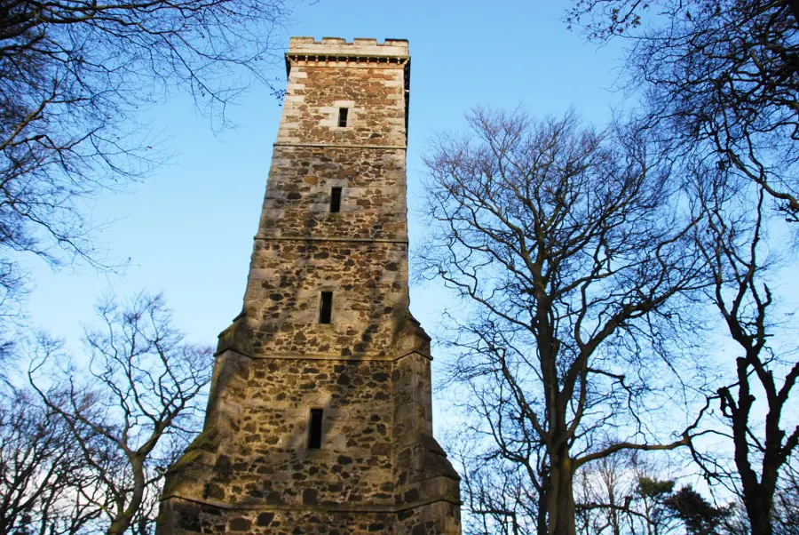
At a fork remain on the main path ahead (ignoring the steps by the fence on the left which lead past a transmitter), and eventually head down a flight of steps to reach a complex junction of paths. Take the path almost opposite that heads uphill and across an open green space. As this enters the trees beyond it reaches another junction - go right here to continue uphill, passing a transmitter mast to reach the stone-built Clermiston Tower. This was built to celebrate the centenary of the birth of Sir Walter Scott, and given to the city to commemorate the centenary of his death; it is sometimes open to the public on Sundays during the summer.

Stage 5
Pass to the right of the tower, descending steeply at first. From here on there are a maze of paths along the undulating crest of the hill - the objective is simply to choose the paths that continue northwards along the ridge and it would be difficult to stick exactly to the same paths. Some sections of path are boggy and others are rocky and slippery underfoot. At one point there is a view out towards the Forth Bridges with the Highlands beyond if the day is clear. With luck you should emerge at a large turning area by the end of a track and continue ahead with a fenced quarry area on your left - if you accidentally emerge into the housing area of Clermiston to the west side of the hill then you can reach this point by turning right onto the start of the track. From the fence the path eventually drops down to rejoin the outward route near the start. Turn left to return to Queensferry Road and the bus.

Route Profile
