Summary
This is the most straightforward route up and down Ben More, Mull's only Munro, and makes for a great hillwalk avoiding the need for any scrambling. Phone the Benmore Estate (01680 300229) Aug - 20 Oct for dates of deer stalking - no stalking on Sundays.
Grade

Bog Factor

Rating
Distance
Time
(in summer)
Ascent
Terrain
Rough path, boggy in places lower down and stony higher up
Are you REALLY ready for winter hills?
Hillwalking when there is snow lying requires an ice-axe, crampons and knowledge of how to use them safely. The description here is for summer conditions.
See our Winter Skills page for basic information on the essential skills, techniques and knowledge needed for winter.
Getting there
Start
Parking on grass on shore side of B8035 opposite turning for Dhiseig, west of Knock.
Public Transport
None to start.
Start Grid Ref
NM494359
Summits Climbed
- Munro
- Ben More (Mull)

Stage 1
Opposite the track for Dhiseig there is a large parking area on grass, just east of a bridge, on the shore side of the A8035. Start by heading up the track towards Dhiseig and keeping straight ahead at the entrance to the house continuing on the footpath.

Stage 2
Head straight through a gate and then bear slightly right to follow a path alongside the Abhainn Dhiseig which tumbles down in a small gorge. As you climb the views behind of Ulva and other smaller islands improve. At a fence bear left to follow it to a gate and go through the gate. Here two sets of paths have been worn both of which converge higher up the hill, either bear right to continue to follow the Abhainn Dhiseig or follow the worn ground straight ahead SSE - the latter route is boggier and slightly less attractive.

Stage 3
Soon the top of the peak of Ben More can be seen directly ahead, with the flank of An Gearna on the left to the east. Aim directly for Ben More, crossing a side stream at a clear crossing point with a worn path ignoring the path that branches off towards An Gearna. Soon the path runs alongside the Abhainn Dhiseig passing some very ruined buildings - marked on the map, but now only piles of stones, and then crossing the stream at an easy spot to continue uphill on the far side.

Stage 4
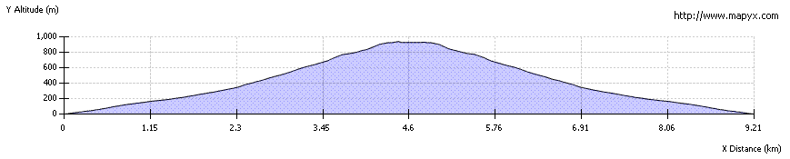
Pass a series of waterfalls on the left and follow the path, which becomes increasingly stony and eroded as you climb. The path keeps fairly close to the stream at first, but it is also possible to head directly up the more grassy ground to the right or southwest. As the ridge becomes more defined, a series of small cairns marks the clear path, which is now stony and scree-covered in places. On the steepest ground it ascends in small zig zags until the gradient eases onto the summit ridge.

Stage 5
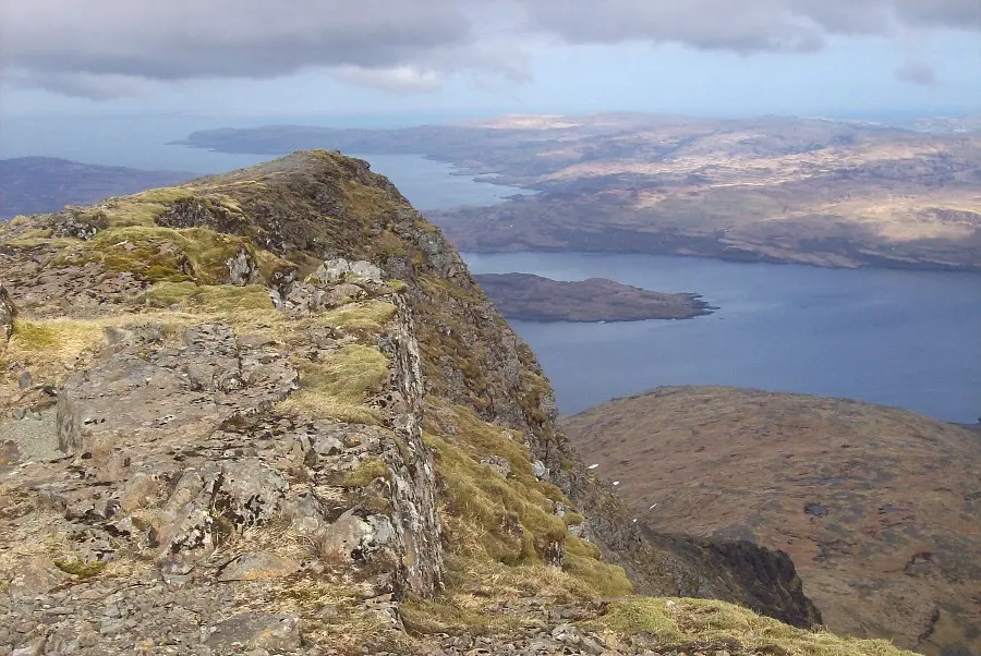
From here the views become much more dramatic, with the ridge route from A' Chioch coming into view. Follow the ridge southeast to reach the large summit shelter and tiny stumps of the remains of the trig point at 966m. To the south the ridge extends dramatically whilst just to the south of the summit is the start of the scramble route heading eastnortheast to A'Chioch.

Stage 6
On a clear day the mainland summits such as Ben Cruachan can clearly be seen and there are great views over most of Mull and to Ulva. Whilst it is possible to descend via A'Chioch this route is much better and easier as an ascent route up Ben More. The easiest and quickest route back is to retrace your outward steps to return directly to the road.

Route Profile