Summary
Great Bernera is the largest of many islands in Loch Roag off the shores of Lewis, connected to its larger neighbour by a road bridge since 1953. An exploration of the island on foot makes for a grand half day; the route follows faint and sometimes wet paths up the west side of the island to the magnificent beach at Bostadh before returning along the quiet minor road.


Terrain
Waymarked route but across rugged, boggy and sometimes pathless ground. Return along minor road.
Getting there
Start
Car park at community centre, Breacleit.
Public Transport
Bus to Breacleit, Great Bernera.
Start Grid Ref
NB158367

Stage 1
The walk begins from the car park at the Bernera Community Centre and Museum, which also has a seasonal cafe, in Breacleit. Start by walking west along the road towards Bhalasaigh and Tacleit, with views over several lochs. Take a right turn at a junction signed for Bhalasaigh and continue to the road end. Cross the long, well built footbridge over Tòb Bhalasaigh (a tòb is a loch which is washed by the sea at high tides) towards a couple of houses.

Stage 2
Head up the pathway towards the second house (Tigh na Sith) then turn right through a pedestrian gate. The walk is marked by a series of marker posts - when you reach each one take a moment to look out for the next as there isn't always a path. The route heads up through a gate in another fence to reach the ruins of a house before crossing a narrow neck of land between Tòb Bhalasaigh and the sea. Go through a gap in a fence and pass to the left of a derelict house, still following the markers which trace a route up the western coastline.

Stage 3
Cross a stile over a fence and then aim left of a rocky bulge, still near the coastline. Watch out for a marker post with an arrow pointing right - here the route swings east to pass around the southern end of a loch inlet, crossing an area of lazy-beds. The route then runs along a strip of boggy ground between the inlet and a small loch - keep to a low rocky ridge as marked for the driest going. Soon the route comes closer to the loch; note the stone enclosure in the water - this is a lobster pool - even today Great Bernera is renowned for its lobster. Again look out for a marker with an arrow pointing right indicating a change of direction.

Stage 4
The route runs through a soggy gap between two low rocky hills and then continues for some distance along the left side of a fence. At the end of the fence turn right across a boardwalk and then follow the markers as the way descends to some very muddy ground to a gate and a minor road just beyond. Turn left along the road, then left again at a t-junction. After 100m a sign just before a small wooden house (footway to Bosta) indicates where to turn right through a gate. Follow the path that heads diagonally left and then steeply uphill revealing some grand views back over towards the hills of Uig.

Stage 5
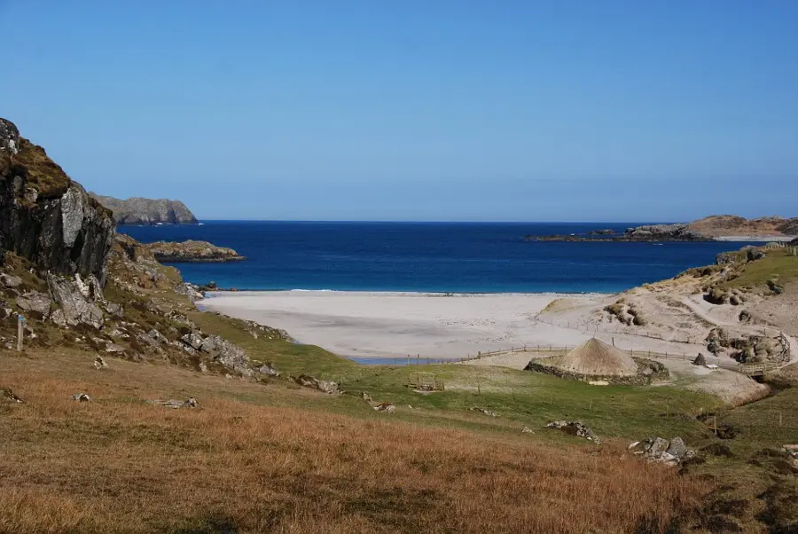
The route now leads over a boggy plateau that would require careful navigation if visibility was poor - the path splits and is indistinct in a couple of places. Continue past two marker posts with small cairns, then pass through a gate in a stone wall at the north end of a small lochan. Rather than climb up to the next cairn the route swings right, keeping beneath the hill before bearing left to climb across its eastern flanks overlooking Loch Sgial. Keep following the marker posts to reach a gate and descend to the Bosta glen. Once down in the glen the going is very boggy in places, passing the ruins of a deserted township. The reward for hard going is however a rich one - at the foot of the glen is a magnificent sandy beach. In the foreground is a low-walled stone and thatched building - a reconstruction of an iron age house; it is open in the summer months. Do not cross the footbridge but instead continue down to visit the thatched house.

Stage 6
The construction of the house is based upon one of five unearthed amid the dunes here by a storm in 1993; the original houses were re-covered with sand for protection though some traces remain. Cross the footbridge from the enclosure outside the house to follow the path above the dunes. This then turns right along the far wall of the cemetery, noting a second fine beach off to the left. The bell seen out in the sea is a Time and Tide bell, one of twelve installed to be rung by high tides as part of an art project across Britain. Beyond the cemetery the road is joined, with public toilets opposite.

Stage 7
The minor road is now followed for the 4.5km walk back to Breascleit. There are good views across Loch Carloway. Keep straight ahead at the junction with the road to Tobson - a memorial on the right here commemorates the Bernera riots of 1874, part of the campaign for security of tenure that eventually resulted in the Crofters' Act. Continue along the road to return to the start.

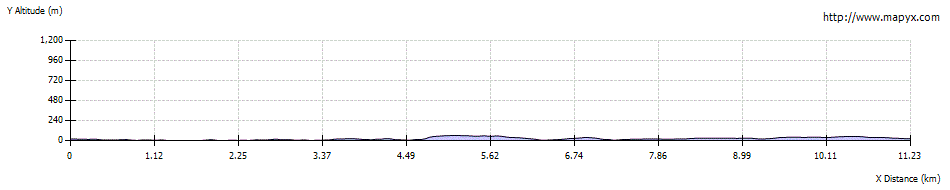
Route Profile