Summary
The Heritage Trail follows a traditional route linking the old summer shielings along a very remote but spectacular stretch of the Lewis' coastline. Far from help or easy escape routes for much of the way, it is a challenging route across unforgiving terrain.
Grade

Bog Factor

Rating
Distance
Time
(in summer)
Ascent
Terrain
Minor road at either end, but most of the route has no formal path and is extremely rugged going, with many boggy patches and plenty of ascent and descent. There are waymarkers but given the remote location, navigation skills essential. With pre-planning, it is possible to make the return by bus.
Are you REALLY ready for winter hills?
Hillwalking when there is snow lying requires an ice-axe, crampons and knowledge of how to use them safely. The description here is for summer conditions.
See our Winter Skills page for basic information on the essential skills, techniques and knowledge needed for winter.
Getting there
Start
Tolsta North bus stop.
Public Transport
Bus links North Tolsta from Stornoway for the start; bus from Port of Ness links to Stornoway at the end.
Start Grid Ref
NB512486

Stage 1
If starting from the bus stop at the north end of Tolsta continue north along the road leaving the houses behind and staying on the road at the entrance to the car park (toilets here) on the right. Follow the road around the headland, it is worth crossing the stile to get a view of some sea stacks including the impressive Caisteal a' Mhorair - topped with the scant remains of a medieval castle - overlooking the stunning sands of Garry Beach. Return to the road and continue past a lochan and the parking for the beach (off to your right).

Stage 2
Soon the Garry Bridge is reached. Built by Lord Leverhulme as part of an ambitious plan to make a road from Stornoway to Ness, the project was abandoned in 1921 when Lord Leverhulme sold Lewis to concentrate his plans on Harris. This was due to opposition from islanders, many of whom had returned from the first World War and wanted land to croft rather than possible jobs in Leverhulme industries - though the crofters in Tolsta itself supported Leverhulme and had called for suspension of the land raids. Some have dubbed the Garry Bridge 'The Bridge to Nowhere'.

Stage 3
Keep following the track as it follows the headland and then bends inland with views of a small waterfall in a box canyon opposite. When the track bends left to head inland, leave it at a marker post to cross a small concrete bridge. On the far side immediately turn right - keeping to the north side of the burn but gaining height, eventually curving left to reach the coastline. The route vaguely follows an ancient route linking summer shielings but no sign of that now exists on the ground; instead keep a sharp eye out for marker posts which have been moved nearer the coast in recent years - more up and down, but with better going underfoot.

Stage 4
Soon the route passes a reconstructed shieling with a turf roof. Continuing, there are soon views off to the right (and back) to Dùn Othail, a large fortress-like rock joined to the mainland at a deep chasm; there are the remains of a building on its summit. According to legend, both the kidnapped heir of the Clan MacLeod and his kidnapper - a MacNicol - were said to have been killed here when the latter threw himself from the rocks. Very soon a marker post indicates where the preferred route turns insland to avoid an area sensitive for breeding birds - follow the marker posts across the pathless moors just inland before returning to the coast around 1km further on.

Stage 5
Back on the coast path, the route continues for another kilometre to reach the site of old shielings at Cùilatotar (labelled Quilatotar on maps); today it is hard to tell the ruins from the outcropping rocks. Beyond, keep following the posts as the route descends steeply into a gorge, crossing two burns at a confluence, then steeply climbing again on the far side towards Lower Dìobadal - the markers help find the best line, but the burn crossing could be tricky in spate. Climb towards a hut, but before reaching it bear right to continue back along the coast.

Stage 6
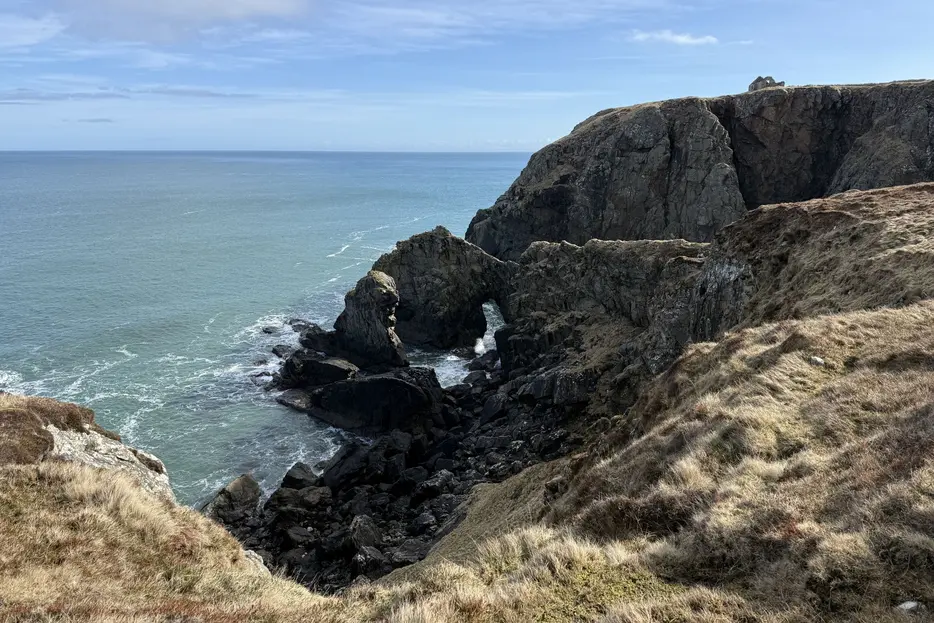
The route now heads towards Sròn an t-Seileir (Cellar Head); there is another very brief but boggy marked detour to avoid another area sensitive for breeding birds. At Rubha an t-Seileir the route crosses a landslipped area almost detatched from the adjacent cliffs. There are views to a natural arches at the foot of the cliffs far below. After 3km there is a small burn crossing, and an old chapel comes into view on the next headland. Before reaching it the route passes high above a beach and then cuts inland to descend to and cross a burn. On the far side the route swings right, zig-zags uphill, then swings right again, heading back along the clifftops towards the ruined chapel at Filiscleitir.

Stage 7
Continue along the cliff to reach the remains of the chapel. The chapel was built in the 18th century by a local man, John Nicolson, who returned a wealthy man from America, and erected the chapel as well as nearby Edgemoor Hall, the ruins of which still remain. Services were held at this cliff top spot until the 1930's with trawler crews among the congregation. From the chapel follow the cliff to the remains of a house from which there are good views north to the Butt of Lewis; this was also the site of an ancient fort. The markers now continue along the coast, giving great views back to the ruined house atop a great cliff with rock arches below.

Stage 8
The markers lead across the heather back from the cliffs for half a kilometre bfore turning left to climb inland, keeping south of Gill Basisga, to reach a peat cutting track. Turn right along this, boggy at first but eventually improving, to reach a group of old shielings and summer huts at Cuidhsiadar. Continue on the main track passing more peat cuttings to reach the houses of Sgiogarstaigh.

Stage 9
There is parking here and if transport has been arranged the walk can be finished here. Otherwise continue along the road, ignoring the first turn on the right but taking the second at a cross-roads. After passing a final house the road becomes a grassy track. Pass through two gates and across the pasture land, reaching Port Ness along the southern side of its beautiful sandy beach. Continue along a track to reach the road in the village. From here a bus can be caught back to Stornoway.

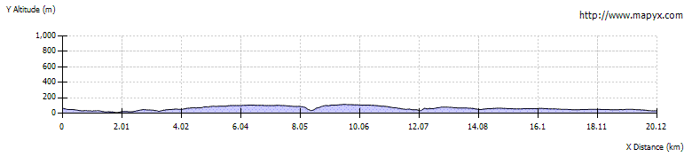
Route Profile