Summary
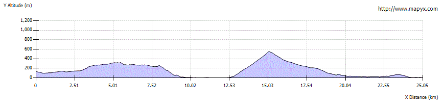
This very long variant heads across the appropriately named 'Rough Bounds of Knoydart' to divert to Inverie. The first section to Sourlies involves rough and boggy going once beyond the forestry; the second half has a better path but climbs steeply to the Màm Meadail pass. If it is too much, consider spending a night at the idyllically-located Sourlies bothy or camping nearby. Please note that Inverie is very isolated and all accommodation (except camping) needs to be booked up in advance as it is often full to capacity.
Please read the WARNING below before setting out on this route.

Grade

Bog Factor
Terrain
Rough and boggy paths; better graded path on ascent to Màm Meadail
Getting there
Start
Track above A' Chuil bothy.
Public Transport
No road access.
Start Grid Ref
NM942923
Services
There is no road access to any point along this walk which is extremely remote, including the start - at a mountain bothy - or the end - at Inverie. Sourlies bothy passed en-route is very small and often full - a tent should be carried. Inverie has the Old Forge pub, a cafe, shop, bunkhouse, camping (no showers) and other accommodation, but for those without a tent all the accommodation is often booked up in advance. Inverie also has a ferry service to Mallaig.