
Summary
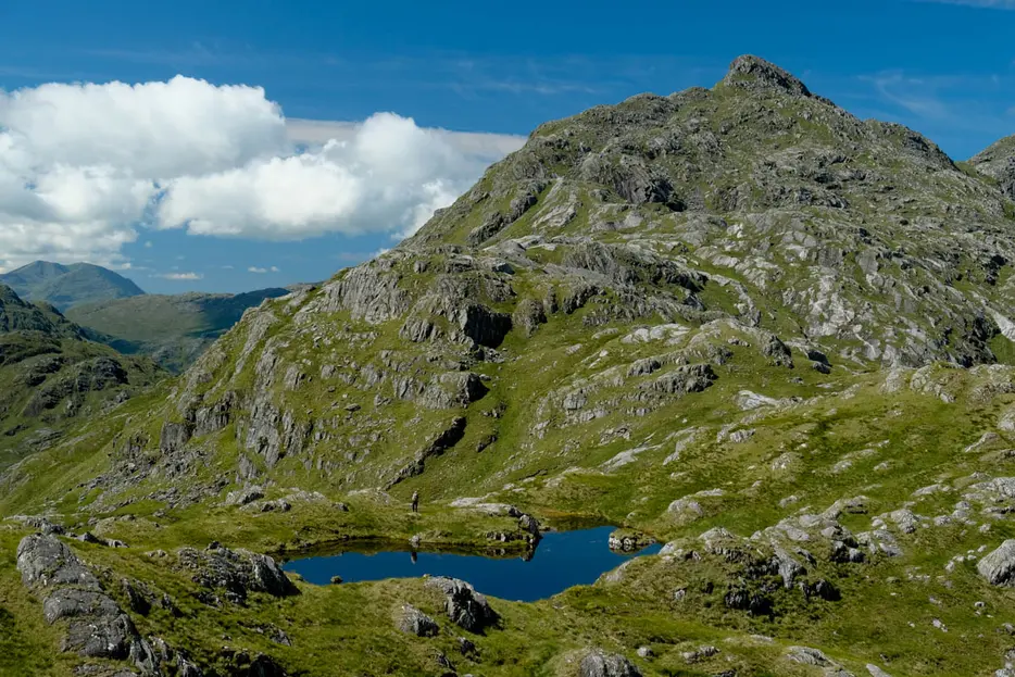
Bidein a' Chabair is a remote Corbett on the rugged fringes of Knoydart, requiring a long approach. The summit is a fine sharp rock peak and commands superlative views.
Grade

Bog Factor

Rating
Distance
Time
(in summer)
Ascent
Terrain
Good track for approach (a mountain bike would be useful to the bridge over the River Dessary), then pathless going. Boggy ground and a burn crossing is followed by a steep, tussocky grass slope and then a convoluted, complex, rocky and rough ridge with a final simple scramble to the summit.
Are you REALLY ready for winter hills?
Hillwalking when there is snow lying requires an ice-axe, crampons and knowledge of how to use them safely. The description here is for summer conditions.
See our Winter Skills page for basic information on the essential skills, techniques and knowledge needed for winter.
Getting there
Start
Car park at end of public road up Loch Arkaig.
Public Transport
No public transport along Loch Arkaig road.
Start Grid Ref
NM988916
Summits Climbed
- Corbett
- Bidein a' Chabair

Stage 1
There is a parking area at the end of the seemingly endless rollercoaster of a public road near the head of Loch Arkaig. Begin the walk by continuing on the track beyond the vehicle barrier. At the junction, take the track descending left (signed for Glenfinnan and Kinlocheil). This passes well to the right of the house at Strathan and soon crosses a bridge over the River Dessary. The great dome of Sgùrr Thuilm - and the lower, rockier summit of Streap to its left - dominate the views. Continue on the track as it enters the forestry beyond. 300m into the forest a junction is reached; take the track off to the right here.

Stage 2
The track now climbs and then undulates through the dense plantations on the south side of Glendessary for several kilometres. Just before the far end of the trees a cairn indicates a detour path that heads downhill through the trees to the right to visit the bothy at A' Chuil. The bothy is maintained by volunteers from the Mountain Bothy Association; please help by carrying out any rubbish you find here, and always follow the bothy code when visiting. Otherwise, continue on the track to leave the forest, sloping downhill and then rentering another section of forestry beyond. Eventually the good track ends at a bridge over the River Dessary - if using a mountain bike it is best to leave it here.

Stage 3
A much boggier, rougher ATV track now continues, initially alongside the River Dessary. The track then leaves the river and includes a couple of steep ascents before it exits the forest beside a stile. The wild upper reaches of Glen Dessary now stretch ahead; after a short distance look for a good place to leave the track and cross the burn - this is usually straightforward but could become difficult or dangerous if in high spate. The next objective is to ascend the steep slopes of Meall na Sroine - it is fairly easy to avoid any rocky outcrops and make the ascent up this section on steep, tussocky grass.

Stage 4
Eventually the open slope relents a little and the route continues up a broad, rocky and complex ridge, crossing a minor summit at around 600m with slight dip beyond and then ascending again to the rocky outcrops on the top of Meall na Sroine at 674m. From here the sharp summit peak of Bidein a' Chabair is well seen - but the ridge to reach it is going to take some time! Descend briefly, passing to the left of a small lochan.

Stage 5
The ridge has many rocky outcrops and boggy hollows, and traversing it without losing unecessary height requires constant navigation. After rounding the head of Coire nan Laogh it climbs more steeply southwest, passing to the south of another lochan. Across the glen Sgùrr na Ciche and Garbh Chioch Mhor look extremely rocky and rugged.

Stage 6
Eventually the ridge swings left again towards the final rocky summit peak, which has looked formidable during the approach. A faint path appears at the base of this, ascending the steep grassy to the left initially, with some zig-zags, and then swinging back right to head up a slight scramble on the final rocky section - considerably easier than it appeared, though with a slightly exposed step.

Stage 7
The summit cairn is tiny, but the view is immense. The ridge leads the eye away towards the western summit, the equally fine peak of Sgùrr na h-Aide, which is a fine viewpoint itself but 8m lower than where you stand. Beyond that are the islands of Eigg and Rum, whilst a few paces southwest bring Loch Morar into view. Great depth is given to the view by the dizzying sweep down to Sourlies at the head of Loch Nevis.

Stage 8
Both flanks of the ridge are extremely steep - especially that to the south - so the route of return is to retrace your steps all the way back along the ridge. Once down, you'll be glad if left a mountain bike near the bridge over the River Dessary for the long tracks back through the forestry.

Route Profile
