Summary
Queensberry is the most southerly of the Lowther Hills, its position making it a prominent local landmark and an extensive viewpoint. The hill has mostly featureless, wet grassy slopes but the ascent from Mitchellslacks makes best use of ATV tracks. An alternative rougher return is given over the distinctive peak of Wee Queensberry.
Grade

Bog Factor

Rating
Distance
Time
(in summer)
Ascent
Terrain
Track and then faint grassy ATV track and path to summit. Alternative return route given is rough and pathless.
Are you REALLY ready for winter hills?
Hillwalking when there is snow lying requires an ice-axe, crampons and knowledge of how to use them safely. The description here is for summer conditions.
See our Winter Skills page for basic information on the essential skills, techniques and knowledge needed for winter.
Getting there
Start
Road verge near start of farm track, Mitchellslacks.
Public Transport
None to start.
Start Grid Ref
NX965959
Summits Climbed
- Fiona
- Queensberry

Stage 1
Park on the verge of the public road by the Scotways footpath sign just beyond the track Mitchellslacks - a remote spot on the northern edge of the Forest of Ae. There is space for a couple of cars on the grass verge - do not park at the Mitchellslacks entrance as large vehicles need to turn here; there may be more space further along the public road. The path soon joins the track and leads to a bridge; cross this, and then fork left - ignoring the Scottish Rights of Way sign. The track passes along the right edge of the farm of Mitchellslacks - go through the gate straight ahead into the field.

Stage 2
A faint grassy track now continues through the field, passing through a gate in the wall half way along before continuing on the other side of the wall. It then passes through another gate - keep straight ahead on the now clearer main track. The track forks in three, two main tracks and a fainter one off right - take the middle track. This now leads up the glen, keeping to the left flank of a grassy knoll called the Law, but staying high above the Capel Burn.

Stage 3
Continue following the track up the glen until a gate shortly before the ruins of New House and another ruined farmhouse. After passing through the gate turn right up an ATV track that climbs steeply, keeping north of a burn.

Stage 4
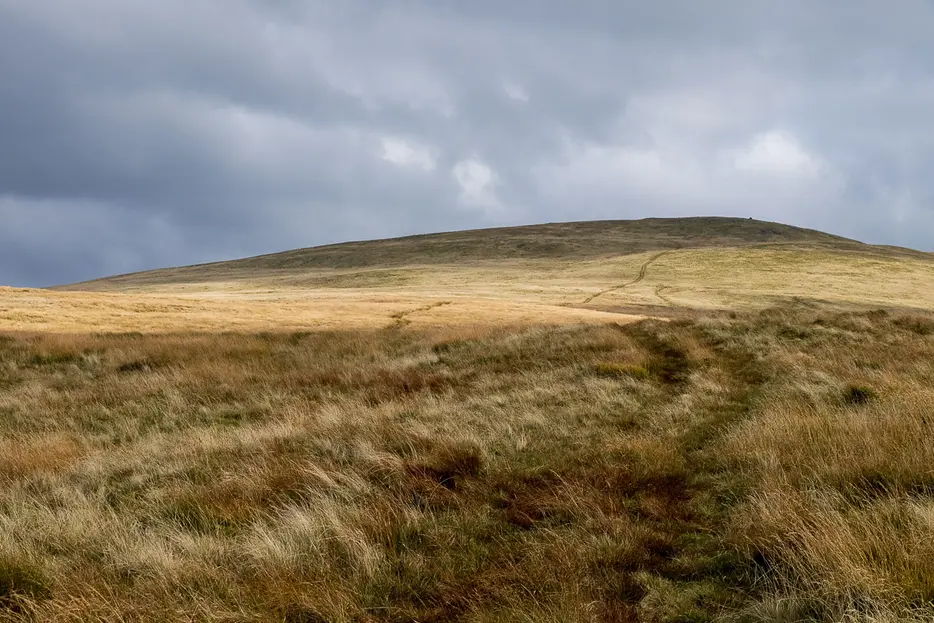
Once above the initial steep section the ATV tracks turn towards Queensberry, heading towards a prominent high cairn. Once near the cairn fork right onto a faint path that passes the cairn.

Stage 5
The path continues climbing to reach the summit, which is marked by a massive cairn, as befits the summit of one of the most prominent hills in the area. Queensberry is the southernmost of the Lowther Hills and has very extensive views.

Stage 6
The view takes in a sweep of the Solway Firth as well as both the Galloway Hills and - in the opposite direction - those of Moffat. There are a great many windfarms in view, with the massive Harestanes nearby, and a ring of windfarms visible to the north. The easiest and quickest descent is to retrace your steps, but there is an alternative, which is pathless and crosses rough, tussocky ground.

Stage 7
For this harder alternative descent, retrace your steps briefly before striking directly southwards over tussocky ground towards the wide bealach that separates Queensberry from Wee Queensberry. Cross the bealach and then continue up to the twin peaked summit of the latter hill; the second summit has a trig point. From here initially descend steeply to the west, then continuing over rough ground towards the cairn at High Church. Descend west from here, picking up a faint track that leads down to a complex of sheep pens. From the pens a better track leads back to rejoin the outward route just south of the Law. Turn left to retrace steps back to the start.

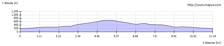
Route Profile