
Stunning all-round imagery captured by Walkhighlands this summer has just been launched on Google Street View opening up some amazing Highland paths to virtual visitors. We hope that being able to see the routes on the screen will encourage people from far and wide to visit Scotland and also encourage Scots to tackle an iconic walk.
The Walkhighlands team spent parts of last summer capturing the 360° imagery using the futuristic Google Trekker. This weighty device combines 15 camera lens and a GPS and automatically snaps a series of photos every 2.5 seconds. In addition to carrying the 44lb backpack and their normal hiking gear many people stopped to ask about the strange looking device or pose for selfies with it.

Helen with the Google Trekker on Cairn Gorm
Walkhighlands’ Helen Webster commented, “It was certainly a fun challenge lugging Marvin (as we nicknamed the Trekker) up various glens, mountains and hills. Most kids and younger folk knew immediately that it was for Street View and we were greeted with excited chants of “Google, Google” in some locations. Older folk tended to be intrigued and to ask a lot of questions whilst a rare few would just totally ignore the strange looking Trekker or hide from view as we passed.
“We’ve had some great feedback since we started the project with people telling us it will help plan their trip to Scotland and inspire them to get out on a walk and there was even one disabled person who was looking forward to exploring the walk on her screen as she was no longer able to get out in the hills”.
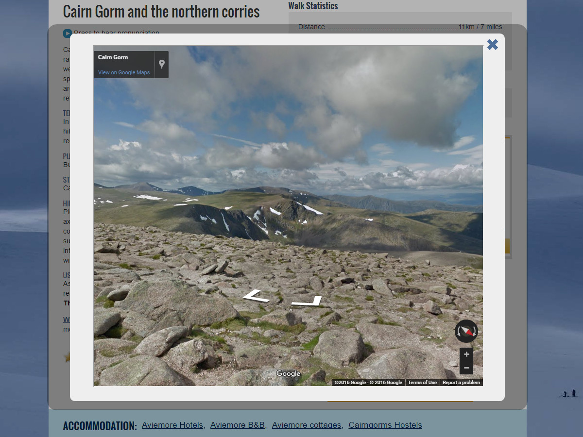
The resulting imagery now forms part of Google Street View as well as being part of our own online route guides. The routes covered include the Old Man of Storr on Isle of Skye, Cairn Gorm, the Mither Tap of Bennachie in Aberdeenshire, Craigellachie National Nature Reserve at Aviemore, and the route to Coire Ardair on the Creag Meagaidh National Nature Reserve. Since the imagery was recorded Google has worked through the footage to blur any individual identifying faces and ensure a seamless run through of each walk. We’ve also added Streetview options to other walks where imagery is available, including Ben Nevis, Ben Lomond and Buachaille Etive Beag in Glencoe.

The Streetview option on featured walks
Walkhighlands works on behalf of more than 3,000 tourism businesses and accommodation providers in Scotland linking them to visitors planning walking trips. It is the busiest walkers’ site in the UK and the busiest independent Scottish tourism website, receiving over 25,000 unique visitors each day. Its aim is to help visitors plan their walks and find accommodation as well as chat to and encourage others through its popular community forum, which has begun many friendships and even a couple of weddings. The business is based in the Cairngorms National Park in the Highlands and has been promoting walks and tourism in Scotland for 10 years.