Summary
Ranking amongst the highest of the Corbetts, Beinn nan Oighreag was briefly thought to top 3000 feet. The approach given here from Glen Lochay is perhaps the most attractive, following an old path to the shielings of the Allt Dhuin Croisg.
Grade

Bog Factor

Rating
Distance
Time
(in summer)
Ascent
Terrain
Boggy old path for approach, then burn crossing and pathless grassy / heathery hillside.
Are you REALLY ready for winter hills?
Hillwalking when there is snow lying requires an ice-axe, crampons and knowledge of how to use them safely. The description here is for summer conditions.
See our Winter Skills page for basic information on the essential skills, techniques and knowledge needed for winter.
Getting there
Start
Start of tarmac track branching from Glen Lochay minor road at NN539352.
Public Transport
None to start.
Start Grid Ref
NN539352
Summits Climbed
- Corbett
- Beinn nan Oighreag

Stage 1
Park carefully - taking care not to cause an obstruction - by the start of tarmac track branching from Glen Lochay minor road at NN539352, about 700m from where the two roads up the glen join up. Begin by walking up this tarred lane as it climbs through woodland, soon swinging sharply to the right. When it forks take the left branch, continuing uphill. When a fence comes into view directly up the hillside to the left (the track eventually leads to it) shortcut by following a grassy trod directly up (through braken in summer) to the near corner of the fence.

Stage 2
From here a faint path gently climbs NW across the hillside, there are a few marker poles to help, it is very boggy and indistinct in places. When this reaches a broken old stone wall the old path zig-zags back; head uphill beside the wall to meet the path again higher up, then heading left along it. The old path now contours the hillside for several kilometres; it is boggy in many places and 'improved' by the placing of old railway sleepers. There are airy bridges - consisting of two old iron girders - over several burns. The views up Glen Lochay are stunning throughout.

Stage 3
The path leads through a gate, and then later meets another gate where a track meets a stone wall. The correct route bears right through this gate, keeping slightly uphill beside the very tumbledown remains of a wall. Later the path reaches the remains of a footbridge over the Allt a' Choire Glais - the bridge is unusable but it is possible to cross the burn in normal conditions without getting wet feet. The path continues high on the bank on the far side before cutting north across flatter ground to reach the Allt Dhuin Croisg.

Stage 4
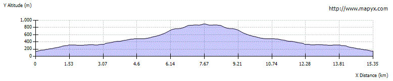
Ford this larger burn by a gravelly section - again it is possible with to cross with dry feet using stones in good conditions. On the far side a muddy ATV track heads west; leave this and instead aim up the very south ridge of Beinn nan Oighreag. Boggy at first, the going improves as height is gained. The ridge levels off at 750m before climbing again to reach a second flattening with the south summit at 876m.

Stage 5
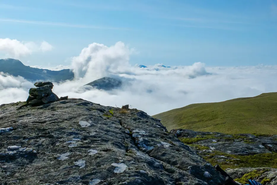
From here a line of old fence posts leads up to the true summit, marked by a large boulder (with a cairn atop). The views are not particularly extensive, with the Tarmachan Ridge showing its least interesting side, and Meall Ghaordaidh rising to the west.

Stage 6
The return route is to retrace your steps. For those who wish to also climb Meall Ghaordaidh, making for a 7 - 7.5 hour day - return to the south summit and then follow the fenceposts during a very steep descent to the Lairig Luaidhe. This passes through broken crags but can be done on steep grass - take care. The crags of the Cam Chreag ridge opposite are best avoided on the right side. Once above these the ridge leads more easily to Meall Ghaordaidh, and the descent can be made by the usual southeast ridge back to the Glen Lochay road.

Route Profile