Summary
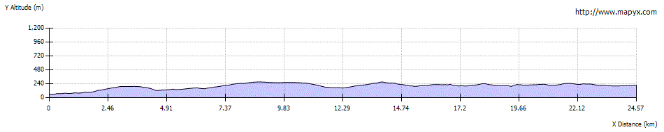
The initial stage of the Cateran Trail is very varied, starting by the Ericht before crossing low moorland to Bridge of Cally. It then heads up the west side of peaceful Strathardle, ending at the attractive village of Kirkmichael.


Terrain
Waymarked paths and tracks, with rougher moorland section. Can be very muddy in places.
Getting there
Start
Riverside car park, Blairgowrie.
Public Transport
Bus between Kirkmichael and Blairgowrie (not Sun).
Start Grid Ref
NO180454

Stage 1
If driving the best place to park for multiple days is probably the Riverside car park on the north side of the centre of Blairgowrie (take Lower Mill St to reach it). Those arriving on foot can reach it by descending steps starting next to the bridge over the river. Begin the walk by following the path upstream beside the Ericht. Further on the right a flight of wooden steps leads to a viewing platform. The river is far below here in a gorge. Return to the track and continue until a path forks off to the right. Take this path; soon there is a second, narrower viewing platform with a series of cataracts in the river below. This is Cargill's Leap, where Donald Cargill, a local minster and covenanter, escaped pursuing troops by leaping the falls below. The path goes left up a flight of wooden steps to reach a track at a higher level. Turn right along this, now high above the river.

Stage 2
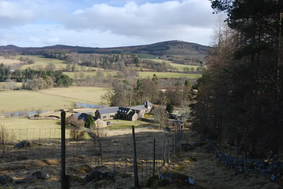
When the wide path forks near some old mills, it is worth detouring along the right hand branch to head out onto a wooden footbridge spanning the river for the views. The track passes some old millworkers cottages on the left and, further on, Brooklinn Mill on the right - now converted to a house. Beyond this the track joins a minor road; turn left here and follow it as it climbs gently uphill and passes Lornty farm. At the next junction, turn right onto a track, signposted for the Cateran Trail and for The Knockie. This track climbs up through rich mixed farmland. There are spacious views, both looking back and northwards over a windfarm to Mount Blair.

Stage 3
Follow the track as it climbs, passing through a walker's gate alongside a locked gate and continue following the track as it turns sharp right and heads downhill towards the large metal buildings at East Gormack. Before reaching this turn right onto a path which descends towards the wooded dell of the Lornty Burn, then turns left to keep above it. Continue on the path between a hedge and fence. The path follows the edge of a couple of fields until it emerges at a minor road. Turn right to pass a farm and down to a bridge.

Stage 4
The minor road soon becomes a track. Remain on the main track when it curves right at each of two junctions (waymarked), crossing a cattle grid, before turning left at a waymarker post onto a smaller, muddier track. This leads uphill and through a gate; keep straight on where other muddy tracks go off to one side or the other. The route now continues straight ahead, crossing almost level moorland, with distant views of the Mounth hills far ahead. The old track curves left at a wooded area and descends into Strathardle, eventually emerging at a signposted junction in the forest. The Cateran Trail turns left here - the Bridge of Cally Hotel is a short detour to the right. Otherwise, the Cateran Trail soon reaches the Blackcraig forestry parking area and goes through the gate to continue on the track with younger trees and more open ground at first.

Stage 5
The track climbs steadily before reaching a junction; bear right here to begin descending passing the house at Blackcraig croft. Keep ahead at the next track junction (the main track swings left here), following a stony (and very eroded in places), walled lane downhill with views to the mountains ahead. Keep left at the bottom as the route then passes through a wooded area, keep right to pass a pond and cottage on your left then continue on the track. There are several track junctions but the route generally keeps straight ahead and is well marked. After passing the first houses at Crowhill fork left and then immediately turn left through a wooden kissing gate into a field. Keep right to skirt round the stone wall and turn right through a walker's gate to pass around the house returning to the track beyond. Keep left at the next fork avoiding the more surfaced track leading to Balmachreuchie.

Stage 6
Soon leave the track to take a grassy path ahead and pass through woodland before an open section on a wider grassy track with lovely views ahead. Go through a high gate and woodland and pass the buildings at Dalnabreck. Soon the path turns left after a stone wall to climb steeply beside a high fence to a gate. Go through this and turn right, following the fence across rough pastures. After 500m go through another gate and keep on the track to the left of a stone wall (the route markers on this section indicate a rougher route in the heather but the track is easier going). As some trees are reached the route drops to cross a footbridge over the Pitcalmick Burn before continuing through pastures.

Stage 7
A wall is crossed at a high gate and the path meanders through trees and crosses the Allt Cul na Coille before bearing right to reach a track. Turn right along this heading left along a good track to pass Dalvey loch and cross a cattle grid. Pass below the cottage and keep right at a couple of forks.

Stage 8
After more gates, the route bears right and crosses a bridge and comes close to the River Ardle before leading into the village of Kirkmichael, passing the ruined church. Turn right on the road at the church; the Cateran Trail takes the next left whilst the road swings right and crosses the river to reach the shop/cafe and hotel.
Next stage: Kirkmichael to the Spittal of Glenshee

Route Profile