Summary
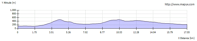
From Poulary (on the Tomdoun to Kinlochhourn road) the route heads west to pick up a path which heads over the Mam na Seilg pass before a descending to cross the River Loyne (a wade even in low water conditions) and another climb before the old road is followed to reach the Cluanie Inn and Bakehouse coffee shop on the A87.


Terrain
Moorland paths, boggy in places, some indistinct sections. Crossing the River Loyne could be impossible in spate conditions
Are you REALLY ready for winter hills?
Hillwalking when there is snow lying requires an ice-axe, crampons and knowledge of how to use them safely. The description here is for summer conditions.
See our Winter Skills page for basic information on the essential skills, techniques and knowledge needed for winter.
Getting there
Start
Poulary.
Public Transport
Long distance buses serve Cluanie; no public transport to Poulary.
Start Grid Ref
NH132014

Stage 1
From Poulary head west along the Kinlochhourn road. 2km further on the road bends and a signed (Shielbridge and Cluanie) path heads to the right, staying on the east side of the Allt a'Ghobhainn as it climbs gently at first.

Stage 2
The views back improve as the route climbs, the path is narrow but always fairly easy to follow although boggy in places. As it continues north it crosses tributary burns a number of times. It then follows a number of zig zags as it climbs to the summit of the high pass, the Mam na Seilg.

Stage 3
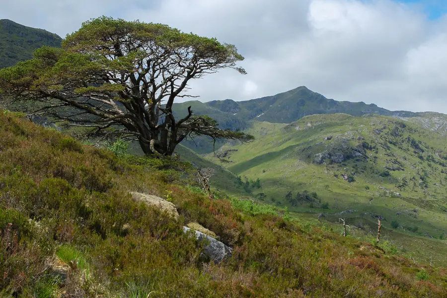
From here the first views of the Glenshiel mountains come into view, Creag a'Mhaim in the foreground and A' Chralaig and Stob Coire Cralaig far beyond. The path meanders slightly over the rocky and lumpy pass before descending into Glen Loyne.

Stage 4
After crossing the Allt Mam na Seilg the route becomes delightful with views up and down the glen and after crossing a deer fence on a stile, a lovely area of re-generating trees. The path, which is faint in places, keeps heading NW traversing the hillside as it descends to eventually reach another gate and stile at the far end of the enclosure.

Stage 5
From here the path is indistinct but continues NW until it reaches the Allt Mialach. Bear right here to reach the River Loyne. The crossing here can be very difficult, or even impassable in spate conditions, and will always involve a paddle or wade. There are some good wild camping spots in this area and the remote glen is very atmospheric. Continue on the path (very boggy in places) heading NW on the far side of the river.

Stage 6
The path widens and improves after it joins another path and continues up the glen, crossing a couple of burns. Shortly after crossing the Allt Coire nan Leac, watch out for a small cairn marking the slanting path to the right to climb NE towards the gap between Creag Liathtais and Creag a'Mhaim.

Stage 7
The well-graded path makes easy work of the climb, crossing a couple of burns before the bealach is reached. From here there is a great view of Loch Loyne which is actually a reservoir, part of the much larger hydro-electric scheme that includes Loch Cluanie. As the old road comes into sight, the path reaches a junction with the route up the Munro, Creag a'Mhaim, popular with Munro-baggers as the first or last of the South Glen Shiel ridge. Turn right here to head downhill to reach the old road.

Stage 8
This was the original 'Road to the Isles' before the rivers Cluanie and Loyne were dammed in the 1950s and parts of the road flooded and replaced with the modern day A87. Turn left to head north on the old road. As the route descends Loch Cluanie comes into view and then Cluanie Lodge, a private house. There are a number of possible wild-camping options along this section, and again when, once past the vehicle barrier and over the bridge, the track heads up to the A87 to emerge a tiny distance from the Cluanie Inn which has accommodation and serves bar meals, there is a seasonal bakehouse cafe opposite.
Next stage: Cluanie to Morvich

Route Profile